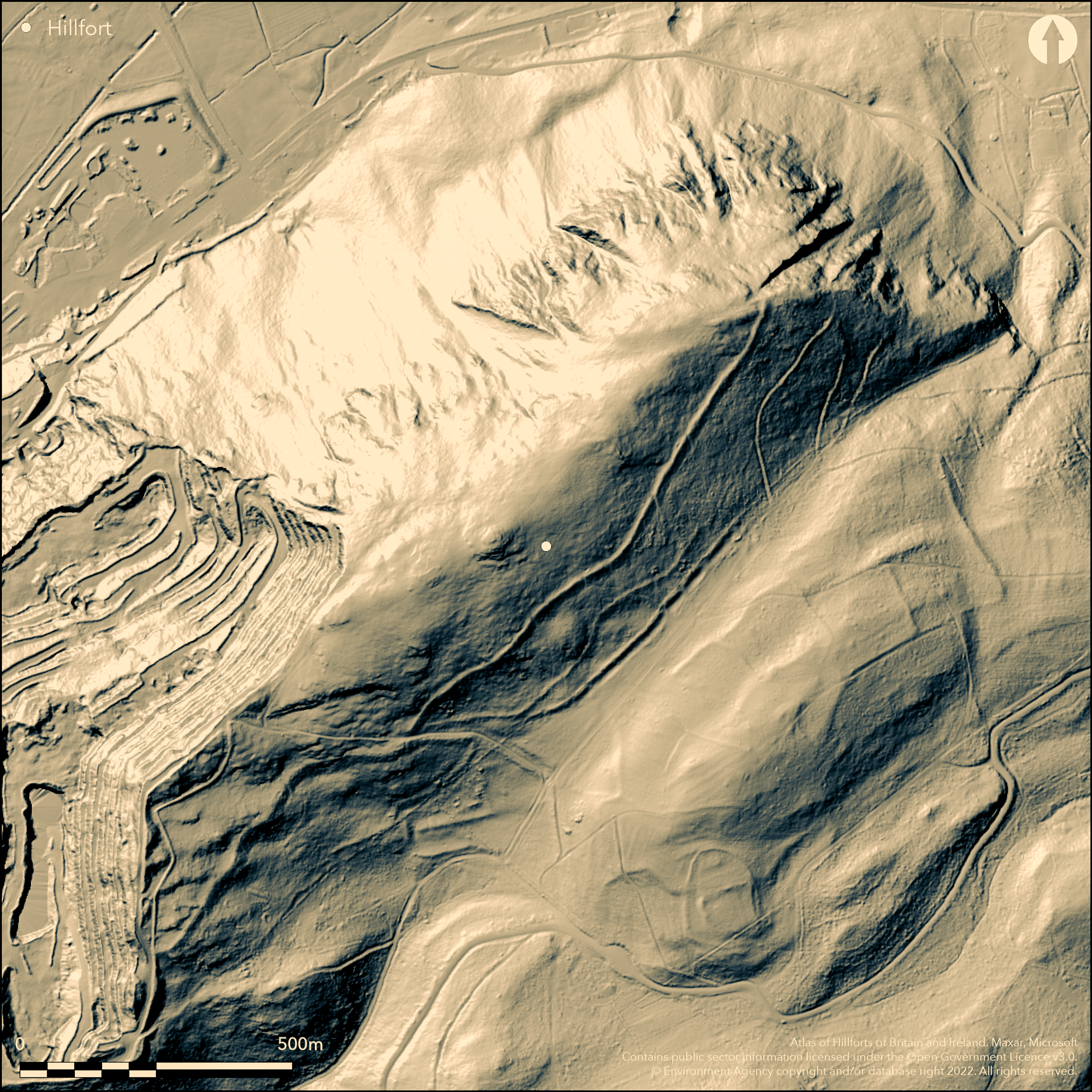
LiDAR 1m DTM Hillshade
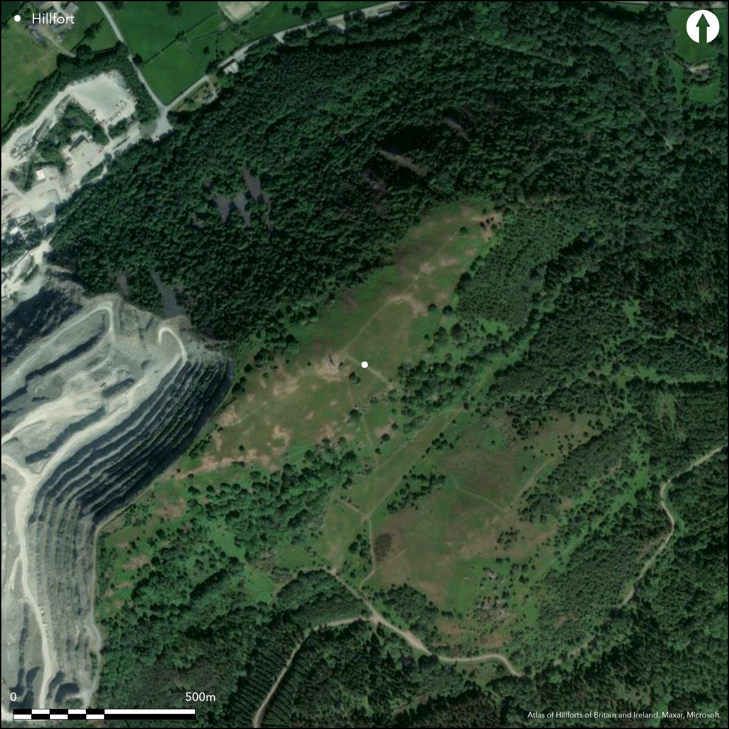
Satellite Imagery
LiDAR 1m DTM Hillshade
Satellite Imagery
Scroll left/right to view further images.
HER: Clwyd Powys 50055 (None)
NMR: SJ 21 SE (141162)
SM: MG021(POW)
NGR: SJ295144
X: 329570 Y: 314408 (OSGB36)
Large, excavated contour hillfort, now part-quarried away, located on summit of NE-SW volcanic ridge commanding the River Severn valley (River Severn 1.75km away) above its confluence with the Afon Vernwy. Surrounding slopes N and W precipitous, S very steep, E moderate to strong. Near Bausley Hill (Atlas No 1197), Cefn-y-Castell, Middletown Hill (Atlas No 1198) and New Pieces (Atlas No 1536) hillforts. Measures c. 1,150m long by max. 250m across, with internal area c. 28ha. Defined by two or three widely-spaced stone-revetted ramparts on the SE side, with a centrally placed entrance, elsewhere defined by precipitous slopes. The strong stone inner bank is revetted to front and back, with weaker outer bank. Further strong outer bank with outer ditch and traces of counterscarp. Excavations between 1933-5 and 1969-73, prior to quarrying, showed occupation from late Bronze Age to the fourth century AD, with ramparts substantially intact at the latter period (O'Neil 1937; Musson 1991). Forty C14 dates and dateable finds suggest late Bronze Age construction of primary rampart with end of Iron Age occupation in first millennium BC. Environmental evidence from the summit Buckbean Pond showed extensive seasonal occupation (Buckland et al. 2001). Lesser defended enclosure, with associated field system c. 270m to SE. Many roundhouses and four-posters. Finds indicated metalworking, spinning and weaving and leather and wood working. Important finds from pond and its associated cistern included wooden sword and bowl. Later Roman rectangular structure. Rodney's Pillar monument to Admiral George Brydges Rodney on summit. On 1st Ed. OS map (1886).
Citizen Science: ✗
Reliability of Data: Confirmed
Reliability of Interpretation: Confirmed
X: -338884 Y: 6931868 (EPSG: 3857)
Longitude: -3.0442505223934995 Latitude: 52.72269390914387 (EPSG:4326)
Country: Wales
Current County or Unitary Authority: Powys
Historic County: Montgomeryshire
Current Parish/Community/Council/Townland: Bausley with Criggion
Part-destroyed by Criggion Quarry. Rodney's Pillar at summit. Rodney';s Pillar.
| Extant | ✓ |
| Cropmark | ✗ |
| Likely Destroyed | ✓ |
Upland pasture with spasmodic scrub and trees and bare rock. Large quarry.
| Woodland | ✓ |
| Commercial Forestry Plantation | ✗ |
| Parkland | ✗ |
| Pasture (Grazing) | ✓ |
| Arable | ✗ |
| Scrub/Bracken | ✓ |
| Bare Outcrop | ✗ |
| Heather/Moorland | ✗ |
| Heath | ✗ |
| Built-up | ✗ |
| Coastal Grassland | ✗ |
| Other | ✓ |
Outstanding, large, excavated contour hillfort, now part-quarried away, located on summit of NE-SW ridge volcanic ridge commanding the River Severn valley (River Severn 1.75km away) above its confluence with the Afon Vernwy. Surrounding slopes N and W precipitous, S very steep, E moderate to strong.
| Contour Fort | ✓ |
| Partial Contour Fort | ✗ |
| Promontory Fort | ✗ |
| Hillslope Fort | ✗ |
| Level Terrain Fort | ✗ |
| Marsh Fort | ✗ |
| Multiple Enclosure Fort | ✗ |
| Hilltop | ✓ |
| Coastal Promontory | ✗ |
| Inland Promontory | ✗ |
| Valley Bottom | ✗ |
| Knoll/Hillock/Outcrop | ✗ |
| Ridge | ✗ |
| Cliff/Plateau-edge/Scarp | ✗ |
| Hillslope | ✗ |
| Lowland | ✗ |
| Spur | ✗ |
Dominant Topographic Feature: Hill top
| North | ✗ |
| Northeast | ✗ |
| East | ✗ |
| Southeast | ✗ |
| South | ✗ |
| Southwest | ✗ |
| West | ✗ |
| Northwest | ✗ |
| Level | ✓ |
Altitude: 366.0m
N/A
Excavations showed occupation from late Bronze Age to the fourth century AD. Later Roman rectangular structure. Forty C14 dates give construction of primary rampart to 990-860 BC tpq, refortification 470-340 BC, hillfort end 190-80 BC (Horn Forthcoming). Four dateable brooches and metalwork of 1,000 BC-700BC date.
Reliability: A - High
| Pre 1200BC | ✗ |
| 1200BC - 800BC | ✓ |
| 800BC - 400BC | ✓ |
| 400BC - AD50 | ✓ |
| AD50 - AD400 | ✓ |
| AD400 - AD 800 | ✗ |
| Post AD800 | ✗ |
| Unknown | ✗ |
| Pre Hillfort: | None |
| Post Hillfort: | None |
| Artefactual: | Many finds. Four dateable brooches and metalwork of 1,000 BC-700 BC date. |
| C14: | None |
| Morphology/Earthwork/Typology: | Much dating evidence found. |
On 1st Ed. OS map (1886). Excavations between 1933-5 by B.H. St.J. O'Neil, and by C.R. Musson 1969-1973, prior to quarrying,
| 1st Identified Map Depiction (1886): | OS map. |
| Other (1977): | Visit by Hillfort Study Group |
| Excavation (None): | B.H. St. J. O'Neil. |
| Excavation (None): | C.R. Musson. |
Finds indicated metalworking, spinning and weaving and leather and wood working. Important finds from pond and its associated cistern included wooden sword and bowl. Many roundhouses and four-post structures. Later Roman rectangular structure.
Buckbean pond and associated cistern on summit of site. Stream 0.6ha outside fort.
| None | ✗ |
| Spring | ✗ |
| Stream | ✗ |
| Pool | ✓ |
| Flush | ✗ |
| Well | ✗ |
| Other | ✗ |
Roundhouse evidence.
| No Known Features | ✗ |
| Round Stone Structures | ✗ |
| Rectangular Stone Structures | ✗ |
| Curvilinear Platforms | ✓ |
| Other Roundhouse Evidence | ✗ |
| Pits | ✗ |
| Quarry Hollows | ✗ |
| Other | ✗ |
Many roundhouses and four-post structures. Later Roman rectangular structure.
| No Known Excavation | ✗ |
| Pits | ✗ |
| Postholes | ✗ |
| Roundhouses | ✓ |
| Rectangular Structures | ✓ |
| Roads/Tracks | ✗ |
| Quarry Hollows | ✗ |
| Other | ✗ |
| Nothing Found | ✗ |
None
| No Known Geophysics | ✓ |
| Pits | ✗ |
| Roundhouses | ✗ |
| Rectangular Structures | ✗ |
| Roads/Tracks | ✗ |
| Quarry Hollows | ✗ |
| Other | ✗ |
| Nothing Found | ✗ |
Finds indicated metalworking, spinning and weaving and leather and wood working. Four dateable brooches. Important finds from pond and its associated cistern included wooden sword and bowl.
| No Known Finds | ✗ |
| Pottery | ✓ |
| Metal | ✓ |
| Metalworking | ✗ |
| Human Bones | ✗ |
| Animal Bones | ✗ |
| Lithics | ✗ |
| Environmental | ✗ |
| Other | ✓ |
None
| APs Not Checked | ✓ |
| None | ✗ |
| Roundhouses | ✗ |
| Rectangular Structures | ✗ |
| Pits | ✗ |
| Postholes | ✗ |
| Roads/Tracks | ✗ |
| Other | ✗ |
SE entrance with a diagonal passageway overlooked by natural outcrops and the innermost bank. Outer bank has two gaps on the SW.
| 3: | None |
| 2: | None |
Guard Chambers: ✗
Chevaux de Frise: ✗
| 1. Passage-way/Corridor (South east): | Diagonal passageway. |
| 1. Oblique (South east): | Diagonal overlooked passageway. |
| 2. Simple Gap (South west): | Possible. Outer bank has two gaps on SW. |
Defined by two or three widely-spaced stone-revetted ramparts on the SE side, with a centrally placed entrance, elsewhere defined by precipitous slopes. The strong stone inner bank is revetted to front and back, with weaker outer bank. Further strong outer bank with outer ditch and traces of counterscarp.
| Area 1: | 28.0ha. |
| Total: | 28.0ha. |
Total Footprint Area: Noneha.
None
| ✗ | None |
| ✗ | None |
| NE Quadrant: | 0 |
| SE Quadrant: | 3 |
| SW Quadrant: | 0 |
| NW Quadrant: | 0 |
| Total: | 3 |
| Partial Univallate | ✗ |
| Univallate | ✗ |
| Partial Bivallate | ✗ |
| Bivallate | ✗ |
| Partial Multivallate | ✓ |
| Multivallate | ✗ |
| Unknown | ✗ |
| Partial Univallate | ✗ |
| Univallate | ✗ |
| Partial Bivallate | ✗ |
| Bivallate | ✗ |
| Partial Multivallate | ✗ |
| Multivallate | ✗ |
Strong stone inner bank, revetted to front and back. Traces of coubnerscarp.
| None | ✗ |
| Earthen Bank | ✓ |
| Stone Wall | ✓ |
| Rubble | ✓ |
| Wall-walk | ✗ |
| Evidence of Timber | ✗ |
| Vitrification | ✗ |
| Other Burning | ✗ |
| Palisade | ✗ |
| Counter Scarp Bank | ✓ |
| Berm | ✗ |
| Unfinished | ✗ |
| Other | ✗ |
Defined by two or three widely-spaced stone-revetted ramparts on the SE side, elsewhere defined by precipitous slopes. The strong stone inner bank is revetted to front and back, with weaker outer bank. Further strong outer bank with outer ditch and traces of counterscarp.
| None | ✗ |
| Earthen Bank | ✓ |
| Stone Wall | ✓ |
| Murus Duplex | ✗ |
| Timber-framed | ✓ |
| Timber-laced | ✗ |
| Vitrification | ✗ |
| Other Burning | ✗ |
| Palisade | ✗ |
| Counter Scarp Bank | ✓ |
| Berm | ✗ |
| Unfinished | ✗ |
| No Known Excavation | ✗ |
| Other | ✗ |
| ✗ | None |
| ✓ | Strong outer bank with outer ditch. |
Number of Ditches: 1
| ✗ | None |
Buckland, P.c., Parker Pearson, M., Wigley, A. and Girling, A. 2001. Is there anybody out there? A reconstruction of the environmental evidence from the Breiddin hillfort, Ant J, 81, 51-76.
Horn, J. Forthcoming. The dating of hillforts in Britain and Ireland. Unpublished PhD thesis, University of Edinburgh.
Musson, C.R., 1970. The Breiddin 1969, Current Arch, 19, 215-18.
Musson, C.R. 1972. Two winters at the Breiddin, Current Arch, 33, 263-67.
Musson, C.R. 1976. Excavations at the Breiddin 1969-1973, in ed. D.W. Harding, Hillforts, later prehistoric earthworks in Britain and Ireland, London: Academic Press, 293-302.
Musson, C.R. 1991. The Breiddin hillfort. A later prehistoric settlement in the Welsh Marches, London: CBA Research Report No 76.
Musson, C. 2012. Montgomeryshire hillforts and enclosures from the air, in Britnell, W.J. and Silvester, R.J. (eds) Reflections on the past. Essays in honour of Frances Lynch. Cambrian Archaeological Association, 351-368.
O'Neil, B.H. St.J. 1937. Excavations at the Breiddin Hill Camp, Montgomeryshire 1933-35, Archaeol Camb, 97, 1-57.
Atlas of Hillforts:
Wikidata:
This work is licensed under CC BY-SA 4.0

 and should be cited as:
Lock, Gary and Ralston, Ian. 2024. Atlas of Hillforts of Britain and Ireland. Available at: https://hillforts.arch.ox.ac.uk
Document Version 1.1