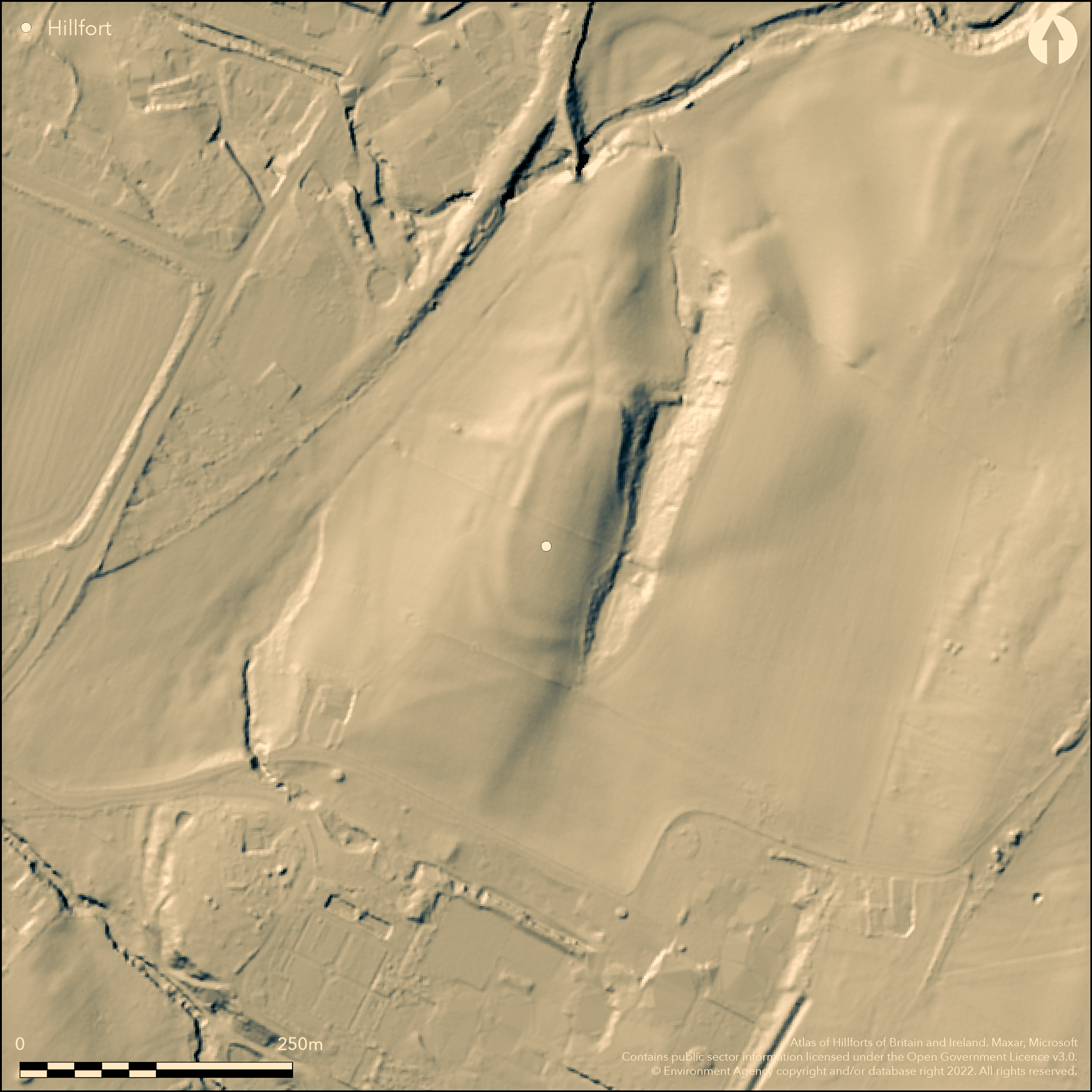
LiDAR 1m DTM Hillshade
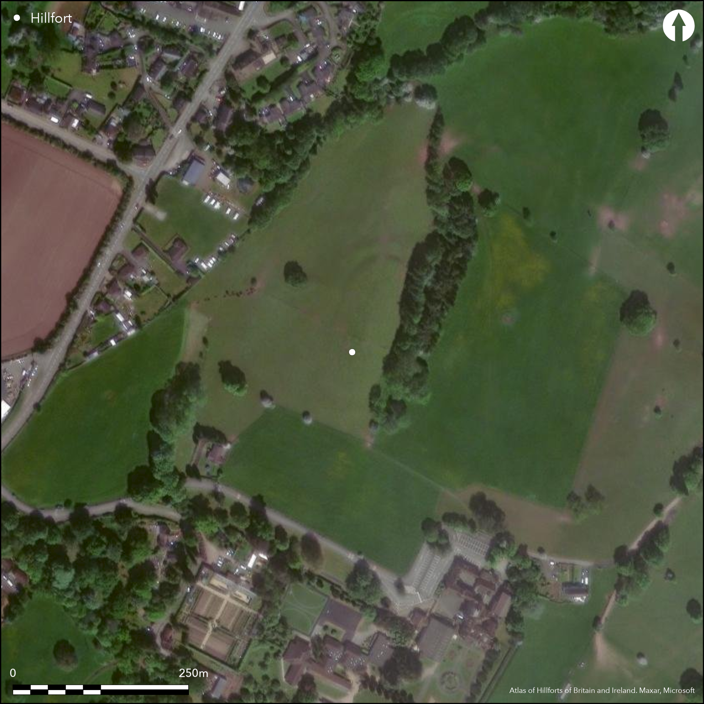
Satellite Imagery
LiDAR 1m DTM Hillshade
Satellite Imagery
Scroll left/right to view further images.
HER: Clwyd Powys 50376 (None)
NMR: SO 13 NE (306022)
SM: BR159(POW)
NGR: SO17503758
X: 317500 Y: 237580 (OSGB36)
Small partial contour hillfort located on ridge at the confluence of the River Wye and Afon Llynfi between two stream tributaries of the Llynfi at Three Cocks. Surrounding slopes moderate to N and S, moderate to strong to E and W. Not in a commanding position as overlooked by higher ground to E. Sub-rectangular measuring c. 120m by 45m with internal area of main enclosure c. 0.45ha. Wooded ravine provides natural protection on E, the remainder having double banks and ditches with a counterscarp on W. Possible annexe to N. Material for the ramparts depended on the nature of the ditches; eg sandstone and marl. Inturned entrances on the NNE and SSW, the former approached by a slightly sunken track bounded by interesting banks. Excavations by H.N. Savory in 1951 produced Neolithic and Roman material, latter associated with iron workings in nearby Gwernyfed Park. Site within a 17th century deer park and shown as a feature on an estate map of 1756. Deliberately levelled after WWI and subsequently ploughed and now under improved pasture. On 1st Ed. OS map (1888).
Citizen Science: ✗
Reliability of Data: Confirmed
Reliability of Interpretation: Confirmed
X: -356667 Y: 6805630 (EPSG: 3857)
Longitude: -3.203990717693376 Latitude: 52.0304337880621 (EPSG:4326)
Country: Wales
Current County or Unitary Authority: Powys
Historic County: Brecknockshire
Current Parish/Community/Council/Townland: Gwernyfed
Deliberately levelled after WWI and subsequently ploughed. Split into two fields - NE and smaller SW.
| Extant | ✓ |
| Cropmark | ✗ |
| Likely Destroyed | ✓ |
Under improved pasture. Wooded ravine on E. Within a 17th century deer park.
| Woodland | ✗ |
| Commercial Forestry Plantation | ✗ |
| Parkland | ✓ |
| Pasture (Grazing) | ✓ |
| Arable | ✗ |
| Scrub/Bracken | ✗ |
| Bare Outcrop | ✗ |
| Heather/Moorland | ✗ |
| Heath | ✗ |
| Built-up | ✗ |
| Coastal Grassland | ✗ |
| Other | ✗ |
Small, sub-rectangular, partial contour hillfort located on ridge at the confluence of the River Wye and Afon Llynfi between two stream tributaries of the Llynfi at Three Cocks. Surrounding slopes moderate to N and S, moderate to strong to E and W. Not in a commanding position as overlooked by higher ground to E.
| Contour Fort | ✗ |
| Partial Contour Fort | ✓ |
| Promontory Fort | ✗ |
| Hillslope Fort | ✗ |
| Level Terrain Fort | ✗ |
| Marsh Fort | ✗ |
| Multiple Enclosure Fort | ✗ |
| Hilltop | ✗ |
| Coastal Promontory | ✗ |
| Inland Promontory | ✗ |
| Valley Bottom | ✗ |
| Knoll/Hillock/Outcrop | ✗ |
| Ridge | ✓ |
| Cliff/Plateau-edge/Scarp | ✗ |
| Hillslope | ✗ |
| Lowland | ✗ |
| Spur | ✗ |
Dominant Topographic Feature: Ridge
| North | ✗ |
| Northeast | ✗ |
| East | ✗ |
| Southeast | ✗ |
| South | ✗ |
| Southwest | ✗ |
| West | ✗ |
| Northwest | ✓ |
| Level | ✗ |
Altitude: 115.0m
N/A
Early Iron Age potsherd and Romano-British pottery piece all indicate long activity.
Reliability: C - Low
| Pre 1200BC | ✗ |
| 1200BC - 800BC | ✗ |
| 800BC - 400BC | ✓ |
| 400BC - AD50 | ✓ |
| AD50 - AD400 | ✗ |
| AD400 - AD 800 | ✗ |
| Post AD800 | ✗ |
| Unknown | ✗ |
| Pre Hillfort: | None |
| Post Hillfort: | None |
| Artefactual: | None |
Feature on an estate map of 1756. On 1st Ed. OS map (1888). Excavation by H.N. Savory 1951. RCAHMW investigations 1951, 1983. CPAT defended enclosures survey 2006-2007.
| 1st Identified Map Depiction (1756): | Estate map. |
| Other (1888): | OS map. |
| Excavation (1951): | S.N. Savory |
| Other (None): | RCAHMW investigations. |
| Other (None): | CPAT defended enclosures survey. |
Neolithic potsherds and early Iron Age potsherd and Romano-British pottery.
Spring close to SE corner and stream 0.1km outside fort.
| None | ✓ |
| Spring | ✗ |
| Stream | ✗ |
| Pool | ✗ |
| Flush | ✗ |
| Well | ✗ |
| Other | ✗ |
None
| No Known Features | ✓ |
| Round Stone Structures | ✗ |
| Rectangular Stone Structures | ✗ |
| Curvilinear Platforms | ✗ |
| Other Roundhouse Evidence | ✗ |
| Pits | ✗ |
| Quarry Hollows | ✗ |
| Other | ✗ |
No details.
| No Known Excavation | ✗ |
| Pits | ✗ |
| Postholes | ✗ |
| Roundhouses | ✗ |
| Rectangular Structures | ✗ |
| Roads/Tracks | ✗ |
| Quarry Hollows | ✗ |
| Other | ✓ |
| Nothing Found | ✗ |
None
| No Known Geophysics | ✓ |
| Pits | ✗ |
| Roundhouses | ✗ |
| Rectangular Structures | ✗ |
| Roads/Tracks | ✗ |
| Quarry Hollows | ✗ |
| Other | ✗ |
| Nothing Found | ✗ |
Neolithic potsherds and early Iron Age potsherd and Romano-British pottery.
| No Known Finds | ✗ |
| Pottery | ✓ |
| Metal | ✗ |
| Metalworking | ✗ |
| Human Bones | ✗ |
| Animal Bones | ✗ |
| Lithics | ✗ |
| Environmental | ✗ |
| Other | ✗ |
None
| APs Not Checked | ✓ |
| None | ✗ |
| Roundhouses | ✗ |
| Rectangular Structures | ✗ |
| Pits | ✗ |
| Postholes | ✗ |
| Roads/Tracks | ✗ |
| Other | ✗ |
Inturned entrances on the NNE and SSW, the former approached by a slightly sunken track bounded by interesting banks. Savory determined the NNE entrance to be only 1.08 m wide.
| None: | Total gaps not determined. |
| 2: | None |
Guard Chambers: ✗
Chevaux de Frise: ✗
| 1. In-turned (North east): | Approached by a slightly sunken track bounded by interesting banks. |
| 1. Hollow Way (North east): | Approached by a slightly sunken track bounded by interesting banks. |
| 2. In-turned (South west): | None |
Ravine provides natural protection on E, the remainder having double banks and ditches with a counterscarp on W. Material for the ramparts depended on the nature of the ditches; eg sandstone and marl.
| Area 1: | 0.45ha. |
| Total: | 0.45ha. |
Total Footprint Area: 0.8ha.
None
| ✗ | Main enclosure c. 0.45ha. |
| ✗ | None |
| NE Quadrant: | 0 |
| SE Quadrant: | 0 |
| SW Quadrant: | 2 |
| NW Quadrant: | 2 |
| Total: | 2 |
| Partial Univallate | ✗ |
| Univallate | ✗ |
| Partial Bivallate | ✓ |
| Bivallate | ✗ |
| Partial Multivallate | ✗ |
| Multivallate | ✗ |
| Unknown | ✗ |
| Partial Univallate | ✗ |
| Univallate | ✗ |
| Partial Bivallate | ✗ |
| Bivallate | ✗ |
| Partial Multivallate | ✗ |
| Multivallate | ✗ |
Counterscarp on W. Sandstone and marl banks.
| None | ✗ |
| Earthen Bank | ✓ |
| Stone Wall | ✗ |
| Rubble | ✓ |
| Wall-walk | ✗ |
| Evidence of Timber | ✗ |
| Vitrification | ✗ |
| Other Burning | ✗ |
| Palisade | ✗ |
| Counter Scarp Bank | ✓ |
| Berm | ✗ |
| Unfinished | ✗ |
| Other | ✗ |
Material for the ramparts depended on the nature of the ditches; eg sandstone and marl.
| None | ✗ |
| Earthen Bank | ✓ |
| Stone Wall | ✗ |
| Murus Duplex | ✗ |
| Timber-framed | ✗ |
| Timber-laced | ✗ |
| Vitrification | ✗ |
| Other Burning | ✗ |
| Palisade | ✗ |
| Counter Scarp Bank | ✓ |
| Berm | ✗ |
| Unfinished | ✗ |
| No Known Excavation | ✗ |
| Other | ✗ |
| ✗ | None |
| ✓ | None |
Number of Ditches: 2
| ✓ | Possible annexe on N. |
Lloyd, J.C and Savory, H.N. 1958. Excavations at an early Iron Age hill-fort and a Romano-British iron-smelting place at Gwernyfed Park, Aberllynfi in 1951, Brycheiniog, 4, 53-71.
RCAHMW 1986. An inventory of the ancient monuments in Brecknock (Brycheiniog). The Prehistoric and Roman monuments, Vol 1, Part 2, Hill-forts and Roman remains, HF 57, London: HMSO.
Savory, H.N. 1952. List of Hill-forts and other earthworks in Wales, III, Brecknockshire, Bull Board Celtic Stud, 14, 74.
Savory, H.N. 1954. List of hill-forts and other earthworks in Wales and Monmouthshire. Additions and corrections to Sections I-III, Bull Board Celtic Stud, 15, (1952-54), 230.
Silvester, B. 2007. The Clwyd-Powys Archaeological Trust. Defended enclosures in Brecknock, CPAT Report No 859, Welshpool: CPAT.
Atlas of Hillforts:
Wikidata:
This work is licensed under CC BY-SA 4.0

 and should be cited as:
Lock, Gary and Ralston, Ian. 2024. Atlas of Hillforts of Britain and Ireland. Available at: https://hillforts.arch.ox.ac.uk
Document Version 1.1