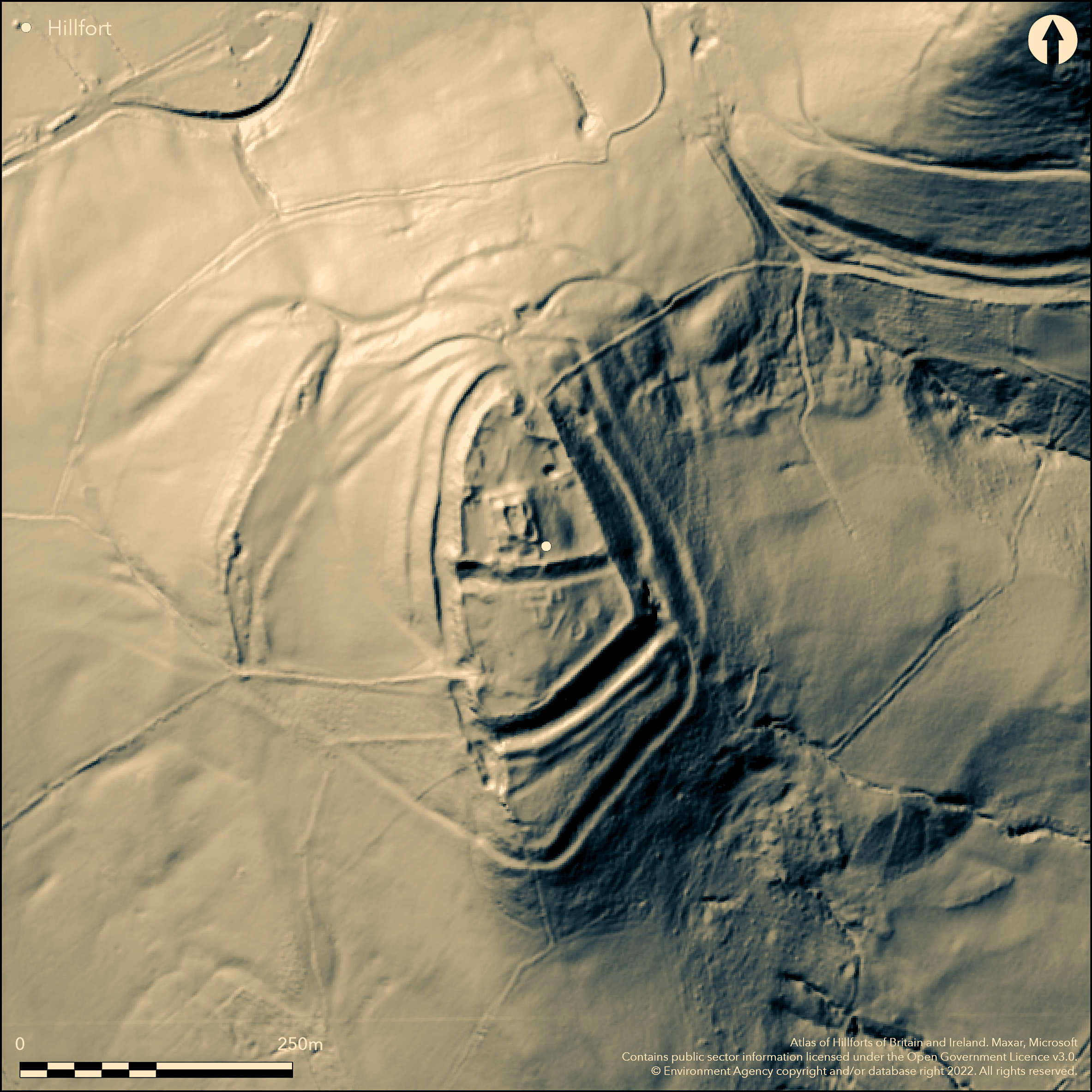
LiDAR 1m DTM Hillshade
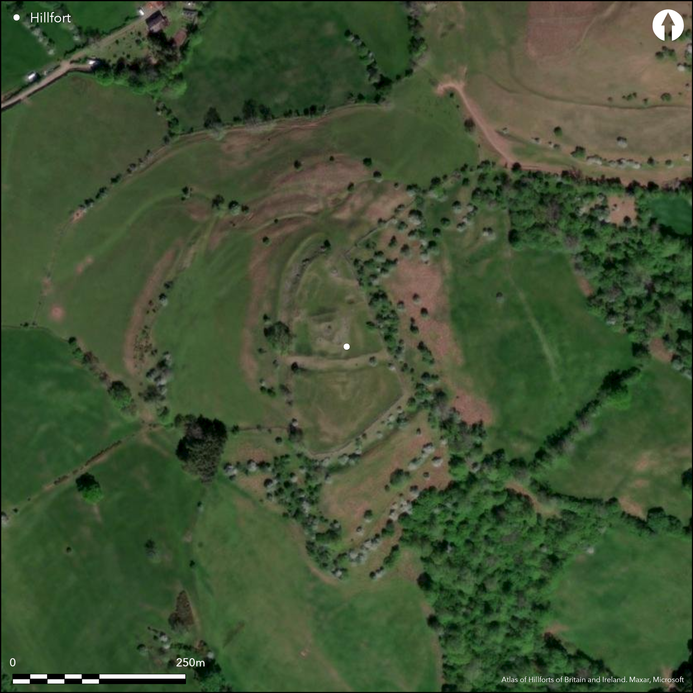
Satellite Imagery
LiDAR 1m DTM Hillshade
Satellite Imagery
Scroll left/right to view further images.
HER: Clwyd Powys 50422 (None)
NMR: SO 13 SE (92015)
SM: BR015(POW)
NGR: SO17913009
X: 317910 Y: 230090 (OSGB36)
Strategically sited, high, prominent and impressive, contour hillfort located on interfluve overlooking a col, and a possible routeway through the NW Black Mountains from the River Usk to the River Wye, at the entrance to The Forest pass at the headwaters and valleys of the Afon Rhiangell and the Afon Llyfni at Talgarth. Surrounding slopes N, S, W steep, E very steep. Measures c. 363m by 280m with internal area 1.36ha. This complex, multivallate Iron Age hillfort, contains the remains of a medieval castle in its centre, whose fortifications have obscured the Iron Age details to a degree (see also Castell Dinas Bran in Denbighshire - Atlas No 1159). For example, the inner rampart was incorporated in the castle defences. Evidence for a third continuous rampart system uncertain, as is the dating of outworks to W. Iron Age entrances obscured by castle gates. N castle gate possibly follows hillfort entrance as evidence of inturns. Castle possibly constructed in later 12th century as first mentioned in 1234. Described in survey of 1337 (Walker, 1999) and thought to have passed out of use thereafter. Leyland reported castle destroyed in the reign of Henry IV. Hillfort in generally good condition but affected by quarrying at S end of main defences and at the W outworks. On 1st Ed. OS map (1886-87). Minimal investigations, undated.
Citizen Science: ✗
Reliability of Data: Confirmed
Reliability of Interpretation: Confirmed
X: -355802 Y: 6793468 (EPSG: 3857)
Longitude: -3.196219788327498 Latitude: 51.96316768313782 (EPSG:4326)
Country: Wales
Current County or Unitary Authority: Powys
Historic County: Brecknockshire
Current Parish/Community/Council/Townland: Talgarth
Generally good condition but affected by quarrying at S end of main defences and at the W outworks. Contains the remains of a medieval castle in its centre, whose fortifications have obscured the Iron Age details to a degree.
| Extant | ✓ |
| Cropmark | ✗ |
| Likely Destroyed | ✗ |
Rough grass and bare rock. Contains the remains of a medieval castle in its centre. Quarrying.
| Woodland | ✗ |
| Commercial Forestry Plantation | ✗ |
| Parkland | ✗ |
| Pasture (Grazing) | ✓ |
| Arable | ✗ |
| Scrub/Bracken | ✗ |
| Bare Outcrop | ✗ |
| Heather/Moorland | ✗ |
| Heath | ✗ |
| Built-up | ✓ |
| Coastal Grassland | ✗ |
| Other | ✓ |
Strategically sited, high, prominent and impressive, contour hillfort located on interfluve overlooking a col, and a possible routeway through the NW Black Mountains from the River Usk to the River Wye, at the entrance to The Forest pass at the headwaters and valleys of the Afon Rhiangell and the Afon Llyfni. Surrounding slopes N, S, W steep, E very steep.
| Contour Fort | ✓ |
| Partial Contour Fort | ✗ |
| Promontory Fort | ✗ |
| Hillslope Fort | ✗ |
| Level Terrain Fort | ✗ |
| Marsh Fort | ✗ |
| Multiple Enclosure Fort | ✗ |
| Hilltop | ✓ |
| Coastal Promontory | ✗ |
| Inland Promontory | ✗ |
| Valley Bottom | ✗ |
| Knoll/Hillock/Outcrop | ✗ |
| Ridge | ✗ |
| Cliff/Plateau-edge/Scarp | ✗ |
| Hillslope | ✗ |
| Lowland | ✗ |
| Spur | ✗ |
Dominant Topographic Feature: Hill top
| North | ✗ |
| Northeast | ✗ |
| East | ✗ |
| Southeast | ✗ |
| South | ✗ |
| Southwest | ✗ |
| West | ✗ |
| Northwest | ✗ |
| Level | ✓ |
Altitude: 450.0m
N/A
None.
Reliability: D - None
| Pre 1200BC | ✗ |
| 1200BC - 800BC | ✗ |
| 800BC - 400BC | ✗ |
| 400BC - AD50 | ✗ |
| AD50 - AD400 | ✗ |
| AD400 - AD 800 | ✗ |
| Post AD800 | ✗ |
| Unknown | ✓ |
| Pre Hillfort: | None |
| Post Hillfort: | Medieval castle site. |
Castle described in survey of 1337. Leyland (16th century) reported that the castle had been destroyed in the reign of Henry IV. On 1st Ed. OS map (1886-87). RCAHMW investigation 1983. CPAT defended enclosures survey 2006-2007.
| 1st Identified Written Reference (1337): | Described in survey - no details. |
| 1st Identified Map Depiction (1889): | OS map. |
| Other (1983): | RCAHMW investigation. |
| Other (None): | Reported by Leland - no details. |
| Other (None): | CPAT defended enclosures survey. |
None.
Dinas Well just outside N gate and stream 0.2 km. Afon Rhiangell 0.5 km.
| None | ✓ |
| Spring | ✗ |
| Stream | ✗ |
| Pool | ✗ |
| Flush | ✗ |
| Well | ✗ |
| Other | ✗ |
None
| No Known Features | ✓ |
| Round Stone Structures | ✗ |
| Rectangular Stone Structures | ✗ |
| Curvilinear Platforms | ✗ |
| Other Roundhouse Evidence | ✗ |
| Pits | ✗ |
| Quarry Hollows | ✗ |
| Other | ✗ |
None
| No Known Excavation | ✓ |
| Pits | ✗ |
| Postholes | ✗ |
| Roundhouses | ✗ |
| Rectangular Structures | ✗ |
| Roads/Tracks | ✗ |
| Quarry Hollows | ✗ |
| Other | ✗ |
| Nothing Found | ✗ |
None
| No Known Geophysics | ✓ |
| Pits | ✗ |
| Roundhouses | ✗ |
| Rectangular Structures | ✗ |
| Roads/Tracks | ✗ |
| Quarry Hollows | ✗ |
| Other | ✗ |
| Nothing Found | ✗ |
None
| No Known Finds | ✓ |
| Pottery | ✗ |
| Metal | ✗ |
| Metalworking | ✗ |
| Human Bones | ✗ |
| Animal Bones | ✗ |
| Lithics | ✗ |
| Environmental | ✗ |
| Other | ✗ |
None
| APs Not Checked | ✓ |
| None | ✗ |
| Roundhouses | ✗ |
| Rectangular Structures | ✗ |
| Pits | ✗ |
| Postholes | ✗ |
| Roads/Tracks | ✗ |
| Other | ✗ |
Iron Age entrances obscured by castle gates. Main castle entrance to SW, and could also be a possible entrance to hillfort, but N castle gate also possibly follows a hillfort entrance as evidence of inturns.
| 2: | None |
| 2: | Iron Age entrances obscured by castle gates. |
Guard Chambers: ✗
Chevaux de Frise: ✗
| 1. In-turned (North): | Possible entrance. |
| 1. Simple Gap (South west): | Main castle entrance. Possible hillfort entrance? |
Iron Age details obscured by later castle. For example, the inner rampart was incorporated in the castle defences and evidence for a third continuous rampart system uncertain as is the dating of outworks to W.
| Area 1: | 1.36ha. |
| Total: | 1.36ha. |
Total Footprint Area: Noneha.
None
| ✗ | None |
| ✗ | Castle obscures any details and quadrants estimated. Evidence for a third continuous rampart uncertain. |
| NE Quadrant: | 2 |
| SE Quadrant: | 2 |
| SW Quadrant: | 2 |
| NW Quadrant: | 2 |
| Total: | 2 |
| Partial Univallate | ✗ |
| Univallate | ✗ |
| Partial Bivallate | ✗ |
| Bivallate | ✓ |
| Partial Multivallate | ✗ |
| Multivallate | ✗ |
| Unknown | ✗ |
| Partial Univallate | ✗ |
| Univallate | ✗ |
| Partial Bivallate | ✗ |
| Bivallate | ✗ |
| Partial Multivallate | ✗ |
| Multivallate | ✗ |
Castle obscures any details.
| None | ✗ |
| Earthen Bank | ✓ |
| Stone Wall | ✗ |
| Rubble | ✗ |
| Wall-walk | ✗ |
| Evidence of Timber | ✗ |
| Vitrification | ✗ |
| Other Burning | ✗ |
| Palisade | ✗ |
| Counter Scarp Bank | ✗ |
| Berm | ✗ |
| Unfinished | ✗ |
| Other | ✗ |
None
| None | ✓ |
| Earthen Bank | ✗ |
| Stone Wall | ✗ |
| Murus Duplex | ✗ |
| Timber-framed | ✗ |
| Timber-laced | ✗ |
| Vitrification | ✗ |
| Other Burning | ✗ |
| Palisade | ✗ |
| Counter Scarp Bank | ✗ |
| Berm | ✗ |
| Unfinished | ✗ |
| No Known Excavation | ✓ |
| Other | ✗ |
| ✗ | None |
| ✗ | Castle obscures any details. |
Number of Ditches: 0
| ✗ | None |
Cathcart King, D.J. 1961, The castles of Breconshire, Brycheiniog, 7, 71-94.
Kay, R.E. 1964. Castell Dinas, Parish of Talgarth, Brecknockshire, Brycheiniog, 10, 15-27.
RCAHMW 1986. An inventory of the ancient monuments in Brecknock (Brycheiniog). The Prehistoric and Roman monuments, Vol 1, Part 2, Hill-forts and Roman remains, HF 50, London: HMSO.
Savory, H.N. 1952. List of Hill-forts and other earthworks in Wales, III, Brecknockshire, Bull Board Celtic Stud, 14, 71.
Silvester, B. 2007. The Clwyd-Powys Archaeological Trust. Defended enclosures in Brecknock, CPAT Report No 859, Welshpool: CPAT.
Walker, R.F. 1999. Bwlchddinas Castle, Breconshire and the survey of 1337, Brycheiniog, 31, 1998-99, 19-30.
Atlas of Hillforts:
Wikidata:
This work is licensed under CC BY-SA 4.0

 and should be cited as:
Lock, Gary and Ralston, Ian. 2024. Atlas of Hillforts of Britain and Ireland. Available at: https://hillforts.arch.ox.ac.uk
Document Version 1.1