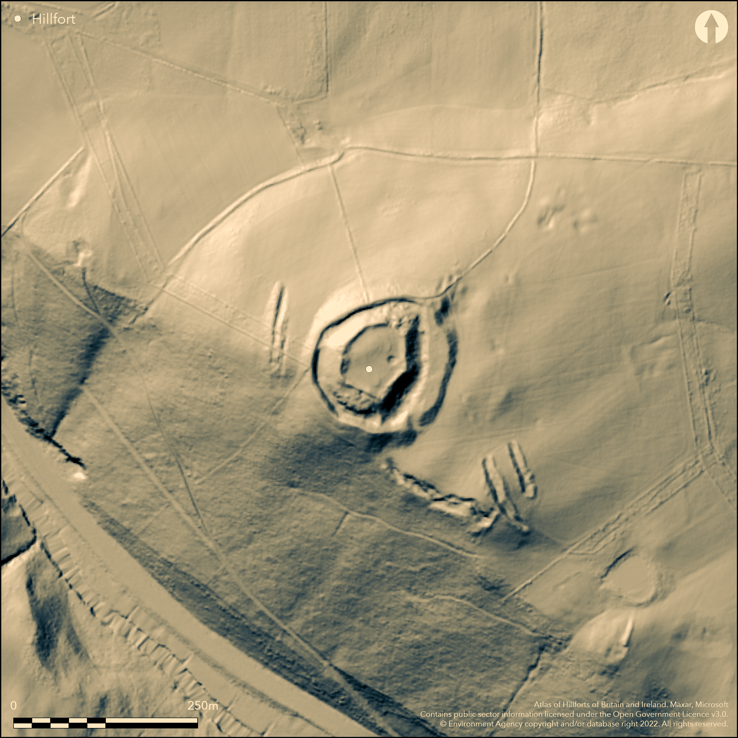
LiDAR 1m DTM Hillshade
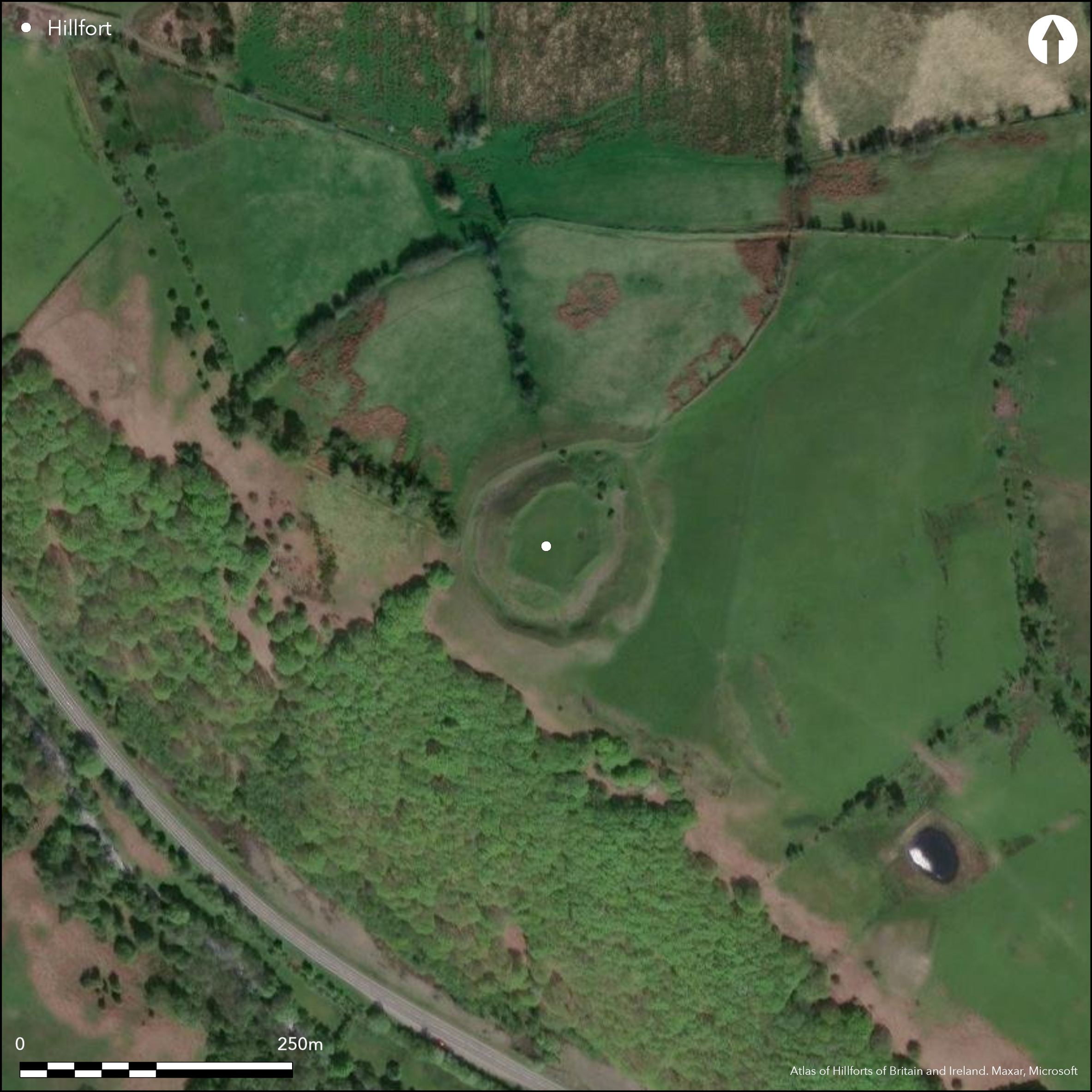
Satellite Imagery
LiDAR 1m DTM Hillshade
Satellite Imagery
Scroll left/right to view further images.
HER: Clwyd Powys 50476 (None)
NMR: SO 07 NE (96533)
SM: RD038(POW)
NGR: SO 09006 75449
X: 309006 Y: 275449 (OSGB36)
The medieval Castell Tinboeth, located on hill top above Castle Wood and River Ithon to SW, lies within possible Iron Age hillfort at Llanbadarn Fynydd. Evidence for location of contour hillfort masked by castle defences, probably constructed in late 13th century by powerful Mortimer family and mentioned in documents of 1316 and 1322. Dominant remains of the site are the castle ringwork, with impressive deep ditch, and stone traces of castle's twin-towered gatehouse at NE point. Enough evidence to suggest preceding enclosure, and detailed earthwork survey much needed. Possible hillfort measures c. 45m by 50m, with internal area c. 0.88ha. May be downhill from ringwork, with two banks and ditches. Bank and ditch following the scarp running off S side of ringwork possibly being the S defences of the enclosure; now disturbed by later quarrying. On SE this curves and closes in on two banks and ditches, and this possibly part of a funnelled entrance, but not proven. To N of these also possible that defences ran across this area. Grass and scrub. On 1st Ed. OS map (1889). Minimal investigations.
Citizen Science: ✗
Reliability of Data: Unconfirmed
Reliability of Interpretation: Unconfirmed
X: -371579 Y: 6867209 (EPSG: 3857)
Longitude: -3.3379532357908897 Latitude: 52.36947562505634 (EPSG:4326)
Country: Wales
Current County or Unitary Authority: Powys
Historic County: Radnorshire
Current Parish/Community/Council/Townland: Llanbadarn Fynydd
Much affected by medieval castle and disturbed by quarrying on S.
| Extant | ✓ |
| Cropmark | ✗ |
| Likely Destroyed | ✓ |
Grassy interior of banks and remains. Some scrub. Medieval castle. Quarrying.
| Woodland | ✗ |
| Commercial Forestry Plantation | ✗ |
| Parkland | ✗ |
| Pasture (Grazing) | ✓ |
| Arable | ✗ |
| Scrub/Bracken | ✓ |
| Bare Outcrop | ✗ |
| Heather/Moorland | ✗ |
| Heath | ✗ |
| Built-up | ✓ |
| Coastal Grassland | ✗ |
| Other | ✓ |
Possible contour hillfort located on hill top above Castle Wood and River Ithon to SW.
| Contour Fort | ✓ |
| Partial Contour Fort | ✗ |
| Promontory Fort | ✗ |
| Hillslope Fort | ✗ |
| Level Terrain Fort | ✗ |
| Marsh Fort | ✗ |
| Multiple Enclosure Fort | ✗ |
| Hilltop | ✓ |
| Coastal Promontory | ✗ |
| Inland Promontory | ✗ |
| Valley Bottom | ✗ |
| Knoll/Hillock/Outcrop | ✗ |
| Ridge | ✗ |
| Cliff/Plateau-edge/Scarp | ✗ |
| Hillslope | ✗ |
| Lowland | ✗ |
| Spur | ✗ |
Dominant Topographic Feature: Hill top
| North | ✗ |
| Northeast | ✗ |
| East | ✗ |
| Southeast | ✗ |
| South | ✗ |
| Southwest | ✗ |
| West | ✗ |
| Northwest | ✗ |
| Level | ✓ |
Altitude: 404.0m
N/A
Probably Iron Age, but conjecture only.
Reliability: D - None
| Pre 1200BC | ✗ |
| 1200BC - 800BC | ✗ |
| 800BC - 400BC | ✗ |
| 400BC - AD50 | ✗ |
| AD50 - AD400 | ✗ |
| AD400 - AD 800 | ✗ |
| Post AD800 | ✗ |
| Unknown | ✓ |
| Pre Hillfort: | None |
| Post Hillfort: | Medieval castle. |
On 1st Ed. OS map (1889). CPAT defended enclosures survey 2006.
| 1st Identified Map Depiction (1889): | OS map. |
| Other (2006): | CPAT defended enclosures survey. |
None.
None
| None | ✓ |
| Spring | ✗ |
| Stream | ✗ |
| Pool | ✗ |
| Flush | ✗ |
| Well | ✗ |
| Other | ✗ |
None
| No Known Features | ✓ |
| Round Stone Structures | ✗ |
| Rectangular Stone Structures | ✗ |
| Curvilinear Platforms | ✗ |
| Other Roundhouse Evidence | ✗ |
| Pits | ✗ |
| Quarry Hollows | ✗ |
| Other | ✗ |
None
| No Known Excavation | ✓ |
| Pits | ✗ |
| Postholes | ✗ |
| Roundhouses | ✗ |
| Rectangular Structures | ✗ |
| Roads/Tracks | ✗ |
| Quarry Hollows | ✗ |
| Other | ✗ |
| Nothing Found | ✗ |
None
| No Known Geophysics | ✓ |
| Pits | ✗ |
| Roundhouses | ✗ |
| Rectangular Structures | ✗ |
| Roads/Tracks | ✗ |
| Quarry Hollows | ✗ |
| Other | ✗ |
| Nothing Found | ✗ |
None
| No Known Finds | ✓ |
| Pottery | ✗ |
| Metal | ✗ |
| Metalworking | ✗ |
| Human Bones | ✗ |
| Animal Bones | ✗ |
| Lithics | ✗ |
| Environmental | ✗ |
| Other | ✗ |
None
| APs Not Checked | ✓ |
| None | ✗ |
| Roundhouses | ✗ |
| Rectangular Structures | ✗ |
| Pits | ✗ |
| Postholes | ✗ |
| Roads/Tracks | ✗ |
| Other | ✗ |
On SE, bank curves and closes in on two banks and ditches, and this suggested as part of a funnelled entrance, but not proven.
| 1: | Total breaks cannot be determined. |
| 2: | Possible entrance only. |
Guard Chambers: ✗
Chevaux de Frise: ✗
| 1. Passage-way/Corridor (South east): | Not proven |
Possible surviving remains of enclosure may be downhill from ringwork on W, with two banks and ditches, and bank and ditch following the scarp running off S side of ringwork, possibly being S defences of the enclosure; now disturbed by later quarrying. On SE this curves and closes in on two banks and ditches.
| Area 1: | 0.88ha. |
| Total: | 0.88ha. |
Total Footprint Area: Noneha.
None
| ✗ | None |
| ✗ | Quadrants not proven, especially to N. |
| NE Quadrant: | 0 |
| SE Quadrant: | 2 |
| SW Quadrant: | 2 |
| NW Quadrant: | 0 |
| Total: | 2 |
| Partial Univallate | ✗ |
| Univallate | ✗ |
| Partial Bivallate | ✓ |
| Bivallate | ✗ |
| Partial Multivallate | ✗ |
| Multivallate | ✗ |
| Unknown | ✗ |
| Partial Univallate | ✗ |
| Univallate | ✗ |
| Partial Bivallate | ✗ |
| Bivallate | ✗ |
| Partial Multivallate | ✗ |
| Multivallate | ✗ |
Composition not determined.
| None | ✗ |
| Earthen Bank | ✓ |
| Stone Wall | ✗ |
| Rubble | ✗ |
| Wall-walk | ✗ |
| Evidence of Timber | ✗ |
| Vitrification | ✗ |
| Other Burning | ✗ |
| Palisade | ✗ |
| Counter Scarp Bank | ✗ |
| Berm | ✗ |
| Unfinished | ✗ |
| Other | ✗ |
None
| None | ✗ |
| Earthen Bank | ✗ |
| Stone Wall | ✗ |
| Murus Duplex | ✗ |
| Timber-framed | ✗ |
| Timber-laced | ✗ |
| Vitrification | ✗ |
| Other Burning | ✗ |
| Palisade | ✗ |
| Counter Scarp Bank | ✗ |
| Berm | ✗ |
| Unfinished | ✗ |
| No Known Excavation | ✓ |
| Other | ✗ |
| ✗ | None |
| ✓ | None |
Number of Ditches: 2
| ✗ | None |
Silvester, R.J. and Hankinson, R. 2006. Defended enclosures in Radnorshire. Project report, CPAT Report 781, Welshpool: CPAT.
Atlas of Hillforts:
Wikidata:
This work is licensed under CC BY-SA 4.0

 and should be cited as:
Lock, Gary and Ralston, Ian. 2024. Atlas of Hillforts of Britain and Ireland. Available at: https://hillforts.arch.ox.ac.uk
Document Version 1.1