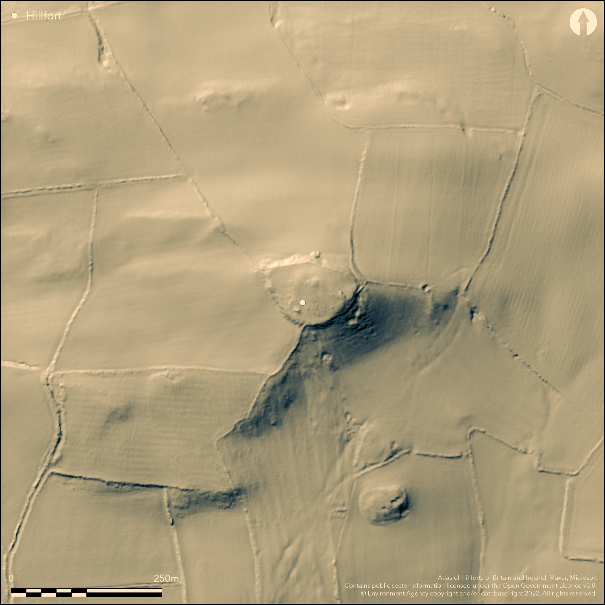
LiDAR 1m DTM Hillshade
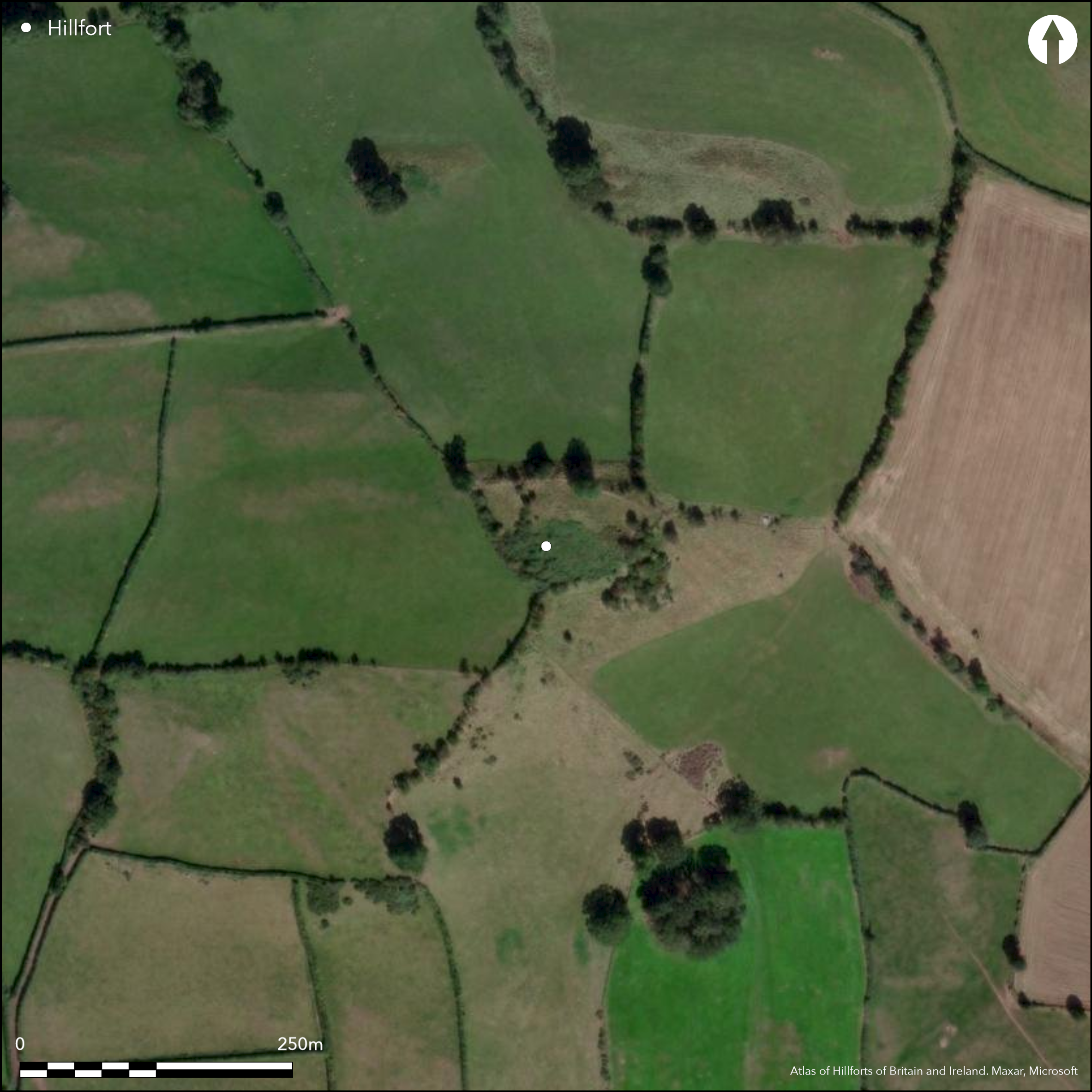
Satellite Imagery
LiDAR 1m DTM Hillshade
Satellite Imagery
Scroll left/right to view further images.
HER: Clwyd Powys 620 (None)
NMR: SO 02 NE 12 (305714)
SM: BR247(POW)
NGR: SO 0821 2911
X: 308210 Y: 229110 (OSGB36)
Contour hillfort, one of a cluster of hillforts surrounding Brecon on a high hilltop overlooking the River Usk. On the opposite side of the valley to Slwch Tump (Atlas No. 1324 ). Triangular in form measuring 90m by 62m with internal area 0.43ha. Defined by substantial rampart, up to 4m high on N, and ditch, latter not visible from surface but existence proved by excavation. The rampart was dug through sandstone (possibly used for revetment) into the underlying marl. Possible entrances on the NE and NW corners. Excavated by H.N. Savory in 1959 showed the perimeter to have consisted of a rampart and ditch, with an entrance on the SE. Rectilinear house floors within were dated to the Iron Age. 3rd or 4th century BC date assigned to pottery, including a possible sherd of stamped Malvernian ware. Oxen, sheep and pig bone found near the W entrance. Interior ploughed and rampart much reduced and covered by trees and undergrowth.
Citizen Science: ✗
Reliability of Data: Confirmed
Reliability of Interpretation: Confirmed
X: -371484 Y: 6791603 (EPSG: 3857)
Longitude: -3.3370990017360724 Latitude: 51.95284040205984 (EPSG:4326)
Country: Wales
Current County or Unitary Authority: Powys
Historic County: Brecknockshire
Current Parish/Community/Council/Townland: Llanfrynach
Interior ploughed and rampart much reduced and covered by trees and undergrowth.
| Extant | ✓ |
| Cropmark | ✗ |
| Likely Destroyed | ✗ |
Rough pasture and scrub.
| Woodland | ✗ |
| Commercial Forestry Plantation | ✗ |
| Parkland | ✗ |
| Pasture (Grazing) | ✓ |
| Arable | ✗ |
| Scrub/Bracken | ✓ |
| Bare Outcrop | ✗ |
| Heather/Moorland | ✗ |
| Heath | ✗ |
| Built-up | ✗ |
| Coastal Grassland | ✗ |
| Other | ✗ |
Contour hillfort, one of a cluster of hillforts surrounding Brecon on a high hilltop overlooking the River Usk.
| Contour Fort | ✓ |
| Partial Contour Fort | ✗ |
| Promontory Fort | ✗ |
| Hillslope Fort | ✗ |
| Level Terrain Fort | ✗ |
| Marsh Fort | ✗ |
| Multiple Enclosure Fort | ✗ |
| Hilltop | ✓ |
| Coastal Promontory | ✗ |
| Inland Promontory | ✗ |
| Valley Bottom | ✗ |
| Knoll/Hillock/Outcrop | ✗ |
| Ridge | ✗ |
| Cliff/Plateau-edge/Scarp | ✗ |
| Hillslope | ✗ |
| Lowland | ✗ |
| Spur | ✗ |
Dominant Topographic Feature: Hill top
| North | ✗ |
| Northeast | ✗ |
| East | ✗ |
| Southeast | ✗ |
| South | ✗ |
| Southwest | ✗ |
| West | ✗ |
| Northwest | ✗ |
| Level | ✓ |
Altitude: 317.0m
N/A
Excavated 1959 with 3rd or 4th century BC date assigned to pottery, including a possible sherd of stamped Malvernian ware. Rectilinear house floors within were dated to the Iron Age.
Reliability: B - Medium
| Pre 1200BC | ✗ |
| 1200BC - 800BC | ✗ |
| 800BC - 400BC | ✗ |
| 400BC - AD50 | ✓ |
| AD50 - AD400 | ✗ |
| AD400 - AD 800 | ✗ |
| Post AD800 | ✗ |
| Unknown | ✗ |
| Pre Hillfort: | None |
| Post Hillfort: | None |
| Artefactual: | Pottery. |
| Morphology/Earthwork/Typology: | House floors. |
Excavated 1959 by H.N. Savory. RCAHMW investigation 1978. CPAT defended enclosures survey 2006-2007.
| Excavation (1959): | H.N. Savory. |
| Other (1978): | RCAHMW investigation. |
| Other (1982): | Visit by Hillfort Study Group |
| Other (None): | CPAT defended enclosures survey. |
Rectilinear house floors within were dated to the Iron Age. 3rd or 4th century BC date assigned to pottery, including a possible sherd of stamped Malvernian ware. Oxen, sheep and pig bone found near the W entrance. Slingstones.
Stream 0.4km outside fort.
| None | ✓ |
| Spring | ✗ |
| Stream | ✗ |
| Pool | ✗ |
| Flush | ✗ |
| Well | ✗ |
| Other | ✗ |
None
| No Known Features | ✓ |
| Round Stone Structures | ✗ |
| Rectangular Stone Structures | ✗ |
| Curvilinear Platforms | ✗ |
| Other Roundhouse Evidence | ✗ |
| Pits | ✗ |
| Quarry Hollows | ✗ |
| Other | ✗ |
Rectilinear house floors within were dated to the Iron Age.
| No Known Excavation | ✗ |
| Pits | ✗ |
| Postholes | ✗ |
| Roundhouses | ✗ |
| Rectangular Structures | ✓ |
| Roads/Tracks | ✗ |
| Quarry Hollows | ✗ |
| Other | ✗ |
| Nothing Found | ✗ |
None
| No Known Geophysics | ✓ |
| Pits | ✗ |
| Roundhouses | ✗ |
| Rectangular Structures | ✗ |
| Roads/Tracks | ✗ |
| Quarry Hollows | ✗ |
| Other | ✗ |
| Nothing Found | ✗ |
Pottery, including a possible sherd of stamped Malvernian ware. Oxen, sheep and pig bone found near the W entrance. Slingstones.
| No Known Finds | ✗ |
| Pottery | ✓ |
| Metal | ✗ |
| Metalworking | ✗ |
| Human Bones | ✗ |
| Animal Bones | ✓ |
| Lithics | ✓ |
| Environmental | ✗ |
| Other | ✗ |
None
| APs Not Checked | ✓ |
| None | ✗ |
| Roundhouses | ✗ |
| Rectangular Structures | ✗ |
| Pits | ✗ |
| Postholes | ✗ |
| Roads/Tracks | ✗ |
| Other | ✗ |
Possible entrances on the NE and NW corners.
| 2: | None |
| 2: | None |
Guard Chambers: ✗
Chevaux de Frise: ✗
| 1. Simple Gap (North east): | None |
| 2. Simple Gap (North west): | None |
Defined by rampart, up to 4m high on N, and ditch, latter not visible from surface but existence proved by excavation. The rampart was dug through sandstone (possibly used for revetment) into the underlying marl.
| Area 1: | 0.43ha. |
| Total: | 0.43ha. |
Total Footprint Area: Noneha.
None
| ✗ | None |
| ✓ | None |
| NE Quadrant: | 1 |
| SE Quadrant: | 1 |
| SW Quadrant: | 1 |
| NW Quadrant: | 1 |
| Total: | 1 |
| Partial Univallate | ✗ |
| Univallate | ✓ |
| Partial Bivallate | ✗ |
| Bivallate | ✗ |
| Partial Multivallate | ✗ |
| Multivallate | ✗ |
| Unknown | ✗ |
| Partial Univallate | ✗ |
| Univallate | ✗ |
| Partial Bivallate | ✗ |
| Bivallate | ✗ |
| Partial Multivallate | ✗ |
| Multivallate | ✗ |
None
| None | ✗ |
| Earthen Bank | ✓ |
| Stone Wall | ✗ |
| Rubble | ✗ |
| Wall-walk | ✗ |
| Evidence of Timber | ✗ |
| Vitrification | ✗ |
| Other Burning | ✗ |
| Palisade | ✗ |
| Counter Scarp Bank | ✗ |
| Berm | ✗ |
| Unfinished | ✗ |
| Other | ✗ |
Excavation showed site defined by rampart and ditch. Possible sandstone revetment.
| None | ✗ |
| Earthen Bank | ✓ |
| Stone Wall | ✓ |
| Murus Duplex | ✗ |
| Timber-framed | ✗ |
| Timber-laced | ✗ |
| Vitrification | ✗ |
| Other Burning | ✗ |
| Palisade | ✗ |
| Counter Scarp Bank | ✗ |
| Berm | ✗ |
| Unfinished | ✗ |
| No Known Excavation | ✗ |
| Other | ✗ |
| ✗ | None |
| ✓ | Ditch not visible from surface. |
Number of Ditches: 1
| ✗ | None |
Savory, H.N. 1952. List of Hill-forts and other earthworks in Wales, III, Brecknockshire, Bull Board Celtic Stud, 14, 72.
Savory, H.N. 1971. Prehistoric Brecknock, Brycheiniog, XV, 3-22.
Silvester, B. 2007. The Clwyd-Powys Archaeological Trust. Defended enclosures in Brecknock, CPAT Report No 859, Welshpool: CPAT.
RCAHMW 1986. An inventory of the ancient monuments in Brecknock (Brycheiniog). The Prehistoric and Roman monuments, Vol 1, Part 2, Hill-forts and Roman remains, HF 31, London: HMSO.
Atlas of Hillforts:
Wikidata:
This work is licensed under CC BY-SA 4.0

 and should be cited as:
Lock, Gary and Ralston, Ian. 2024. Atlas of Hillforts of Britain and Ireland. Available at: https://hillforts.arch.ox.ac.uk
Document Version 1.1