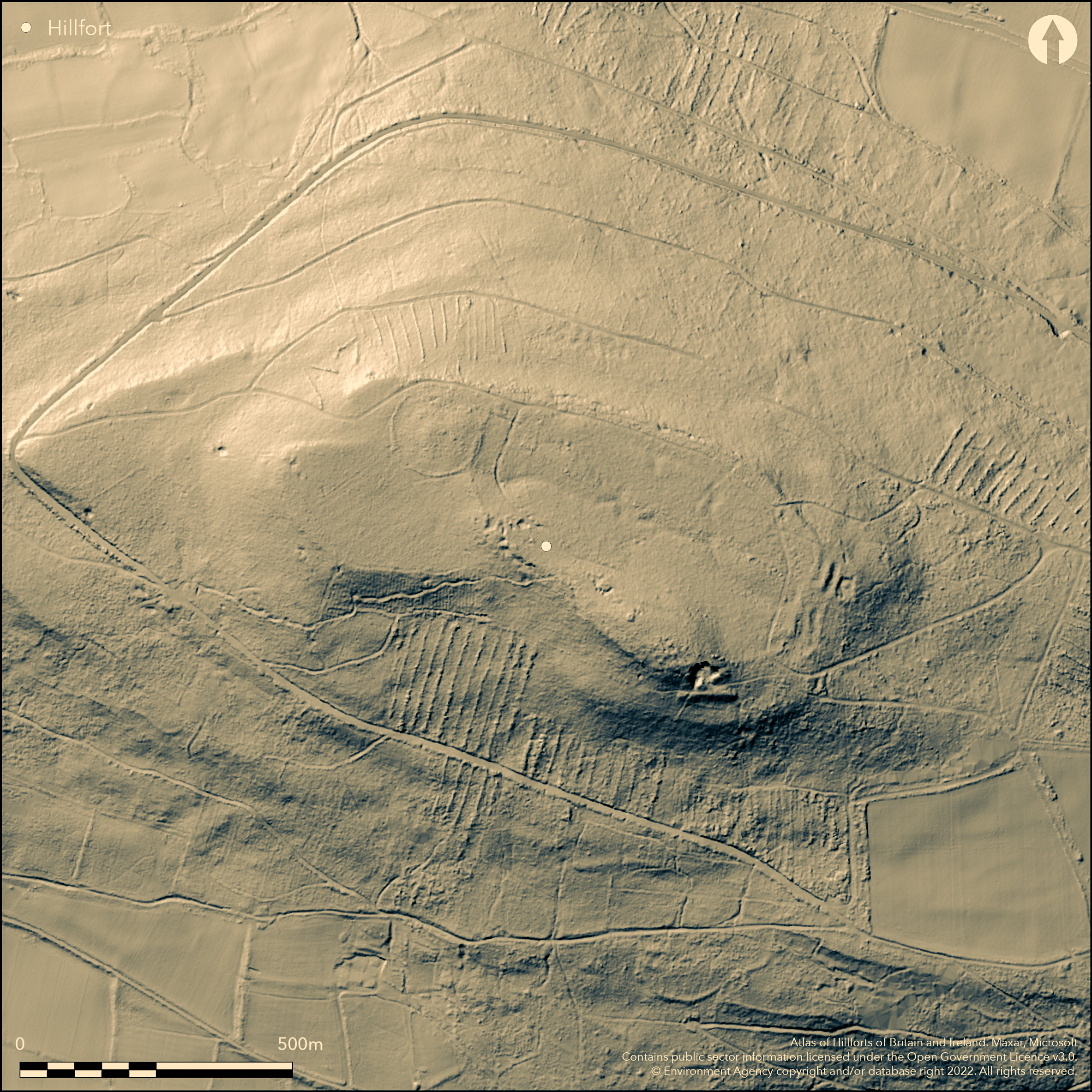
LiDAR 1m DTM Hillshade
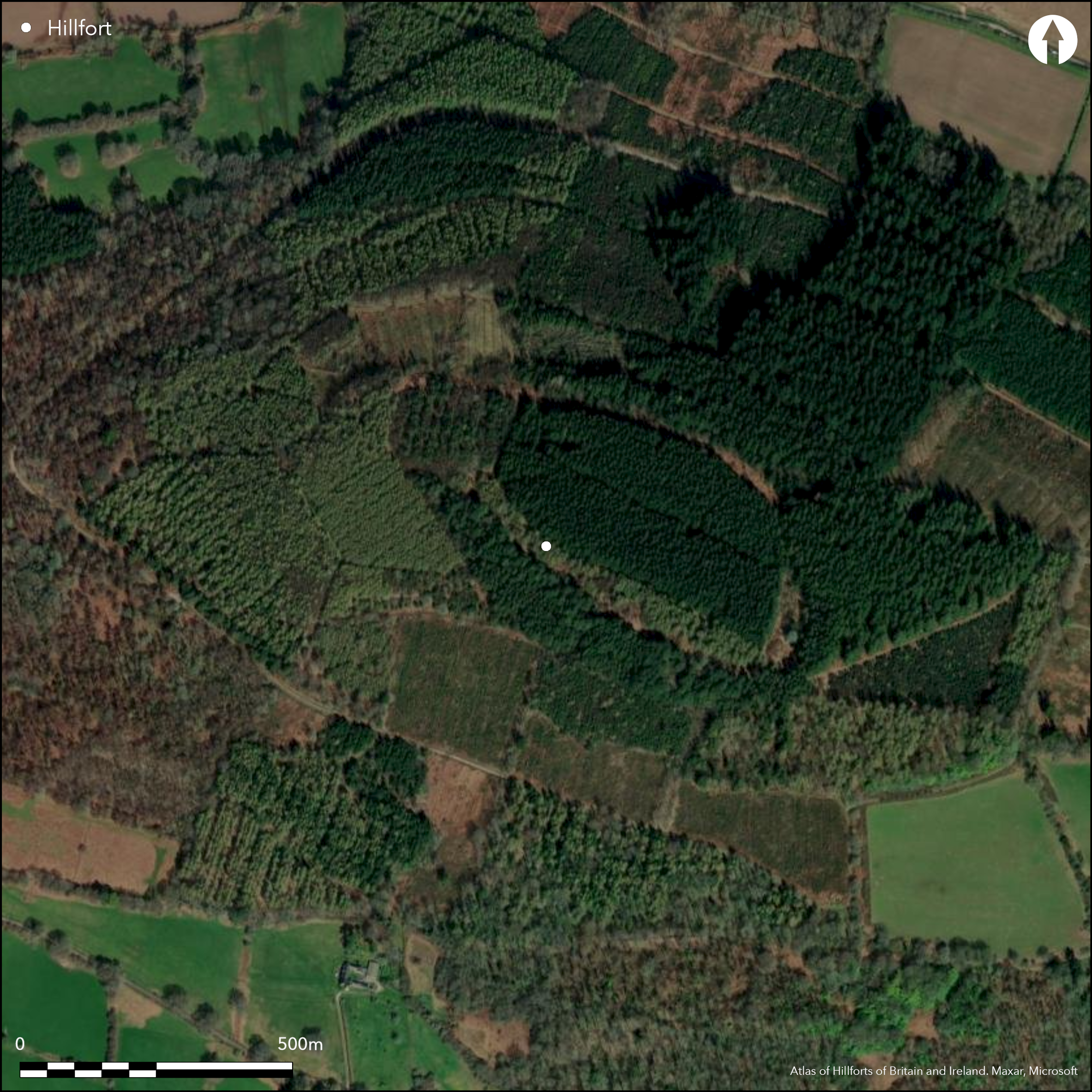
Satellite Imagery
LiDAR 1m DTM Hillshade
Satellite Imagery
Scroll left/right to view further images.
HER: Clwyd Powys 664 (None)
NMR: SO 12 SE (275613)
SM: BR116(POW)
NGR: SO17202070
X: 317200 Y: 220700 (OSGB36)
Possible, large, contour hillfort, located on hill summit of the very prominent Myarth to NE and commanding a potential route from the River Usk to the River Wye. Steep or very steep surrounding steep-sided hill 5km NW of Crickhowell. It dominates a narrow stretch of middle Usk valley to S and the lower reaches of Rhiangoll valley to NE. Measures c. 354m ESE-WNW by 210m, with interior area c. 12ha. Probably now mostly destroyed by mining and afforestation. H.N. Savory (1952) visited the site in 1947 finding a bivallate hillfort with fine and deep inturned entrance on central ESE with guard chamber with dry-stone walling on the N side. Successive visits by OS and RCAHMW surveyors 1973-82 found no traces of earthworks, but site heavily disturbed and afforested with linear mining. CPAT site investigation in 1988 found length of double 'rampart' running around NE part of the hill. Also recorded from the air during undated RCAHMW aerial reconnaissance. On 1st Ed. OS map (1887).
Citizen Science: ✗
Reliability of Data: Unconfirmed
Reliability of Interpretation: Confirmed
X: -356700 Y: 6778214 (EPSG: 3857)
Longitude: -3.204290182771407 Latitude: 51.878655466122 (EPSG:4326)
Country: Wales
Current County or Unitary Authority: Powys
Historic County: Brecknockshire
Current Parish/Community/Council/Townland: Llanfihangel Cwmdu with Bwlch and Cathedine
Probably mostly destroyed, but possible circuit cleared of trees.
| Extant | ✓ |
| Cropmark | ✗ |
| Likely Destroyed | ✓ |
Dense plantation, re-afforested 1948-73.
| Woodland | ✗ |
| Commercial Forestry Plantation | ✓ |
| Parkland | ✗ |
| Pasture (Grazing) | ✗ |
| Arable | ✗ |
| Scrub/Bracken | ✗ |
| Bare Outcrop | ✗ |
| Heather/Moorland | ✗ |
| Heath | ✗ |
| Built-up | ✗ |
| Coastal Grassland | ✗ |
| Other | ✗ |
Possible large contour hillfort, located on hill summit of the very prominent Myarth, a to NE and commanding a potential route from the River Usk to the River Wye. Steep or very steep surrounding steep-sided hill 5km NW of Crickhowell. It dominating narrow stretch of middle Usk valley to S and the lower reaches of Rhiangoll valley to NE.
| Contour Fort | ✓ |
| Partial Contour Fort | ✗ |
| Promontory Fort | ✗ |
| Hillslope Fort | ✗ |
| Level Terrain Fort | ✗ |
| Marsh Fort | ✗ |
| Multiple Enclosure Fort | ✗ |
| Hilltop | ✓ |
| Coastal Promontory | ✗ |
| Inland Promontory | ✗ |
| Valley Bottom | ✗ |
| Knoll/Hillock/Outcrop | ✗ |
| Ridge | ✗ |
| Cliff/Plateau-edge/Scarp | ✗ |
| Hillslope | ✗ |
| Lowland | ✗ |
| Spur | ✗ |
Dominant Topographic Feature: Hill top
| North | ✗ |
| Northeast | ✗ |
| East | ✗ |
| Southeast | ✗ |
| South | ✗ |
| Southwest | ✗ |
| West | ✗ |
| Northwest | ✗ |
| Level | ✓ |
Altitude: 280.0m
N/A
None.
Reliability: D - None
| Pre 1200BC | ✗ |
| 1200BC - 800BC | ✗ |
| 800BC - 400BC | ✗ |
| 400BC - AD50 | ✗ |
| AD50 - AD400 | ✗ |
| AD400 - AD 800 | ✗ |
| Post AD800 | ✗ |
| Unknown | ✓ |
| Pre Hillfort: | None |
| Post Hillfort: | None |
On 1st Ed. OS map (1887). Site investigation H.N. Savory 1947. Site observations and investigations by OS and RCAHMW 1973-82. Site observation CPAT 1988. CPAT defended enclosures survey 2006-2007. Recorded from the air during RCAHMW aerial reconnaissance - no date.
| 1st Identified Map Depiction (1887): | OS map. |
| Other (1947): | Site investigation H. N. Savory 1947 |
| Other (None): | Site observations and investigations by OS and RCAHMW. |
| Other (None): | CPAT defended enclosures survey. |
| Other (None): | RCAHMW aerial reconnaissance. |
None.
None
| None | ✓ |
| Spring | ✗ |
| Stream | ✗ |
| Pool | ✗ |
| Flush | ✗ |
| Well | ✗ |
| Other | ✗ |
None
| No Known Features | ✓ |
| Round Stone Structures | ✗ |
| Rectangular Stone Structures | ✗ |
| Curvilinear Platforms | ✗ |
| Other Roundhouse Evidence | ✗ |
| Pits | ✗ |
| Quarry Hollows | ✗ |
| Other | ✗ |
None
| No Known Excavation | ✓ |
| Pits | ✗ |
| Postholes | ✗ |
| Roundhouses | ✗ |
| Rectangular Structures | ✗ |
| Roads/Tracks | ✗ |
| Quarry Hollows | ✗ |
| Other | ✗ |
| Nothing Found | ✗ |
None
| No Known Geophysics | ✓ |
| Pits | ✗ |
| Roundhouses | ✗ |
| Rectangular Structures | ✗ |
| Roads/Tracks | ✗ |
| Quarry Hollows | ✗ |
| Other | ✗ |
| Nothing Found | ✗ |
None
| No Known Finds | ✓ |
| Pottery | ✗ |
| Metal | ✗ |
| Metalworking | ✗ |
| Human Bones | ✗ |
| Animal Bones | ✗ |
| Lithics | ✗ |
| Environmental | ✗ |
| Other | ✗ |
None
| APs Not Checked | ✓ |
| None | ✗ |
| Roundhouses | ✗ |
| Rectangular Structures | ✗ |
| Pits | ✗ |
| Postholes | ✗ |
| Roads/Tracks | ✗ |
| Other | ✗ |
On the ESE Savory located a well-preserved inturned entrance with a rectangular guard chamber of dry-stone walling about 1.5m square built into the internal face of the N rampart return. Two short lengths of bank either side of entrance approach. Appears to be no trace now.
| 1: | None |
| 2: | None |
Guard Chambers: ✓
Chevaux de Frise: ✗
| 1. In-turned (East): | Located by Savory in 1947. |
| 1. Recesses/Guard Chambers (East): | None |
Probably single rampart with two ramparts on E side.
| Area 1: | 12.0ha. |
| Total: | 12.0ha. |
Total Footprint Area: Noneha.
None
| ✗ | None |
| ✓ | Ramparts estimated. |
| NE Quadrant: | 2 |
| SE Quadrant: | 2 |
| SW Quadrant: | 1 |
| NW Quadrant: | 1 |
| Total: | 2 |
| Partial Univallate | ✓ |
| Univallate | ✗ |
| Partial Bivallate | ✓ |
| Bivallate | ✗ |
| Partial Multivallate | ✗ |
| Multivallate | ✗ |
| Unknown | ✗ |
| Partial Univallate | ✗ |
| Univallate | ✗ |
| Partial Bivallate | ✗ |
| Bivallate | ✗ |
| Partial Multivallate | ✗ |
| Multivallate | ✗ |
Probably stone-walled site.
| None | ✗ |
| Earthen Bank | ✗ |
| Stone Wall | ✓ |
| Rubble | ✗ |
| Wall-walk | ✗ |
| Evidence of Timber | ✗ |
| Vitrification | ✗ |
| Other Burning | ✗ |
| Palisade | ✗ |
| Counter Scarp Bank | ✗ |
| Berm | ✗ |
| Unfinished | ✗ |
| Other | ✗ |
None
| None | ✗ |
| Earthen Bank | ✗ |
| Stone Wall | ✗ |
| Murus Duplex | ✗ |
| Timber-framed | ✗ |
| Timber-laced | ✗ |
| Vitrification | ✗ |
| Other Burning | ✗ |
| Palisade | ✗ |
| Counter Scarp Bank | ✗ |
| Berm | ✗ |
| Unfinished | ✗ |
| No Known Excavation | ✓ |
| Other | ✗ |
| ✗ | None |
| ✗ | No details. |
Number of Ditches: 0
| ✗ | None |
Savory, H.N. 1952. List of Hill-forts and other earthworks in Wales, III, Brecknockshire, Bull Board Celtic Stud, 15, 71.
Silvester, B. 2007. The Clwyd-Powys Archaeological Trust. Defended enclosures in Brecknock, CPAT Report No 859, Welshpool: CPAT.
RCAHMW 1986. An inventory of the ancient monuments in Brecknock (Brycheiniog). The Prehistoric and Roman monuments, Vol 1, Part 2, Hill-forts and Roman remains, London: HMSO.
Atlas of Hillforts:
Wikidata:
This work is licensed under CC BY-SA 4.0

 and should be cited as:
Lock, Gary and Ralston, Ian. 2024. Atlas of Hillforts of Britain and Ireland. Available at: https://hillforts.arch.ox.ac.uk
Document Version 1.1