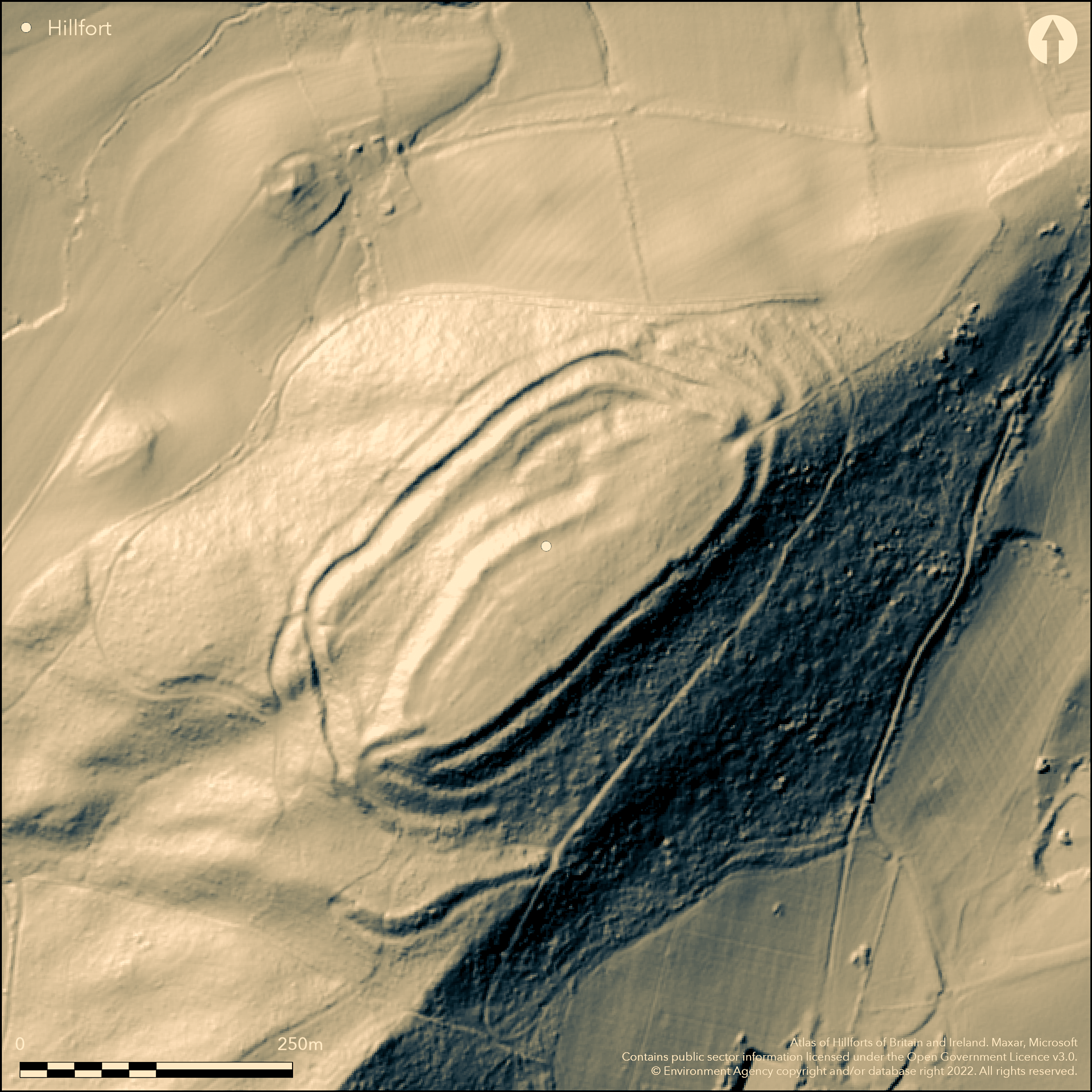
LiDAR 1m DTM Hillshade
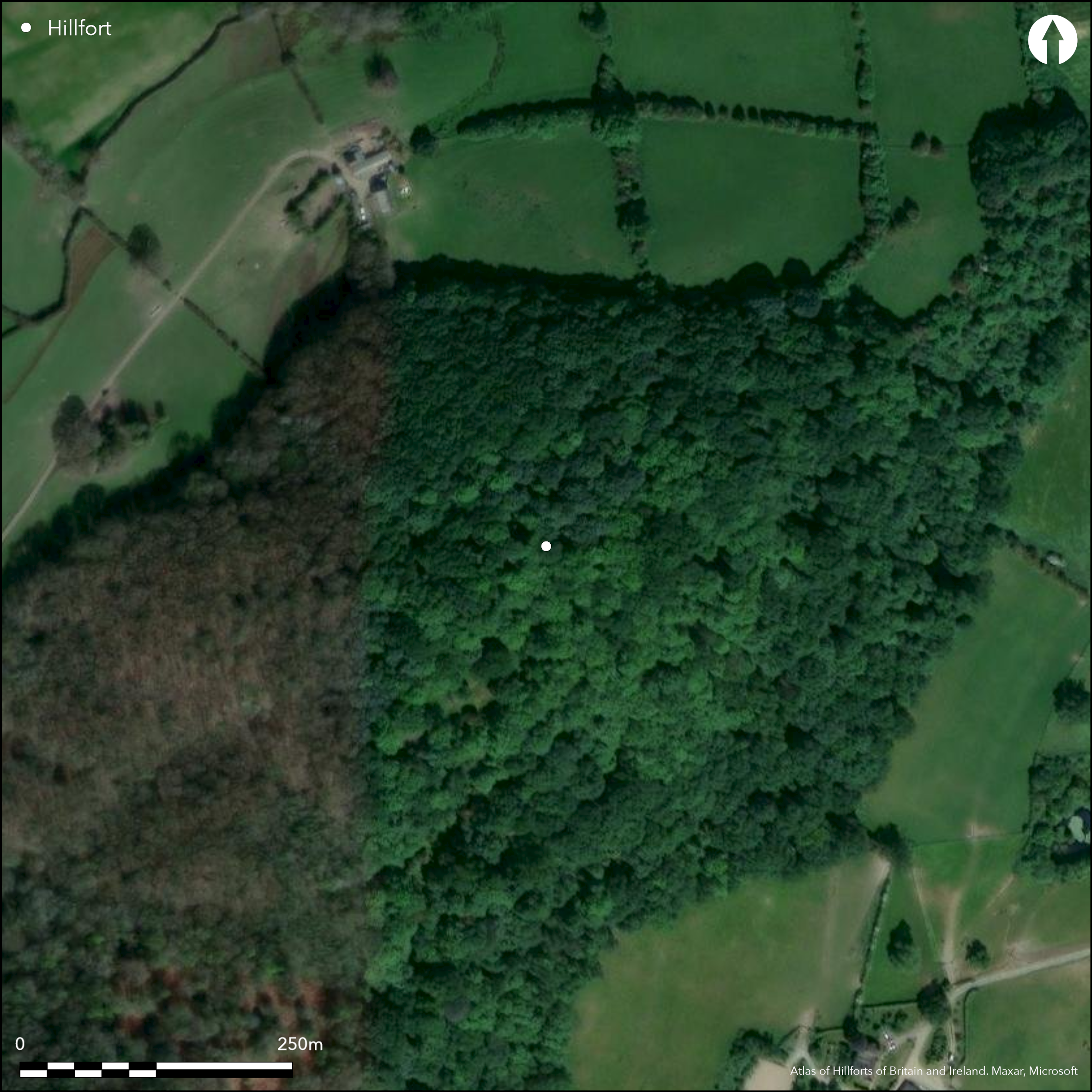
Satellite Imagery
LiDAR 1m DTM Hillshade
Satellite Imagery
Scroll left/right to view further images.
HER: Clwyd Powys 93 (None)
NMR: SJ 21 SW (306997)
SM: MG006(POW)
NGR: SJ 22410 13050
X: 322410 Y: 313050 (OSGB36)
Important contour hillfort on summit of long hill running SW-NW overlooking the Guilsfield Brook to where it meets the River Severn near Guilsfield. Surrounding slopes moderate to strong to N and W, steep to S and E. Measures c. 239m NE-SW by 65m, with internal area c. 2.7ha. Possible two-phased construction, from 1.25ha interior area to 2.7ha. Massive and complex defences with high natural scarp running along entire length of interior. Scarp with rock-cut ditch and stony counterscarp to the NW with double scarp (mainly) to the SE. Annexe to the NE found by RCAHMW earthwork survey 2007. Fine entrances, that to SW with long inturned passage with oblique approach; that to NE simpler passage with outworks. Nearby Bronze Age 'Guilsfield Hoard' (see Crowther's Camp Atlas No. 1348). Find of Iron Age or Roman boar figurine from helmet. Overgrown, heavily wooded, Woodland Trust site. On 1st Ed. OS map (1886). Undated.
Citizen Science: ✗
Reliability of Data: Confirmed
Reliability of Interpretation: Confirmed
X: -350647 Y: 6929444 (EPSG: 3857)
Longitude: -3.149919849626096 Latitude: 52.709507470995 (EPSG:4326)
Country: Wales
Current County or Unitary Authority: Powys
Historic County: Montgomeryshire
Current Parish/Community/Council/Townland: Guilsfield
Woodland Trust owned with archaeology now being lost to wood. Information board.
| Extant | ✓ |
| Cropmark | ✗ |
| Likely Destroyed | ✗ |
Heavily wooded and overgrown. Much scrub. Interior, once open, now being lost to undergrowth.
| Woodland | ✓ |
| Commercial Forestry Plantation | ✗ |
| Parkland | ✗ |
| Pasture (Grazing) | ✗ |
| Arable | ✗ |
| Scrub/Bracken | ✓ |
| Bare Outcrop | ✗ |
| Heather/Moorland | ✗ |
| Heath | ✗ |
| Built-up | ✗ |
| Coastal Grassland | ✗ |
| Other | ✗ |
Important contour hillfort overlooking the Guilsfield Brook to where it meets the River Severn. Surrounding slopes moderate to strong to N and W, steep to S and E.
| Contour Fort | ✓ |
| Partial Contour Fort | ✗ |
| Promontory Fort | ✗ |
| Hillslope Fort | ✗ |
| Level Terrain Fort | ✗ |
| Marsh Fort | ✗ |
| Multiple Enclosure Fort | ✗ |
| Hilltop | ✓ |
| Coastal Promontory | ✗ |
| Inland Promontory | ✗ |
| Valley Bottom | ✗ |
| Knoll/Hillock/Outcrop | ✗ |
| Ridge | ✗ |
| Cliff/Plateau-edge/Scarp | ✗ |
| Hillslope | ✗ |
| Lowland | ✗ |
| Spur | ✗ |
Dominant Topographic Feature: Hill top
| North | ✗ |
| Northeast | ✗ |
| East | ✗ |
| Southeast | ✗ |
| South | ✗ |
| Southwest | ✗ |
| West | ✗ |
| Northwest | ✗ |
| Level | ✓ |
Altitude: 219.0m
N/A
None.
Reliability: D - None
| Pre 1200BC | ✗ |
| 1200BC - 800BC | ✗ |
| 800BC - 400BC | ✗ |
| 400BC - AD50 | ✗ |
| AD50 - AD400 | ✗ |
| AD400 - AD 800 | ✗ |
| Post AD800 | ✗ |
| Unknown | ✓ |
| Pre Hillfort: | None |
| Post Hillfort: | Possible Roman boar figurine found. |
CPAT Montgomeryshire Small enclosures project 1990-97. Detailed RCAHMW earthwork survey and investigation 2007.
| 1st Identified Map Depiction (1886): | OS map. |
| Other (2007): | RCAHMW survey. |
| Other (None): | CPAT Montgomeryshire Small enclosures project. |
Chance find of Iron Age or Roman boar figurine from helmet.
Guilsfield Brook 0.65 km below fort.
| None | ✓ |
| Spring | ✗ |
| Stream | ✗ |
| Pool | ✗ |
| Flush | ✗ |
| Well | ✗ |
| Other | ✗ |
None
| No Known Features | ✓ |
| Round Stone Structures | ✗ |
| Rectangular Stone Structures | ✗ |
| Curvilinear Platforms | ✗ |
| Other Roundhouse Evidence | ✗ |
| Pits | ✗ |
| Quarry Hollows | ✗ |
| Other | ✗ |
None
| No Known Excavation | ✓ |
| Pits | ✗ |
| Postholes | ✗ |
| Roundhouses | ✗ |
| Rectangular Structures | ✗ |
| Roads/Tracks | ✗ |
| Quarry Hollows | ✗ |
| Other | ✗ |
| Nothing Found | ✗ |
None
| No Known Geophysics | ✓ |
| Pits | ✗ |
| Roundhouses | ✗ |
| Rectangular Structures | ✗ |
| Roads/Tracks | ✗ |
| Quarry Hollows | ✗ |
| Other | ✗ |
| Nothing Found | ✗ |
Chance find of Iron Age or Roman boar figurine from helmet.
| No Known Finds | ✗ |
| Pottery | ✗ |
| Metal | ✓ |
| Metalworking | ✗ |
| Human Bones | ✗ |
| Animal Bones | ✗ |
| Lithics | ✗ |
| Environmental | ✗ |
| Other | ✗ |
None
| APs Not Checked | ✓ |
| None | ✗ |
| Roundhouses | ✗ |
| Rectangular Structures | ✗ |
| Pits | ✗ |
| Postholes | ✗ |
| Roads/Tracks | ✗ |
| Other | ✗ |
Fine entrances, that to the SW with long, oblique, inturned passage; that to the NE simpler with outworks.
| 2: | None |
| 2: | Two fine entrances. |
Guard Chambers: ✗
Chevaux de Frise: ✗
| 1. In-turned (South west): | Oblique approach with long passage. |
| 1. Oblique (South west): | Oblique approach. |
| 1. Passage-way/Corridor (South west): | Long passage. |
| 2. Outworks (North east): | Simpler passage with outworks. |
Massive and complex defences with high natural scarp running along entire length of interior. Scarp with rock-cut ditch and stony counterscarp to the NW with double scarp (mainly) to the SE.
| Area 1: | 1.25ha. |
| Area 2: | 2.7ha. |
| Total: | 2.7ha. |
Total Footprint Area: Noneha.
None
| ✓ | At least two-phased construction, from 1.25ha interior area to 2.7ha. |
| ✓ | None |
| NE Quadrant: | 2 |
| SE Quadrant: | 2 |
| SW Quadrant: | 2 |
| NW Quadrant: | 2 |
| Total: | 2 |
| Partial Univallate | ✗ |
| Univallate | ✗ |
| Partial Bivallate | ✗ |
| Bivallate | ✓ |
| Partial Multivallate | ✗ |
| Multivallate | ✗ |
| Unknown | ✗ |
| Partial Univallate | ✗ |
| Univallate | ✓ |
| Partial Bivallate | ✗ |
| Bivallate | ✗ |
| Partial Multivallate | ✗ |
| Multivallate | ✗ |
Stony banks. Counterscarp to NW.
| None | ✗ |
| Earthen Bank | ✓ |
| Stone Wall | ✗ |
| Rubble | ✓ |
| Wall-walk | ✗ |
| Evidence of Timber | ✗ |
| Vitrification | ✗ |
| Other Burning | ✗ |
| Palisade | ✗ |
| Counter Scarp Bank | ✓ |
| Berm | ✗ |
| Unfinished | ✗ |
| Other | ✗ |
None
| None | ✗ |
| Earthen Bank | ✗ |
| Stone Wall | ✗ |
| Murus Duplex | ✗ |
| Timber-framed | ✗ |
| Timber-laced | ✗ |
| Vitrification | ✗ |
| Other Burning | ✗ |
| Palisade | ✗ |
| Counter Scarp Bank | ✗ |
| Berm | ✗ |
| Unfinished | ✗ |
| No Known Excavation | ✓ |
| Other | ✗ |
| ✗ | None |
| ✓ | Rock-cut ditch to NW. |
Number of Ditches: 2
| ✓ | Annexe to the NE found by RCAHMW survey 2007. |
Barker, L , 2009. Gaer Fawr: An Analysis of the Earthworks, Aberystwyth: RCAHMW.
Brown 2009. Beacons in the landscape. The hillforts of England and Wales, Oxford: Windgather Press/Oxbow.
Burnham, H. 1995. A guide to ancient and historic Wales - Clwyd and Powys, London: HMSO, 64-5.
Royal Commission on the Ancient and Historical Monuments and Constructions in Wales and Monmouthshire, 1911. An Inventory of the Ancient Monuments in Wales and Monmouthshire, I, County of Montgomery, No. 214, London: HMSO.
Silvester, R.J. and Britnell, W.J. 1993. Montgomeryshire small enclosures project. Summary Report 1993, CPAT Report No 80, Welshpool, Clwyd-Powys Archaeological Trust.
Spurgeon, C.J. 1972. Enclosures of Iron Age type in the Upper Severn Basin, In Lynch, F. and Burgess, C. (eds.) 1972, Prehistoric man in Wales and the West, 337, 39, Bath: Adams and Dart.
Atlas of Hillforts:
Wikidata:
This work is licensed under CC BY-SA 4.0

 and should be cited as:
Lock, Gary and Ralston, Ian. 2024. Atlas of Hillforts of Britain and Ireland. Available at: https://hillforts.arch.ox.ac.uk
Document Version 1.1