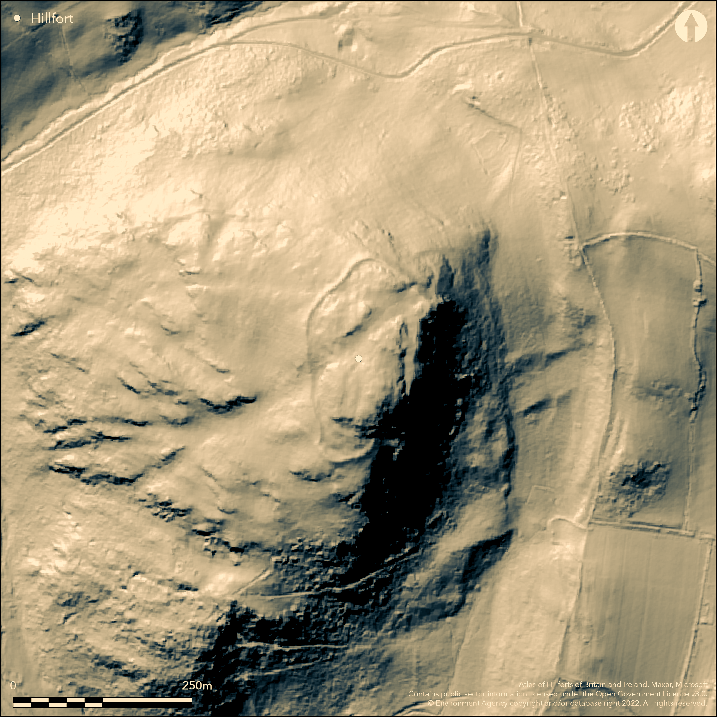
LiDAR 1m DTM Hillshade
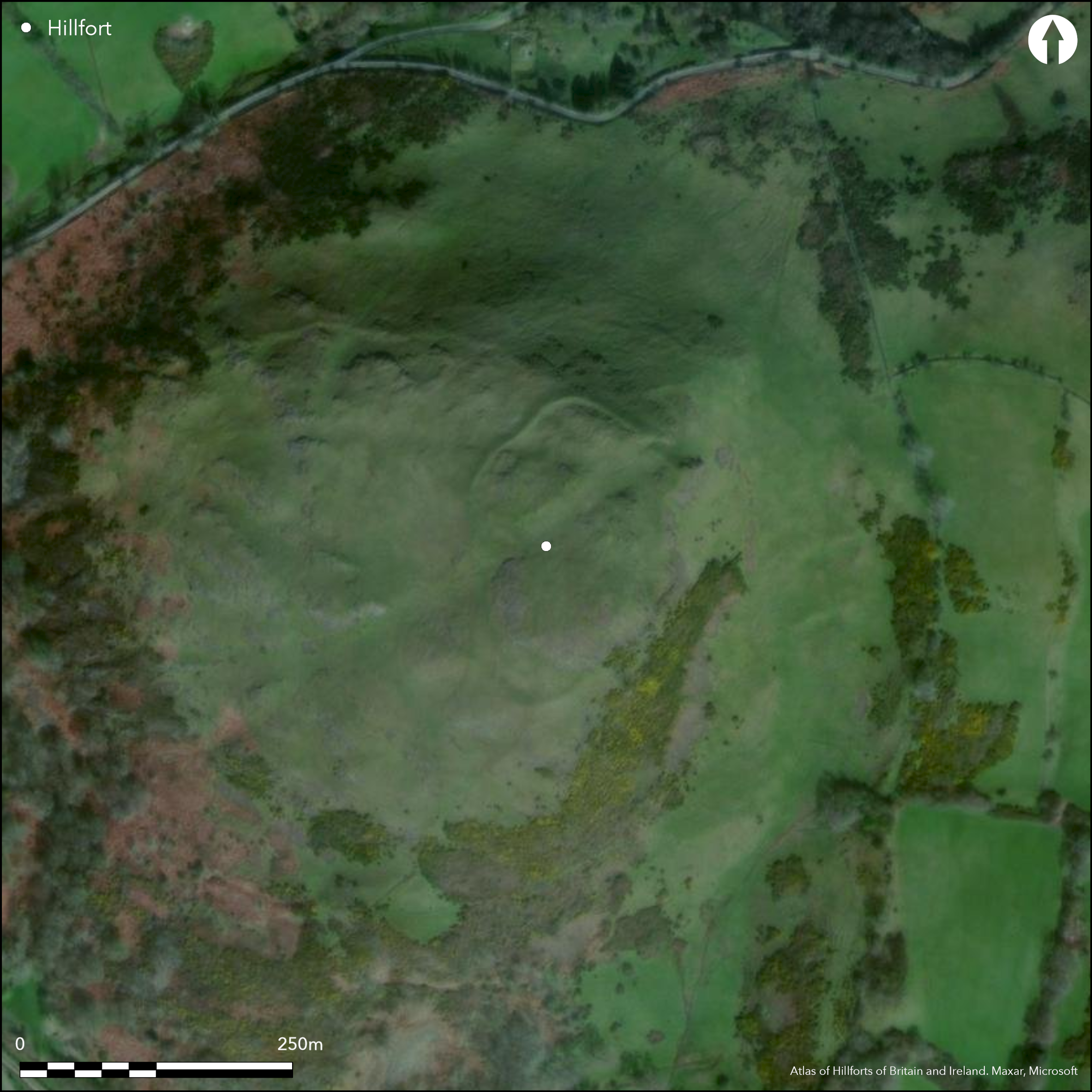
Satellite Imagery
LiDAR 1m DTM Hillshade
Satellite Imagery
Scroll left/right to view further images.
HER: Clwyd Powys 194 (None)
NMR: SO 29 SE (306409)
SM: MG337(POW)
NGR: SO2939094980
X: 329390 Y: 294980 (OSGB36)
Univallate contour hillfort located on steep rocky slopes of prominent Roundton Hill (called Roundtain on 1882-83 1:2500 OS map but hillfort not delineated, not recognised until mid-1950s and first OS survey in 1973), above Churchstoke and the River Camlad to W, and near to its confluence with the Caebitra to S, at Churchstoke. Commanding and exposed position. Surrounding slopes precipitous to N and W, very steep to S and steep to E. Measures c. 210m N-S by 100m, with internal area 1.2ha. Irregular interior of grassy terraces with rocky outcrops. Stone and earth rampart best on S and SW sides. No rampart visible on E, where replaced by steep rocky scarp c. 50m high, except where very short stretch near entrance on NE. On SW rampart encloses flattish area below summit, here internal, but no external, ditch, again above very steep slopes. Rampart slight on W, appearing more as a terrace, but increases northwards rising to 1.3m high at entrance. Simple entrance at NE, c. 2m wide at base and approached by zig-zag path which starts at the saddle separating Roundton from the next hill on ENE. No internal features other than flat areas. Some animal damage, but generally well-preserved under rough upland grazing and bare rock. LiDAR and topographic survey (Hankinson and Hannaford 2015), undated.
Citizen Science: ✗
Reliability of Data: Confirmed
Reliability of Interpretation: Confirmed
X: -338718 Y: 6899832 (EPSG: 3857)
Longitude: -3.0427546028665997 Latitude: 52.54804357414094 (EPSG:4326)
Country: Wales
Current County or Unitary Authority: Powys
Historic County: Montgomeryshire
Current Parish/Community/Council/Townland: Churchstoke
Some animal damage, but generally well-preserved.Designated National Nature Reserve 2000 due to important volcanic geology and flora.
| Extant | ✓ |
| Cropmark | ✗ |
| Likely Destroyed | ✗ |
Rough upland grazing with bare rock outcrops. SSSI.
| Woodland | ✗ |
| Commercial Forestry Plantation | ✗ |
| Parkland | ✗ |
| Pasture (Grazing) | ✓ |
| Arable | ✗ |
| Scrub/Bracken | ✗ |
| Bare Outcrop | ✗ |
| Heather/Moorland | ✗ |
| Heath | ✗ |
| Built-up | ✗ |
| Coastal Grassland | ✗ |
| Other | ✗ |
Univallate contour hillfort located on steep rocky slopes of prominent Roundton Hill above Churchstoke and the River Camlad to W and near to its confluence with the Caebitra to S. Commanding and exposed position. Surrounding slopes precipitous to N and W, very steep to S and steep to E.
| Contour Fort | ✓ |
| Partial Contour Fort | ✗ |
| Promontory Fort | ✗ |
| Hillslope Fort | ✗ |
| Level Terrain Fort | ✗ |
| Marsh Fort | ✗ |
| Multiple Enclosure Fort | ✗ |
| Hilltop | ✓ |
| Coastal Promontory | ✗ |
| Inland Promontory | ✗ |
| Valley Bottom | ✗ |
| Knoll/Hillock/Outcrop | ✗ |
| Ridge | ✗ |
| Cliff/Plateau-edge/Scarp | ✗ |
| Hillslope | ✗ |
| Lowland | ✗ |
| Spur | ✗ |
Dominant Topographic Feature: Hill top
| North | ✗ |
| Northeast | ✗ |
| East | ✗ |
| Southeast | ✗ |
| South | ✗ |
| Southwest | ✗ |
| West | ✗ |
| Northwest | ✗ |
| Level | ✓ |
Altitude: 360.0m
N/A
None.
Reliability: D - None
| Pre 1200BC | ✗ |
| 1200BC - 800BC | ✗ |
| 800BC - 400BC | ✗ |
| 400BC - AD50 | ✗ |
| AD50 - AD400 | ✗ |
| AD400 - AD 800 | ✗ |
| Post AD800 | ✗ |
| Unknown | ✓ |
| Pre Hillfort: | None |
| Post Hillfort: | None |
First OS survey 1973. CPAT Historic Landscape Characterisation, Vale of Montgomery 1999-2000. CPAT defended enclosures in Montgomeryshire survey 2007-2008. LiDAR and topographic survey 2013 (Hankinson and Hannaford 2015).
| 1st Identified Map Depiction (1973): | None |
| LiDAR Survey (2013): | None |
| Earthwork Survey (2013): | None |
| Other (None): | CPAT Historic Landscape Characterisation, Vale of Montgomery. |
| Other (None): | CPAT defended enclosures project. |
No internal features.
Stream 0.3km outside fort.
| None | ✓ |
| Spring | ✗ |
| Stream | ✗ |
| Pool | ✗ |
| Flush | ✗ |
| Well | ✗ |
| Other | ✗ |
None
| No Known Features | ✓ |
| Round Stone Structures | ✗ |
| Rectangular Stone Structures | ✗ |
| Curvilinear Platforms | ✗ |
| Other Roundhouse Evidence | ✗ |
| Pits | ✗ |
| Quarry Hollows | ✗ |
| Other | ✗ |
None
| No Known Excavation | ✓ |
| Pits | ✗ |
| Postholes | ✗ |
| Roundhouses | ✗ |
| Rectangular Structures | ✗ |
| Roads/Tracks | ✗ |
| Quarry Hollows | ✗ |
| Other | ✗ |
| Nothing Found | ✗ |
None
| No Known Geophysics | ✓ |
| Pits | ✗ |
| Roundhouses | ✗ |
| Rectangular Structures | ✗ |
| Roads/Tracks | ✗ |
| Quarry Hollows | ✗ |
| Other | ✗ |
| Nothing Found | ✗ |
None
| No Known Finds | ✓ |
| Pottery | ✗ |
| Metal | ✗ |
| Metalworking | ✗ |
| Human Bones | ✗ |
| Animal Bones | ✗ |
| Lithics | ✗ |
| Environmental | ✗ |
| Other | ✗ |
Area immediately S of entrance, where level area c. 10m diameter, looks promising.
| APs Not Checked | ✓ |
| None | ✗ |
| Roundhouses | ✗ |
| Rectangular Structures | ✗ |
| Pits | ✗ |
| Postholes | ✗ |
| Roads/Tracks | ✗ |
| Other | ✗ |
Simple entrance at NE, c. 2m wide at base and approached by zig-zag path which starts at the saddle separating Roundton from the next hill on ENE.
| 1: | None |
| 2: | None |
Guard Chambers: ✗
Chevaux de Frise: ✗
| 1. Simple Gap (North east): | Approached by zig-zag path. |
Stone and earth rampart best on S and SW sides. No rampart visible on E, where replaced by steep rocky scarp c. 50m high, except where very short stretch near entrance on NE. On SW rampart encloses flattish area below summit, here internal, but no external, ditch, again above very steep slopes. Rampart slight on W, appearing more as a terrace, but increases northwards rising to 1.3m high at entrance.
| Area 1: | 1.2ha. |
| Total: | 1.2ha. |
Total Footprint Area: Noneha.
None
| ✗ | None |
| ✓ | None |
| NE Quadrant: | 1 |
| SE Quadrant: | 1 |
| SW Quadrant: | 1 |
| NW Quadrant: | 1 |
| Total: | 1 |
| Partial Univallate | ✗ |
| Univallate | ✓ |
| Partial Bivallate | ✗ |
| Bivallate | ✗ |
| Partial Multivallate | ✗ |
| Multivallate | ✗ |
| Unknown | ✗ |
| Partial Univallate | ✗ |
| Univallate | ✗ |
| Partial Bivallate | ✗ |
| Bivallate | ✗ |
| Partial Multivallate | ✗ |
| Multivallate | ✗ |
Earth and stone bank.
| None | ✗ |
| Earthen Bank | ✓ |
| Stone Wall | ✗ |
| Rubble | ✓ |
| Wall-walk | ✗ |
| Evidence of Timber | ✗ |
| Vitrification | ✗ |
| Other Burning | ✗ |
| Palisade | ✗ |
| Counter Scarp Bank | ✗ |
| Berm | ✗ |
| Unfinished | ✗ |
| Other | ✗ |
None
| None | ✗ |
| Earthen Bank | ✗ |
| Stone Wall | ✗ |
| Murus Duplex | ✗ |
| Timber-framed | ✗ |
| Timber-laced | ✗ |
| Vitrification | ✗ |
| Other Burning | ✗ |
| Palisade | ✗ |
| Counter Scarp Bank | ✗ |
| Berm | ✗ |
| Unfinished | ✗ |
| No Known Excavation | ✓ |
| Other | ✗ |
| ✗ | None |
| ✓ | None |
Number of Ditches: 1
| ✗ | None |
Britnell, W. J. Martin, C. H. R. and Hankinson, R. 2000. Bro Trefaldwyn Historic Landscape: historic landscape characterization, Unpublished report, Welshpool: CPAT.
Jones, N. W. and Owen, W. J. 2001. Montgomeryshire Wildlife Trust Reserves. Archaeological Baseline Survey. Final Report, Unpublished report, Welshpool: CPAT.
Hankinson, R. 2008. Defended enclosures in Montgomeryshire. A further study. Project Report. CPAT Report No 918, Welshpool: Clwyd-Powys Archaeological Trust.
Hankinson, R. and Hannaford, H. 2015. Churchstoke, Roundton Hill. Archaeol Wales, 54, 183-35.
Musson, C. 2012. Montgomeryshire hillforts and enclosures from the air, in Britnell, W.J. and Silvester, R.J. (eds) Reflections on the past. Essays in honour of Frances Lynch. Cambrian Archaeological Association, 351-368.
Atlas of Hillforts:
Wikidata:
This work is licensed under CC BY-SA 4.0

 and should be cited as:
Lock, Gary and Ralston, Ian. 2024. Atlas of Hillforts of Britain and Ireland. Available at: https://hillforts.arch.ox.ac.uk
Document Version 1.1