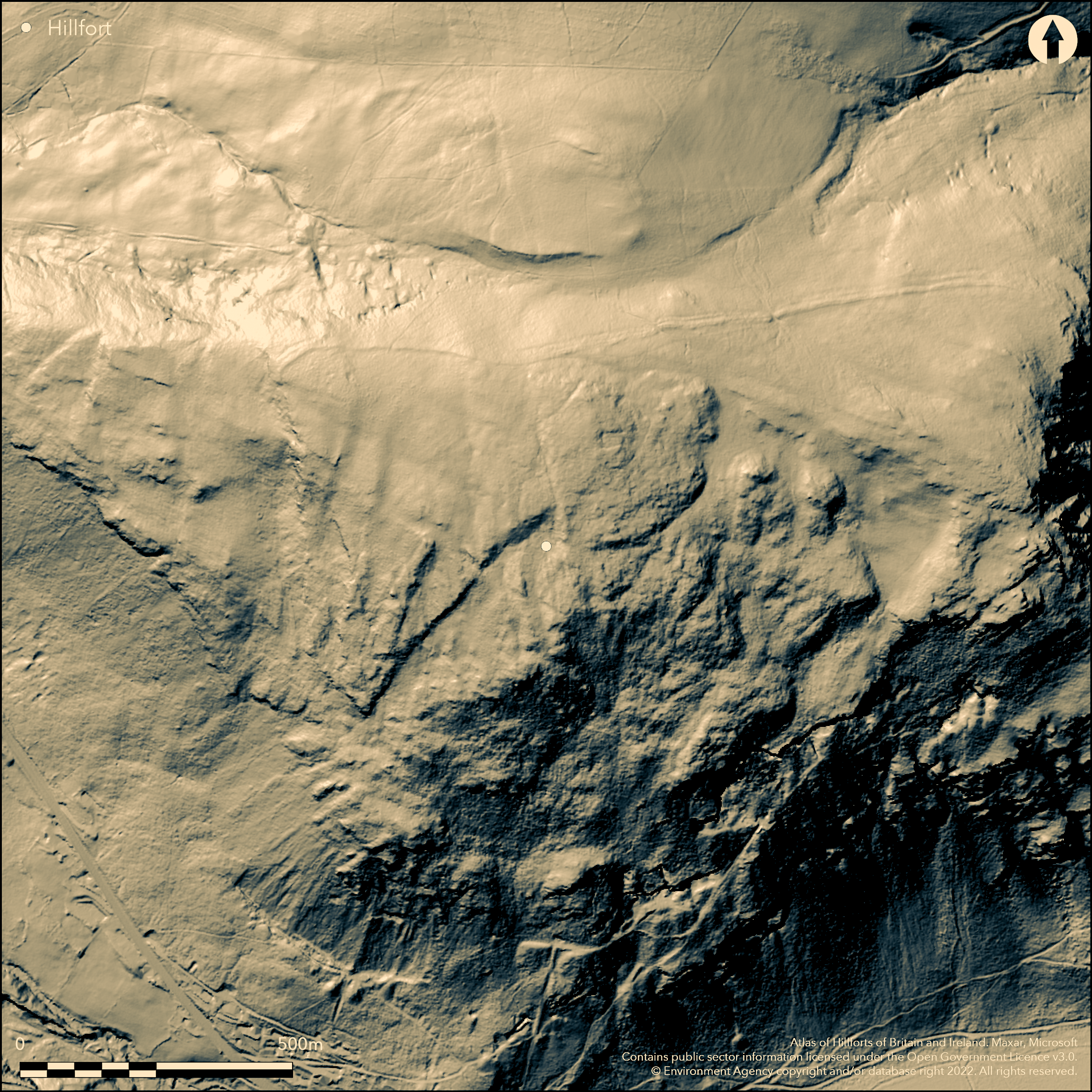
LiDAR 1m DTM Hillshade
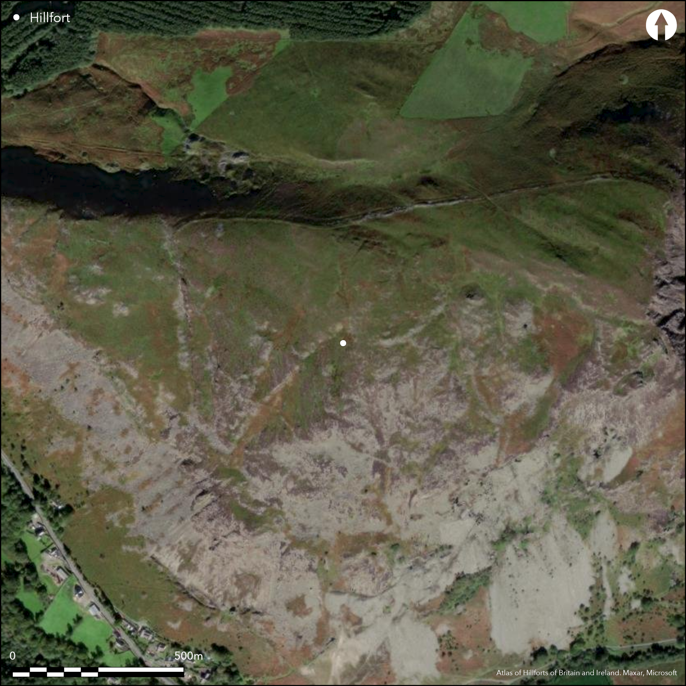
Satellite Imagery
LiDAR 1m DTM Hillshade
Satellite Imagery
Scroll left/right to view further images.
HER: Clwyd Powys 1465 (None)
NMR: SJ 02 NE (306533)
SM: MG004(POW)
NGR: SJ054269
X: 305431 Y: 326995 (OSGB36)
Very large and very rocky contour hillfort located on very prominent outcrop above confluence of Afon Eirth and Afon Tanat to S and their steep respective valleys to SW and S and SE. On possible route through the Berwyn Mountains. Precipitous rocky slopes to E, SE, S and SW (350m on S), steep to very steep on NW and NE and moderate along ridge to N. Measures c. 800m N-S by 500m, with internal area c. 16ha. Only ramparts are on N, now a ruinous stone wall c. 930m long from high crags on NE to lower crags on NW, composed of rhyolite blocks for most of length and shale for 150m, above a steep natural scarp, no ditch. Some wall-facing visible. No ditch. Simple entrance through middle of wall on N and slanting possible inturned entrance at its W end. At least 170 hut sites recognised with many original round huts in evidence with few rectangular late medieval hafodau. Important mineral site from prehistoric period through to historic. Inconclusive excavation in 1933 by R.U. Sayce (1937). Extensive surveys and some excavation by P. Crew, G. Guilbert and D. Roe between 1974 to publication in 2012. Rocky upland moorland grazing. On 1st Ed. OS map (1885-1900). Undated
Citizen Science: ✗
Reliability of Data: Confirmed
Reliability of Interpretation: Confirmed
X: -379065 Y: 6952006 (EPSG: 3857)
Longitude: -3.405195098349327 Latitude: 52.832128087115436 (EPSG:4326)
Country: Wales
Current County or Unitary Authority: Powys
Historic County: Montgomeryshire
Current Parish/Community/Council/Townland: Llangynog
Ruinous.
| Extant | ✓ |
| Cropmark | ✗ |
| Likely Destroyed | ✗ |
Rocky upland moorland grazing.
| Woodland | ✗ |
| Commercial Forestry Plantation | ✗ |
| Parkland | ✗ |
| Pasture (Grazing) | ✓ |
| Arable | ✗ |
| Scrub/Bracken | ✗ |
| Bare Outcrop | ✗ |
| Heather/Moorland | ✓ |
| Heath | ✗ |
| Built-up | ✗ |
| Coastal Grassland | ✗ |
| Other | ✗ |
Very large and rocky contour hillfort located on very prominent outcrop above confluence of Afon Eirth and Afon Tanat to S and their steep respective valleys to SW and S and SE. Precipitous rocky slopes to E, SE, S and SW, steep to very steep on NW and NE and moderate along ridge to N.
| Contour Fort | ✓ |
| Partial Contour Fort | ✗ |
| Promontory Fort | ✗ |
| Hillslope Fort | ✗ |
| Level Terrain Fort | ✗ |
| Marsh Fort | ✗ |
| Multiple Enclosure Fort | ✗ |
| Hilltop | ✓ |
| Coastal Promontory | ✗ |
| Inland Promontory | ✗ |
| Valley Bottom | ✗ |
| Knoll/Hillock/Outcrop | ✗ |
| Ridge | ✗ |
| Cliff/Plateau-edge/Scarp | ✗ |
| Hillslope | ✗ |
| Lowland | ✗ |
| Spur | ✗ |
Dominant Topographic Feature: Hill top
| North | ✗ |
| Northeast | ✗ |
| East | ✗ |
| Southeast | ✗ |
| South | ✗ |
| Southwest | ✗ |
| West | ✗ |
| Northwest | ✗ |
| Level | ✓ |
Altitude: 533.0m
N/A
Important mineral site from prehistoric period through to historic, but dates not determined.
Reliability: D - None
| Pre 1200BC | ✗ |
| 1200BC - 800BC | ✗ |
| 800BC - 400BC | ✗ |
| 400BC - AD50 | ✗ |
| AD50 - AD400 | ✗ |
| AD400 - AD 800 | ✗ |
| Post AD800 | ✗ |
| Unknown | ✓ |
| Pre Hillfort: | None |
| Post Hillfort: | Important mineral site. |
Excavation by R.U. Sayce 1933. On 1st Ed. OS map (1885-1900). Extensive surveys and some excavation by P. Crew, G. Gulbert and D. Roe between 1974 to publication in 2012. Topographical survey CPAT and UCNW, Bangor 1978. CPAT Montgomeryshire Small enclosures project 1990-97
| 1st Identified Written Reference (1880): | Referred to by G.E. Robinson. |
| Excavation (1933): | Section through rampart by R.U. Sayce. |
| Earthwork Survey (1974): | D. Roe and P. Crew. |
| Excavation (1975): | Section re-opened by Crew el al. |
| Earthwork Survey (1978): | D. Roe and P. Crew. |
| Other (1978): | Field observation by G. Guilbert and Welsh Office. |
| Earthwork Survey (1978): | CPAT and UCNW Bangor. |
| Excavation (1980): | Excavation of structure by Crew et al. |
| 1st Identified Map Depiction (None): | None |
| Other (None): | Extensive surveys and some excavation by P. Crew, G. Gulbert and D. Roe. |
| Other (None): | CPAT Montgomeryshire Small enclosures project 1990-97. |
At least 170 hut sites recognised with many original round huts in evidence with few rectangular late medieval hafodau. Formerly thought of as ring cairns. Glass bead, spindle whorl, game-board, rubbing stone, stone hammer, quern. Possible round house site investigated 1980.
Stream 0.4km outside fort.
| None | ✓ |
| Spring | ✗ |
| Stream | ✗ |
| Pool | ✗ |
| Flush | ✗ |
| Well | ✗ |
| Other | ✗ |
At least 170 hut sites recognised, with many original round huts in evidence with few rectangular late medieval hafodau.
| No Known Features | ✗ |
| Round Stone Structures | ✓ |
| Rectangular Stone Structures | ✓ |
| Curvilinear Platforms | ✓ |
| Other Roundhouse Evidence | ✗ |
| Pits | ✗ |
| Quarry Hollows | ✗ |
| Other | ✗ |
Possible roundhouse site investigated.
| No Known Excavation | ✗ |
| Pits | ✗ |
| Postholes | ✗ |
| Roundhouses | ✓ |
| Rectangular Structures | ✗ |
| Roads/Tracks | ✗ |
| Quarry Hollows | ✗ |
| Other | ✗ |
| Nothing Found | ✗ |
None
| No Known Geophysics | ✓ |
| Pits | ✗ |
| Roundhouses | ✗ |
| Rectangular Structures | ✗ |
| Roads/Tracks | ✗ |
| Quarry Hollows | ✗ |
| Other | ✗ |
| Nothing Found | ✗ |
Glass bead, spindle whorl, game-board, rubbing stone, stone hammer, quern.
| No Known Finds | ✗ |
| Pottery | ✗ |
| Metal | ✗ |
| Metalworking | ✗ |
| Human Bones | ✗ |
| Animal Bones | ✗ |
| Lithics | ✓ |
| Environmental | ✗ |
| Other | ✓ |
None
| APs Not Checked | ✓ |
| None | ✗ |
| Roundhouses | ✗ |
| Rectangular Structures | ✗ |
| Pits | ✗ |
| Postholes | ✗ |
| Roads/Tracks | ✗ |
| Other | ✗ |
Two simple gap entrances through rampart on its E and W, both c. 1.5m wide, giving oblique passageways c. 10m-12 long , each approached by hollow way. E entrance has possible inturn , W similar, but no inturn and without curving wall face.
| 2: | None |
| 2: | None |
Guard Chambers: ✗
Chevaux de Frise: ✗
| 1. Passage-way/Corridor (North east): | c. 1.5m wide and oblique passageway c. 10m-12 long. |
| 1. Hollow Way (North east): | Approached by hollow way. |
| 1. Oblique (North east): | Oblique passageway. |
| 1. In-turned (North east): | Possible inturn and curving wall face. |
| 1. Simple Gap (North east): | None |
| 2. Passage-way/Corridor (North west): | c. 1.5m wide and oblique passageway c. 10m-12 long. |
| 2. Hollow Way (North west): | Approached by hollow way. |
| 2. Oblique (North west): | Oblique passageway. |
| 2. Simple Gap (North west): | None |
Only ramparts required was on N, now a ruinous stone wall above a steep natural scarp, no ditch.
| Area 1: | 16.0ha. |
| Total: | 16.0ha. |
Total Footprint Area: Noneha.
None
| ✗ | None |
| ✗ | Precipitous slopes on S resulting in only defence required on N. |
| NE Quadrant: | 1 |
| SE Quadrant: | 0 |
| SW Quadrant: | 0 |
| NW Quadrant: | 1 |
| Total: | 1 |
| Partial Univallate | ✓ |
| Univallate | ✗ |
| Partial Bivallate | ✗ |
| Bivallate | ✗ |
| Partial Multivallate | ✗ |
| Multivallate | ✗ |
| Unknown | ✗ |
| Partial Univallate | ✗ |
| Univallate | ✗ |
| Partial Bivallate | ✗ |
| Bivallate | ✗ |
| Partial Multivallate | ✗ |
| Multivallate | ✗ |
Dry-stone walled site.
| None | ✗ |
| Earthen Bank | ✗ |
| Stone Wall | ✓ |
| Rubble | ✗ |
| Wall-walk | ✗ |
| Evidence of Timber | ✗ |
| Vitrification | ✗ |
| Other Burning | ✗ |
| Palisade | ✗ |
| Counter Scarp Bank | ✗ |
| Berm | ✗ |
| Unfinished | ✗ |
| Other | ✗ |
Low spread stone wall c. 6.5m wide and c. 1m high found.
| None | ✗ |
| Earthen Bank | ✗ |
| Stone Wall | ✓ |
| Murus Duplex | ✗ |
| Timber-framed | ✗ |
| Timber-laced | ✗ |
| Vitrification | ✗ |
| Other Burning | ✗ |
| Palisade | ✗ |
| Counter Scarp Bank | ✗ |
| Berm | ✗ |
| Unfinished | ✗ |
| No Known Excavation | ✗ |
| Other | ✗ |
| ✗ | None |
| ✗ | No ditch. |
Number of Ditches: 0
| ✗ | None |
Burnham, H. 1995. A guide to ancient and historic Wales - Clwyd and Powys, London: HMSO.
Crew, P., Guilbert, G. and Roe, D. 2012. Craig Rhiwarth Hillfort, Montgomeryshire, In Britnell, W.J., and Silvester, R.J. (eds) , Reflections on the Past: Essays in honour of Frances Lynch, Cambrian Archaeological Association.
Musson, C. 2012. Montgomeryshire hillforts and enclosures from the air, in Britnell, W.J. and Silvester, R.J. (eds) Reflections on the past. Essays in honour of Frances Lynch. Cambrian Archaeological Association, 351-368.
Richards, R. 1938. Craig Rhiwarth, The Montgomeryshire Collections, 45, 196-200.
Robinson, G. E. 1880. Hut dwellings in Montgomeryshire , Arch Camb, 11, 25-30.
Roe, D. and Crew, P. , 1975 . Craig Rhiwarth, Arch in Wales, 15, 37.
Roe, D. and Crew, P. 1977. Craig Rhiwarth Hillfort, Arch in Wales, 17, 23.
Royal Commission on the Ancient and Historical Monuments and Constructions in Wales and Monmouthshire, 1911. An Inventory of the Ancient Monuments in Wales and Monmouthshire, I, County of Montgomery, No. 633, London: HMSO.
Sayce, R. U. 1937 , The Stone Rings of Craig Rhiwarth, The Montgomeryshire Collections, 45, 121-104.
Silvester, R.J. and Britnell, W.J. 1993. Montgomeryshire small enclosures project. Summary Report 1993, CPAT Report No 80, Welshpool, Clwyd-Powys Archaeological Trust.
Atlas of Hillforts:
Wikidata:
This work is licensed under CC BY-SA 4.0

 and should be cited as:
Lock, Gary and Ralston, Ian. 2024. Atlas of Hillforts of Britain and Ireland. Available at: https://hillforts.arch.ox.ac.uk
Document Version 1.1