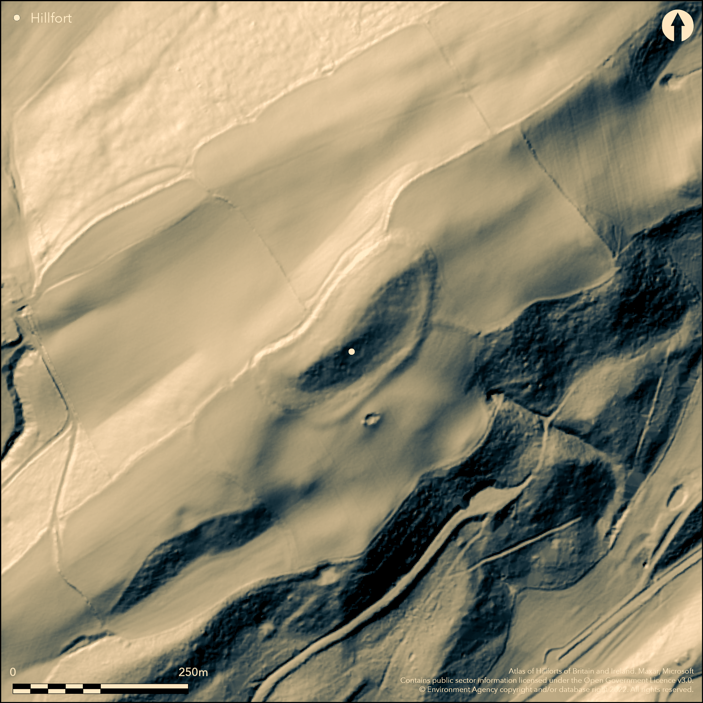
LiDAR 1m DTM Hillshade
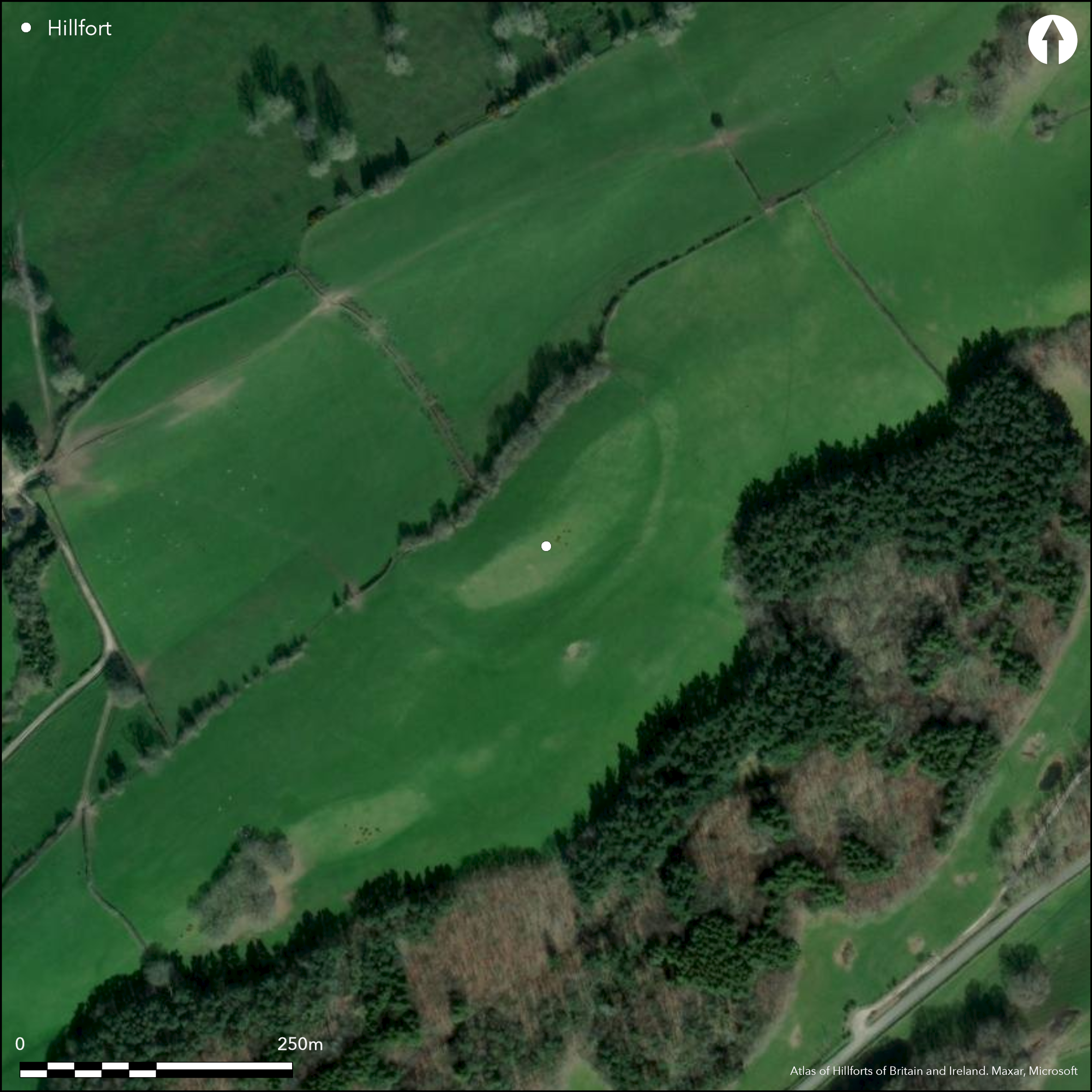
Satellite Imagery
LiDAR 1m DTM Hillshade
Satellite Imagery
Scroll left/right to view further images.
HER: Clwyd Powys 1032 (None)
NMR: SO 19 NW (306224)
SM: MG155(POW)
NGR: SO13979762
X: 313970 Y: 297620 (OSGB36)
Prominent, oval, univallate contour hillfort sited on a knoll on a NE-SW ridge in the hills above River Severn in an area of clusters of small hillforts. Opposite to Lower Ucheldre. Surrounding slopes steep or very steep to N and S, moderate to strong to E and W. Measures 174m NE-SW by 80m, with internal area 1.2ha. Bank and ditch visible on SW and just on NE and vestiges of counterscarp on these sides also. Elsewhere much eroded to scarps. References to three banks in antiquity - no details, but possible vestige of inner bank near entrance at NE and possible inner and outer traces on SW. Possible NE entrance. On OS 1:25,000 map (1937-1961). Minimal investigations, undated.
Citizen Science: ✗
Reliability of Data: Confirmed
Reliability of Interpretation: Confirmed
X: -364103 Y: 6903770 (EPSG: 3857)
Longitude: -3.270789320049598 Latitude: 52.569550387979355 (EPSG:4326)
Country: Wales
Current County or Unitary Authority: Powys
Historic County: Montgomeryshire
Current Parish/Community/Council/Townland: Bettws
Much eroded to scarps in part.
| Extant | ✓ |
| Cropmark | ✗ |
| Likely Destroyed | ✗ |
Pasture. Line of trees follows NW quadrant. Wooded in 19th century.
| Woodland | ✗ |
| Commercial Forestry Plantation | ✗ |
| Parkland | ✗ |
| Pasture (Grazing) | ✓ |
| Arable | ✗ |
| Scrub/Bracken | ✗ |
| Bare Outcrop | ✗ |
| Heather/Moorland | ✗ |
| Heath | ✗ |
| Built-up | ✗ |
| Coastal Grassland | ✗ |
| Other | ✗ |
Prominent, oval, univallate contour hillfort sited on a knoll on a NE-SW ridge in the hills above River Severn in an area of clusters of small hillforts.
| Contour Fort | ✓ |
| Partial Contour Fort | ✗ |
| Promontory Fort | ✗ |
| Hillslope Fort | ✗ |
| Level Terrain Fort | ✗ |
| Marsh Fort | ✗ |
| Multiple Enclosure Fort | ✗ |
| Hilltop | ✗ |
| Coastal Promontory | ✗ |
| Inland Promontory | ✗ |
| Valley Bottom | ✗ |
| Knoll/Hillock/Outcrop | ✓ |
| Ridge | ✗ |
| Cliff/Plateau-edge/Scarp | ✗ |
| Hillslope | ✗ |
| Lowland | ✗ |
| Spur | ✗ |
Dominant Topographic Feature: Knoll
| North | ✗ |
| Northeast | ✗ |
| East | ✗ |
| Southeast | ✗ |
| South | ✗ |
| Southwest | ✗ |
| West | ✗ |
| Northwest | ✗ |
| Level | ✓ |
Altitude: 299.0m
N/A
None
Reliability: D - None
| Pre 1200BC | ✗ |
| 1200BC - 800BC | ✗ |
| 800BC - 400BC | ✗ |
| 400BC - AD50 | ✗ |
| AD50 - AD400 | ✗ |
| AD400 - AD 800 | ✗ |
| Post AD800 | ✗ |
| Unknown | ✓ |
| Pre Hillfort: | None |
| Post Hillfort: | None |
References to three banks in antiquity - no details. On OS 1:25,000 map (1937-1961). Investigation by RCAHMW 1909. Investigation by CPAT 1978 and 1991. CPAT Montgomeryshire Small enclosures project 1990-97.
| Other (1909): | RCAHMW investigation. |
| 1st Identified Map Depiction (None): | None |
| Other (None): | CPAT investigations. |
| Other (None): | PAT Montgomeryshire Small enclosures project. |
| 1st Identified Written Reference (None): | Reference in antiquity - no details. |
None
Stream 0.4km outside fort.
| None | ✓ |
| Spring | ✗ |
| Stream | ✗ |
| Pool | ✗ |
| Flush | ✗ |
| Well | ✗ |
| Other | ✗ |
None
| No Known Features | ✓ |
| Round Stone Structures | ✗ |
| Rectangular Stone Structures | ✗ |
| Curvilinear Platforms | ✗ |
| Other Roundhouse Evidence | ✗ |
| Pits | ✗ |
| Quarry Hollows | ✗ |
| Other | ✗ |
None
| No Known Excavation | ✓ |
| Pits | ✗ |
| Postholes | ✗ |
| Roundhouses | ✗ |
| Rectangular Structures | ✗ |
| Roads/Tracks | ✗ |
| Quarry Hollows | ✗ |
| Other | ✗ |
| Nothing Found | ✗ |
None
| No Known Geophysics | ✓ |
| Pits | ✗ |
| Roundhouses | ✗ |
| Rectangular Structures | ✗ |
| Roads/Tracks | ✗ |
| Quarry Hollows | ✗ |
| Other | ✗ |
| Nothing Found | ✗ |
None
| No Known Finds | ✓ |
| Pottery | ✗ |
| Metal | ✗ |
| Metalworking | ✗ |
| Human Bones | ✗ |
| Animal Bones | ✗ |
| Lithics | ✗ |
| Environmental | ✗ |
| Other | ✗ |
None
| APs Not Checked | ✓ |
| None | ✗ |
| Roundhouses | ✗ |
| Rectangular Structures | ✗ |
| Pits | ✗ |
| Postholes | ✗ |
| Roads/Tracks | ✗ |
| Other | ✗ |
Possible NE entrance.
| 2: | Slight gap to SE. |
| 2: | None |
Guard Chambers: ✗
Chevaux de Frise: ✗
| 1. Simple Gap (North east): | Type estimated. |
Bank and ditch visible on SW and just on NE and vestiges of counterscarp on these sides also. Elsewhere much eroded to scarps. References to three banks in antiquity - no details, but possible vestige of inner bank near entrance at NE and possible inner and outer traces on SW.
| Area 1: | 1.2ha. |
| Total: | 1.2ha. |
Total Footprint Area: Noneha.
None
| ✗ | None |
| ✓ | Banks unclear. It is possible that the site had three ramparts, and vestiges to NE and SW. |
| NE Quadrant: | 2 |
| SE Quadrant: | 1 |
| SW Quadrant: | 3 |
| NW Quadrant: | 1 |
| Total: | 3 |
| Partial Univallate | ✓ |
| Univallate | ✗ |
| Partial Bivallate | ✓ |
| Bivallate | ✗ |
| Partial Multivallate | ✓ |
| Multivallate | ✗ |
| Unknown | ✗ |
| Partial Univallate | ✗ |
| Univallate | ✗ |
| Partial Bivallate | ✗ |
| Bivallate | ✗ |
| Partial Multivallate | ✗ |
| Multivallate | ✗ |
Counterscarp to SW and trace to NE.
| None | ✗ |
| Earthen Bank | ✓ |
| Stone Wall | ✗ |
| Rubble | ✗ |
| Wall-walk | ✗ |
| Evidence of Timber | ✗ |
| Vitrification | ✗ |
| Other Burning | ✗ |
| Palisade | ✗ |
| Counter Scarp Bank | ✓ |
| Berm | ✗ |
| Unfinished | ✗ |
| Other | ✗ |
None
| None | ✗ |
| Earthen Bank | ✗ |
| Stone Wall | ✗ |
| Murus Duplex | ✗ |
| Timber-framed | ✗ |
| Timber-laced | ✗ |
| Vitrification | ✗ |
| Other Burning | ✗ |
| Palisade | ✗ |
| Counter Scarp Bank | ✗ |
| Berm | ✗ |
| Unfinished | ✗ |
| No Known Excavation | ✓ |
| Other | ✗ |
| ✗ | None |
| ✓ | None |
Number of Ditches: 1
| ✗ | None |
Royal Commission on the Ancient and Historical Monuments and Constructions in Wales and Monmouthshire, 1911. An Inventory of the Ancient Monuments in Wales and Monmouthshire, I, County of Montgomery, No. 31, London: HMSO.
Silvester, R.J. and Britnell, W.J. 1993. Montgomeryshire small enclosures project. Summary Report 1993, CPAT Report No 80, Welshpool, Clwyd-Powys Archaeological Trust.
Spurgeon, C.J. 1972. Enclosures of Iron Age type in the Upper Severn Basin, In Lynch, F. and Burgess, C. (eds.) 1972, Prehistoric man in Wales and the West, 333, 28, Bath: Adams and Dart.
Atlas of Hillforts:
Wikidata:
This work is licensed under CC BY-SA 4.0

 and should be cited as:
Lock, Gary and Ralston, Ian. 2024. Atlas of Hillforts of Britain and Ireland. Available at: https://hillforts.arch.ox.ac.uk
Document Version 1.1