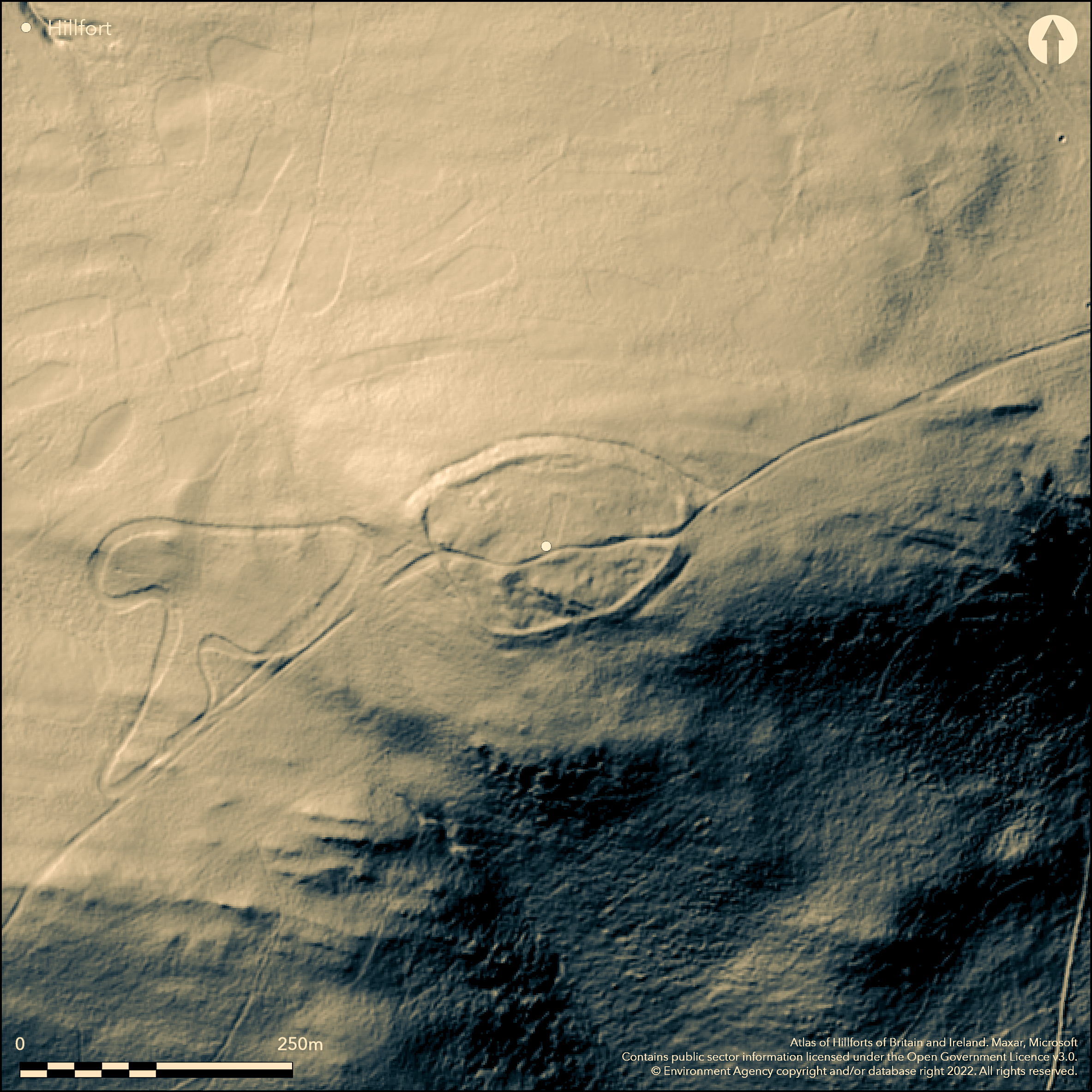
LiDAR 1m DTM Hillshade
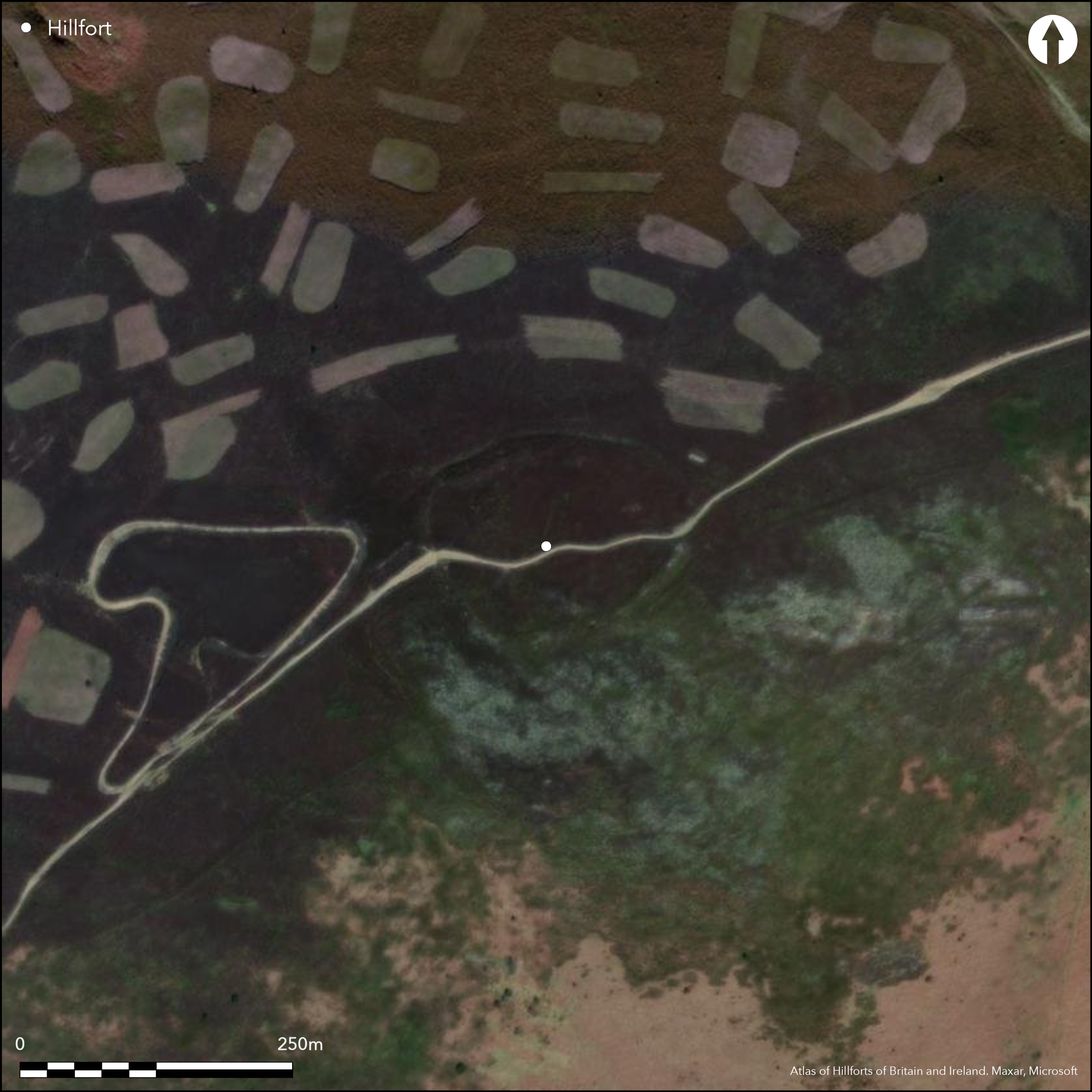
Satellite Imagery
LiDAR 1m DTM Hillshade
Satellite Imagery
Scroll left/right to view further images.
HER: Clwyd Powys 101366 (None)
NMR: SJ 14 NE (306813)
SM: None
NGR: SJ1670546365
X: 316697 Y: 346370 (OSGB36)
High and isolated site on the ridge of the Llantysilio Mountains overlooked by Moel y Gamelin and its surmounting Bronze Age cairn. Very exposed. Possibly situated on routeways along and across the ridge. Steep to very steep surrounding slopes apart from along ridge on E. Roughly oval measuring c. 140m E-W by 100m, with internal area c. 0.95ha. Substantial single stone bank, most probably concealing a dry-stone wall, surrounds site to 3.1m high externally and 0.6m internally with 10m wide ditch to N, but on W worn away. Impressive 20m long inturned entrance on E. Hillfort constituent part of the Heather and Hillforts Landscape Partnership Scheme, funded by the Heritage Lottery fund of Denbighshire County Council 2006-2011, included CPAT condition survey (Jones 2004) and detailed topographical and geophysical surveys by Engineering Archaeological Services (Brooks and Laws 2007 and 2009 respectively), interpretation and visitor management prescriptions. Around 20 potential roundhouse sites identified, 11 of which levelled platforms, with evidence of internal tracks and two possible rectangular structures. Small excavation by CPAT in 2010 of trench 20m by 3m in centre of enclosure found two successive roundhouses with at least two phases of occupation, earlier with narrow drip gully c. 7m diameter overlain by levelled platform. Three C14 dates show activity related to the houses from 4th-1st centuries BC (Grant and Jones 2012). Long-standing damage by visitor pressure and motor cycle route through ramparts and setting damaged by motor cycle track/circuit to W. Heather moorland. On 1st Ed. OS map (1875). Undated.
Citizen Science: ✗
Reliability of Data: Confirmed
Reliability of Interpretation: Confirmed
X: -361008 Y: 6984500 (EPSG: 3857)
Longitude: -3.2429899780121385 Latitude: 53.00811963580807 (EPSG:4326)
Country: Wales
Current County or Unitary Authority: Denbighshire
Historic County: Denbighshire
Current Parish/Community/Council/Townland: Bryneglwys
Common land problems. Long-standing damage by visitor pressure and motor cycle route through ramparts and setting damaged by motor cycle track/circuit to W. Visitor management and interpretation as part of Heather and Hillforts project of Denbighshire County Council.
| Extant | ✓ |
| Cropmark | ✗ |
| Likely Destroyed | ✗ |
Heather moorland and rough grazing.
| Woodland | ✗ |
| Commercial Forestry Plantation | ✗ |
| Parkland | ✗ |
| Pasture (Grazing) | ✗ |
| Arable | ✗ |
| Scrub/Bracken | ✗ |
| Bare Outcrop | ✗ |
| Heather/Moorland | ✓ |
| Heath | ✗ |
| Built-up | ✗ |
| Coastal Grassland | ✗ |
| Other | ✗ |
High and isolated contour hillfort located on the ridge of the Llantysilio Mountains overlooked by Moel y Gamelin and its surmounting Bronze Age cairn. Very exposed. Possibly situated on routeways along and across the ridge. Steep to very steep surrounding slopes.
| Contour Fort | ✓ |
| Partial Contour Fort | ✗ |
| Promontory Fort | ✗ |
| Hillslope Fort | ✗ |
| Level Terrain Fort | ✗ |
| Marsh Fort | ✗ |
| Multiple Enclosure Fort | ✗ |
| Hilltop | ✗ |
| Coastal Promontory | ✗ |
| Inland Promontory | ✗ |
| Valley Bottom | ✗ |
| Knoll/Hillock/Outcrop | ✗ |
| Ridge | ✓ |
| Cliff/Plateau-edge/Scarp | ✗ |
| Hillslope | ✗ |
| Lowland | ✗ |
| Spur | ✗ |
Dominant Topographic Feature: Ridge
| North | ✗ |
| Northeast | ✗ |
| East | ✗ |
| Southeast | ✗ |
| South | ✗ |
| Southwest | ✗ |
| West | ✗ |
| Northwest | ✗ |
| Level | ✓ |
Altitude: 504.0m
N/A
Three C14 dates from excavation, 4th-1st centuries BC (Grant and Jones 2012).
Reliability: B - Medium
| Pre 1200BC | ✗ |
| 1200BC - 800BC | ✗ |
| 800BC - 400BC | ✗ |
| 400BC - AD50 | ✓ |
| AD50 - AD400 | ✗ |
| AD400 - AD 800 | ✗ |
| Post AD800 | ✗ |
| Unknown | ✗ |
| Pre Hillfort: | None |
| Post Hillfort: | None |
| C14: | None |
On 1st Ed. OS map (1875). Hillfort constituent part of the Heather and Hillforts Landscape Partnership Scheme, funded by the Heritage Lottery fund of Denbighshire County Council 2006-2011, included CPAT condition survey (Jones 2004) and detailed topographical and geophysical surveys by Engineering Archaeological Services (Brooks and Laws 2007 and 2009 respectively), interpretation and visitor management prescriptions. Small excavation by CPAT in 2010.
| 1st Identified Map Depiction (1875): | OS map. |
| Other (2004): | CPAT condition survey. |
| Earthwork Survey (2007): | Engineering Archaeological Services. |
| Geophysical Survey (2009): | Engineering Archaeological Services. |
| Excavation (2010): | CPAT trench in centre of site. |
| Other (2012): | Visited by Hillfort Study Group |
| Other (None): | Heather and Hillforts Landscape Partnership Scheme, funded by the Heritage Lottery fund of Denbighshire County Council. |
Around 20 potential roundhouse sites identified, 11 of which levelled platforms, with evidence of internal tracks and two possible rectangular structures. Small excavation of trench 20m by 2m in centre of enclosure found two successive roundhouses with at least two phases of occupation, earlier with narrow drip gully c. 7m diameter overlain by levelled platform. Round rubbing and hammer stone. Charred grain of wheat.
Stream 0.35km outside fort.
| None | ✓ |
| Spring | ✗ |
| Stream | ✗ |
| Pool | ✗ |
| Flush | ✗ |
| Well | ✗ |
| Other | ✗ |
Hut platforms visible, but heather makes interpretation difficult.
| No Known Features | ✗ |
| Round Stone Structures | ✗ |
| Rectangular Stone Structures | ✗ |
| Curvilinear Platforms | ✓ |
| Other Roundhouse Evidence | ✗ |
| Pits | ✗ |
| Quarry Hollows | ✗ |
| Other | ✗ |
Small excavation of trench 20m by 2m in centre of enclosure found two successive roundhouses with at least two phases of occupation, earlier with narrow drip gully c. 7m diameter overlain by levelled platform.
| No Known Excavation | ✗ |
| Pits | ✗ |
| Postholes | ✗ |
| Roundhouses | ✓ |
| Rectangular Structures | ✗ |
| Roads/Tracks | ✗ |
| Quarry Hollows | ✗ |
| Other | ✗ |
| Nothing Found | ✗ |
Around 20 potential roundhouse sites identified, 11 of which levelled platforms, with evidence of internal tracks and two possible rectangular structures.
| No Known Geophysics | ✗ |
| Pits | ✗ |
| Roundhouses | ✓ |
| Rectangular Structures | ✓ |
| Roads/Tracks | ✓ |
| Quarry Hollows | ✗ |
| Other | ✗ |
| Nothing Found | ✗ |
Round rubbing and hammer stone.
| No Known Finds | ✗ |
| Pottery | ✗ |
| Metal | ✗ |
| Metalworking | ✗ |
| Human Bones | ✗ |
| Animal Bones | ✗ |
| Lithics | ✓ |
| Environmental | ✓ |
| Other | ✗ |
None
| APs Not Checked | ✓ |
| None | ✗ |
| Roundhouses | ✗ |
| Rectangular Structures | ✗ |
| Pits | ✗ |
| Postholes | ✗ |
| Roads/Tracks | ✗ |
| Other | ✗ |
Eroded visitor/motor cycle track through site from E to W has damaged the fine 20m inturned entrance passage on E.
| 2: | Track through site E-W. |
| 2: | Fine entrance. |
Guard Chambers: ✗
Chevaux de Frise: ✗
| 1. In-turned (East): | Long 20m passage formed by inturns. |
| 1. Passage-way/Corridor (East): | Long 20m passage formed by inturns. |
| 2. Simple Gap (West): | Damaged gap. |
Substantial single stone bank, most probably concealing a dry-stone wall, surrounds site to 3.1m high externally and 0.6m internally with 10m wide ditch to N, but on W worn away.
| Area 1: | 0.95ha. |
| Total: | 0.95ha. |
Total Footprint Area: Noneha.
None
| ✗ | None |
| ✓ | Damaged by motor bikes and visitors pressure. |
| NE Quadrant: | 1 |
| SE Quadrant: | 1 |
| SW Quadrant: | 1 |
| NW Quadrant: | 1 |
| Total: | 1 |
| Partial Univallate | ✗ |
| Univallate | ✓ |
| Partial Bivallate | ✗ |
| Bivallate | ✗ |
| Partial Multivallate | ✗ |
| Multivallate | ✗ |
| Unknown | ✗ |
| Partial Univallate | ✗ |
| Univallate | ✗ |
| Partial Bivallate | ✗ |
| Bivallate | ✗ |
| Partial Multivallate | ✗ |
| Multivallate | ✗ |
Stone-walled site.
| None | ✗ |
| Earthen Bank | ✗ |
| Stone Wall | ✓ |
| Rubble | ✗ |
| Wall-walk | ✗ |
| Evidence of Timber | ✗ |
| Vitrification | ✗ |
| Other Burning | ✗ |
| Palisade | ✗ |
| Counter Scarp Bank | ✗ |
| Berm | ✗ |
| Unfinished | ✗ |
| Other | ✗ |
No excavation of ramparts.
| None | ✗ |
| Earthen Bank | ✗ |
| Stone Wall | ✗ |
| Murus Duplex | ✗ |
| Timber-framed | ✗ |
| Timber-laced | ✗ |
| Vitrification | ✗ |
| Other Burning | ✗ |
| Palisade | ✗ |
| Counter Scarp Bank | ✗ |
| Berm | ✗ |
| Unfinished | ✗ |
| No Known Excavation | ✓ |
| Other | ✗ |
| ✗ | None |
| ✓ | 10m wide ditch to N, but on W worn away. |
Number of Ditches: 1
| ✗ | None |
Brooks, I.P. and Laws, K. 2007. Heather and Hillfort survey report: Moel y Gaer, Llantysilio, EAS Client Report 2007/01.
Brooks, I.P. and Laws, K. 2009. Moel y Gaer, Llantysilio: Geophysical survey, EAS Client Report 2009/10.
Brown, I. 2009. Beacons in the landscape. The hillforts of England and Wales, Oxford: Windgather Press/ Oxbow Books.
Burnham, H. 1995. A guide to ancient and historic Wales - Clwyd and Powys, 64, London: HMSO, 64.
Davies, Canon Ellis 1929. The prehistoric and Roman remains of Denbighshire, Cardiff: William Lewis, 366.
Grant, I. 2010. Moel y Gaer Hillfort, Llanytysilio, Denbighshire. Archaeological excavation, CPAT Report No 1059, Welshpool: CPAT.
Grant, I. and Jones, N.W. 2012. The investigation of two roundhouses within Moel-y-Gaer hillfort, Llantysilio, Denbighshire. Archaeol Wales, 52, 49-55.
Jones, N.W. 2004. Heather and Hillforts. Archaeological condition survey, CPAT Report No. 654, Welshpool: CPAT.
Mrowiec, H. (ed) 2011. Heather and Hillforts of the Clwydian Range and Llantysilio Mountains, Ruthin: Heather and Hillforts Partnership Board, Denbighshire County Council.
Atlas of Hillforts:
Wikidata:
This work is licensed under CC BY-SA 4.0

 and should be cited as:
Lock, Gary and Ralston, Ian. 2024. Atlas of Hillforts of Britain and Ireland. Available at: https://hillforts.arch.ox.ac.uk
Document Version 1.1