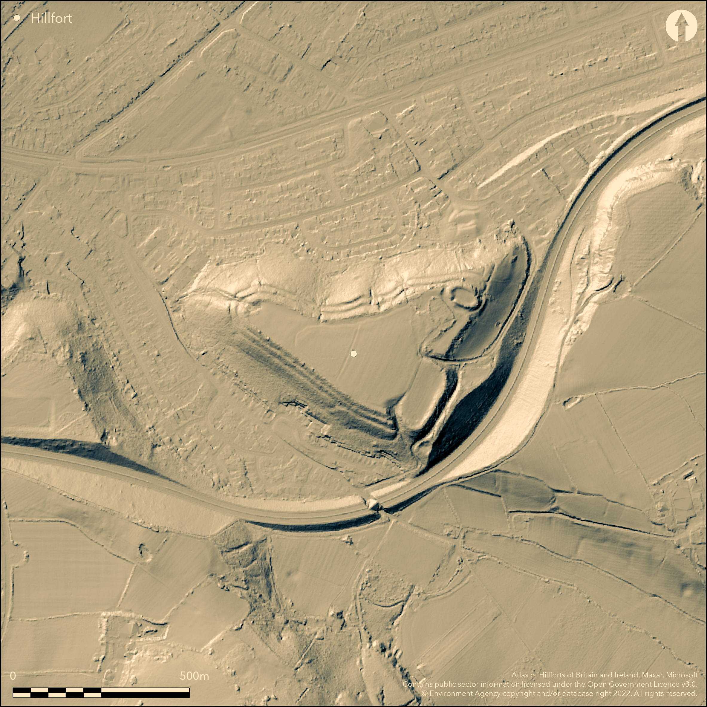
LiDAR 1m DTM Hillshade
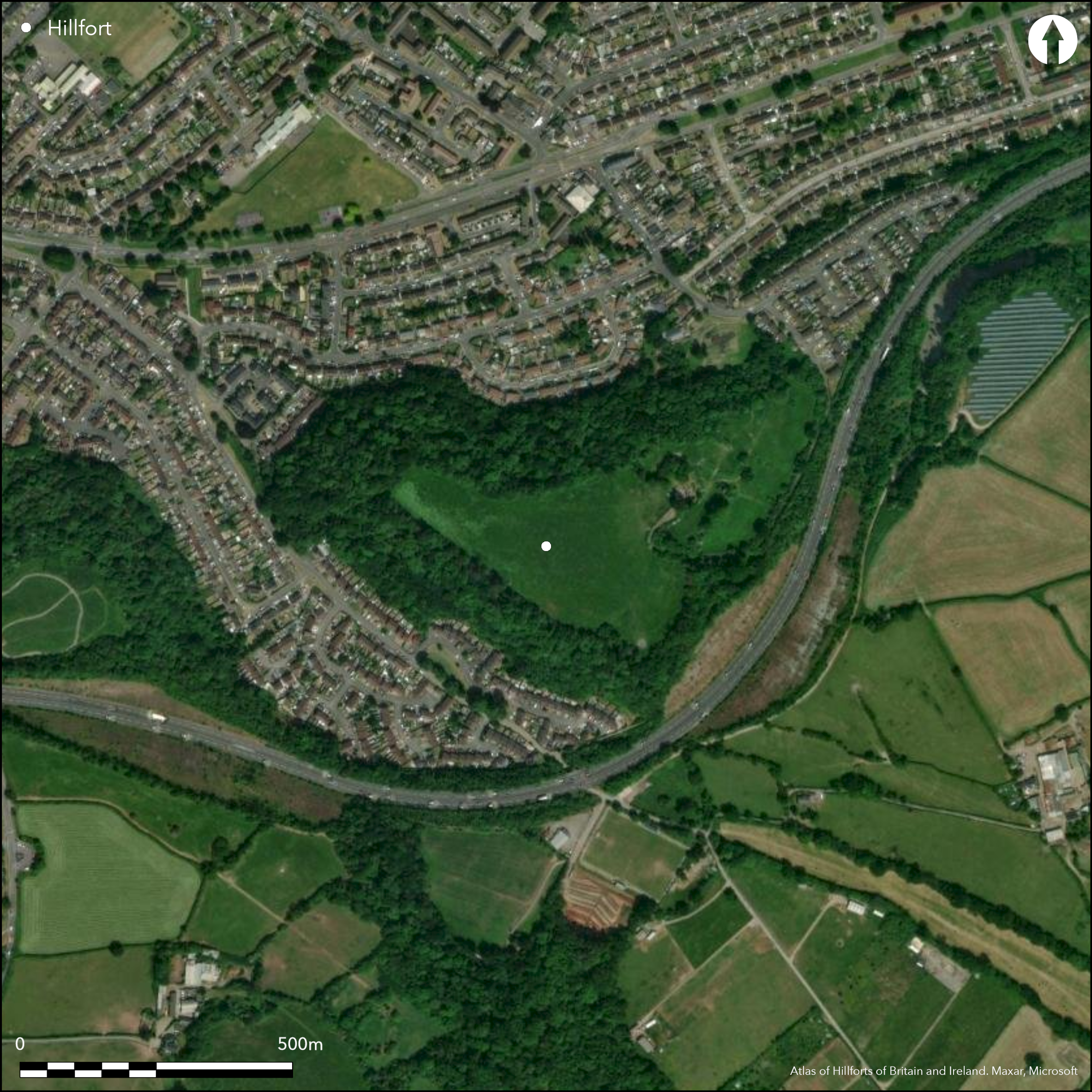
Satellite Imagery
LiDAR 1m DTM Hillshade
Satellite Imagery
Scroll left/right to view further images.
HER: Glamorgan Gwent 00093s (None)
NMR: ST 17 NW (94517)
SM: GM018CDF
NGR: ST13357500
X: 313350 Y: 175000 (OSGB36)
Fine large contour site on top of a steeply sloping spur strategically located above the Ely and Taff river valleys in an area much affected now by development. At 5.1ha one of the largest hillforts in SE Wales. Spur triangular in shape with moderate to steep surrounding slopes, especially to N and SW, and defended by three massive parallel ramparts. Greatest ramparts to S with huge banks, ditches and counterscarp, although recent excavations suggest that first phase Iron Age ramparts were small, maximum 0.5m high with gaps through them later enlarged possibly post-Roman. Low bank cutting off an area at E end of the fort between the two entrances may indicate the original site or later annexe. Excavations have revealed roundhouses and four-post structures. Two original entrance on E side, the N-most inturned. In S corner another entrance follows a possible natural gully. The gap at W end not original and follows line of spring seepage. Possible medieval castle ringwork in NE corner of the fort and old parish church within to S. LiDar survey, geophysics and on-going (2015) excavations (Davis and Sharples) are revealing much detail of construction and use from the late Bronze Age/early Iron Age through the Roman and early medieval periods. Earlier use includes a causewayed enclosure with possibly five lines of ditch and much pottery and lithics. Wooded with interior pasture, formerly cultivated. On 1st Ed. OS map (1880).
Citizen Science: ✗
Reliability of Data: Confirmed
Reliability of Interpretation: Confirmed
X: -361661 Y: 6704367 (EPSG: 3857)
Longitude: -3.2488556471357373 Latitude: 51.4672622001672 (EPSG:4326)
Country: Wales
Current County or Unitary Authority: Cardiff
Historic County: Glamorgan
Current Parish/Community/Council/Townland: Caerau
Near intact, but setting surrounded by development.
| Extant | ✓ |
| Cropmark | ✗ |
| Likely Destroyed | ✗ |
Three ramparts and ditches generally wooded. Interior pasture, formerly cultivated. Possible medieval castle ringwork in NE corner.
| Woodland | ✓ |
| Commercial Forestry Plantation | ✗ |
| Parkland | ✗ |
| Pasture (Grazing) | ✓ |
| Arable | ✗ |
| Scrub/Bracken | ✗ |
| Bare Outcrop | ✗ |
| Heather/Moorland | ✗ |
| Heath | ✗ |
| Built-up | ✗ |
| Coastal Grassland | ✗ |
| Other | ✓ |
Fine large contour site on top of a steeply sloping spur strategically located above the Ely and Taff river valleys. Moderate to steep surrounding slopes, especially to N and SW,
| Contour Fort | ✓ |
| Partial Contour Fort | ✗ |
| Promontory Fort | ✗ |
| Hillslope Fort | ✗ |
| Level Terrain Fort | ✗ |
| Marsh Fort | ✗ |
| Multiple Enclosure Fort | ✗ |
| Hilltop | ✗ |
| Coastal Promontory | ✗ |
| Inland Promontory | ✗ |
| Valley Bottom | ✗ |
| Knoll/Hillock/Outcrop | ✗ |
| Ridge | ✗ |
| Cliff/Plateau-edge/Scarp | ✗ |
| Hillslope | ✗ |
| Lowland | ✗ |
| Spur | ✓ |
Dominant Topographic Feature: Spur
| North | ✗ |
| Northeast | ✗ |
| East | ✗ |
| Southeast | ✗ |
| South | ✗ |
| Southwest | ✗ |
| West | ✗ |
| Northwest | ✗ |
| Level | ✓ |
Altitude: 75.0m
N/A
On-going excavations date the site to the Late Bronze Age/early Iron Age with continued occupation through the Roman and Saxon periods. Neolithic activity and a possible causewayed enclosure. Medieval castle ringwork and church.
Reliability: D - None
| Pre 1200BC | ✗ |
| 1200BC - 800BC | ✗ |
| 800BC - 400BC | ✓ |
| 400BC - AD50 | ✓ |
| AD50 - AD400 | ✗ |
| AD400 - AD 800 | ✗ |
| Post AD800 | ✗ |
| Unknown | ✗ |
| Pre Hillfort: | None |
| Post Hillfort: | None |
| Artefactual: | None |
| Morphology/Earthwork/Typology: | None |
On 1st Ed. OS map (1880). RCAHMW investigation 1965. GGAT Prehistoric defended enclosures in Glamorgan survey 2005. LiDar survey by National Museum and RCAHMW 2011. Time Team investigation 2012. On-going excavations Cardiff University. LiDAR and geophysics 2011.
| 1st Identified Map Depiction (1880): | OS map |
| Other (1965): | RCAHMW investigation. |
| Other (2005): | GGAT Prehistoric defended enclosures in Glamorgan survey. |
| LiDAR Survey (2011): | Survey by National Museum and RCAHMW. |
| LiDAR Survey (2011): | None |
| Geophysical Survey (2011): | None |
| Other (2012): | Time Team investigation. |
| Excavation (None): | Cardiff University |
On-going excavation (2015) has shown extensive occupation with roundhouses, four-posters, pits and much pottery and other material culture from the Iron Age through early medieval periods, much Neolithic material.
The gap at W end of site not original but follows line of spring seepage, possibly indicating water source.
| None | ✗ |
| Spring | ✓ |
| Stream | ✗ |
| Pool | ✗ |
| Flush | ✗ |
| Well | ✗ |
| Other | ✗ |
No details.
| No Known Features | ✗ |
| Round Stone Structures | ✗ |
| Rectangular Stone Structures | ✗ |
| Curvilinear Platforms | ✗ |
| Other Roundhouse Evidence | ✓ |
| Pits | ✗ |
| Quarry Hollows | ✗ |
| Other | ✗ |
None
| No Known Excavation | ✗ |
| Pits | ✓ |
| Postholes | ✓ |
| Roundhouses | ✓ |
| Rectangular Structures | ✓ |
| Roads/Tracks | ✗ |
| Quarry Hollows | ✗ |
| Other | ✗ |
| Nothing Found | ✗ |
None
| No Known Geophysics | ✗ |
| Pits | ✓ |
| Roundhouses | ✓ |
| Rectangular Structures | ✗ |
| Roads/Tracks | ✗ |
| Quarry Hollows | ✗ |
| Other | ✗ |
| Nothing Found | ✗ |
None
| No Known Finds | ✗ |
| Pottery | ✓ |
| Metal | ✗ |
| Metalworking | ✗ |
| Human Bones | ✗ |
| Animal Bones | ✓ |
| Lithics | ✓ |
| Environmental | ✓ |
| Other | ✗ |
LiDAR survey 2011 highlighted triangular interior of hillfort and the steep N and S slopes, with the three massive ramparts with accompanying ditches. Further processing of the LiDAR data resulted in a Çbare-earth digital terrain model, with houses and trees stripped away, revealing the magnificent sculpted ramparts and ditches.
| APs Not Checked | ✗ |
| None | ✗ |
| Roundhouses | ✗ |
| Rectangular Structures | ✗ |
| Pits | ✗ |
| Postholes | ✗ |
| Roads/Tracks | ✗ |
| Other | ✓ |
Two original entrance on E side, the N-most inturned. In S corner another entrance follows a possible natural gully. The gap at W end not original and follows line of spring seepage.
| 4: | The gap at W end not original and follows line of spring seepage. |
| 2: | None |
Guard Chambers: ✗
Chevaux de Frise: ✗
| 1. In-turned (East): | The N-most of the two E entrances. |
| 2. Simple Gap (East): | None |
| 3. Other Forms (South): | Follows possible natural gully. |
Defended by three massive parallel ramparts. Greatest ramparts to S with huge banks, ditches and counterscarp. Low bank cutting off an area at E end of the fort between the two entrances may indicate the original site or later annexe.
| Area 1: | 5.1ha. |
| Total: | 5.1ha. |
Total Footprint Area: Noneha.
None
| ✗ | None |
| ✓ | None |
| NE Quadrant: | 3 |
| SE Quadrant: | 3 |
| SW Quadrant: | 3 |
| NW Quadrant: | 3 |
| Total: | 3 |
| Partial Univallate | ✗ |
| Univallate | ✗ |
| Partial Bivallate | ✗ |
| Bivallate | ✗ |
| Partial Multivallate | ✗ |
| Multivallate | ✓ |
| Unknown | ✗ |
| Partial Univallate | ✗ |
| Univallate | ✗ |
| Partial Bivallate | ✗ |
| Bivallate | ✗ |
| Partial Multivallate | ✗ |
| Multivallate | ✗ |
None
| None | ✗ |
| Earthen Bank | ✓ |
| Stone Wall | ✗ |
| Rubble | ✗ |
| Wall-walk | ✗ |
| Evidence of Timber | ✗ |
| Vitrification | ✗ |
| Other Burning | ✗ |
| Palisade | ✗ |
| Counter Scarp Bank | ✓ |
| Berm | ✗ |
| Unfinished | ✗ |
| Other | ✗ |
None
| None | ✗ |
| Earthen Bank | ✓ |
| Stone Wall | ✗ |
| Murus Duplex | ✗ |
| Timber-framed | ✗ |
| Timber-laced | ✗ |
| Vitrification | ✗ |
| Other Burning | ✗ |
| Palisade | ✗ |
| Counter Scarp Bank | ✗ |
| Berm | ✗ |
| Unfinished | ✗ |
| No Known Excavation | ✗ |
| Other | ✗ |
| ✗ | None |
| ✓ | None |
Number of Ditches: 3
| ✓ | Low bank cutting off an area at E end of the fort between the two entrances may indicate the original site or a possible later annexe. |
Davis, O. and Sharples, N. 2013 and 2104 interim reports, geophysical report and evaluation report downloadable from: https://caerheritageproject.com/learning/publications/ [accessed June 2015].
Davis, O., Sharples, N. and Wyatt, D. 2013. The Caer Heritage Project: a preliminary note on recent research and community engagement at Caerau hillfort, Cardiff. Archaeol Wales, 53, 119-25.
Davis, O., Sharples, N. and Wyatt, D. 2014. The Caer Heritage Project: Fieldwork at Caerau. Archaeol Wales, 54, 35-42.
Gerrard, C., Wiggins, H., and Evans, E. 2006. Prehistoric defended enclosures in Glamorgan with recommendations for fieldwork: Year 3 Report, GGAT Report No 2006/089, Project No GGAT78, Swansea: GGAT.
RCAHMW 1976. An inventory of the ancient monuments in Glamorgan, 1.2, Pre-Norman, Parts I-III, 673, Cardiff: HMSO.
Savory, H.N. 1949. List of hill-forts and other earthworks in Wales, Bull Board Celtic Stud, 13, 154.
Whittle, E. 1992. A guide to ancient and historic Wales - Glamorgan and Gwent, London: HMSO, 33.
Atlas of Hillforts:
Wikidata:
This work is licensed under CC BY-SA 4.0

 and should be cited as:
Lock, Gary and Ralston, Ian. 2024. Atlas of Hillforts of Britain and Ireland. Available at: https://hillforts.arch.ox.ac.uk
Document Version 1.1