LiDAR 1m DTM Hillshade
Satellite Imagery
LiDAR 1m DTM Hillshade
Satellite Imagery
Scroll left/right to view further images.
HER: Glamorgan Gwent 00233w (None)
NMR: SS 59 SW 3 (301311)
SM: GM124
NGR: SS50559240
X: 250550 Y: 192400 (OSGB36)
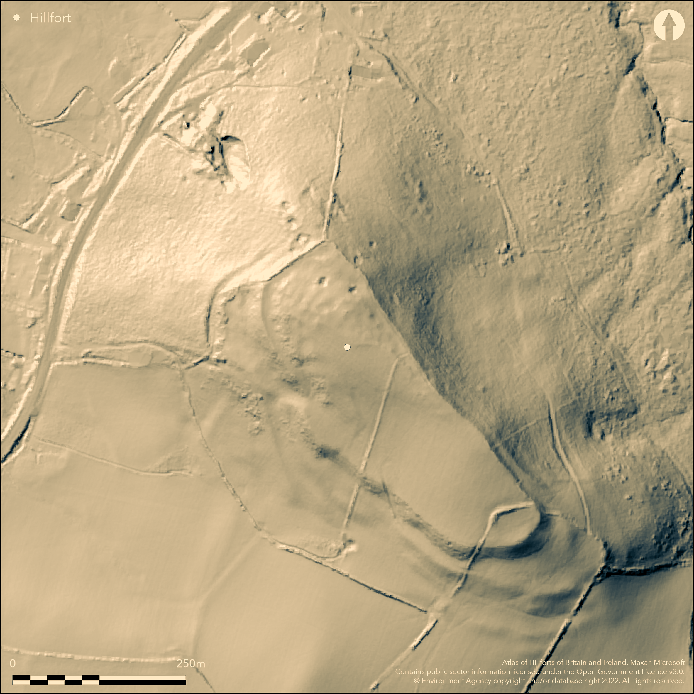
Isolated, large, multivallate, contour and important site on NW-SE ridge, commanding the estuary of the Afon Loughor and Llanrhidian Marsh on the Gower. Steep surrounding slopes to N, E and W, less on S, where ridge connected to a plateau, and falling to the salt marsh on the NW. Roughly oblong in shape measuring 320m NW-SE by 110m, with internal area 2.9ha. Strongly defended with up to three ramparts, stony to N, and small medieval ringwork of 0.1ha at SE end, c. 40m E-W by 30m. Narrow section cut by L.Ll. Morgan 1910 showed inner rampart of disintegrated shale incorporating possibly earlier bank of yellow clay. Ditch c. 7.5m wide and 2.5m deep found and generally seems to have not been on the very steep slopes of the NE and NW sides. Second bank was levelled but had ditch c. 4m wide and 1.5m deep, with counterscarp visible on W corner. Suggested revetment or breastwork. Trench also cut across ringwork. No finds in either section. Inner rampart preserved and runs around entire circuit to 7.5m outer. Wide internal quarry ditch on NW. Outer defences badly damaged by cultivation, but second bank substantial, but lost to SW, with ditch, as found by Morgan. To S corner, across col, third rampart, much reduced, can be traced, its crest about 40m from second bank. Here defences huge at 85m across. Only entrance on SW side. Simple gap with with large mound commanding the approach to the gate. Two terraced roadways, one seemingly blocked by the second rampart and suggesting earlier univallate fort, but no direct evidence for this theory, although Morgan had suggested an earlier bank in his excavations. Past quarrying to NW. Interior now pasture, but cultivated in past. Evidence of hut platforms. On 1st Ed. OS map (1878-79).
Citizen Science: ✗
Reliability of Data: Confirmed
Reliability of Interpretation: Confirmed
X: -463066 Y: 6730002 (EPSG: 3857)
Longitude: -4.159796431874995 Latitude: 51.61049703196643 (EPSG:4326)
Country: Wales
Current County or Unitary Authority: Swansea
Historic County: Glamorgan
Current Parish/Community/Council/Townland: Llanrhidian Lower
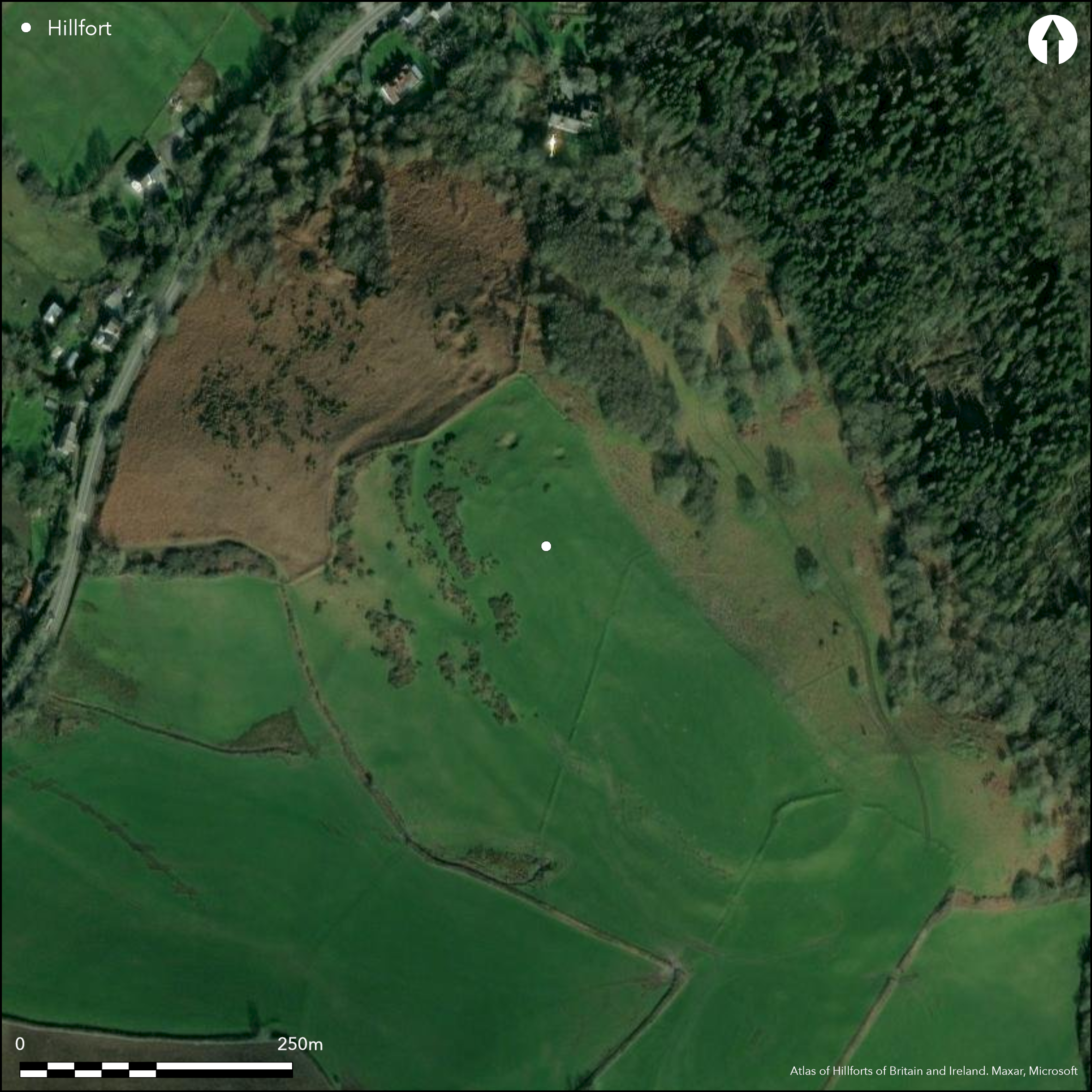
Inner rampart in good order. Outer ramparts badly damaged by cultivation. Interior cultivated in past. Small quarry pits at NW end and disused quarry impinges ramparts here.
| Extant | ✓ |
| Cropmark | ✗ |
| Likely Destroyed | ✗ |
Improved pasture. Quarrying.
| Woodland | ✗ |
| Commercial Forestry Plantation | ✗ |
| Parkland | ✗ |
| Pasture (Grazing) | ✓ |
| Arable | ✗ |
| Scrub/Bracken | ✗ |
| Bare Outcrop | ✗ |
| Heather/Moorland | ✗ |
| Heath | ✗ |
| Built-up | ✗ |
| Coastal Grassland | ✗ |
| Other | ✓ |
Isolated, large, multivallate, contour and important site overlooking the Afon Loughor and Llanrhidian Marsh. Steep surrounding slopes to N, E and W, less on S, where ridge connected to a plateau, and falling to the salt marsh on the NW.
| Contour Fort | ✓ |
| Partial Contour Fort | ✗ |
| Promontory Fort | ✗ |
| Hillslope Fort | ✗ |
| Level Terrain Fort | ✗ |
| Marsh Fort | ✗ |
| Multiple Enclosure Fort | ✗ |
| Hilltop | ✗ |
| Coastal Promontory | ✗ |
| Inland Promontory | ✗ |
| Valley Bottom | ✗ |
| Knoll/Hillock/Outcrop | ✗ |
| Ridge | ✓ |
| Cliff/Plateau-edge/Scarp | ✗ |
| Hillslope | ✗ |
| Lowland | ✗ |
| Spur | ✗ |
Dominant Topographic Feature: Ridge
| North | ✗ |
| Northeast | ✗ |
| East | ✗ |
| Southeast | ✗ |
| South | ✗ |
| Southwest | ✓ |
| West | ✗ |
| Northwest | ✗ |
| Level | ✗ |
Altitude: 110.0m
N/A
Undated with small medieval ringwork in interior.
Reliability: D - None
| Pre 1200BC | ✗ |
| 1200BC - 800BC | ✗ |
| 800BC - 400BC | ✗ |
| 400BC - AD50 | ✗ |
| AD50 - AD400 | ✗ |
| AD400 - AD 800 | ✗ |
| Post AD800 | ✗ |
| Unknown | ✓ |
| Pre Hillfort: | None |
| Post Hillfort: | Small medieval ringwork in interior. |
On 1st Ed. OS map (1878-79). Narrow sections cut by W. Ll. Morgan 1910. RCAHMW investigation 1966. GGAT Prehistoric defended enclosures in Glamorgan survey 2005.
| Excavation (1910): | W. Ll. Morgan. |
| Other (1966): | RCAHMW investigation. |
| Other (1986): | Visited by Hillfort Study Group |
| Other (2005): | GGAT Prehistoric defended enclosures in Glamorgan survey. |
| 1st Identified Map Depiction (None): | OS map. |
Internal quarry ditch. Three round hut platforms 10-13m diameter
Spring just outside outer bank to SW, where low bank runs downhill from entrance, the strong spring rising from excavated hollow.
| None | ✓ |
| Spring | ✗ |
| Stream | ✗ |
| Pool | ✗ |
| Flush | ✗ |
| Well | ✗ |
| Other | ✗ |
Internal quarry ditch. Three round hut platforms 10-13m diameter, with possibly more.
| No Known Features | ✗ |
| Round Stone Structures | ✗ |
| Rectangular Stone Structures | ✗ |
| Curvilinear Platforms | ✓ |
| Other Roundhouse Evidence | ✗ |
| Pits | ✗ |
| Quarry Hollows | ✓ |
| Other | ✗ |
None
| No Known Excavation | ✗ |
| Pits | ✗ |
| Postholes | ✗ |
| Roundhouses | ✗ |
| Rectangular Structures | ✗ |
| Roads/Tracks | ✗ |
| Quarry Hollows | ✗ |
| Other | ✗ |
| Nothing Found | ✓ |
None
| No Known Geophysics | ✓ |
| Pits | ✗ |
| Roundhouses | ✗ |
| Rectangular Structures | ✗ |
| Roads/Tracks | ✗ |
| Quarry Hollows | ✗ |
| Other | ✗ |
| Nothing Found | ✗ |
None
| No Known Finds | ✓ |
| Pottery | ✗ |
| Metal | ✗ |
| Metalworking | ✗ |
| Human Bones | ✗ |
| Animal Bones | ✗ |
| Lithics | ✗ |
| Environmental | ✗ |
| Other | ✗ |
None
| APs Not Checked | ✓ |
| None | ✗ |
| Roundhouses | ✗ |
| Rectangular Structures | ✗ |
| Pits | ✗ |
| Postholes | ✗ |
| Roads/Tracks | ✗ |
| Other | ✗ |
Only entrance on SW side. Simple gap with with large mound commanding the approach to the gate. Two terraced roadways, one seemingly blocked by the second rampart. A low bank runs downhill from the fort entrance, and a strong spring rises from a deeply excavated hollow.
| 1: | None |
| 2: | None |
Guard Chambers: ✗
Chevaux de Frise: ✗
| 1. Simple Gap (South west): | Large mounds commands approach. |
| 1. Simple Gap (South west): | Large mounds commands approach. |
Strongly defended with up to three ramparts, stony to N. Narrow section cut by L.Ll. Morgan 1910 showed inner rampart of disintegrated shale incorporating possibly earlier bank of yellow clay. Ditch c. 7.5m wide and 2.5m deep found and generally seems to have not been on the very steep slopes of the Ne and NW sides. Second bank was levelled but had ditch c. 4m wide and 1.5m deep, with counterscarp visible on W corner. Suggested revetment or breastwork. Wide internal quarry ditch on NW. Outer defences badly damaged by cultivation, but second bank substantial, but lost to SW, with ditch, as found by Morgan. To S corner, across col, third rampart, much reduced, can be traced, its crest about 40m from second bank. Here defences huge at 85m across.
| Area 1: | 2.9ha. |
| Total: | 2.9ha. |
Total Footprint Area: Noneha.
None
| ✗ | None |
| ✓ | None |
| NE Quadrant: | 3 |
| SE Quadrant: | 3 |
| SW Quadrant: | 3 |
| NW Quadrant: | 2 |
| Total: | 3 |
| Partial Univallate | ✗ |
| Univallate | ✗ |
| Partial Bivallate | ✓ |
| Bivallate | ✗ |
| Partial Multivallate | ✓ |
| Multivallate | ✗ |
| Unknown | ✗ |
| Partial Univallate | ✗ |
| Univallate | ✗ |
| Partial Bivallate | ✗ |
| Bivallate | ✗ |
| Partial Multivallate | ✗ |
| Multivallate | ✗ |
Counterscarp visible on W corner of second bank.
| None | ✗ |
| Earthen Bank | ✓ |
| Stone Wall | ✗ |
| Rubble | ✗ |
| Wall-walk | ✗ |
| Evidence of Timber | ✗ |
| Vitrification | ✗ |
| Other Burning | ✗ |
| Palisade | ✗ |
| Counter Scarp Bank | ✓ |
| Berm | ✗ |
| Unfinished | ✗ |
| Other | ✗ |
Inner rampart of disintegrated shale, incorporating bank of yellow clay (possibly earlier defence). Suggested revetment or breastwork.
| None | ✗ |
| Earthen Bank | ✓ |
| Stone Wall | ✓ |
| Murus Duplex | ✗ |
| Timber-framed | ✗ |
| Timber-laced | ✗ |
| Vitrification | ✗ |
| Other Burning | ✗ |
| Palisade | ✗ |
| Counter Scarp Bank | ✗ |
| Berm | ✗ |
| Unfinished | ✗ |
| No Known Excavation | ✗ |
| Other | ✓ |
| ✗ | None |
| ✓ | None |
Number of Ditches: 3
| ✗ | None |
Gerrard, C., Wiggins, H., and Evans, E. 2006. Prehistoric defended enclosures in Glamorgan with recommendations for fieldwork: Year 3 Report, GGAT Report No 2006/089, Project No GGAT78, Swansea: GGAT.
Morgan, L.Ll. 1910-11. No details, Trans Swansea Sc. Soc. 1910-11, 133.
Morgan, L.Ll. 1912-13. No details, Trans Swansea Sc. Soc. 1912-13, 92.
RCAHMW 1976. An inventory of the ancient monuments in Glamorgan, 1.2, Pre-Norman, Parts I-III, 665, Cardiff: HMSO
Savory, H.N. 1949. List of hill-forts in Wales, Bull Board Celtic Stud, 13, 154.
Atlas of Hillforts:
Wikidata:
This work is licensed under CC BY-SA 4.0![]()
![]()
![]() and should be cited as:
and should be cited as:
Lock, Gary and Ralston, Ian. 2024. Atlas of Hillforts of Britain and Ireland. Available at: https://hillforts.arch.ox.ac.uk
Document Version 1.1