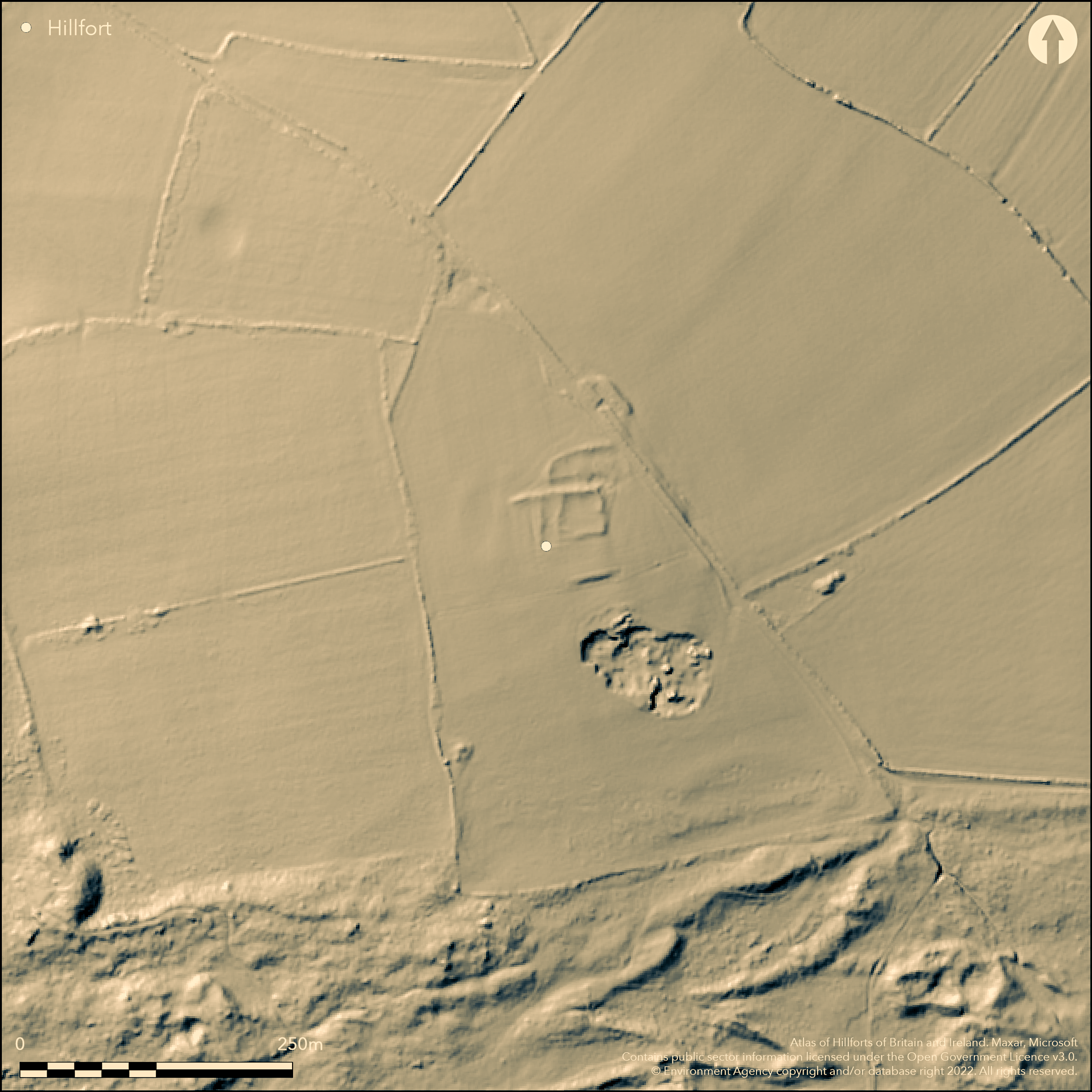
LiDAR 1m DTM Hillshade
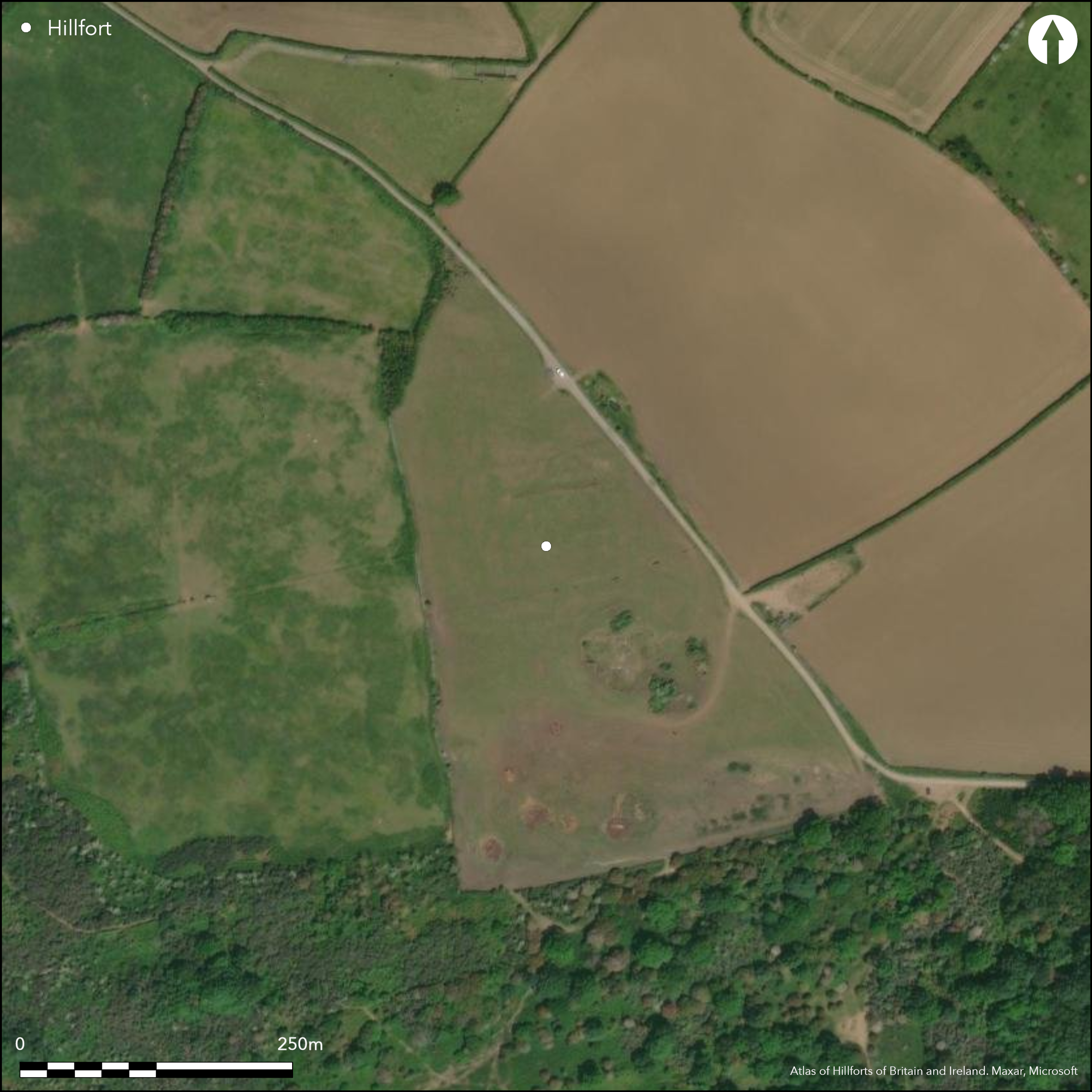
Satellite Imagery
LiDAR 1m DTM Hillshade
Satellite Imagery
Scroll left/right to view further images.
HER: Glamorgan Gwent 00246m (None)
NMR: SS 87 NE (301305)
SM: GM102
NGR: SS86397798
X: 286390 Y: 177980 (OSGB36)
Important concentric site located just on almost level summit above the mouth of Ogmore River (Afon Ogwr) behind Merthyr Mawr Warren. Moderate surrounding slopes, steeper on W. Excavations by J.L. Davies 1966-67 and 1973 showed a complex sequence of pre-Roman phases, starting with undefended site, with at least one timber roundhouse, followed by palisaded second phase, then banked and ditched settlement with further phases. Occupation from second to third century BC through to Romano-British and Roman period. Inner enclosure, set in N part of an outer circuit, sub-rectangular in form, c. 56m E-W by 50m, covering c. 0.2ha internal area. Defined by, formerly strong, single bank and ditch, with stony bank projecting from N and joined to E wall as possibly a yard or building c.9m by 30m. The semi-concentric outer circuit, c.15m-20m is distant on N, W and E, covering c.0.9ha and now almost gone, Possible field boundary from S side. Entrance uncertain. Under pasture and scrub. Included as a hillfort here but possibly a defended farmstead at one time.
Citizen Science: ✗
Reliability of Data: Confirmed
Reliability of Interpretation: Confirmed
X: -404957 Y: 6708301 (EPSG: 3857)
Longitude: -3.637791488392868 Latitude: 51.48927179320282 (EPSG:4326)
Country: Wales
Current County or Unitary Authority: Bridgend
Historic County: Glamorgan
Current Parish/Community/Council/Townland: Merthyr Mawr
Almost destroyed in part by past cultivation.
| Extant | ✓ |
| Cropmark | ✗ |
| Likely Destroyed | ✓ |
Pasture and scrub.
| Woodland | ✗ |
| Commercial Forestry Plantation | ✗ |
| Parkland | ✗ |
| Pasture (Grazing) | ✓ |
| Arable | ✗ |
| Scrub/Bracken | ✓ |
| Bare Outcrop | ✗ |
| Heather/Moorland | ✗ |
| Heath | ✗ |
| Built-up | ✗ |
| Coastal Grassland | ✗ |
| Other | ✗ |
Important concentric site located just on almost level summit above the mouth of Ogmore River (Afon Ogwr) behind Merthyr Mawr Warren. Moderate surrounding slopes, steeper on W.
| Contour Fort | ✗ |
| Partial Contour Fort | ✓ |
| Promontory Fort | ✗ |
| Hillslope Fort | ✗ |
| Level Terrain Fort | ✗ |
| Marsh Fort | ✗ |
| Multiple Enclosure Fort | ✗ |
| Hilltop | ✓ |
| Coastal Promontory | ✗ |
| Inland Promontory | ✗ |
| Valley Bottom | ✗ |
| Knoll/Hillock/Outcrop | ✗ |
| Ridge | ✗ |
| Cliff/Plateau-edge/Scarp | ✗ |
| Hillslope | ✗ |
| Lowland | ✗ |
| Spur | ✗ |
Dominant Topographic Feature: Hilltop
| North | ✗ |
| Northeast | ✗ |
| East | ✗ |
| Southeast | ✗ |
| South | ✗ |
| Southwest | ✗ |
| West | ✗ |
| Northwest | ✗ |
| Level | ✓ |
Altitude: 75.0m
N/A
Excavations, in 1966-7 and 1973 showed occupation started in second to third century BC, continuing into Romano-British and Roman periods. Second to fourth century AD Roman pottery found together with several possible granaries and corn-drying kilns.
Reliability: B - Medium
| Pre 1200BC | ✗ |
| 1200BC - 800BC | ✗ |
| 800BC - 400BC | ✗ |
| 400BC - AD50 | ✓ |
| AD50 - AD400 | ✓ |
| AD400 - AD 800 | ✗ |
| Post AD800 | ✗ |
| Unknown | ✗ |
| Pre Hillfort: | None |
| Post Hillfort: | None |
| Artefactual: | Excavations showed occupation opened in the Iron Age, continuing into the Romano-British period with second to fourth century AD Roman pottery and several possible granaries and corn-drying kilns. |
RCAHMW investigation 1966. Excavations, in 1966-7 and 1973 by J.L Davies. GGAT Prehistoric defended enclosures in Glamorgan survey 2005.
| Other (1966): | RCAHMW investigation. |
| Other (2005): | GGAT Prehistoric defended enclosures in Glamorgan survey. |
| Excavation (None): | J.L. Davies. |
Second to fourth century AD Roman pottery.
Stream 0.8km outside fort.
| None | ✓ |
| Spring | ✗ |
| Stream | ✗ |
| Pool | ✗ |
| Flush | ✗ |
| Well | ✗ |
| Other | ✗ |
None
| No Known Features | ✓ |
| Round Stone Structures | ✗ |
| Rectangular Stone Structures | ✗ |
| Curvilinear Platforms | ✗ |
| Other Roundhouse Evidence | ✗ |
| Pits | ✗ |
| Quarry Hollows | ✗ |
| Other | ✗ |
Several possible granaries & corn-drying kilns. Earlier timber roundhouse.
| No Known Excavation | ✗ |
| Pits | ✗ |
| Postholes | ✗ |
| Roundhouses | ✓ |
| Rectangular Structures | ✗ |
| Roads/Tracks | ✗ |
| Quarry Hollows | ✗ |
| Other | ✓ |
| Nothing Found | ✗ |
None
| No Known Geophysics | ✓ |
| Pits | ✗ |
| Roundhouses | ✗ |
| Rectangular Structures | ✗ |
| Roads/Tracks | ✗ |
| Quarry Hollows | ✗ |
| Other | ✗ |
| Nothing Found | ✗ |
Second to fourth century AD Roman pottery. Several possible granaries and corn-drying kilns.
| No Known Finds | ✗ |
| Pottery | ✓ |
| Metal | ✗ |
| Metalworking | ✗ |
| Human Bones | ✗ |
| Animal Bones | ✗ |
| Lithics | ✗ |
| Environmental | ✗ |
| Other | ✓ |
None
| APs Not Checked | ✓ |
| None | ✗ |
| Roundhouses | ✗ |
| Rectangular Structures | ✗ |
| Pits | ✗ |
| Postholes | ✗ |
| Roads/Tracks | ✗ |
| Other | ✗ |
Position of the entrance is uncertain.
| 0: | None |
| 2: | None |
Guard Chambers: ✗
Chevaux de Frise: ✗
Inner enclosure, set in N part of an outer circuit, sub-rectangular in form, c. 56m E-W by 50m, covering c. 0.2ha internal area. Defined by, formerly strong, single bank and ditch, with stony bank projecting from N and joined to E wall as possibly a yard or building c. 9m by 30m. The semi-concentric outer circuit, c.15m-20m is distant on N, W and E, covering c. 0.9ha and now almost gone,
| Area 1: | 0.2ha. |
| Area 2: | 0.9ha. |
| Total: | 0.9ha. |
Total Footprint Area: Noneha.
None
| ✓ | Excavations by J.L. Davies 1966-67 and 1973 showed a complex sequence of pre-Roman phases, starting with undefended site, with at least one timber roundhouse, followed by palisaded second phase, then banked and ditched settlement with further phases. |
| ✓ | None |
| NE Quadrant: | 2 |
| SE Quadrant: | 2 |
| SW Quadrant: | 2 |
| NW Quadrant: | 2 |
| Total: | 2 |
| Partial Univallate | ✗ |
| Univallate | ✗ |
| Partial Bivallate | ✗ |
| Bivallate | ✓ |
| Partial Multivallate | ✗ |
| Multivallate | ✗ |
| Unknown | ✗ |
| Partial Univallate | ✗ |
| Univallate | ✓ |
| Partial Bivallate | ✗ |
| Bivallate | ✗ |
| Partial Multivallate | ✗ |
| Multivallate | ✗ |
Stony banks.
| None | ✗ |
| Earthen Bank | ✓ |
| Stone Wall | ✗ |
| Rubble | ✓ |
| Wall-walk | ✗ |
| Evidence of Timber | ✗ |
| Vitrification | ✗ |
| Other Burning | ✗ |
| Palisade | ✗ |
| Counter Scarp Bank | ✗ |
| Berm | ✗ |
| Unfinished | ✗ |
| Other | ✗ |
Excavations by J.L. Davies 1966-67 and 1973 showed a complex sequence of pre-Roman phases, starting with undefended site, with at least one timber roundhouse, followed by palisaded second phase, then banked and ditched settlement with further phases. Stony banks.
| None | ✗ |
| Earthen Bank | ✓ |
| Stone Wall | ✗ |
| Murus Duplex | ✗ |
| Timber-framed | ✗ |
| Timber-laced | ✗ |
| Vitrification | ✗ |
| Other Burning | ✗ |
| Palisade | ✓ |
| Counter Scarp Bank | ✗ |
| Berm | ✗ |
| Unfinished | ✗ |
| No Known Excavation | ✗ |
| Other | ✓ |
| ✗ | None |
| ✓ | Ditch to both enclosures likely, |
Number of Ditches: 2
| ✗ | None |
Arnold, C.J. and Davies, J.L. 2000. Roman and Early Medieval Wales, Stroud: Sutton Publishing.
Davies, J.L. 1966. Excavations at Cae Summerhouse, Tythegston, Glam., 1966, Morgannwg, 10, 54-59.
Davies, J.L. 1967. Excavations at Cae Summerhouse, Tythegston, Glam: Second Interim Report, Morgannwg, 11, 75-77.
Davies, J.L. 1973. Cae Summerhouse, Tythegston, Morgannwg, 17, 53-7.
Gerrard, C., Wiggins, H., and Evans, E. 2006. Prehistoric defended enclosures in Glamorgan with recommendations for fieldwork: Year 3 Report, GGAT Report No 2006/089, Project No GGAT78, Swansea: GGAT.
RCAHMW 1976. An inventory of the ancient monuments in Glamorgan, 1.2, Pre-Norman, Parts I-III, 691, Cardiff: HMSO.
Atlas of Hillforts:
Wikidata:
This work is licensed under CC BY-SA 4.0

 and should be cited as:
Lock, Gary and Ralston, Ian. 2024. Atlas of Hillforts of Britain and Ireland. Available at: https://hillforts.arch.ox.ac.uk
Document Version 1.1