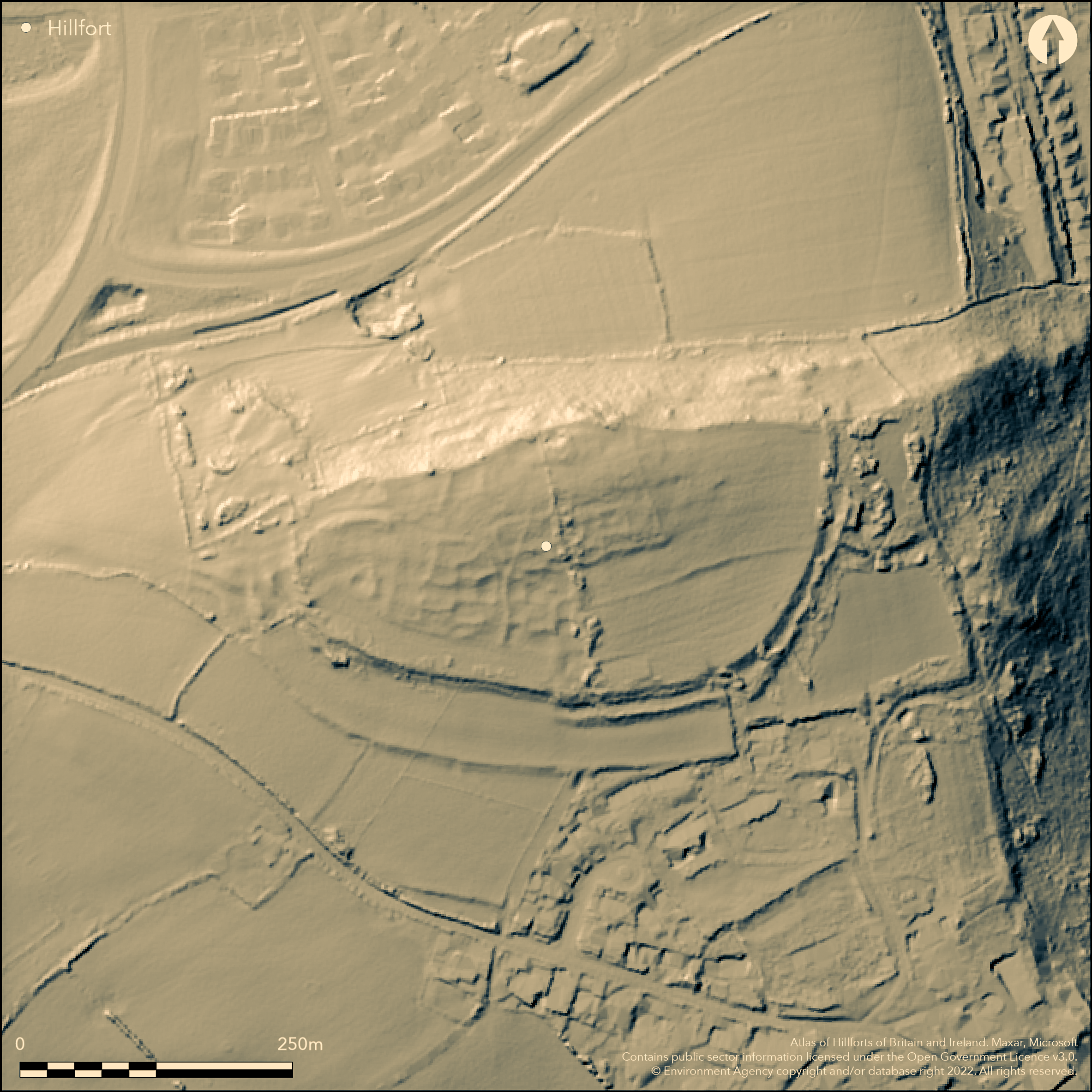
LiDAR 1m DTM Hillshade
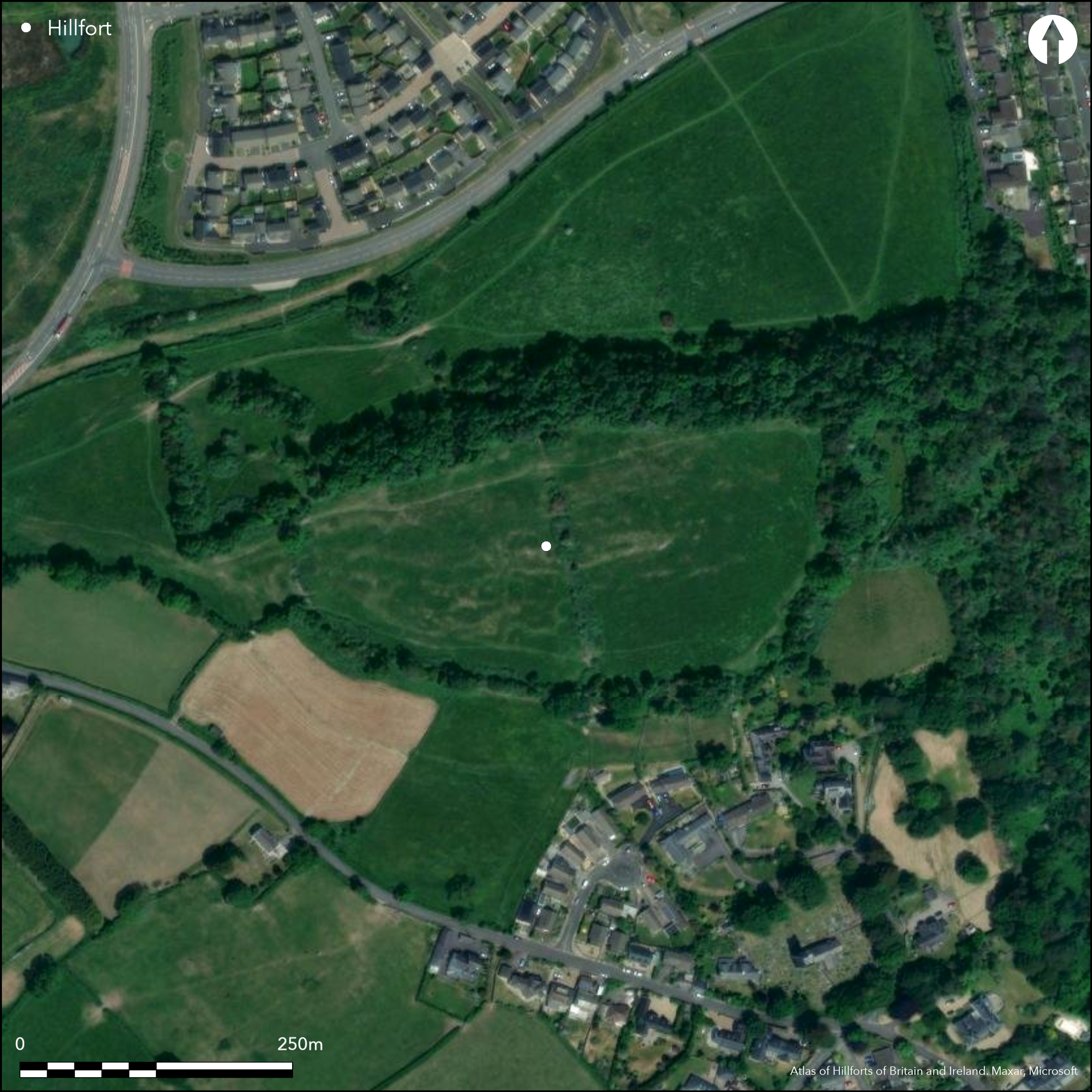
Satellite Imagery
LiDAR 1m DTM Hillshade
Satellite Imagery
Scroll left/right to view further images.
HER: Glamorgan Gwent 00263s (None)
NMR: SS 97 SE 8 (93053)
SM: GM100
NGR: SS98357427
X: 298350 Y: 174270 (OSGB36)
Multivallate contour hillfort located next to castle remains on the top Llanblethian Hill at the E end of a promontory above the valley of the River Thaw at Cowbridge. N and S moderate to strong surrounding slopes, steeper on E steep and moderate on W. Large site at 3.8ha internal area within main rampart, but a further 1.1ha between the inner and outer ramparts as an annexe on the E. Site badly damaged by cultivation and field boundaries, but circuits appear to have been double on N and E and triple on S and W. Inner rampart extant throughout; very stony and revetted with ditch, except on edge of steep N scarp; counterscarp, but disturbed. Middle rampart formerly along most of W and S and well preserved near entrance and barely traceable elsewhere. Outer rampart with ditch is badly damaged but can be traced around most of circuit, but on N ruinous and overgrown, possibly running along top of steep natural scarp, but the situation is more complex at the W end. Here is the only recognised original entrance, others impossible to define definitely because of damage. Here gap in outer rampart probably recent, but to SE of this, where banks thickened and slightly inturned, is the original and certainly complex version. Another possible entrance may be on the S side, and this would have given access into the E annexe from the main enclosure, there being no present gap between it and the inner rampart for access. Low banks and hollows in the interior could have been a series of farmsteads of indeterminate date. Excavations 1965-71 (Davies 1967) found Iron Age and 1st to 4th century AD pottery and quern-stones. Single dry-stone walled rectangular building, located within area of 100m by 75m in interior of hillfort, excavated, with occupation from later 2nd to 4th century AD. Whole complex suggested as farmstead with stockyard enclosures using the hillfort defences as the home field (Arnold and Davies, 2000, 78-9). Badly multilated. Village of Llanblethian to S, and part of defences here destroyed by private gardens and farm buildings. Public footpath and field boundary cross the site. Modern bungalow and medieval fortification ruin within annexe. Surface quarrying in interior. On 1st Ed. OS map 1877-80.
Citizen Science: ✗
Reliability of Data: Confirmed
Reliability of Interpretation: Confirmed
X: -385669 Y: 6702748 (EPSG: 3857)
Longitude: -3.464521205151835 Latitude: 51.45820223393041 (EPSG:4326)
Country: Wales
Current County or Unitary Authority: Vale of Glamorgan
Historic County: Glamorgan
Current Parish/Community/Council/Townland: Cowbridge With Llanblethian
Badly multilated. Village of Llanblethian to S, and part of defences here destroyed by private gardens and farm buildings. Public footpath and field boundary cross the site. Modern bungalow and medieval fortification ruin within annexe. Field boundary. Surface quarrying in interior.
| Extant | ✓ |
| Cropmark | ✗ |
| Likely Destroyed | ✓ |
Pasture, gardens and farm buildings. Medieval fortification ruin within annexe.
| Woodland | ✗ |
| Commercial Forestry Plantation | ✗ |
| Parkland | ✗ |
| Pasture (Grazing) | ✓ |
| Arable | ✗ |
| Scrub/Bracken | ✓ |
| Bare Outcrop | ✗ |
| Heather/Moorland | ✗ |
| Heath | ✗ |
| Built-up | ✓ |
| Coastal Grassland | ✗ |
| Other | ✓ |
Multivallate contour hillfort next to castle remains on the top Llanblethian Hill at the E end of a promontory above the valley of the River Thaw at Cowbridge. N and S moderate to strong surrounding slopes, steeper on E steep and moderate on W.
| Contour Fort | ✓ |
| Partial Contour Fort | ✗ |
| Promontory Fort | ✗ |
| Hillslope Fort | ✗ |
| Level Terrain Fort | ✗ |
| Marsh Fort | ✗ |
| Multiple Enclosure Fort | ✗ |
| Hilltop | ✓ |
| Coastal Promontory | ✗ |
| Inland Promontory | ✗ |
| Valley Bottom | ✗ |
| Knoll/Hillock/Outcrop | ✗ |
| Ridge | ✗ |
| Cliff/Plateau-edge/Scarp | ✗ |
| Hillslope | ✗ |
| Lowland | ✗ |
| Spur | ✗ |
Dominant Topographic Feature: Hill top
| North | ✗ |
| Northeast | ✗ |
| East | ✗ |
| Southeast | ✗ |
| South | ✗ |
| Southwest | ✗ |
| West | ✗ |
| Northwest | ✗ |
| Level | ✓ |
Altitude: 90.0m
N/A
Iron Age and 1st to 4th century AD pottery and quern-stones from excavation. Single dry-stone walled rectangular building, located within area of 100m by 75m in interior of hillfort, excavated, with occupation from later 2nd to 4th century AD. Whole complex suggested as farmstead with stockyard enclosures using the hillfort defences as the home field (Arnold and Davies, 2000, 78-9).
Reliability: B - Medium
| Pre 1200BC | ✗ |
| 1200BC - 800BC | ✗ |
| 800BC - 400BC | ✗ |
| 400BC - AD50 | ✓ |
| AD50 - AD400 | ✓ |
| AD400 - AD 800 | ✗ |
| Post AD800 | ✗ |
| Unknown | ✗ |
| Pre Hillfort: | None |
| Post Hillfort: | None |
| Artefactual: | Iron Age and 1st to 4th century AD pottery and quern-stones. |
| Other: | Single dry-stone walled rectangular building, located within area of 100m by 75m in interior of hillfort, excavated, with occupation from later 2nd to 4th century AD. Whole complex suggested as farmstead with stockyard enclosures using the hillfort defences as the home field (Arnold and Davies, 2000, 78-9). |
On 1st Ed. OS map 1877-80. Medieval fortification mentioned in 1578 Morganniae Archaiographia. Excavations 1965-7 by J.L. Davies. RCAHMW investigation 1966. GGAT Prehistoric defended enclosures in Glamorgan survey 2005.
| 1st Identified Written Reference (1578): | Morganiae Archaiographia. |
| Other (1966): | RCAHMW investigation. |
| Other (2005): | GGAT Prehistoric defended enclosures in Glamorgan survey. |
| 1st Identified Map Depiction (None): | OS map. |
| Excavation (None): | J.L Davies. |
Low banks and hollows of unknown date; possibly small farmsteads. S wall of rectangular Roman building overlay pit. Possible ruined ring-cairn at highest part of hill. Iron Age and first to fourth century pottery and quern-stones.
Stream 0.2km outside fort.
| None | ✓ |
| Spring | ✗ |
| Stream | ✗ |
| Pool | ✗ |
| Flush | ✗ |
| Well | ✗ |
| Other | ✗ |
Low banks and hollows of unknown date; possibly small farmsteads. Possible ruined ring-cairn at highest part of hill.
| No Known Features | ✗ |
| Round Stone Structures | ✗ |
| Rectangular Stone Structures | ✗ |
| Curvilinear Platforms | ✗ |
| Other Roundhouse Evidence | ✗ |
| Pits | ✗ |
| Quarry Hollows | ✗ |
| Other | ✓ |
Single dry-stone walled rectangular building, located within area of 100m by 75m in interior of hillfort. Overlying pit.
| No Known Excavation | ✗ |
| Pits | ✓ |
| Postholes | ✗ |
| Roundhouses | ✗ |
| Rectangular Structures | ✓ |
| Roads/Tracks | ✗ |
| Quarry Hollows | ✗ |
| Other | ✗ |
| Nothing Found | ✗ |
None
| No Known Geophysics | ✓ |
| Pits | ✗ |
| Roundhouses | ✗ |
| Rectangular Structures | ✗ |
| Roads/Tracks | ✗ |
| Quarry Hollows | ✗ |
| Other | ✗ |
| Nothing Found | ✗ |
Iron Age and first to fourth century pottery and quern-stones.
| No Known Finds | ✗ |
| Pottery | ✓ |
| Metal | ✗ |
| Metalworking | ✗ |
| Human Bones | ✗ |
| Animal Bones | ✗ |
| Lithics | ✓ |
| Environmental | ✗ |
| Other | ✗ |
None
| APs Not Checked | ✓ |
| None | ✗ |
| Roundhouses | ✗ |
| Rectangular Structures | ✗ |
| Pits | ✗ |
| Postholes | ✗ |
| Roads/Tracks | ✗ |
| Other | ✗ |
On W is the only recognised original entrance, others impossible to define definitely because of damage. Although gap in outer rampart probably recent, but to SE of this, where banks thickened and slightly inturned, is the original and certainly complex version. Another possible entrance may be on the S side, and this would have given access into the E annexe from the main enclosure, there being no present gap between it and the inner rampart for access.
| 3: | Gap in outer rampart on W probably recent. |
| 2: | None |
Guard Chambers: ✗
Chevaux de Frise: ✗
| 1. In-turned (West): | Complex entrance, but much disturbed. |
| 2. Simple Gap (South): | Possible entrance may be on the S side, and this would have given access into the E annexe from the main enclosure, there being no present gap between it and the inner rampart for access. |
Site badly damaged by cultivation and field boundaries, but circuits appear to have been double on N and E and triple on S and W. Inner rampart extant throughout; very stony and revetted with ditch, except on edge of steep N scarp. Counterscarp, but disturbed. Middle rampart formerly along most of W and S and well preserved near entrance and barely traceable elsewhere. Outer rampart with ditch is badly damaged, but can be traced around most of circuit, but on N ruinous and overgrown, possibly running along top of steep natural scarp, but the situation is more complex at the W end.
| Area 1: | 3.8ha. |
| Total: | 3.8ha. |
Total Footprint Area: Noneha.
None
| ✗ | None |
| ✓ | Quadrants complex and estimated. |
| NE Quadrant: | 3 |
| SE Quadrant: | 3 |
| SW Quadrant: | 3 |
| NW Quadrant: | 3 |
| Total: | 3 |
| Partial Univallate | ✗ |
| Univallate | ✗ |
| Partial Bivallate | ✗ |
| Bivallate | ✗ |
| Partial Multivallate | ✗ |
| Multivallate | ✓ |
| Unknown | ✗ |
| Partial Univallate | ✗ |
| Univallate | ✗ |
| Partial Bivallate | ✗ |
| Bivallate | ✗ |
| Partial Multivallate | ✗ |
| Multivallate | ✗ |
Very stony banks and revetted in parts. Disturbed counterscarp to inner bank.
| None | ✗ |
| Earthen Bank | ✓ |
| Stone Wall | ✗ |
| Rubble | ✓ |
| Wall-walk | ✗ |
| Evidence of Timber | ✗ |
| Vitrification | ✗ |
| Other Burning | ✗ |
| Palisade | ✗ |
| Counter Scarp Bank | ✓ |
| Berm | ✗ |
| Unfinished | ✗ |
| Other | ✗ |
Rubble found containing pottery on excavated terrace on S.
| None | ✗ |
| Earthen Bank | ✗ |
| Stone Wall | ✗ |
| Murus Duplex | ✗ |
| Timber-framed | ✗ |
| Timber-laced | ✗ |
| Vitrification | ✗ |
| Other Burning | ✗ |
| Palisade | ✗ |
| Counter Scarp Bank | ✓ |
| Berm | ✗ |
| Unfinished | ✗ |
| No Known Excavation | ✗ |
| Other | ✓ |
| ✗ | None |
| ✓ | None |
Number of Ditches: 3
| ✓ | Annexe of c. 1.1ha on E and small medieval fortification in N part with building ruins 16m by 8m and walls 1.3m thick - a substantial house rather than a castle as such. Possible entrance may be on the S side, and this would have given access into the E annexe from the main enclosure, there being no present gap between it and the inner rampart for access. |
Davies, J.L. 1967. Excavations at Caer Dynnaf, Llanblethian, Glam., 1965-1967, Morgannwg, 11, 77-78;
Gerrard, C., Wiggins, H., and Evans, E. 2006. Prehistoric defended enclosures in Glamorgan with recommendations for fieldwork: Year 3 Report, GGAT Report No 2006/089, Project No GGAT78, Swansea: GGAT.
RCAHMW 1976. An inventory of the ancient monuments in Glamorgan, 1.2, Pre-Norman, Parts I-III, 670, Cardiff: HMSO.
Savory, H.N. 1949. List of hill-forts in Wales, Bull Board Celtic Stud,13, 154.
Whittle, E. 1992: A guide to ancient and historic Wales - Glamorgan and Gwent, 188, London: HMSO.
Atlas of Hillforts:
Wikidata:
This work is licensed under CC BY-SA 4.0

 and should be cited as:
Lock, Gary and Ralston, Ian. 2024. Atlas of Hillforts of Britain and Ireland. Available at: https://hillforts.arch.ox.ac.uk
Document Version 1.1