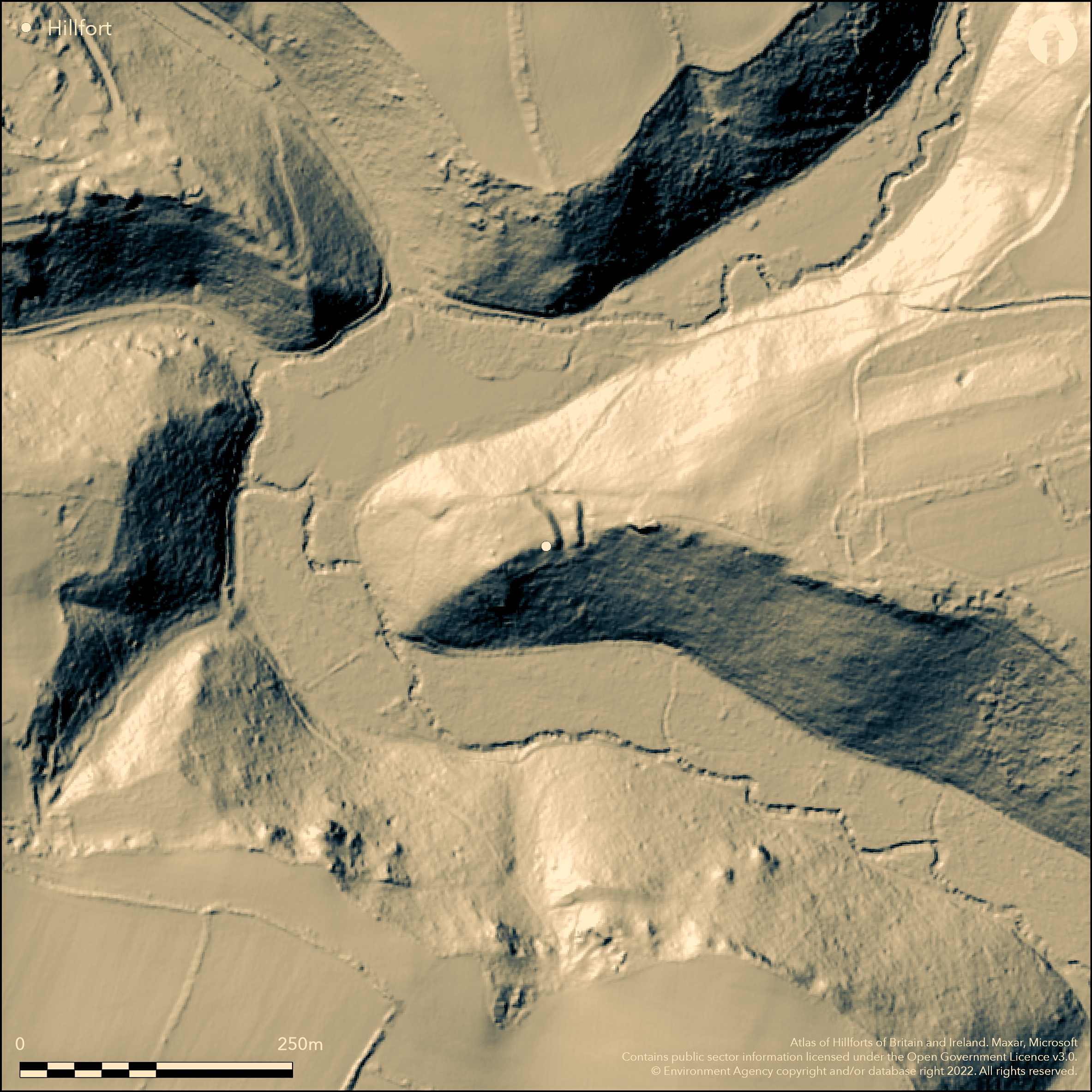
LiDAR 1m DTM Hillshade
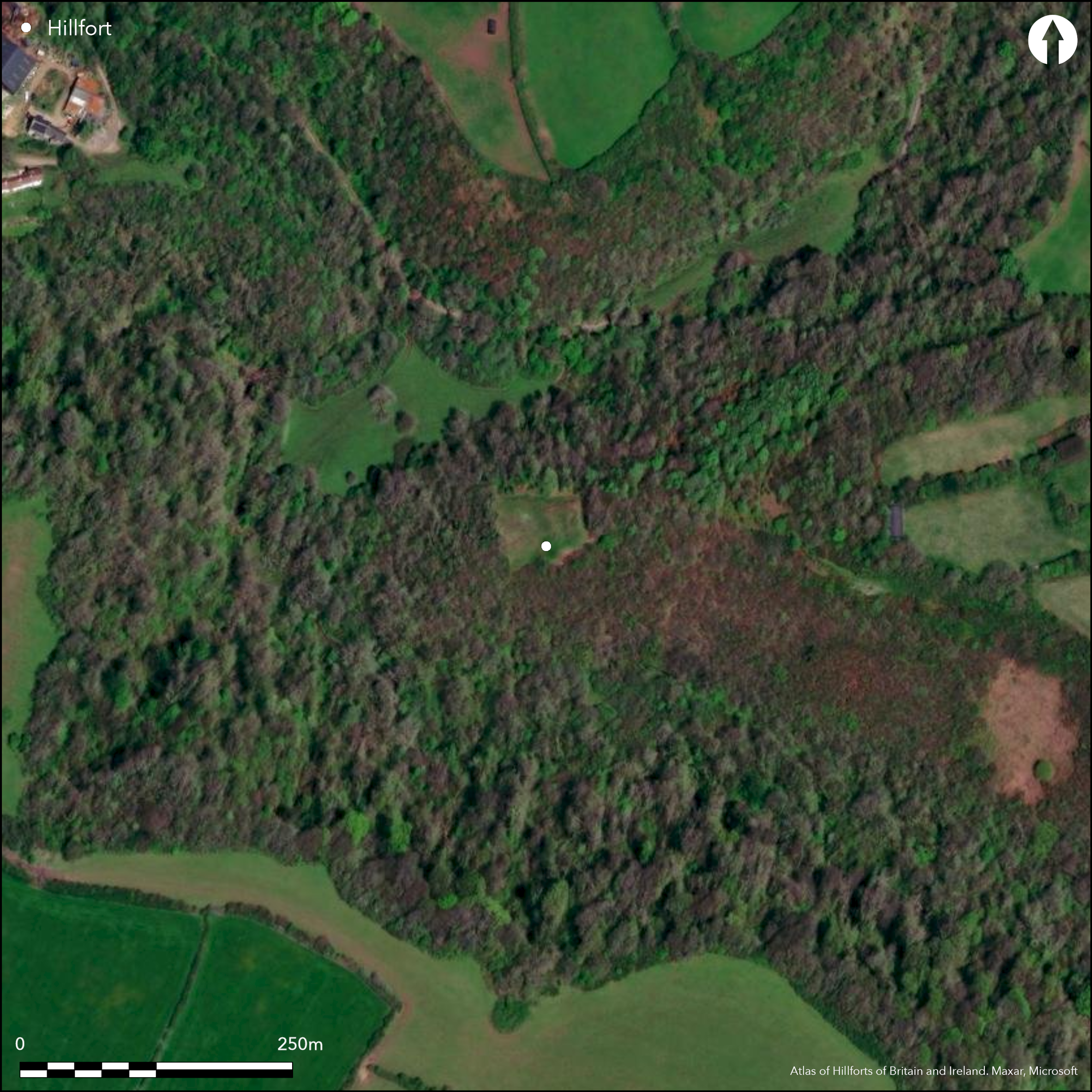
Satellite Imagery
LiDAR 1m DTM Hillshade
Satellite Imagery
Scroll left/right to view further images.
HER: Glamorgan Gwent 00309w (None)
NMR: SS 58 NE (301340)
SM: GM126
NGR: SS56938780
X: 256930 Y: 187800 (OSGB36)
Small inland promontory fort sited at the W extremity of a narrow ridge within the loop of the Bishopston river in a narrow valley next to a stream flowing into Pwlldu Bay.The fort stands at 30m OD at the W extremity of a narrow ridge within the loop of the Bishopston river about a kilometre S of the village. On N, W and S very steep slopes and cliffs form natural defence. Interior area c. 48m by 36m of c. 0.1 hectares. Two ramparts and two rock-cut ditches cut off the narrow neck of the promontory, the outer ditch utilising a natural fault. Overall the defences are 26m in extent. One of the small Gower sites excavated by Audrey Williams before World War II, here in 1939 (Williams 1940). Section through ramparts and several trenches opened in interior. Inner rampart c. 1.2m high of soil and stone with a rough revetment on the outer face. Ditch c. 4m wide, but wider in places. Outer bank c. 8.5m wide, 3m high internally and 2m externally. Outer ditch 4.5m wide. Entrance on N. Hut site against inner rampart of five postholes and hearth, suggesting oval timber structure c.4m by 3m with possible S entrance. Hearth central against rampart containing burnt oak, hazel and hawthorn. Shells and animal bones found. Bronze penannular brooch of llate 1st to 4th century AD. Sherd of late Iron Age pottery and Iron finger ring (1st century BC to 2nd century AD). Iron slag, nails and slingstones from surface debris. Oval hollow 3.4m by 2.4m filled with dark soil, shells, and animal bones interpreted as midden. Main part of site covered with scrub and a few trees, N and S slopes tree-covered. On 1st Ed. OS map (1878).
Citizen Science: ✗
Reliability of Data: Confirmed
Reliability of Interpretation: Confirmed
X: -452608 Y: 6722893 (EPSG: 3857)
Longitude: -4.065844835209665 Latitude: 51.570821460872146 (EPSG:4326)
Country: Wales
Current County or Unitary Authority: Swansea
Historic County: Glamorgan
Current Parish/Community/Council/Townland: Bishopston
Good condition. Footpath crosses the two ditches, with wooden steps in and out of external ditch.
| Extant | ✓ |
| Cropmark | ✗ |
| Likely Destroyed | ✗ |
Light wooded site.
| Woodland | ✓ |
| Commercial Forestry Plantation | ✗ |
| Parkland | ✗ |
| Pasture (Grazing) | ✗ |
| Arable | ✗ |
| Scrub/Bracken | ✓ |
| Bare Outcrop | ✗ |
| Heather/Moorland | ✗ |
| Heath | ✗ |
| Built-up | ✗ |
| Coastal Grassland | ✗ |
| Other | ✗ |
Small inland promontory fort sited at the W extremity of a narrow ridge within the loop of the Bishopston river in a narrow valley next to a stream flowing into Pwlldu Bay.The fort stands at 30m OD at the W extremity of a narrow ridge within the loop of the Bishopston river about a kilometre S of the village. On N, W and S very steep slopes and cliffs.
| Contour Fort | ✗ |
| Partial Contour Fort | ✗ |
| Promontory Fort | ✓ |
| Hillslope Fort | ✗ |
| Level Terrain Fort | ✗ |
| Marsh Fort | ✗ |
| Multiple Enclosure Fort | ✗ |
| Hilltop | ✗ |
| Coastal Promontory | ✗ |
| Inland Promontory | ✓ |
| Valley Bottom | ✗ |
| Knoll/Hillock/Outcrop | ✗ |
| Ridge | ✓ |
| Cliff/Plateau-edge/Scarp | ✗ |
| Hillslope | ✗ |
| Lowland | ✗ |
| Spur | ✗ |
Dominant Topographic Feature: Ridge
| North | ✗ |
| Northeast | ✗ |
| East | ✗ |
| Southeast | ✗ |
| South | ✗ |
| Southwest | ✗ |
| West | ✗ |
| Northwest | ✓ |
| Level | ✗ |
Altitude: 31.0m
N/A
Sherd of late Iron Age pottery and Iron finger ring (1st century BC to 2nd century AD).
Reliability: B - Medium
| Pre 1200BC | ✗ |
| 1200BC - 800BC | ✗ |
| 800BC - 400BC | ✗ |
| 400BC - AD50 | ✓ |
| AD50 - AD400 | ✓ |
| AD400 - AD 800 | ✗ |
| Post AD800 | ✗ |
| Unknown | ✗ |
| Pre Hillfort: | None |
| Post Hillfort: | None |
| Artefactual: | Pottery and iron finger ring found in excavations |
On 1st Ed. OS map (1878). Excavated by Audrey Williams (Mrs W.F. Grimes) 1939. RCAHMW investigation 1965. GGAT Prehistoric defended enclosures in Glamorgan survey 2005.
| 1st Identified Map Depiction (1878): | OS map. |
| Excavation (1939): | Audrey Williams. |
| Other (1965): | RCAHMW investigation. |
| Other (1986): | Visited by Hillfort Study Group |
| Other (2005): | GGAT Prehistoric defended enclosures in Glamorgan survey. |
Hut site against inner rampart of five postholes and hearth, suggesting oval timber structure c. 4m by 3m with possible S entrance. Hearth central against rampart containing burnt oak, hazel and hawthorn. Shells and animal bones found. Bronze penannular brooch of llate 1st to 4th century AD. Sherd of late Iron Age pottery and Iron finger ring (1st century BC to 2nd century AD). Iron slag, nails and slingstones from surface debris. Oval hollow 3.4m by 2.4m filled with dark soil, shells, and animal bones interpreted as midden.
Stream 0.05km outside fort.
| None | ✓ |
| Spring | ✗ |
| Stream | ✗ |
| Pool | ✗ |
| Flush | ✗ |
| Well | ✗ |
| Other | ✗ |
None
| No Known Features | ✓ |
| Round Stone Structures | ✗ |
| Rectangular Stone Structures | ✗ |
| Curvilinear Platforms | ✗ |
| Other Roundhouse Evidence | ✗ |
| Pits | ✗ |
| Quarry Hollows | ✗ |
| Other | ✗ |
Hut site against inner rampart of five postholes and hearth, suggesting oval timber structure c. 4m by 3m with possible S entrance.
| No Known Excavation | ✗ |
| Pits | ✗ |
| Postholes | ✓ |
| Roundhouses | ✓ |
| Rectangular Structures | ✗ |
| Roads/Tracks | ✗ |
| Quarry Hollows | ✗ |
| Other | ✓ |
| Nothing Found | ✗ |
None
| No Known Geophysics | ✓ |
| Pits | ✗ |
| Roundhouses | ✗ |
| Rectangular Structures | ✗ |
| Roads/Tracks | ✗ |
| Quarry Hollows | ✗ |
| Other | ✗ |
| Nothing Found | ✗ |
Hearth central against rampart containing burnt oak, hazel and hawthorn. Shells and animal bones found. Bronze penannular brooch of llate 1st to 4th century AD. Sherd of late Iron Age pottery and Iron finger ring (1st century BC to 2nd century AD). Iron slag, nails and slingstones from surface debris. Oval hollow 3.4m by 2.4m filled with dark soil, shells, and animal bones interpreted as midden.
| No Known Finds | ✗ |
| Pottery | ✓ |
| Metal | ✓ |
| Metalworking | ✓ |
| Human Bones | ✗ |
| Animal Bones | ✓ |
| Lithics | ✓ |
| Environmental | ✓ |
| Other | ✗ |
None
| APs Not Checked | ✓ |
| None | ✗ |
| Roundhouses | ✗ |
| Rectangular Structures | ✗ |
| Pits | ✗ |
| Postholes | ✗ |
| Roads/Tracks | ✗ |
| Other | ✗ |
Entrance on N where track runs along edge of scarp past end of outer banks and next to inturned arm of inner bank. Path running entrance obliquely down N scarp to a ford possibly contemporary.
| 1: | None |
| 2: | None |
Guard Chambers: ✗
Chevaux de Frise: ✗
| 1. In-turned (North): | None |
| 1. Oblique (North): | Path running entrance obliquely down N scarp to a ford possibly contemporary. |
Two ramparts and two rock-cut ditches cut off the narrow neck of the promontory, the outer ditch utilising a natural fault. Section through ramparts and several trenches opened in interior. Inner rampart c. 1.2m high of soil and stone with a rough revetment on the outer face. Ditch c. 4m wide, but wider in places. Outer bank c. 8.5m wide, 3m high internally and 2m externally. Outer ditch 4.5m wide. Overall the defences are 26m in extent.
| Area 1: | 0.1ha. |
| Total: | 0.1ha. |
Total Footprint Area: Noneha.
None
| ✗ | None |
| ✗ | None |
| NE Quadrant: | 0 |
| SE Quadrant: | 0 |
| SW Quadrant: | 0 |
| NW Quadrant: | 2 |
| Total: | 2 |
| Partial Univallate | ✗ |
| Univallate | ✗ |
| Partial Bivallate | ✓ |
| Bivallate | ✗ |
| Partial Multivallate | ✗ |
| Multivallate | ✗ |
| Unknown | ✗ |
| Partial Univallate | ✗ |
| Univallate | ✗ |
| Partial Bivallate | ✗ |
| Bivallate | ✗ |
| Partial Multivallate | ✗ |
| Multivallate | ✗ |
None
| None | ✗ |
| Earthen Bank | ✓ |
| Stone Wall | ✗ |
| Rubble | ✗ |
| Wall-walk | ✗ |
| Evidence of Timber | ✗ |
| Vitrification | ✗ |
| Other Burning | ✗ |
| Palisade | ✗ |
| Counter Scarp Bank | ✗ |
| Berm | ✗ |
| Unfinished | ✗ |
| Other | ✗ |
Section through ramparts and several trenches opened in interior. Inner rampart c. 1.2m high of soil and stone with a rough revetment on the outer face. Ditch c. 4m wide, but wider in places. Outer bank c. 8.5m wide, 3m high internally and 2m externally. Outer ditch 4.5m wide.
| None | ✗ |
| Earthen Bank | ✓ |
| Stone Wall | ✓ |
| Murus Duplex | ✗ |
| Timber-framed | ✗ |
| Timber-laced | ✗ |
| Vitrification | ✗ |
| Other Burning | ✗ |
| Palisade | ✗ |
| Counter Scarp Bank | ✗ |
| Berm | ✗ |
| Unfinished | ✗ |
| No Known Excavation | ✗ |
| Other | ✗ |
| ✗ | None |
| ✓ | Rock-cut ditches. |
Number of Ditches: 2
| ✗ | None |
Gerrard, C., Wiggins, H., and Evans, E. 2006. Prehistoric defended enclosures in Glamorgan with recommendations for fieldwork: Year 3 Report, GGAT Report No 2006/089, Project No GGAT78, Swansea: GGAT.
RCAHMW 1976. An inventory of the ancient monuments in Glamorgan, 1.2, Pre-Norman, Parts I-III, 677, Cardiff: HMSO.
Savory, H.N. 1949. List of hill-forts in Wales, Bull Board Celtic Stud, 13, 157.
Williams, A. 1940. Excavations at Bishopston Valley promontory fort, Glamorgan, Arch Camb, 95, 9-19.
Atlas of Hillforts:
Wikidata:
This work is licensed under CC BY-SA 4.0

 and should be cited as:
Lock, Gary and Ralston, Ian. 2024. Atlas of Hillforts of Britain and Ireland. Available at: https://hillforts.arch.ox.ac.uk
Document Version 1.1