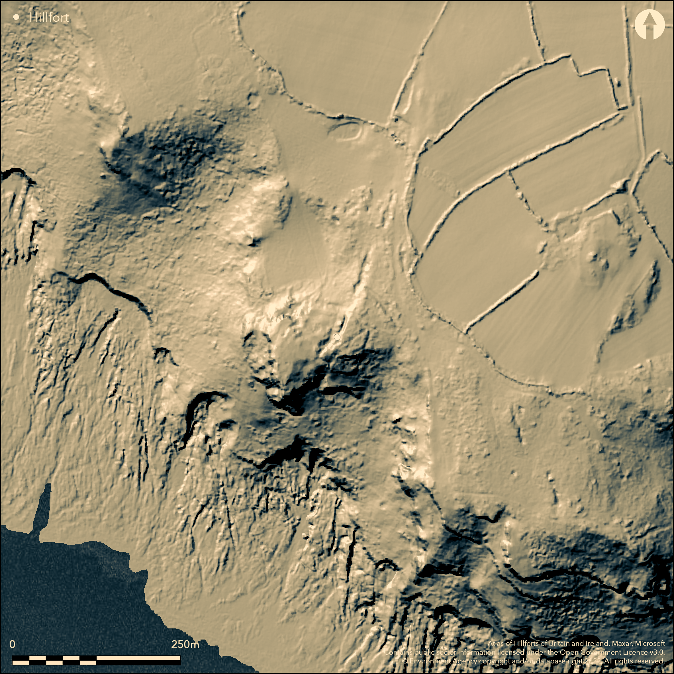
LiDAR 1m DTM Hillshade
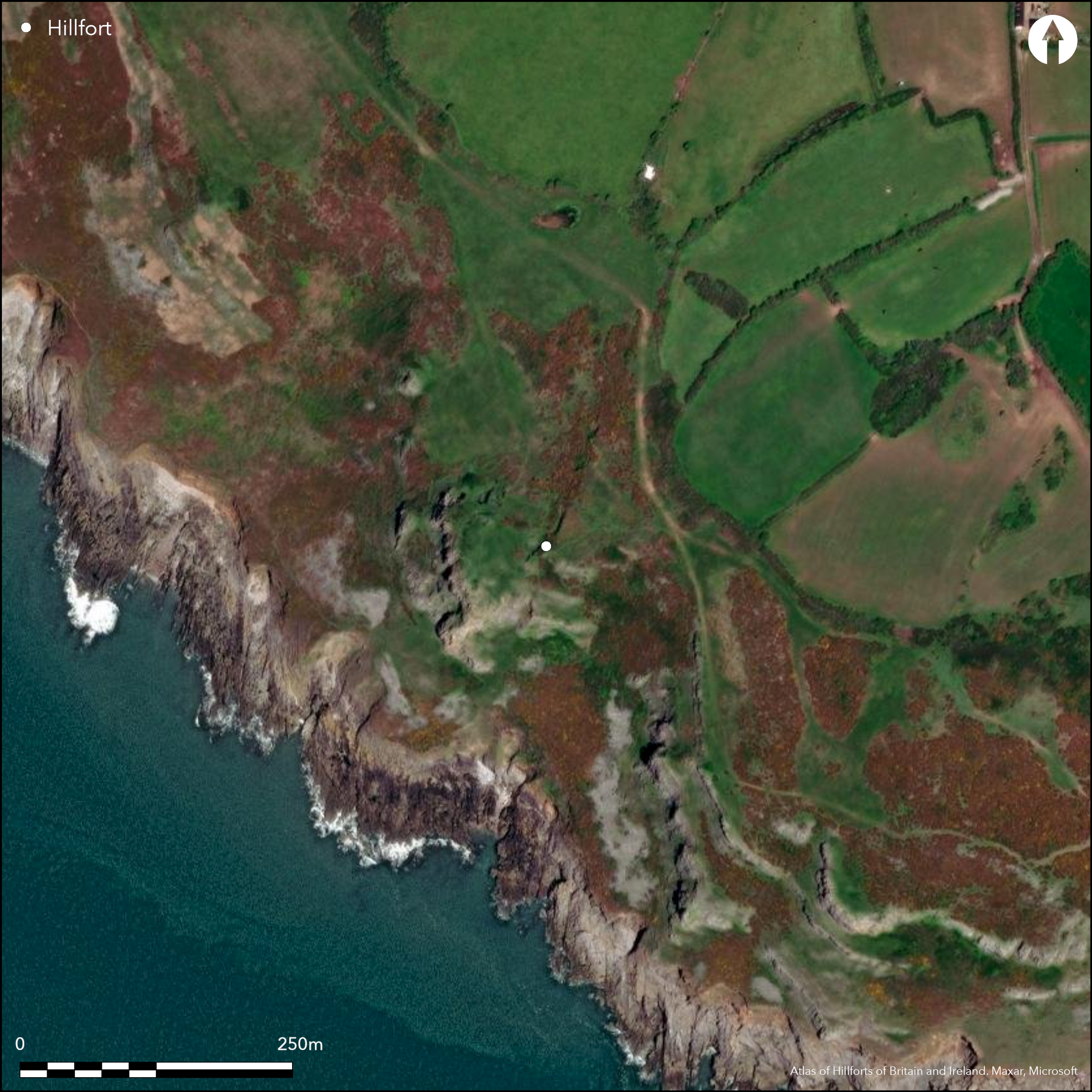
Satellite Imagery
LiDAR 1m DTM Hillshade
Satellite Imagery
Scroll left/right to view further images.
HER: Glamorgan Gwent 00312w (None)
NMR: SS 58 NE (94532)
SM: GM045
NGR: SS56778663
X: 256770 Y: 186630 (OSGB36)
Small coastal promontory fort situated on rocky headland, c. 75m OD, projecting to SW between two wide inlet valleys on W side of Pwll Du Head, Gower. Sheer cliffs on S and W, NW and NE less steep. One of the small Gower sites excavated by Audrey Williams before WWII. Two banks with outer ditches define the site. To seaward an inner bank and ditch, c. 90m long, cuts off in an arc the headland from NE at its base, but plan not straightforward and a 4m high cliff divides site from NW-SW into two areas: an upper E area of c. 20m by 25m and a lower W area of c. 85m by 43m defined by two scarps, the inner to 3m high with ditch and the outer to 1.2m high. Entrance in middle. 2m wide approached by a causeway across the ditch. The landward or outer defensive line confined to E running for 40m and lie 18m from the seaward inner line and consist of bank to c. 2m high externally with outer ditch c. 5m wide to 2m deep. This outer line stops c. 17m short of the cliff edge giving it an unfinished appearance. Total area of fort 0.4ha, but modern quarrying confuses matters. Possible hut platforms on N side of larger enclosure possible modern features. Williams (1941) recorded details of ramparts, including revetments to both ramparts, rock-cut V-shaped and flat-bottomed ditches and outer rampart slight 7.6m continuation to SE verified. Three hut sites also excavated with finds suggesting first to second century AD occupation. Heavily overgrown with gorse, brambles and bracken. On 1st Ed. OS map (1878).
Citizen Science: ✗
Reliability of Data: Confirmed
Reliability of Interpretation: Confirmed
X: -452811 Y: 6721003 (EPSG: 3857)
Longitude: -4.067674831902496 Latitude: 51.56026755806348 (EPSG:4326)
Country: Wales
Current County or Unitary Authority: Swansea
Historic County: Glamorgan
Current Parish/Community/Council/Townland: Pennard
Modern quarrying makes interpretation difficult in places.
| Extant | ✓ |
| Cropmark | ✗ |
| Likely Destroyed | ✗ |
Heavily overgrown with gorse, brambles and bracken. Bare rock. Quarrying.
| Woodland | ✗ |
| Commercial Forestry Plantation | ✗ |
| Parkland | ✗ |
| Pasture (Grazing) | ✗ |
| Arable | ✗ |
| Scrub/Bracken | ✓ |
| Bare Outcrop | ✗ |
| Heather/Moorland | ✗ |
| Heath | ✗ |
| Built-up | ✗ |
| Coastal Grassland | ✓ |
| Other | ✓ |
Small coastal promontory fort situated on rocky headland, c. 75m OD, projecting to SW between two wide inlet valleys on W side of Pwll Du Head, Gower. Sheer cliffs on S and W, NW and NE less steep.
| Contour Fort | ✗ |
| Partial Contour Fort | ✗ |
| Promontory Fort | ✓ |
| Hillslope Fort | ✗ |
| Level Terrain Fort | ✗ |
| Marsh Fort | ✗ |
| Multiple Enclosure Fort | ✗ |
| Hilltop | ✗ |
| Coastal Promontory | ✓ |
| Inland Promontory | ✗ |
| Valley Bottom | ✗ |
| Knoll/Hillock/Outcrop | ✗ |
| Ridge | ✗ |
| Cliff/Plateau-edge/Scarp | ✗ |
| Hillslope | ✗ |
| Lowland | ✗ |
| Spur | ✗ |
Dominant Topographic Feature: Coastal headland
| North | ✗ |
| Northeast | ✗ |
| East | ✗ |
| Southeast | ✗ |
| South | ✗ |
| Southwest | ✓ |
| West | ✗ |
| Northwest | ✗ |
| Level | ✗ |
Altitude: 89.0m
N/A
Late Iron Age to circa second century AD when traces of Roman period occupation found. In hut floor potsherd, dated to the late first to second century AD. Roman glass and a spindle whorl were found just outside.
Reliability: B - Medium
| Pre 1200BC | ✗ |
| 1200BC - 800BC | ✗ |
| 800BC - 400BC | ✗ |
| 400BC - AD50 | ✓ |
| AD50 - AD400 | ✓ |
| AD400 - AD 800 | ✗ |
| Post AD800 | ✗ |
| Unknown | ✗ |
| Pre Hillfort: | None |
| Post Hillfort: | None |
| Artefactual: | Traces of Roman period occupation. |
On 1st Ed. OS map (1878). Excavated by Audrey Williams (Mrs W.F. Grimes) 1939. RCAHMW investigation 1965. GGAT Prehistoric defended enclosures in Glamorgan survey 2005.
| 1st Identified Map Depiction (1878): | OS map. |
| Excavation (1939): | Audrey Williams (Mrs W.F. Grimes). |
| Other (1965): | RCAHMW investigation. |
| Other (1965): | RCAHMW investigation. |
| Other (1986): | Visited by Hillfort Study Group |
| Other (2005): | GGAT investigation. |
| Other (2005): | GGAT Prehistoric defended enclosures in Glamorgan survey. |
Hut built against rampart E of entrance, shown by line of postholes and burnt daub, 3.7m wide on N, tapering to 1.8m on S, 4.6m long, with central hearth. In hut floor potsherd, dated late 1st-2nd century AD. Roman glass and spindle whorl just outside. Second hut traces of daub and dark occupation layer (no definite postholes) 3.7m by 4m, with SW corner hearth. Third hut floor in W, 4m by 2.5m with rock face forming S wall. Ox, pig, sheep (goat) animal bone. Limpet, periwinkle, oyster, whelk. Charcoal. Daub clay. Two slingstones. Pot boilers. Blue-green glass fragment. Grey pottery spindlewhorl. Rim sherd of mortarium red ware.
A rock-cut gully leading to a pit could have been for water storage.
| None | ✗ |
| Spring | ✗ |
| Stream | ✗ |
| Pool | ✗ |
| Flush | ✗ |
| Well | ✓ |
| Other | ✗ |
Possible hut platforms on N side of larger enclosure possible modern features.
| No Known Features | ✓ |
| Round Stone Structures | ✗ |
| Rectangular Stone Structures | ✗ |
| Curvilinear Platforms | ✗ |
| Other Roundhouse Evidence | ✗ |
| Pits | ✗ |
| Quarry Hollows | ✗ |
| Other | ✗ |
Hut built against rampart E of entrance, shown by line of postholes and burnt daub, 3.7m wide on N, tapering to 1.8m on S, 4.6m long, with central hearth. In hut floor potsherd, dated late 1st-2nd century AD. Roman glass and spindle whorl just outside. Second hut traces of daub and dark occupation layer (no definite postholes) 3.7m by 4m, with SW corner hearth. Third hut floor in W, 4m by 2.5m with rock face forming S wall.
| No Known Excavation | ✗ |
| Pits | ✗ |
| Postholes | ✓ |
| Roundhouses | ✓ |
| Rectangular Structures | ✗ |
| Roads/Tracks | ✗ |
| Quarry Hollows | ✗ |
| Other | ✓ |
| Nothing Found | ✗ |
None
| No Known Geophysics | ✓ |
| Pits | ✗ |
| Roundhouses | ✗ |
| Rectangular Structures | ✗ |
| Roads/Tracks | ✗ |
| Quarry Hollows | ✗ |
| Other | ✗ |
| Nothing Found | ✗ |
Ox, pig, sheep (goat) animal bone. Limpet, periwinkle, oyster, whelk. Charcoal. Daub clay. Two slingstones. Pot boilers. Blue-green glass fragment. Grey pottery spindlewhorl. Rim sherd of mortarium red ware.
| No Known Finds | ✗ |
| Pottery | ✓ |
| Metal | ✗ |
| Metalworking | ✗ |
| Human Bones | ✗ |
| Animal Bones | ✓ |
| Lithics | ✓ |
| Environmental | ✓ |
| Other | ✗ |
None
| APs Not Checked | ✓ |
| None | ✗ |
| Roundhouses | ✗ |
| Rectangular Structures | ✗ |
| Pits | ✗ |
| Postholes | ✗ |
| Roads/Tracks | ✗ |
| Other | ✗ |
Entrance in middle of S bank with a pair of gates and 2m wide approached by a causeway across the ditch.
| 1: | None |
| 2: | 2m wide approached by a causeway across the ditch. |
Guard Chambers: ✗
Chevaux de Frise: ✗
| 1. Simple Gap (South): | Through inner defence. Causeway across ditch. |
Two banks with outer ditches define the site. To seaward an inner bank and ditch, c. 90m long, cuts off in an arc the headland from NE at its base, but plan not straightforward and a 4m high cliff divides site from NW-SW into two areas: an upper E area of c. 20m by 25m and a lower W area of c. 85m by 43m defined by two scarps, the inner to 3m high with ditch and the outer to 1.2m high. The landward or outer defensive line confined to E running for 40m and lie 18m from the seaward inner line and consist of bank to c. 2m high externally with outer ditch c. 5m wide to 2m deep. This outer line stops c. 17m short of the cliff edge giving it an unfinished appearance. Total area of fort 0.4ha, but modern quarrying confuses matters. Williams (1941) recorded details of ramparts, including revetments to both ramparts, rock-cut V-shaped and flat-bottomed ditches and outer rampart slight 7.6m continuation to SE verified.
| Area 1: | 0.4ha. |
| Total: | 0.4ha. |
Total Footprint Area: Noneha.
None
| ✗ | None |
| ✗ | None |
| NE Quadrant: | 2 |
| SE Quadrant: | 0 |
| SW Quadrant: | 0 |
| NW Quadrant: | 2 |
| Total: | 2 |
| Partial Univallate | ✗ |
| Univallate | ✗ |
| Partial Bivallate | ✓ |
| Bivallate | ✗ |
| Partial Multivallate | ✗ |
| Multivallate | ✗ |
| Unknown | ✗ |
| Partial Univallate | ✗ |
| Univallate | ✗ |
| Partial Bivallate | ✗ |
| Bivallate | ✗ |
| Partial Multivallate | ✗ |
| Multivallate | ✗ |
Rubble and stone ramparts. Outer line stops c. 17m short of the cliff edge giving it an unfinished appearance.
| None | ✗ |
| Earthen Bank | ✗ |
| Stone Wall | ✓ |
| Rubble | ✓ |
| Wall-walk | ✗ |
| Evidence of Timber | ✗ |
| Vitrification | ✗ |
| Other Burning | ✗ |
| Palisade | ✗ |
| Counter Scarp Bank | ✗ |
| Berm | ✗ |
| Unfinished | ✓ |
| Other | ✗ |
Roughly battered revetments and general details of ramparts.
| None | ✗ |
| Earthen Bank | ✗ |
| Stone Wall | ✓ |
| Murus Duplex | ✗ |
| Timber-framed | ✗ |
| Timber-laced | ✗ |
| Vitrification | ✗ |
| Other Burning | ✗ |
| Palisade | ✗ |
| Counter Scarp Bank | ✗ |
| Berm | ✗ |
| Unfinished | ✗ |
| No Known Excavation | ✗ |
| Other | ✗ |
| ✗ | None |
| ✓ | Rock-cut V-shaped and flat-bottomed ditches. |
Number of Ditches: 2
| ✗ | None |
Gerrard, C., Wiggins, H., and Evans, E. 2006. Prehistoric defended enclosures in Glamorgan with recommendations for fieldwork: Year 3 Report, GGAT Report No 2006/089, Project No GGAT78, Swansea: GGAT.
RCAHMW 1976. An inventory of the ancient monuments in Glamorgan, 1.2, Pre-Norman, Parts I-III, 702, Cardiff: HMSO.
Savory, H.N. 1949.List of hill-forts in Wales, Bull Board Celtic Stud, 13, 156.
Whittle, E. 1992. A guide to ancient and historic Wales - Glamorgan and Gwent, London: HMSO, 52-3.
Williams, A. 1941. The excavation of High Pennard promontory fort, Glamorgan, Arch Camb, 96 (1941), 23-30.
Atlas of Hillforts:
Wikidata:
This work is licensed under CC BY-SA 4.0

 and should be cited as:
Lock, Gary and Ralston, Ian. 2024. Atlas of Hillforts of Britain and Ireland. Available at: https://hillforts.arch.ox.ac.uk
Document Version 1.1