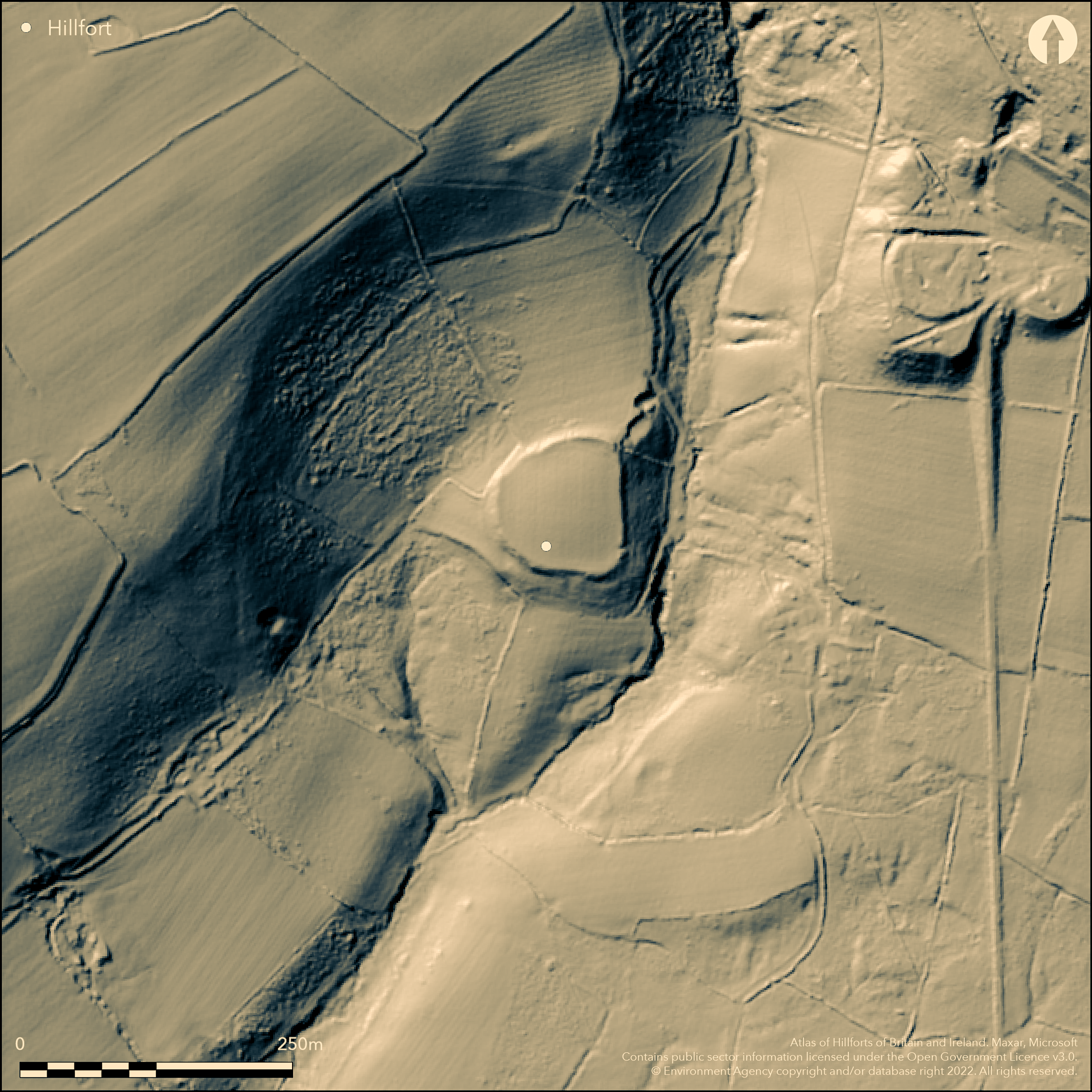
LiDAR 1m DTM Hillshade
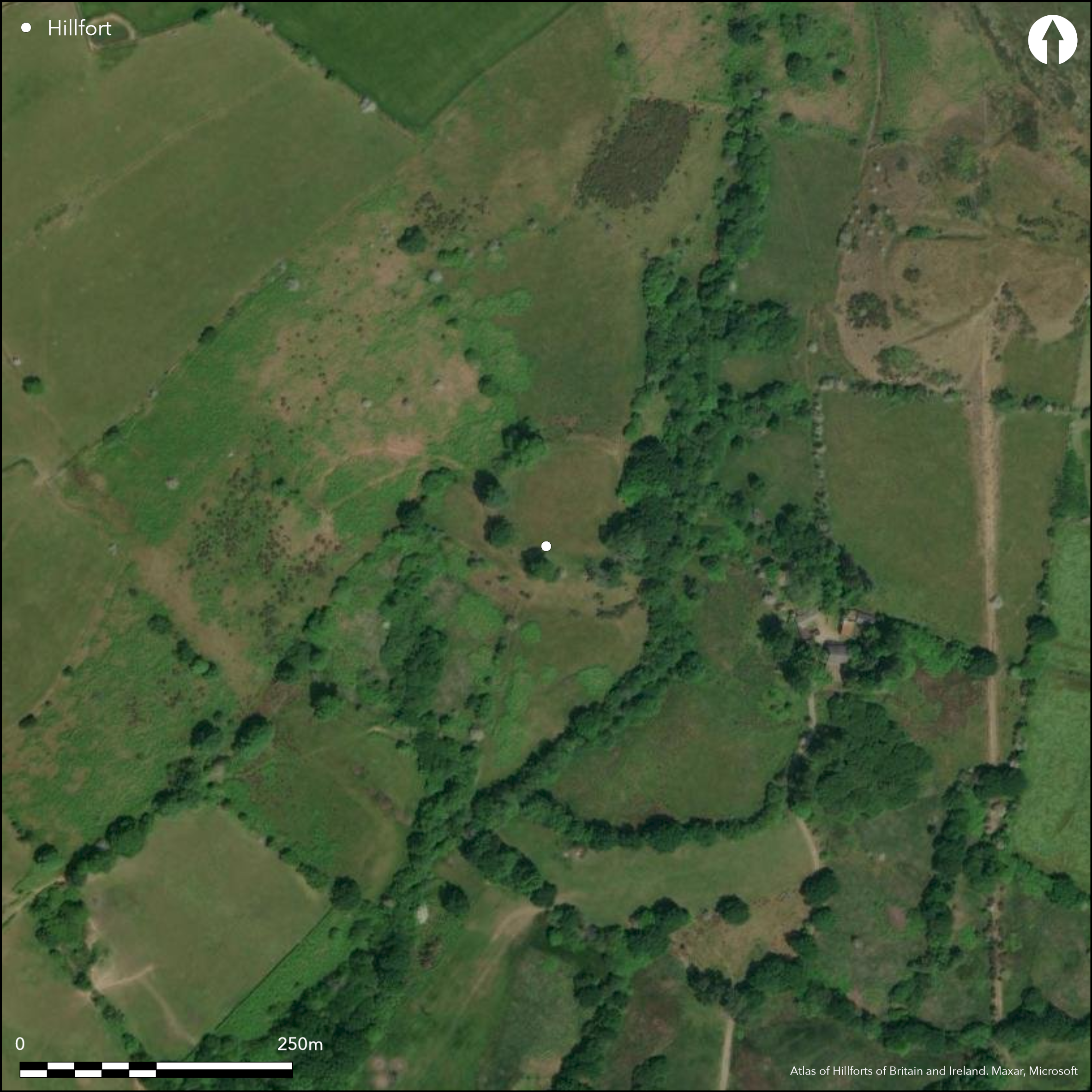
Satellite Imagery
LiDAR 1m DTM Hillshade
Satellite Imagery
Scroll left/right to view further images.
HER: Glamorgan Gwent 00341m (None)
NMR: SS 98 NW 1 (5170)
SM: GM356
NGR: SS94858527
X: 294850 Y: 185270 (OSGB36)
Univallate partial contour fort located on small spur projecting from higher ground on a tributary of the Ewenny River. Slopes to Nant Cwm-Llwyd on E. Steep surrounding slopes. End of spur rises in a knoll fortified by single D-shaped rampart. Measures c. 75m N-S by 65m, enclosing area of c. 0.4ha. Straight E side. For most of circuit only an outward-facing scarp c. 3m high, but on N earth and rubble bank rising to c. 12m wide overall. No sign of revetment. Natural scarp on E. Possible original entrance at SE angle, where terraced cart track 15m wide enters fort. No ditch, but may be buried feature. Improved pasture with tree surrounds. Minimal investigations, undated.
Citizen Science: ✗
Reliability of Data: Confirmed
Reliability of Interpretation: Confirmed
X: -391640 Y: 6720317 (EPSG: 3857)
Longitude: -3.5181633621312236 Latitude: 51.5564356621249 (EPSG:4326)
Country: Wales
Current County or Unitary Authority: Bridgend
Historic County: Glamorgan
Current Parish/Community/Council/Townland: Coychurch Higher
Fair condition.
| Extant | ✓ |
| Cropmark | ✗ |
| Likely Destroyed | ✗ |
Improved pasture with tree surrounds.
| Woodland | ✓ |
| Commercial Forestry Plantation | ✗ |
| Parkland | ✗ |
| Pasture (Grazing) | ✓ |
| Arable | ✗ |
| Scrub/Bracken | ✗ |
| Bare Outcrop | ✗ |
| Heather/Moorland | ✗ |
| Heath | ✗ |
| Built-up | ✗ |
| Coastal Grassland | ✗ |
| Other | ✗ |
Univallate partial contour fort located on small spur projecting from higher ground on a tributary of the Ewenny River. Slopes to Nant Cwm-Llwyd on E. Steep surrounding slopes.
| Contour Fort | ✗ |
| Partial Contour Fort | ✓ |
| Promontory Fort | ✗ |
| Hillslope Fort | ✗ |
| Level Terrain Fort | ✗ |
| Marsh Fort | ✗ |
| Multiple Enclosure Fort | ✗ |
| Hilltop | ✗ |
| Coastal Promontory | ✗ |
| Inland Promontory | ✗ |
| Valley Bottom | ✗ |
| Knoll/Hillock/Outcrop | ✗ |
| Ridge | ✗ |
| Cliff/Plateau-edge/Scarp | ✗ |
| Hillslope | ✗ |
| Lowland | ✗ |
| Spur | ✓ |
Dominant Topographic Feature: Spur with knoll
| North | ✗ |
| Northeast | ✗ |
| East | ✗ |
| Southeast | ✓ |
| South | ✗ |
| Southwest | ✗ |
| West | ✗ |
| Northwest | ✗ |
| Level | ✗ |
Altitude: 180.0m
N/A
None
Reliability: D - None
| Pre 1200BC | ✗ |
| 1200BC - 800BC | ✗ |
| 800BC - 400BC | ✗ |
| 400BC - AD50 | ✗ |
| AD50 - AD400 | ✗ |
| AD400 - AD 800 | ✗ |
| Post AD800 | ✗ |
| Unknown | ✓ |
| Pre Hillfort: | None |
| Post Hillfort: | None |
RCAHMW investigation 1965. GGAT Prehistoric defended enclosures in Glamorgan survey 2005.
| Other (1965): | RCAHMW investigation. |
| Other (2005): | GGAT Prehistoric defended enclosures in Glamorgan survey. |
None
Stream 0.02km outside fort.
| None | ✓ |
| Spring | ✗ |
| Stream | ✗ |
| Pool | ✗ |
| Flush | ✗ |
| Well | ✗ |
| Other | ✗ |
Cart track into site through possible entrance. Original?
| No Known Features | ✗ |
| Round Stone Structures | ✗ |
| Rectangular Stone Structures | ✗ |
| Curvilinear Platforms | ✗ |
| Other Roundhouse Evidence | ✗ |
| Pits | ✗ |
| Quarry Hollows | ✗ |
| Other | ✓ |
None
| No Known Excavation | ✓ |
| Pits | ✗ |
| Postholes | ✗ |
| Roundhouses | ✗ |
| Rectangular Structures | ✗ |
| Roads/Tracks | ✗ |
| Quarry Hollows | ✗ |
| Other | ✗ |
| Nothing Found | ✗ |
None
| No Known Geophysics | ✓ |
| Pits | ✗ |
| Roundhouses | ✗ |
| Rectangular Structures | ✗ |
| Roads/Tracks | ✗ |
| Quarry Hollows | ✗ |
| Other | ✗ |
| Nothing Found | ✗ |
None
| No Known Finds | ✓ |
| Pottery | ✗ |
| Metal | ✗ |
| Metalworking | ✗ |
| Human Bones | ✗ |
| Animal Bones | ✗ |
| Lithics | ✗ |
| Environmental | ✗ |
| Other | ✗ |
None
| APs Not Checked | ✓ |
| None | ✗ |
| Roundhouses | ✗ |
| Rectangular Structures | ✗ |
| Pits | ✗ |
| Postholes | ✗ |
| Roads/Tracks | ✗ |
| Other | ✗ |
Possible original entrance at SE angle, where terraced cart track 15m wide enters fort.
| 1: | None |
| 2: | None |
Guard Chambers: ✗
Chevaux de Frise: ✗
| 1. Simple Gap (South east): | At SE angle, where terraced cart track 15m wide enters fort. |
End of spur rises in a knoll fortified by single D-shaped rampart. Measures c. 75m N-S by 65m, enclosing area of c. 0.4ha. Straight E side. For most of circuit only an outward-facing scarp c. 3m high, but on N earth and rubble bank rising to c. 12m wide overall. No sign of revetment. Natural scarp on E. No ditch, but may be buried feature.
| Area 1: | 0.4ha. |
| Total: | 0.4ha. |
Total Footprint Area: Noneha.
None
| ✗ | None |
| ✗ | Natural scarp on straight E side. |
| NE Quadrant: | 1 |
| SE Quadrant: | 1 |
| SW Quadrant: | 1 |
| NW Quadrant: | 1 |
| Total: | 1 |
| Partial Univallate | ✗ |
| Univallate | ✓ |
| Partial Bivallate | ✗ |
| Bivallate | ✗ |
| Partial Multivallate | ✗ |
| Multivallate | ✗ |
| Unknown | ✗ |
| Partial Univallate | ✗ |
| Univallate | ✗ |
| Partial Bivallate | ✗ |
| Bivallate | ✗ |
| Partial Multivallate | ✗ |
| Multivallate | ✗ |
Earth and rubble bank.
| None | ✗ |
| Earthen Bank | ✓ |
| Stone Wall | ✗ |
| Rubble | ✓ |
| Wall-walk | ✗ |
| Evidence of Timber | ✗ |
| Vitrification | ✗ |
| Other Burning | ✗ |
| Palisade | ✗ |
| Counter Scarp Bank | ✗ |
| Berm | ✗ |
| Unfinished | ✗ |
| Other | ✗ |
None
| None | ✗ |
| Earthen Bank | ✗ |
| Stone Wall | ✗ |
| Murus Duplex | ✗ |
| Timber-framed | ✗ |
| Timber-laced | ✗ |
| Vitrification | ✗ |
| Other Burning | ✗ |
| Palisade | ✗ |
| Counter Scarp Bank | ✗ |
| Berm | ✗ |
| Unfinished | ✗ |
| No Known Excavation | ✓ |
| Other | ✗ |
| ✗ | None |
| ✗ | None |
Number of Ditches: 0
| ✗ | None |
Gerrard, C., Wiggins, H., and Evans, E. 2006. Prehistoric defended enclosures in Glamorgan with recommendations for fieldwork: Year 3 Report, GGAT Report No 2006/089, Project No GGAT78, Swansea: GGAT.
RCAHMW 1976. An inventory of the ancient monuments in Glamorgan, 1.2, Pre-Norman, Parts I-III, 634, Cardiff: HMSO.
Atlas of Hillforts:
Wikidata:
This work is licensed under CC BY-SA 4.0

 and should be cited as:
Lock, Gary and Ralston, Ian. 2024. Atlas of Hillforts of Britain and Ireland. Available at: https://hillforts.arch.ox.ac.uk
Document Version 1.1