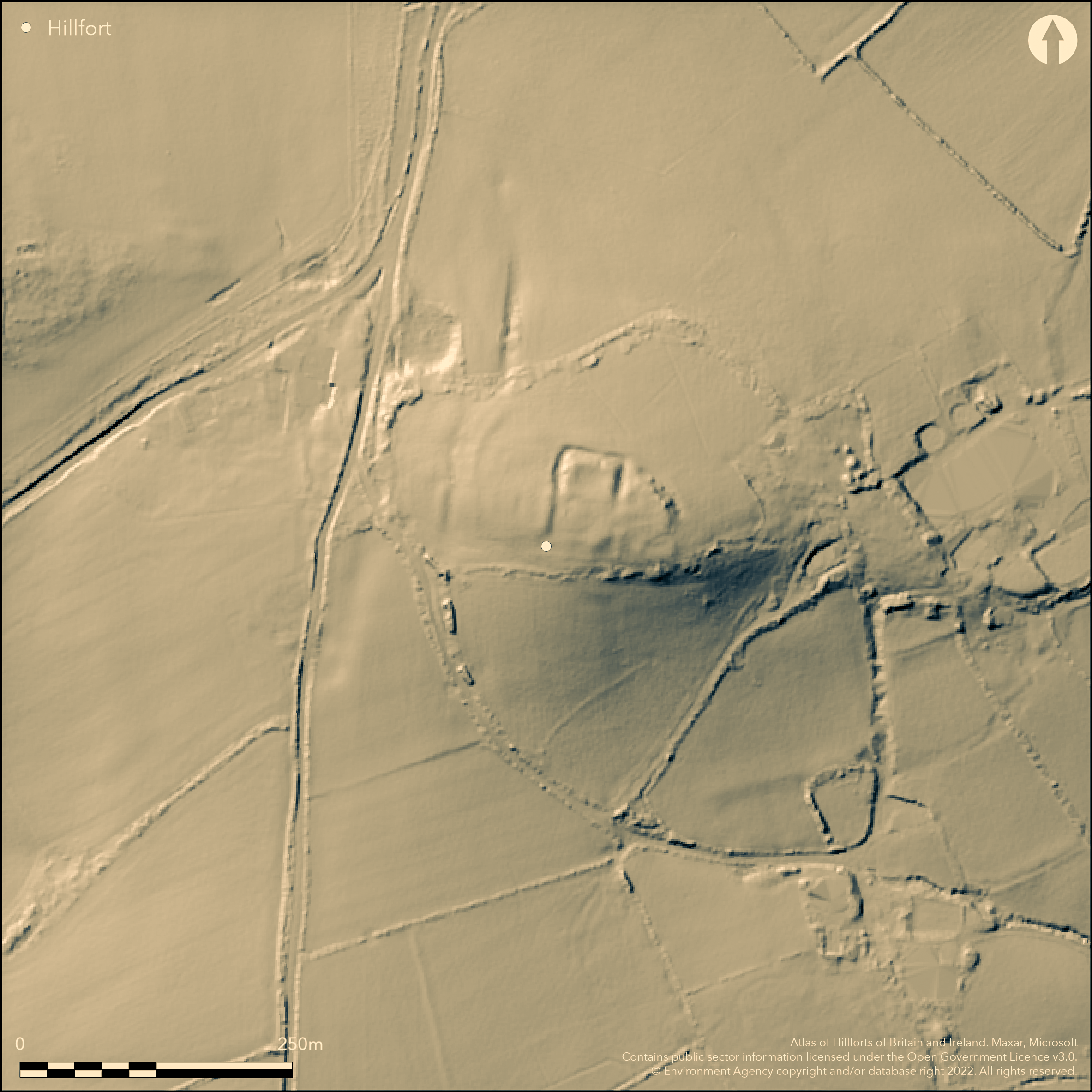
LiDAR 1m DTM Hillshade
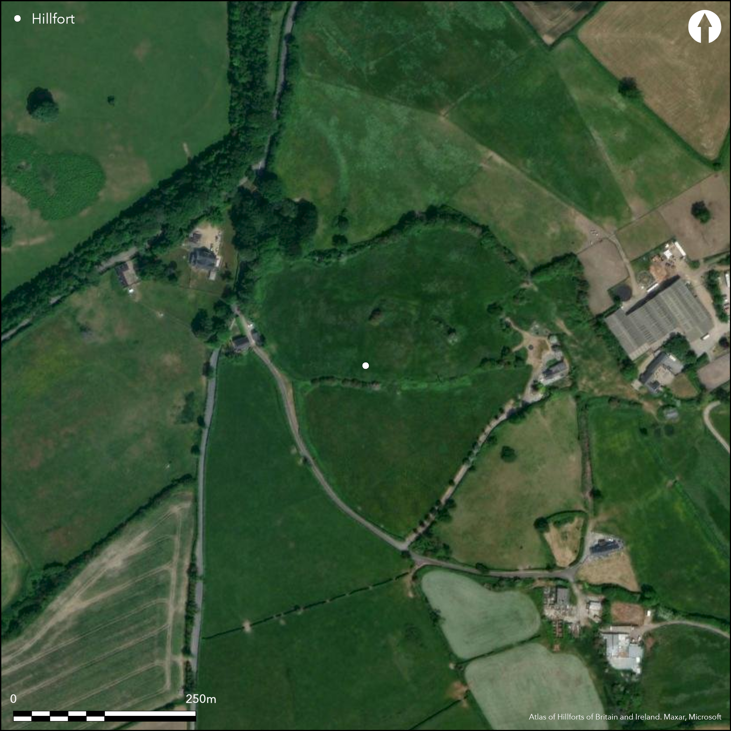
Satellite Imagery
LiDAR 1m DTM Hillshade
Satellite Imagery
Scroll left/right to view further images.
HER: Glamorgan Gwent 00359s (None)
NMR: ST 07 SE 2 (301307)
SM: GM298A
NGR: ST 054 734
X: 305400 Y: 173400 (OSGB36)
Plough-damaged univallate partial contour hillfort of presumed Iron Age date with later medieval manor house within, located on a low hill 820m SW of Bonvilston. Moderate surrounding slopes to N, stronger elsewhere. Area is uncertain, but possible c. 0.8ha and 115m E-W by 85m. Strong bank and ditch, 15m wide by 3m high, with traces of counterscarp, forming three sides of rectangle - medieval. Larger rampart, with silted ditch, from the NE corner for 30m SE. Also slighter banks extend to S. Traces of eroded hillfort rampart 50m W of the rectangle, crossing the hill N-S, with N end close to hollow which was formerly a spring and stream-bed, now dry. Possibly single bank and ditch with quarry ditch. RCAHMW (1976, 30) also suggest rectangle with its sharp ditch result of later vestiges of the 13th-15th century moated manor house (Liege Castle NPRN 15336) within the fragmentary remains of the hillfort beneath. Banks to W, therefore, hillfort remains. As result, extent of enclosure uncertain. Pasture, scrub and isolated and surrounding trees. On 1st Ed. OS map (1878). Minimal investigations, hillfort is undated.
Citizen Science: ✗
Reliability of Data: Confirmed
Reliability of Interpretation: Confirmed
X: -374350 Y: 6701570 (EPSG: 3857)
Longitude: -3.3628451310039695 Latitude: 51.45160499181735 (EPSG:4326)
Country: Wales
Current County or Unitary Authority: Vale of Glamorgan
Historic County: Glamorgan
Current Parish/Community/Council/Townland: Llancarfan
Vestiges of a 13th-15th century moated manor house lies within the fragmentary remains of the fort. Already under the plough in the 16th century. In places extent of enclosure uncertain.
| Extant | ✓ |
| Cropmark | ✗ |
| Likely Destroyed | ✗ |
Pasture, scrub and isolated and surrounding trees. Vestiges of a 13th-15th century moated manor house.
| Woodland | ✗ |
| Commercial Forestry Plantation | ✗ |
| Parkland | ✗ |
| Pasture (Grazing) | ✓ |
| Arable | ✗ |
| Scrub/Bracken | ✓ |
| Bare Outcrop | ✗ |
| Heather/Moorland | ✗ |
| Heath | ✗ |
| Built-up | ✓ |
| Coastal Grassland | ✗ |
| Other | ✓ |
Univallate partial contour hillfort located on low hill 820m SW of Bonvilston.
| Contour Fort | ✗ |
| Partial Contour Fort | ✓ |
| Promontory Fort | ✗ |
| Hillslope Fort | ✗ |
| Level Terrain Fort | ✗ |
| Marsh Fort | ✗ |
| Multiple Enclosure Fort | ✗ |
| Hilltop | ✓ |
| Coastal Promontory | ✗ |
| Inland Promontory | ✗ |
| Valley Bottom | ✗ |
| Knoll/Hillock/Outcrop | ✗ |
| Ridge | ✗ |
| Cliff/Plateau-edge/Scarp | ✗ |
| Hillslope | ✗ |
| Lowland | ✗ |
| Spur | ✗ |
Dominant Topographic Feature: Hill top
| North | ✗ |
| Northeast | ✗ |
| East | ✗ |
| Southeast | ✗ |
| South | ✗ |
| Southwest | ✓ |
| West | ✗ |
| Northwest | ✗ |
| Level | ✗ |
Altitude: 100.0m
N/A
No dating for the hillfort. Vestiges of a 13th-15th century moated manor house lies within the fragmentary remains of the Iron Age fort.
Reliability: D - None
| Pre 1200BC | ✗ |
| 1200BC - 800BC | ✗ |
| 800BC - 400BC | ✗ |
| 400BC - AD50 | ✗ |
| AD50 - AD400 | ✗ |
| AD400 - AD 800 | ✗ |
| Post AD800 | ✗ |
| Unknown | ✓ |
| Pre Hillfort: | None |
| Post Hillfort: | None |
Site apparently mentioned in 1320, reported as being under plough by 1578. On 1st Ed. OS map (1878). RCAHMW investigation 1967. GGAT Prehistoric defended enclosures in Glamorgan survey 2005.
| 1st Identified Written Reference (1320): | Detail unknown. |
| Other (1578): | Mention by Rice Merrick - detail unknown. |
| 1st Identified Map Depiction (1878): | OS map. |
| Other (1967): | RCAHMW investigation. |
| Other (2005): | GGAT Prehistoric defended enclosures in Glamorgan survey. |
None
Traces of eroded rampart 50m W of the rectangle, crossing the hill N-S, and N end close to hollow which was formerly a spring and stream-bed, now dry.
| None | ✗ |
| Spring | ✓ |
| Stream | ✓ |
| Pool | ✗ |
| Flush | ✗ |
| Well | ✗ |
| Other | ✗ |
None
| No Known Features | ✓ |
| Round Stone Structures | ✗ |
| Rectangular Stone Structures | ✗ |
| Curvilinear Platforms | ✗ |
| Other Roundhouse Evidence | ✗ |
| Pits | ✗ |
| Quarry Hollows | ✗ |
| Other | ✗ |
None
| No Known Excavation | ✓ |
| Pits | ✗ |
| Postholes | ✗ |
| Roundhouses | ✗ |
| Rectangular Structures | ✗ |
| Roads/Tracks | ✗ |
| Quarry Hollows | ✗ |
| Other | ✗ |
| Nothing Found | ✗ |
None
| No Known Geophysics | ✓ |
| Pits | ✗ |
| Roundhouses | ✗ |
| Rectangular Structures | ✗ |
| Roads/Tracks | ✗ |
| Quarry Hollows | ✗ |
| Other | ✗ |
| Nothing Found | ✗ |
None
| No Known Finds | ✓ |
| Pottery | ✗ |
| Metal | ✗ |
| Metalworking | ✗ |
| Human Bones | ✗ |
| Animal Bones | ✗ |
| Lithics | ✗ |
| Environmental | ✗ |
| Other | ✗ |
None
| APs Not Checked | ✓ |
| None | ✗ |
| Roundhouses | ✗ |
| Rectangular Structures | ✗ |
| Pits | ✗ |
| Postholes | ✗ |
| Roads/Tracks | ✗ |
| Other | ✗ |
Cannot be determined.
| 0: | Cannot be determined. |
| 2: | Cannot be determined. |
Guard Chambers: ✗
Chevaux de Frise: ✗
Strong bank and ditch, 15m wide by 3m high, with traces of counterscarp, forming three sides of rectangle - medieval. Larger rampart, with silted ditch, from the NE corner for 30m SE. Also slighter banks extend to S. Traces of eroded hillfort rampart 50m W of the rectangle, crossing the hill N-S, and N end close to hollow which was formerly a spring and stream-bed, now dry. Possibly single bank and ditch with quarry ditch.
| Area 1: | 0.8ha. |
| Total: | 0.8ha. |
Total Footprint Area: Noneha.
None
| ✗ | Area is uncertain, but possible c. 0.8ha and 115m E-W by 85m. |
| ✗ | Actual number of banks cannot be determined because of medieval construct. |
| NE Quadrant: | None |
| SE Quadrant: | None |
| SW Quadrant: | None |
| NW Quadrant: | None |
| Total: | None |
| Partial Univallate | ✗ |
| Univallate | ✗ |
| Partial Bivallate | ✗ |
| Bivallate | ✗ |
| Partial Multivallate | ✗ |
| Multivallate | ✗ |
| Unknown | ✓ |
| Partial Univallate | ✗ |
| Univallate | ✗ |
| Partial Bivallate | ✗ |
| Bivallate | ✗ |
| Partial Multivallate | ✗ |
| Multivallate | ✗ |
Traces of counterscarp.
| None | ✗ |
| Earthen Bank | ✓ |
| Stone Wall | ✗ |
| Rubble | ✗ |
| Wall-walk | ✗ |
| Evidence of Timber | ✗ |
| Vitrification | ✗ |
| Other Burning | ✗ |
| Palisade | ✗ |
| Counter Scarp Bank | ✓ |
| Berm | ✗ |
| Unfinished | ✗ |
| Other | ✗ |
None
| None | ✗ |
| Earthen Bank | ✗ |
| Stone Wall | ✗ |
| Murus Duplex | ✗ |
| Timber-framed | ✗ |
| Timber-laced | ✗ |
| Vitrification | ✗ |
| Other Burning | ✗ |
| Palisade | ✗ |
| Counter Scarp Bank | ✗ |
| Berm | ✗ |
| Unfinished | ✗ |
| No Known Excavation | ✓ |
| Other | ✗ |
| ✗ | None |
| ✓ | Actual number of ditches cannot be determined because of later medieval construct. |
Number of Ditches: 0
| ✗ | None |
Gerrard, C., Wiggins, H., and Evans, E. 2006. Prehistoric defended enclosures in Glamorgan with recommendations for fieldwork: Year 3 Report, GGAT Report No 2006/089, Project No GGAT78, Swansea: GGAT.
RCAHMW 1976. An inventory of the ancient monuments in Glamorgan, 1.2, Pre-Norman, Parts I-III, 638, Cardiff: HMSO.
Whittle, E. 1992. A guide to ancient and historic Wales - Glamorgan and Gwent, London: HMSO, 100.
Atlas of Hillforts:
Wikidata:
This work is licensed under CC BY-SA 4.0

 and should be cited as:
Lock, Gary and Ralston, Ian. 2024. Atlas of Hillforts of Britain and Ireland. Available at: https://hillforts.arch.ox.ac.uk
Document Version 1.1