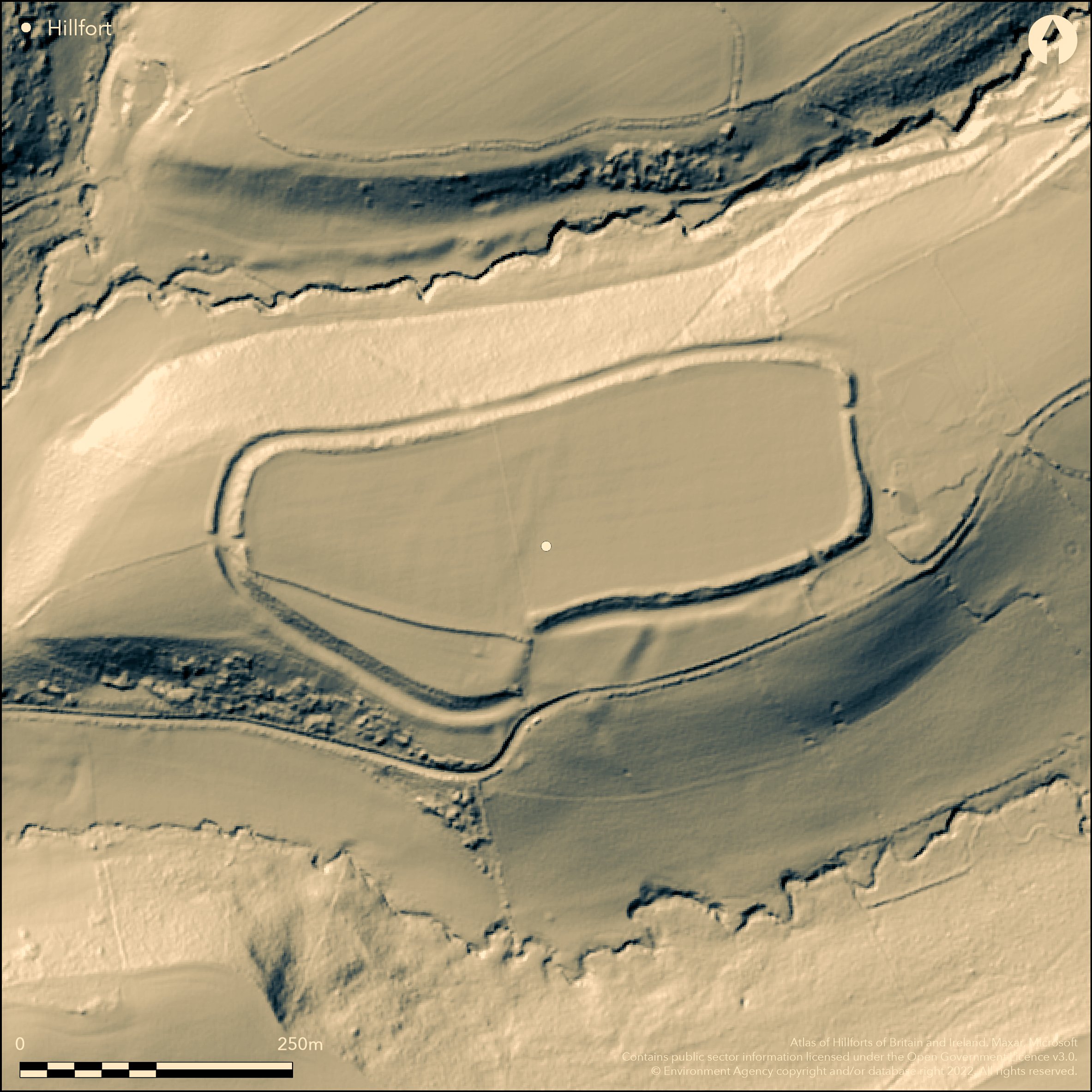
LiDAR 1m DTM Hillshade
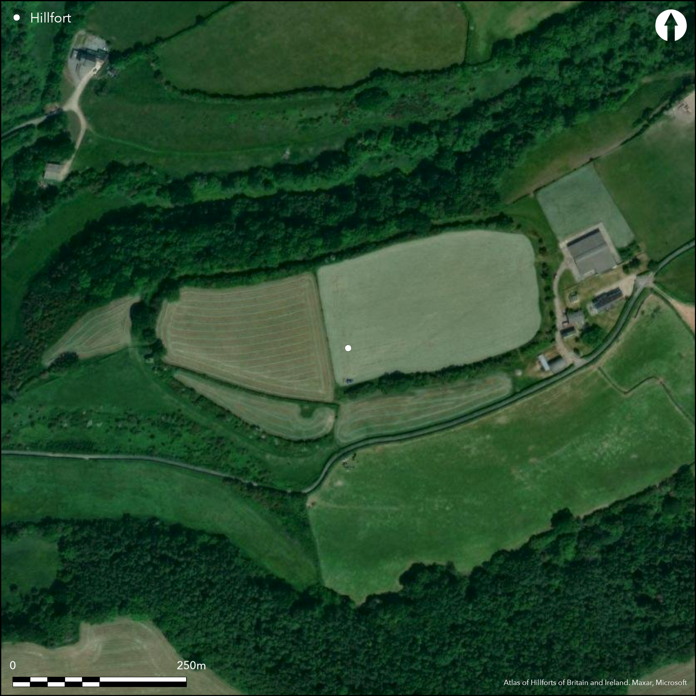
Satellite Imagery
LiDAR 1m DTM Hillshade
Satellite Imagery
Scroll left/right to view further images.
HER: Glamorgan Gwent 00383s (None)
NMR: ST 07 SE (93040)
SM: GM071
NGR: ST05907002
X: 305900 Y: 170020 (OSGB36)
Large, univallate, partial contour hillfort sited on a very prominent E-W ridge between two streams and overlooking the coastal plain and River Thaw. Steep surrounding slopes to N, S and W, moderate to E. Measures c. 350m E-W by 105-135m with internal area c. 4.5ha. Main bank is high and steep and composed of clay and rubble, revetted on the outside at the vulnerable E end. Ditch with counterscarp bank on SW and W. Excavations 1963-64 (Hogg 1976) found earlier smaller enclosure with stone wall possibly superceded by that seen today. Rampart and ditch strong at E end; at other sides bank rises only slightly above interior but steep externally, and has the ditch with counterscarp. Ditch flat-bottomed, shallow S of entrance but much deeper to E. Entrance in middle of S side and outside two banks and ditches from main enclosure seemingly protecting approach, and slighter bank continues downhill to stream. On 1st Ed. OS map (1879).
Citizen Science: ✗
Reliability of Data: Confirmed
Reliability of Interpretation: Confirmed
X: -373449 Y: 6696159 (EPSG: 3857)
Longitude: -3.3547523146105407 Latitude: 51.42130480123721 (EPSG:4326)
Country: Wales
Current County or Unitary Authority: Vale of Glamorgan
Historic County: Glamorgan
Current Parish/Community/Council/Townland: Llancarfan
Good condition. Farm buildings adjacent to E side affect setting.
| Extant | ✓ |
| Cropmark | ✗ |
| Likely Destroyed | ✗ |
Improved pasture.
| Woodland | ✗ |
| Commercial Forestry Plantation | ✗ |
| Parkland | ✗ |
| Pasture (Grazing) | ✓ |
| Arable | ✗ |
| Scrub/Bracken | ✗ |
| Bare Outcrop | ✗ |
| Heather/Moorland | ✗ |
| Heath | ✗ |
| Built-up | ✗ |
| Coastal Grassland | ✗ |
| Other | ✗ |
Large, univallate, partial contour hillfort sited on a very prominent E-W ridge between two streams and overlooking the coastal plain and River Thaw. Steep surrounding slopes to N, S and W, moderate to E.
| Contour Fort | ✗ |
| Partial Contour Fort | ✓ |
| Promontory Fort | ✗ |
| Hillslope Fort | ✗ |
| Level Terrain Fort | ✗ |
| Marsh Fort | ✗ |
| Multiple Enclosure Fort | ✗ |
| Hilltop | ✗ |
| Coastal Promontory | ✗ |
| Inland Promontory | ✗ |
| Valley Bottom | ✗ |
| Knoll/Hillock/Outcrop | ✗ |
| Ridge | ✓ |
| Cliff/Plateau-edge/Scarp | ✗ |
| Hillslope | ✗ |
| Lowland | ✗ |
| Spur | ✗ |
Dominant Topographic Feature: Ridge
| North | ✗ |
| Northeast | ✗ |
| East | ✗ |
| Southeast | ✗ |
| South | ✗ |
| Southwest | ✓ |
| West | ✗ |
| Northwest | ✗ |
| Level | ✗ |
Altitude: 61.0m
N/A
Excavation finds almost all plain Iron Age B pottery, but few sherds with decoration similar to that found in Somerset Lake villages, and a little Roman pottery of 2th-4th century. Occupation probably from Iron Age through to the Romano-British period.
Reliability: B - Medium
| Pre 1200BC | ✗ |
| 1200BC - 800BC | ✗ |
| 800BC - 400BC | ✗ |
| 400BC - AD50 | ✓ |
| AD50 - AD400 | ✓ |
| AD400 - AD 800 | ✗ |
| Post AD800 | ✗ |
| Unknown | ✗ |
| Pre Hillfort: | None |
| Post Hillfort: | None |
| Artefactual: | Iron Age and Romano-British/ Roman wares. |
On 1st Ed. OS map (1879). Excavation 1963-64 by A.H.A. Hogg. RCAHMW survey 1964-65. GGAT Prehistoric defended enclosures in Glamorgan survey 2005.
| 1st Identified Map Depiction (1879): | OS map. |
| Other (2005): | GGAT Prehistoric defended enclosures in Glamorgan survey. |
| Excavation (None): | A.H.A. Hogg |
| Other (None): | RCAHMW survey. |
Finds almost all plain Iron Age B pottery, but few sherds with decoration similar to that found in Somerset Lake villages, and a little Roman pottery of 2th-4th century. Cremations in cists found in 1876 outside SE corner of site.
Stream 0.1km outside fort.
| None | ✓ |
| Spring | ✗ |
| Stream | ✗ |
| Pool | ✗ |
| Flush | ✗ |
| Well | ✗ |
| Other | ✗ |
None
| No Known Features | ✓ |
| Round Stone Structures | ✗ |
| Rectangular Stone Structures | ✗ |
| Curvilinear Platforms | ✗ |
| Other Roundhouse Evidence | ✗ |
| Pits | ✗ |
| Quarry Hollows | ✗ |
| Other | ✗ |
Foundations of round hut excavated at highest level.
| No Known Excavation | ✗ |
| Pits | ✗ |
| Postholes | ✗ |
| Roundhouses | ✓ |
| Rectangular Structures | ✗ |
| Roads/Tracks | ✗ |
| Quarry Hollows | ✗ |
| Other | ✗ |
| Nothing Found | ✗ |
None
| No Known Geophysics | ✓ |
| Pits | ✗ |
| Roundhouses | ✗ |
| Rectangular Structures | ✗ |
| Roads/Tracks | ✗ |
| Quarry Hollows | ✗ |
| Other | ✗ |
| Nothing Found | ✗ |
Finds almost all plain Iron Age B pottery, but few sherds with decoration similar to that found in Somerset Lake villages, and a little Roman pottery of 2th-4th century. Cremations in cists found in 1876 outside SE corner of site.
| No Known Finds | ✗ |
| Pottery | ✓ |
| Metal | ✗ |
| Metalworking | ✗ |
| Human Bones | ✗ |
| Animal Bones | ✗ |
| Lithics | ✗ |
| Environmental | ✗ |
| Other | ✗ |
None
| APs Not Checked | ✓ |
| None | ✗ |
| Roundhouses | ✗ |
| Rectangular Structures | ✗ |
| Pits | ✗ |
| Postholes | ✗ |
| Roads/Tracks | ✗ |
| Other | ✗ |
Main entrance in middle of S side possibly inturned on E. Outside entrance two banks and ditches built out from main enclosure as if to protect approach, and slighter bank continues downhill to stream. Gaps on NE and SW indeterminate.
| 3: | Gaps on NE and SW indeterminate. |
| 2: | None |
Guard Chambers: ✗
Chevaux de Frise: ✗
| 1. In-turned (South): | Main entrance in middle of S side possibly inturned on E. |
| 1. Other Forms (South): | Outside entrance two banks and ditches built out from main enclosure as if to protect approach, and slighter bank continues downhill to stream. |
Main bank is high and steep and composed of clay and rubble, revetted on the outside at the vulnerable E end. Ditch with counterscarp bank on SW and W. Earlier smaller enclosure with stone wall possibly superceded by one seen today. Rampart and ditch strong at E end; at other sides bank rises only slightly above interior but steep externally, and has the ditch with counterscarp. Ditch flat-bottomed, shallow S of entrance but much deeper to E.
| Area 1: | 4.2ha. |
| Total: | 4.2ha. |
Total Footprint Area: Noneha.
None
| ✓ | Earlier smaller enclosure with stone wall possibly superceded by that seen today. |
| ✓ | None |
| NE Quadrant: | 1 |
| SE Quadrant: | 1 |
| SW Quadrant: | 1 |
| NW Quadrant: | 1 |
| Total: | 1 |
| Partial Univallate | ✗ |
| Univallate | ✓ |
| Partial Bivallate | ✗ |
| Bivallate | ✗ |
| Partial Multivallate | ✗ |
| Multivallate | ✗ |
| Unknown | ✗ |
| Partial Univallate | ✗ |
| Univallate | ✗ |
| Partial Bivallate | ✗ |
| Bivallate | ✗ |
| Partial Multivallate | ✗ |
| Multivallate | ✗ |
Main bank is high and steep and composed of clay and rubble, revetted on the outside at the vulnerable E end. Counterscarp on SW and W.
| None | ✗ |
| Earthen Bank | ✓ |
| Stone Wall | ✓ |
| Rubble | ✓ |
| Wall-walk | ✗ |
| Evidence of Timber | ✗ |
| Vitrification | ✗ |
| Other Burning | ✗ |
| Palisade | ✗ |
| Counter Scarp Bank | ✓ |
| Berm | ✗ |
| Unfinished | ✗ |
| Other | ✗ |
Excavation revealed traces of earlier stone-walled enclosure.
| None | ✗ |
| Earthen Bank | ✓ |
| Stone Wall | ✓ |
| Murus Duplex | ✗ |
| Timber-framed | ✗ |
| Timber-laced | ✗ |
| Vitrification | ✗ |
| Other Burning | ✗ |
| Palisade | ✗ |
| Counter Scarp Bank | ✗ |
| Berm | ✗ |
| Unfinished | ✗ |
| No Known Excavation | ✗ |
| Other | ✗ |
| ✗ | None |
| ✓ | Ditch flat-bottomed, shallow S of entrance but much deeper to E. |
Number of Ditches: 1
| ✗ | None |
Gerrard, C., Wiggins, H., and Evans, E. 2006. Prehistoric defended enclosures in Glamorgan with recommendations for fieldwork: Year 3 Report, GGAT Report No 2006/089, Project No GGAT78, Swansea: GGAT.
Hogg, A.H.A., 1976. Castle Ditches, Llancarfan (Glamorgan), Arch Camb, 125, 13-39.
RCAHMW 1976. An inventory of the ancient monuments in Glamorgan, 1.2, Pre-Norman, Parts I-III, 615, Cardiff: HMSO.
Savory, H.N. 1949. List of hill-forts in Wales, Bull Board Celtic Stud, 13, 154;
Whittle, E. 1992. A guide to ancient and historic Wales - Glamorgan and Gwent, 31, London: HMSO, 31.
Atlas of Hillforts:
Wikidata:
This work is licensed under CC BY-SA 4.0

 and should be cited as:
Lock, Gary and Ralston, Ian. 2024. Atlas of Hillforts of Britain and Ireland. Available at: https://hillforts.arch.ox.ac.uk
Document Version 1.1