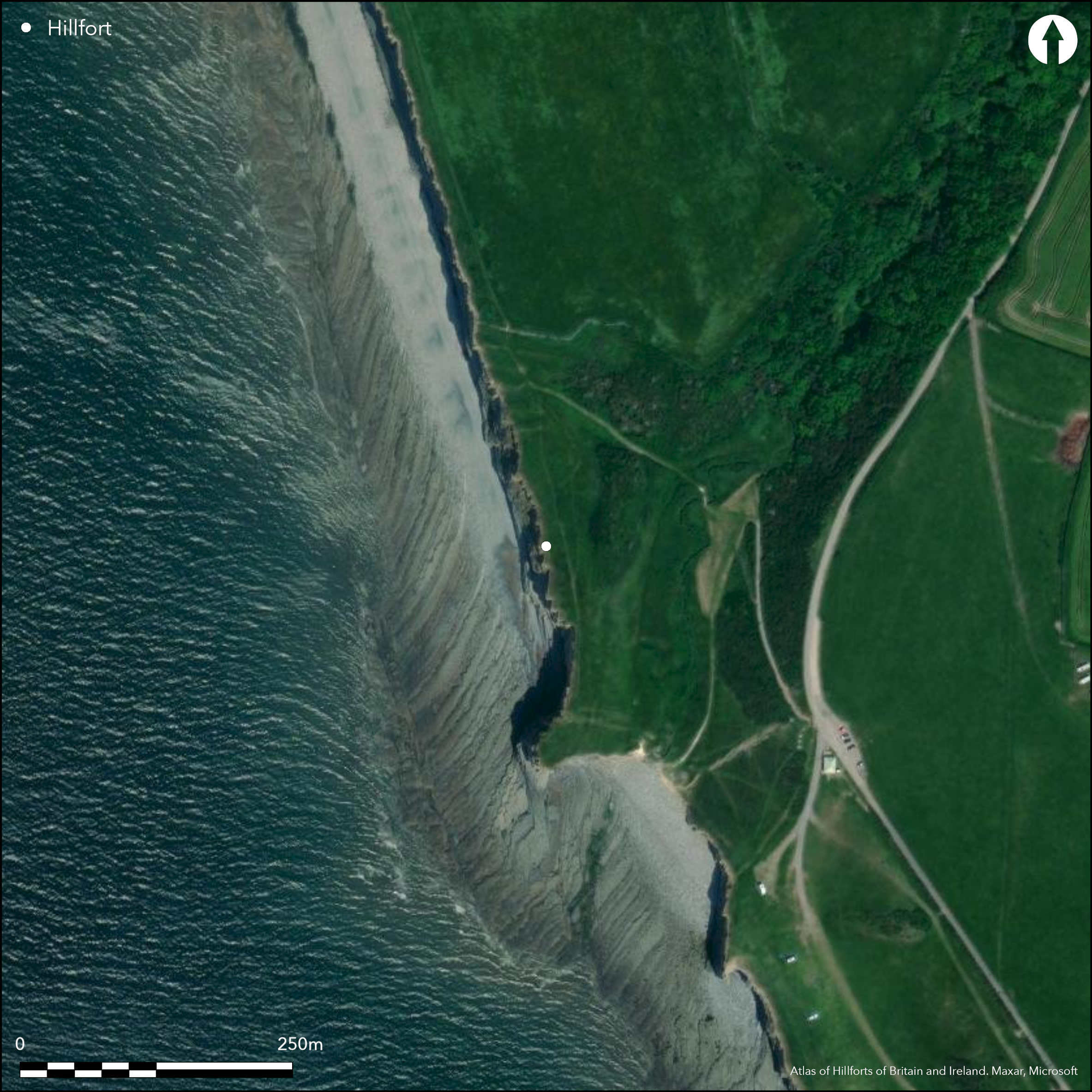
Satellite Imagery
Satellite Imagery
HER: Glamorgan Gwent 00400s (None)
NMR: SS 96 NW 3 (300160)
SM: GM033
NGR: SS91486848
X: 291480 Y: 168480 (OSGB36)
Much eroded coastal promontory fort on narrow SW-facing promontory between Marcoss Cwm and sea cliffs overlooking Porthcawl Point. Now only narrow strip of promontory left. Surrounding slopes to N and E moderate to strong, S and W precipitous sea cliffs. Measures now c. 190m N-S with internal area 0.4-0.5ha and reducing annually. Main defences on the N are of four parallel ramparts close together with rubble banks and flat-bottomed ditches, the three inner have ditches and are steep sided. Third of inner ramparts follows bottom of small cwm, fourth and outermost rampart, built 10m from edge of third ditch and extended E. Approach turns sharp angle as reaches end of ramparts and follows a terraced and revetted trackway. At the entrance this was thickened, or slightly in-turned. Inturned entrance on NE. Outer bank guards approach, which was along a narrow shoulder to the entrance, and cuts off peninsula. Crouched burial found in infill of the innnermost ditch. Medieval pillow mound in the interior. Interior hollows and pits modern. Coastal grassland and scrub. On 1st Ed. OS map (1878). Geophysical survey of interior. Undated.
Citizen Science: ✗
Reliability of Data: Confirmed
Reliability of Interpretation: Confirmed
X: -396475 Y: 6693228 (EPSG: 3857)
Longitude: -3.561591591685174 Latitude: 51.404882839244955 (EPSG:4326)
Country: Wales
Current County or Unitary Authority: Vale of Glamorgan
Historic County: Glamorgan
Current Parish/Community/Council/Townland: St Donats
Much eroded by sea and now only narrow strip of promontory left. Public coastal path.
| Extant | ✓ |
| Cropmark | ✗ |
| Likely Destroyed | ✓ |
Coastal grassland and scrub.
| Woodland | ✗ |
| Commercial Forestry Plantation | ✗ |
| Parkland | ✗ |
| Pasture (Grazing) | ✗ |
| Arable | ✗ |
| Scrub/Bracken | ✓ |
| Bare Outcrop | ✗ |
| Heather/Moorland | ✗ |
| Heath | ✗ |
| Built-up | ✗ |
| Coastal Grassland | ✓ |
| Other | ✗ |
Much eroded coastal promontory fort on narrow SW-facing promontory between Marcoss Cwm and sea cliffs overlooking Porthcawl Point. Now only narrow strip of promontory left. Surrounding slopes to N and E moderate to strong, S and W precipitous sea cliffs.
| Contour Fort | ✗ |
| Partial Contour Fort | ✗ |
| Promontory Fort | ✓ |
| Hillslope Fort | ✗ |
| Level Terrain Fort | ✗ |
| Marsh Fort | ✗ |
| Multiple Enclosure Fort | ✗ |
| Hilltop | ✗ |
| Coastal Promontory | ✓ |
| Inland Promontory | ✗ |
| Valley Bottom | ✗ |
| Knoll/Hillock/Outcrop | ✗ |
| Ridge | ✗ |
| Cliff/Plateau-edge/Scarp | ✗ |
| Hillslope | ✗ |
| Lowland | ✗ |
| Spur | ✗ |
Dominant Topographic Feature: Coastal headland
| North | ✗ |
| Northeast | ✗ |
| East | ✗ |
| Southeast | ✗ |
| South | ✗ |
| Southwest | ✗ |
| West | ✗ |
| Northwest | ✓ |
| Level | ✗ |
Altitude: 30.0m
N/A
None
Reliability: D - None
| Pre 1200BC | ✗ |
| 1200BC - 800BC | ✗ |
| 800BC - 400BC | ✗ |
| 400BC - AD50 | ✗ |
| AD50 - AD400 | ✗ |
| AD400 - AD 800 | ✗ |
| Post AD800 | ✗ |
| Unknown | ✓ |
| Pre Hillfort: | None |
| Post Hillfort: | Medieval pillow mound in the interior. |
On 1st Ed. OS map (1878). Geophysical survey carried out as part of GGAT 61 Coastal Hillforts Survey. RCAHMW investigation 1965. GGAT Prehistoric defended enclosures in Glamorgan survey 2005.
| 1st Identified Map Depiction (1878): | OS map. |
| Other (1965): | RCAHMW investigation. |
| Other (2005): | GGAT Prehistoric defended enclosures in Glamorgan survey. |
| Geophysical Survey (None): | GGAT Coastal Hillforts Survey |
Terraced and revetted trackway. Medieval pillow mound in the interior. Interior hollows and pits modern. Crouched burial found in lower fill of innermost ditch. Geophysical survey carried out as part of GGAT 61 Coastal Hillforts Survey failed to locate any internal structures.
Stream on site.
| None | ✗ |
| Spring | ✗ |
| Stream | ✓ |
| Pool | ✗ |
| Flush | ✗ |
| Well | ✗ |
| Other | ✗ |
Terraced and revetted trackway. Medieval pillow mound in the interior. Interior hollows and pits modern.
| No Known Features | ✓ |
| Round Stone Structures | ✗ |
| Rectangular Stone Structures | ✗ |
| Curvilinear Platforms | ✗ |
| Other Roundhouse Evidence | ✗ |
| Pits | ✗ |
| Quarry Hollows | ✗ |
| Other | ✓ |
None
| No Known Excavation | ✓ |
| Pits | ✗ |
| Postholes | ✗ |
| Roundhouses | ✗ |
| Rectangular Structures | ✗ |
| Roads/Tracks | ✗ |
| Quarry Hollows | ✗ |
| Other | ✗ |
| Nothing Found | ✗ |
Geophysical survey carried out as part of GGAT 61 Coastal Hillforts Survey failed to locate any internal structures.
| No Known Geophysics | ✗ |
| Pits | ✗ |
| Roundhouses | ✗ |
| Rectangular Structures | ✗ |
| Roads/Tracks | ✗ |
| Quarry Hollows | ✗ |
| Other | ✓ |
| Nothing Found | ✗ |
Crouched burial found in lower fill of innermost ditch.
| No Known Finds | ✗ |
| Pottery | ✗ |
| Metal | ✗ |
| Metalworking | ✗ |
| Human Bones | ✓ |
| Animal Bones | ✗ |
| Lithics | ✗ |
| Environmental | ✗ |
| Other | ✗ |
None
| APs Not Checked | ✓ |
| None | ✗ |
| Roundhouses | ✗ |
| Rectangular Structures | ✗ |
| Pits | ✗ |
| Postholes | ✗ |
| Roads/Tracks | ✗ |
| Other | ✗ |
Inturned entrance on NE. Outer bank guards approach, which was along a narrow shoulder to the entrance, and cuts off peninsula.
| 1: | None |
| 2: | None |
Guard Chambers: ✗
Chevaux de Frise: ✗
| 1. In-turned (North east): | None |
| 1. Other Forms (North east): | Outer bank guards approach, which was along a narrow shoulder to the entrance, and cuts off peninsula. |
Main defences on the N are of four parallel ramparts close together with rubble banks and flat-bottomed ditches, the three inner have ditches and are steep sided. Third of inner ramparts follows bottom of small cwm, fourth and outermost rampart, built 10m from edge of third ditch and extended E. Approach turns sharp angle as reaches end of ramparts and follows a terraced and revetted trackway. At the entrance this was thickened, or slightly in-turned.
| Area 1: | 0.5ha. |
| Total: | 0.5ha. |
Total Footprint Area: Noneha.
None
| ✗ | Originally circa 2.4 ha, now much reduced to c. 0.5ha and cliff continues to erode badly. |
| ✗ | None |
| NE Quadrant: | 4 |
| SE Quadrant: | 0 |
| SW Quadrant: | 0 |
| NW Quadrant: | 4 |
| Total: | 4 |
| Partial Univallate | ✗ |
| Univallate | ✗ |
| Partial Bivallate | ✗ |
| Bivallate | ✗ |
| Partial Multivallate | ✓ |
| Multivallate | ✗ |
| Unknown | ✗ |
| Partial Univallate | ✗ |
| Univallate | ✗ |
| Partial Bivallate | ✗ |
| Bivallate | ✗ |
| Partial Multivallate | ✗ |
| Multivallate | ✗ |
Rubble banks.
| None | ✗ |
| Earthen Bank | ✗ |
| Stone Wall | ✗ |
| Rubble | ✓ |
| Wall-walk | ✗ |
| Evidence of Timber | ✗ |
| Vitrification | ✗ |
| Other Burning | ✗ |
| Palisade | ✗ |
| Counter Scarp Bank | ✗ |
| Berm | ✗ |
| Unfinished | ✗ |
| Other | ✗ |
None
| None | ✗ |
| Earthen Bank | ✗ |
| Stone Wall | ✗ |
| Murus Duplex | ✗ |
| Timber-framed | ✗ |
| Timber-laced | ✗ |
| Vitrification | ✗ |
| Other Burning | ✗ |
| Palisade | ✗ |
| Counter Scarp Bank | ✗ |
| Berm | ✗ |
| Unfinished | ✗ |
| No Known Excavation | ✓ |
| Other | ✗ |
| ✗ | None |
| ✓ | Inner three ramparts have flat-bottomed ditches. |
Number of Ditches: 3
| ✗ | None |
Gerrard, C., Wiggins, H., and Evans, E. 2006. Prehistoric defended enclosures in Glamorgan with recommendations for fieldwork: Year 3 Report, GGAT Report No 2006/089, Project No GGAT78, Swansea: GGAT.
RCAHMW 1976. An inventory of the ancient monuments in Glamorgan, 1.2, Pre-Norman, Parts I-III, 667, Cardiff: HMSO.
Savory, H.N. 1949. List of hill-forts in Wales, Bull Board Celtic Stud, 13, 156.
Whittle, E. 1992. A guide to ancient and historic Wales, Glamorgan and Gwent, London: HMSO, 38-9.
Atlas of Hillforts:
Wikidata:
This work is licensed under CC BY-SA 4.0

 and should be cited as:
Lock, Gary and Ralston, Ian. 2024. Atlas of Hillforts of Britain and Ireland. Available at: https://hillforts.arch.ox.ac.uk
Document Version 1.1