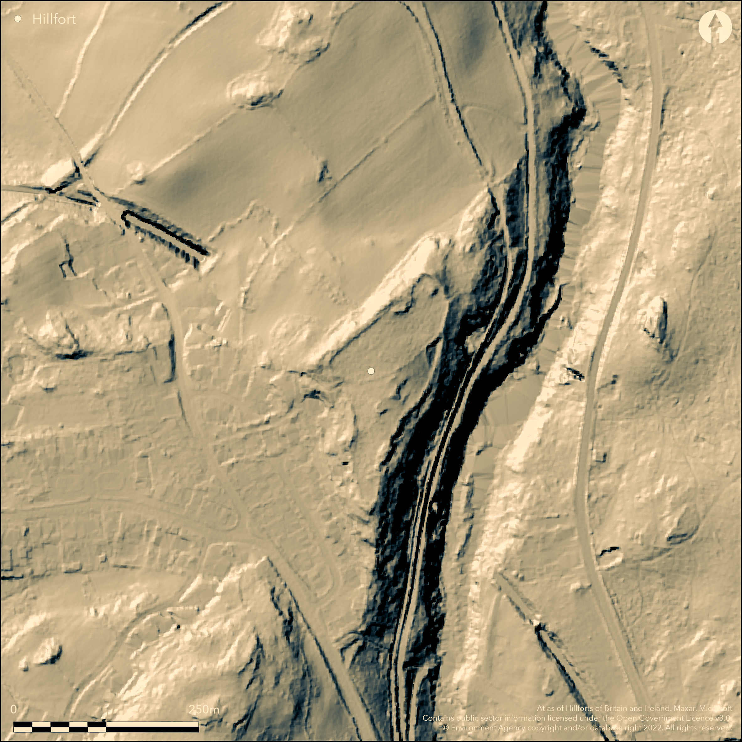
LiDAR 1m DTM Hillshade
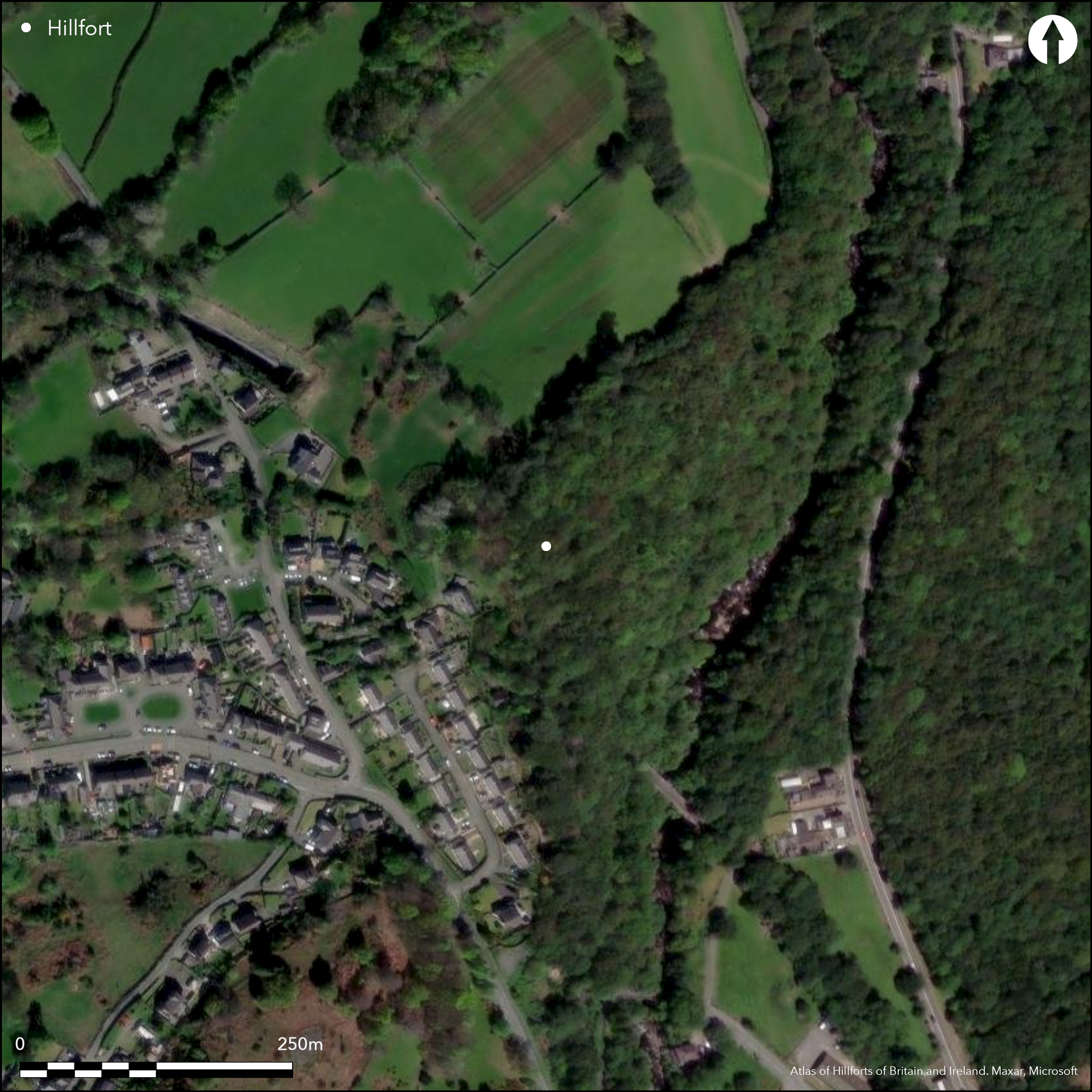
Satellite Imagery
LiDAR 1m DTM Hillshade
Satellite Imagery
Scroll left/right to view further images.
HER: Gwynedd 223 (None)
NMR: SH 66 NW 18 (965348)
SM: CN120
NGR: SH61006805
X: 261000 Y: 368050 (OSGB36)
Univallate partial contour hillfort sited on the end of a NE-facing spur bounded on the NW by a dry valley and just above steep slopes to Afon Ogwen, 0.6km to E. Moderate to strong surrounding slopes to N, S and W, steep to E. Interior area 0.85ha. Formerly surrounded by massive rubble wall to 6m wide on N side where best preserved. Seems absent on SE, but probably just eroded down the steep slope. Entrance at N end of W wall with at least one guard chamber (visible on N side). No interior structure visible. Small excavations in 1976 by GAT (Fasham and White 1992) showed that the rampart to N faced with stone on both the interior and exterior, with rubble core intensely vitrified in places. Possibly had large timbers supporting the wall from inside. C14 dating by GAT showed rampart to be constructed in second or first century BC. A second radiocarbon date from vitrified re-deposited core material from rampart gave Bronze Age date, suggesting that area occupied earlier than the time at which the rampart was built. GAT suggest that, 'as the rampart is structurally of one phase, this early date results from the redeposit of material from an earlier occupation, and does not mean that Pen Dinas is to be added to the list of Bronze Age hillforts'. (GAT, HER 2014). Rampart eventually collapsed outwards downslope. Setting affected by development to W. Woodland, rough upland pasture, scrub and bare rock. Problems with felling damage in 1975 and past windthrow. On 1st Ed. OS map (1889).
Citizen Science: ✗
Reliability of Data: Confirmed
Reliability of Interpretation: Confirmed
X: -454406 Y: 7018464 (EPSG: 3857)
Longitude: -4.081996772190196 Latitude: 53.19130893899328 (EPSG:4326)
Country: Wales
Current County or Unitary Authority: Gwynedd
Historic County: Caernarfonshire
Current Parish/Community/Council/Townland: Llandygai
Setting affected by development to W. Problems with felling damage in 1975 and past windthrow.
| Extant | ✓ |
| Cropmark | ✗ |
| Likely Destroyed | ✗ |
Woodland, rough upland pasture, scrub and bare rock.
| Woodland | ✓ |
| Commercial Forestry Plantation | ✗ |
| Parkland | ✗ |
| Pasture (Grazing) | ✓ |
| Arable | ✗ |
| Scrub/Bracken | ✓ |
| Bare Outcrop | ✗ |
| Heather/Moorland | ✗ |
| Heath | ✗ |
| Built-up | ✗ |
| Coastal Grassland | ✗ |
| Other | ✗ |
Univallate partial contour hillfort sited on a spur just above Afon Ogwen.
| Contour Fort | ✗ |
| Partial Contour Fort | ✓ |
| Promontory Fort | ✗ |
| Hillslope Fort | ✗ |
| Level Terrain Fort | ✗ |
| Marsh Fort | ✗ |
| Multiple Enclosure Fort | ✗ |
| Hilltop | ✗ |
| Coastal Promontory | ✗ |
| Inland Promontory | ✗ |
| Valley Bottom | ✗ |
| Knoll/Hillock/Outcrop | ✗ |
| Ridge | ✗ |
| Cliff/Plateau-edge/Scarp | ✗ |
| Hillslope | ✗ |
| Lowland | ✗ |
| Spur | ✓ |
Dominant Topographic Feature: Spur
| North | ✗ |
| Northeast | ✗ |
| East | ✓ |
| Southeast | ✗ |
| South | ✗ |
| Southwest | ✗ |
| West | ✗ |
| Northwest | ✗ |
| Level | ✗ |
Altitude: 130.0m
N/A
Small excavations in 1976 and C14 dating by GAT showed rampart to be constructed in second or first century BC, with vitrified core of rampart radio-carbon dated to 110 + or - 80 BC. Second radio-carbon date from vitrified re-deposited core material from rampart gave Bronze Age date, suggesting that area occupied earlier than the time at which the rampart was built, GAT suggesting that, as the rampart is structurally of one phase, this early date results from the redeposit of material from an earlier occupation, and does not mean that Pen Dinas is to be added to the list of Bronze Age hillforts. (GAT, HER).
Reliability: B - Medium
| Pre 1200BC | ✗ |
| 1200BC - 800BC | ✗ |
| 800BC - 400BC | ✗ |
| 400BC - AD50 | ✓ |
| AD50 - AD400 | ✗ |
| AD400 - AD 800 | ✗ |
| Post AD800 | ✗ |
| Unknown | ✗ |
| Pre Hillfort: | None |
| Post Hillfort: | None |
| C14: | GAT excavation. |
On 1st Ed. OS map (1889). RCAHMW investigation 1939. Ordnance Survey observation 1969. Small excavations by GAT 1976. GAT investigations 1985, 1991, 1996. GAT planning assessment 2005. GAT prehistoric defended enclosures survey 2004-2005.
| 1st Identified Map Depiction (1889): | OS map. |
| Other (1939): | RCAHMW investigation. |
| Other (1969): | Ordnance Survey observation. |
| Excavation (1976): | GAT |
| Other (2005): | GAT planning assessment. |
| Other (None): | GAT investigations. |
| Other (None): | GAT prehistoric defended enclosures survey. |
Two pits, one possibly holding post. Chance saddle quern found result of windthrow.
Afon Ogwen 0.6km outside fort.
| None | ✓ |
| Spring | ✗ |
| Stream | ✗ |
| Pool | ✗ |
| Flush | ✗ |
| Well | ✗ |
| Other | ✗ |
None
| No Known Features | ✓ |
| Round Stone Structures | ✗ |
| Rectangular Stone Structures | ✗ |
| Curvilinear Platforms | ✗ |
| Other Roundhouse Evidence | ✗ |
| Pits | ✗ |
| Quarry Hollows | ✗ |
| Other | ✗ |
Two pits, one possibly holding post.
| No Known Excavation | ✗ |
| Pits | ✓ |
| Postholes | ✗ |
| Roundhouses | ✗ |
| Rectangular Structures | ✗ |
| Roads/Tracks | ✗ |
| Quarry Hollows | ✗ |
| Other | ✗ |
| Nothing Found | ✗ |
None
| No Known Geophysics | ✓ |
| Pits | ✗ |
| Roundhouses | ✗ |
| Rectangular Structures | ✗ |
| Roads/Tracks | ✗ |
| Quarry Hollows | ✗ |
| Other | ✗ |
| Nothing Found | ✗ |
Chance saddle quern found result of windthrow.
| No Known Finds | ✗ |
| Pottery | ✗ |
| Metal | ✗ |
| Metalworking | ✗ |
| Human Bones | ✗ |
| Animal Bones | ✗ |
| Lithics | ✓ |
| Environmental | ✗ |
| Other | ✗ |
None
| APs Not Checked | ✓ |
| None | ✗ |
| Roundhouses | ✗ |
| Rectangular Structures | ✗ |
| Pits | ✗ |
| Postholes | ✗ |
| Roads/Tracks | ✗ |
| Other | ✗ |
Entrance at N end of W wall with guard chamber (possibly on N side).
| 1: | None |
| 2: | None |
Guard Chambers: ✓
Chevaux de Frise: ✗
| 1. Recesses/Guard Chambers (West): | Possibly on N side. |
| 1. Simple Gap (West): | None |
Formerly surrounded by massive rubble wall to 6m wide and 2m high on N side where best preserved. Seems absent on SE, but probably just eroded down the steep slope.
| Area 1: | 0.85ha. |
| Total: | 0.85ha. |
Total Footprint Area: Noneha.
None
| ✗ | None |
| ✓ | Seems absent on SE, but probably just eroded down the steep slope. |
| NE Quadrant: | 1 |
| SE Quadrant: | 1 |
| SW Quadrant: | 1 |
| NW Quadrant: | 1 |
| Total: | 1 |
| Partial Univallate | ✗ |
| Univallate | ✓ |
| Partial Bivallate | ✗ |
| Bivallate | ✗ |
| Partial Multivallate | ✗ |
| Multivallate | ✗ |
| Unknown | ✗ |
| Partial Univallate | ✗ |
| Univallate | ✗ |
| Partial Bivallate | ✗ |
| Bivallate | ✗ |
| Partial Multivallate | ✗ |
| Multivallate | ✗ |
Massive rubble wall.
| None | ✗ |
| Earthen Bank | ✗ |
| Stone Wall | ✓ |
| Rubble | ✓ |
| Wall-walk | ✗ |
| Evidence of Timber | ✗ |
| Vitrification | ✗ |
| Other Burning | ✗ |
| Palisade | ✗ |
| Counter Scarp Bank | ✗ |
| Berm | ✗ |
| Unfinished | ✗ |
| Other | ✗ |
Small excavations in 1976 by GAT showed that the rampart to N faced with stone on both the interior and exterior, with rubble core intensely vitrified in places. Possibly had large timbers supporting the wall from inside. Vitrification evidence.
| None | ✗ |
| Earthen Bank | ✗ |
| Stone Wall | ✓ |
| Murus Duplex | ✗ |
| Timber-framed | ✓ |
| Timber-laced | ✗ |
| Vitrification | ✓ |
| Other Burning | ✗ |
| Palisade | ✗ |
| Counter Scarp Bank | ✗ |
| Berm | ✗ |
| Unfinished | ✗ |
| No Known Excavation | ✗ |
| Other | ✓ |
| ✗ | None |
| ✗ | None |
Number of Ditches: None
| ✗ | None |
Caffell, G. 1976. Pendinas Hillfort, Cymdeithas Archaeoleg Llandegai a Llanllechid, 2.
Fasham, P. J. and White, R. B. 1992. Pendinas, Llandygai: A section through the defences, Bull Board Celtic Stud, 39 159-166.
RCAHMW 1956. Caernarvonshire Vol I: East, A survey and inventory by the Royal Commission on Ancient and Historical Monuments in Wales and Monmouthshire, No 345, London: HMSO.
Smith, G. 2005. Proposed New Dwelling on Land Adjoining Tal y Cae, Tregarth: Assessment, GAT Report No. 597, Bangor: Gwynedd Archaeological Trust.
Smith, G. H. 2005 , A Survey of Prehistoric Defended Enclosures in North West Wales 2004-2005: West Conwy, Gwynedd (Arfon) and Anglesey, Bangor: Gwynedd Archaeological Trust.
Waddington, K. 2013. The Settlements of Northwest Wales: From the Late Bronze Age to the Early Medieval Period, Cardiff: University of Wales Press.
White, R. B. 1975 Pendinas, Llandegai, Arch in Wales, 15, 29.
White, R. B. 1977. Pendinas, Llandegai, Arch in Wales, 17, 14.
Atlas of Hillforts:
Wikidata:
This work is licensed under CC BY-SA 4.0

 and should be cited as:
Lock, Gary and Ralston, Ian. 2024. Atlas of Hillforts of Britain and Ireland. Available at: https://hillforts.arch.ox.ac.uk
Document Version 1.1