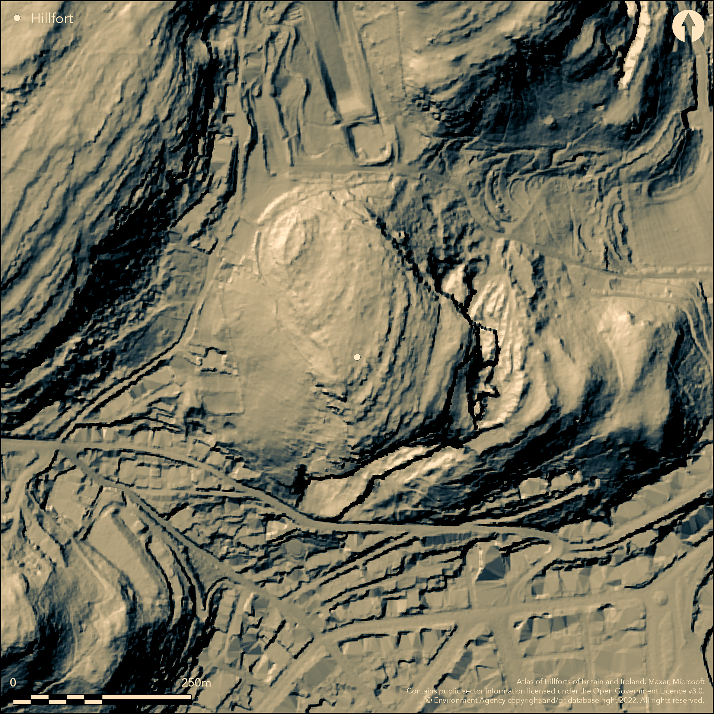
LiDAR 1m DTM Hillshade
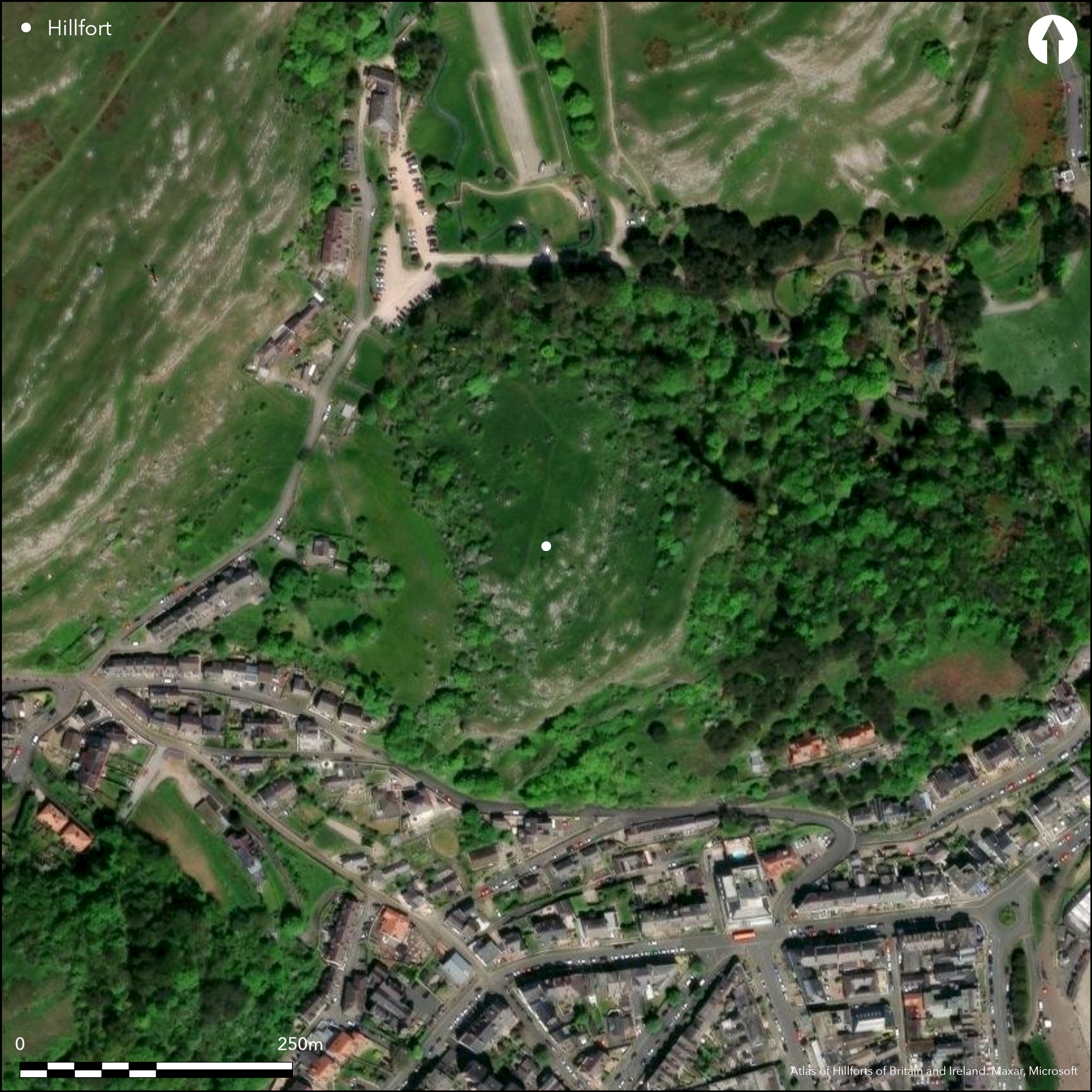
Satellite Imagery
LiDAR 1m DTM Hillshade
Satellite Imagery
Scroll left/right to view further images.
HER: Gwynedd 637 (None)
NMR: SH 78 SE 10 (303125)
SM: CN039
NGR: SH77908295
X: 277900 Y: 382950 (OSGB36)
Fine and complex coastal promontory fort on SE-facing limestone spur of Great Orme's Head overlooking Llandudno Bay. Steep to precipitous surrounding slopes to N, E and S, moderate to Great Orme plateau on W. Measures On NW three lines of works: outermost set at bottom of the slope leading up to the hillfort, and consist of two scarp slopes. Inner is a stone bank or wall built at the top of the slope Inner wall visible on most of W side, around the N side, and half way down the E side. Outer defence best on NW, and may continue round the hill as far as the limit of the inner bank, but no trace on NE. Face of large limestone slabs set on edge exposed in modern break, with precipitous crags and slopes on E and S sides. On NW outer face of the outer scarp dug away, probably in 19th. century, and stone revetment wall 1.8m high built against it to form sheep pens or paddocks. Field walls, paths and modern car park also damaged ramparts. Above a disturbed section to N inner wall broken though in two places by modern paths; most W of these could be an entrance. Possible 65 circular structures in interior, now seen as depressions among the limestone swallets. One of these investigated in 19th. century. Animal bones, limpet and snail shells, deer knife handle, lump of yellow ore, stones and pot boiler and Samian ware fragment found. Amateur excavation 1960 (P. Sirrett, unpublished, see Smith 2011). C14 date of 320-210 cal BC from animal bone (Smith 2011). Ruins of early nineteenth century dry-stone building referred to by RCAHMW inventory (1956), but no further details.
Citizen Science: ✗
Reliability of Data: Confirmed
Reliability of Interpretation: Confirmed
X: -426901 Y: 7044148 (EPSG: 3857)
Longitude: -3.8349136863442626 Latitude: 53.32932649926326 (EPSG:4326)
Country: Wales
Current County or Unitary Authority: Conwy
Historic County: Caernarfonshire
Current Parish/Community/Council/Townland: Llandudno
Much robbed and overgrown with visitor pressure. Setting affected by neighbouring ski run and car park.
| Extant | ✓ |
| Cropmark | ✗ |
| Likely Destroyed | ✓ |
Rough coastal grassland and scrub.
| Woodland | ✗ |
| Commercial Forestry Plantation | ✗ |
| Parkland | ✗ |
| Pasture (Grazing) | ✗ |
| Arable | ✗ |
| Scrub/Bracken | ✓ |
| Bare Outcrop | ✗ |
| Heather/Moorland | ✗ |
| Heath | ✗ |
| Built-up | ✗ |
| Coastal Grassland | ✓ |
| Other | ✗ |
Fine and complex coastal promontory fort on SE-facing limestone spur of Great Orme's Head overlooking Llandudno Bay. Steep to precipitous surrounding slopes to N, E and S, moderate to Great Orme plateau on W.
| Contour Fort | ✗ |
| Partial Contour Fort | ✗ |
| Promontory Fort | ✓ |
| Hillslope Fort | ✗ |
| Level Terrain Fort | ✗ |
| Marsh Fort | ✗ |
| Multiple Enclosure Fort | ✗ |
| Hilltop | ✗ |
| Coastal Promontory | ✓ |
| Inland Promontory | ✗ |
| Valley Bottom | ✗ |
| Knoll/Hillock/Outcrop | ✗ |
| Ridge | ✗ |
| Cliff/Plateau-edge/Scarp | ✗ |
| Hillslope | ✗ |
| Lowland | ✗ |
| Spur | ✓ |
Dominant Topographic Feature: Spur
| North | ✗ |
| Northeast | ✗ |
| East | ✗ |
| Southeast | ✗ |
| South | ✗ |
| Southwest | ✗ |
| West | ✗ |
| Northwest | ✗ |
| Level | ✓ |
Altitude: 121.0m
N/A
C14 date of 320-210 (2 sigma) cal BC from animal bone (Smith 2011).
Reliability: B - Medium
| Pre 1200BC | ✗ |
| 1200BC - 800BC | ✗ |
| 800BC - 400BC | ✗ |
| 400BC - AD50 | ✓ |
| AD50 - AD400 | ✗ |
| AD400 - AD 800 | ✗ |
| Post AD800 | ✗ |
| Unknown | ✗ |
| Pre Hillfort: | None |
| Post Hillfort: | None |
| C14: | None |
Plan by Bezant Lowe (1912). RCAHMW investigation 1948. Ordnance Survey observation 1969. GAT investigations 1969, 1988, 1992, 1993, 1995. GAT prehistoric defended enclosures survey 2004-2005. Amateur excavation 1960 (P. Sirrett, unpublished, see Smith 2011).
| Other (1912): | Plan of Bezant Lowe (1912). |
| Other (1948): | RCAHMW investigation. |
| Excavation (1960): | None |
| Other (1969): | Ordnance Survey observation. |
| Other (1992): | Visited by Hillfort Study Group |
| Other (None): | GAT investigations. |
| Other (None): | GAT prehistoric defended enclosures survey. |
Possible 65 circular structures in interior, now seen as depressions among the limestone swallets. Nineteenth century finds of animal bones, oyster, limpet and snail shells,clay sherd, deer knife handle, stones and pot boiler, lump of yellow ore and Samian ware fragment.
Possible springs below site.
| None | ✓ |
| Spring | ✗ |
| Stream | ✗ |
| Pool | ✗ |
| Flush | ✗ |
| Well | ✗ |
| Other | ✗ |
Possible 65 circular structures in interior, now seen as depressions among the limestone swallets.
| No Known Features | ✗ |
| Round Stone Structures | ✗ |
| Rectangular Stone Structures | ✗ |
| Curvilinear Platforms | ✗ |
| Other Roundhouse Evidence | ✓ |
| Pits | ✗ |
| Quarry Hollows | ✗ |
| Other | ✗ |
None
| No Known Excavation | ✓ |
| Pits | ✗ |
| Postholes | ✗ |
| Roundhouses | ✗ |
| Rectangular Structures | ✗ |
| Roads/Tracks | ✗ |
| Quarry Hollows | ✗ |
| Other | ✗ |
| Nothing Found | ✗ |
None
| No Known Geophysics | ✓ |
| Pits | ✗ |
| Roundhouses | ✗ |
| Rectangular Structures | ✗ |
| Roads/Tracks | ✗ |
| Quarry Hollows | ✗ |
| Other | ✗ |
| Nothing Found | ✗ |
Nineteenth century finds of animal bones, oyster, limpet and snail shells,clay sherd, deer knife handle, stones and pot boiler, lump of yellow ore and Samian ware fragment.
| No Known Finds | ✗ |
| Pottery | ✓ |
| Metal | ✗ |
| Metalworking | ✓ |
| Human Bones | ✗ |
| Animal Bones | ✓ |
| Lithics | ✗ |
| Environmental | ✓ |
| Other | ✗ |
None
| APs Not Checked | ✓ |
| None | ✗ |
| Roundhouses | ✗ |
| Rectangular Structures | ✗ |
| Pits | ✗ |
| Postholes | ✗ |
| Roads/Tracks | ✗ |
| Other | ✗ |
Although no original entrances defined, above a disturbed section to N, inner wall broken though in two places by modern paths; most W of these could be an entrance.
| 3: | None |
| 2: | Possible site only. |
Guard Chambers: ✗
Chevaux de Frise: ✗
| 1. Simple Gap (North): | Inner wall broken though in two places by modern paths; most W of these could be an entrance. |
On NW three lines of defences: outermost set at bottom of the slope leading up to the hillfort, and consist of two scarp slopes. Inner defence is a stone bank or wall built at the top of the slope Inner wall visible on most of W side, around the N side, and half way down the E side. Outer defence best on NW, and may continue round the hill as far as the limit of the inner bank, but no trace on NE. Face of large limestone slabs set on edge exposed in modern break, with precipitous crags and slopes on E and S sides.
| Area 1: | 2.0ha. |
| Total: | 2.0ha. |
Total Footprint Area: Noneha.
None
| ✗ | None |
| ✗ | Precipitous slopes on E and S. |
| NE Quadrant: | 1 |
| SE Quadrant: | 0 |
| SW Quadrant: | 0 |
| NW Quadrant: | 3 |
| Total: | 3 |
| Partial Univallate | ✓ |
| Univallate | ✗ |
| Partial Bivallate | ✗ |
| Bivallate | ✗ |
| Partial Multivallate | ✓ |
| Multivallate | ✗ |
| Unknown | ✗ |
| Partial Univallate | ✗ |
| Univallate | ✗ |
| Partial Bivallate | ✗ |
| Bivallate | ✗ |
| Partial Multivallate | ✗ |
| Multivallate | ✗ |
Inner defence stone bank. Probable stone-walled site.
| None | ✗ |
| Earthen Bank | ✗ |
| Stone Wall | ✓ |
| Rubble | ✗ |
| Wall-walk | ✗ |
| Evidence of Timber | ✗ |
| Vitrification | ✗ |
| Other Burning | ✗ |
| Palisade | ✗ |
| Counter Scarp Bank | ✗ |
| Berm | ✗ |
| Unfinished | ✗ |
| Other | ✗ |
None
| None | ✗ |
| Earthen Bank | ✗ |
| Stone Wall | ✗ |
| Murus Duplex | ✗ |
| Timber-framed | ✗ |
| Timber-laced | ✗ |
| Vitrification | ✗ |
| Other Burning | ✗ |
| Palisade | ✗ |
| Counter Scarp Bank | ✗ |
| Berm | ✗ |
| Unfinished | ✗ |
| No Known Excavation | ✓ |
| Other | ✗ |
| ✗ | None |
| ✓ | None |
Number of Ditches: 1
| ✗ | None |
Muckle, P. 1993 Pen y Dinas Archaeological Survey, GAT Report No. 052, Bangor: Gwynedd Archaeological Trust.
RCAHMW 1956. Caernarvonshire Vol I: East, A survey and inventory by the Royal Commission on Ancient and Historical Monuments in Wales and Monmouthshire, No 367, London: HMSO.
Smith, G. , 2005 , A Survey of Prehistoric Defended Enclosures in North West Wales 2004-2005: West Conwy, Gwynedd (Arfon) and Anglesey, Bangor: Gwynedd Archaeological Trust.
Smith, G. 2011. Re-assessment of two hillforts in North Wales: Pen-y-Dinas, Llandudno, and Caer Seion, Conwy, Arch Wales, 51, 61-78.
Waddington, K. 2013. The Settlements of Northwest Wales: From the Late Bronze Age to the Early Medieval Period, Cardiff: University of Wales Press.
Atlas of Hillforts:
Wikidata:
This work is licensed under CC BY-SA 4.0

 and should be cited as:
Lock, Gary and Ralston, Ian. 2024. Atlas of Hillforts of Britain and Ireland. Available at: https://hillforts.arch.ox.ac.uk
Document Version 1.1