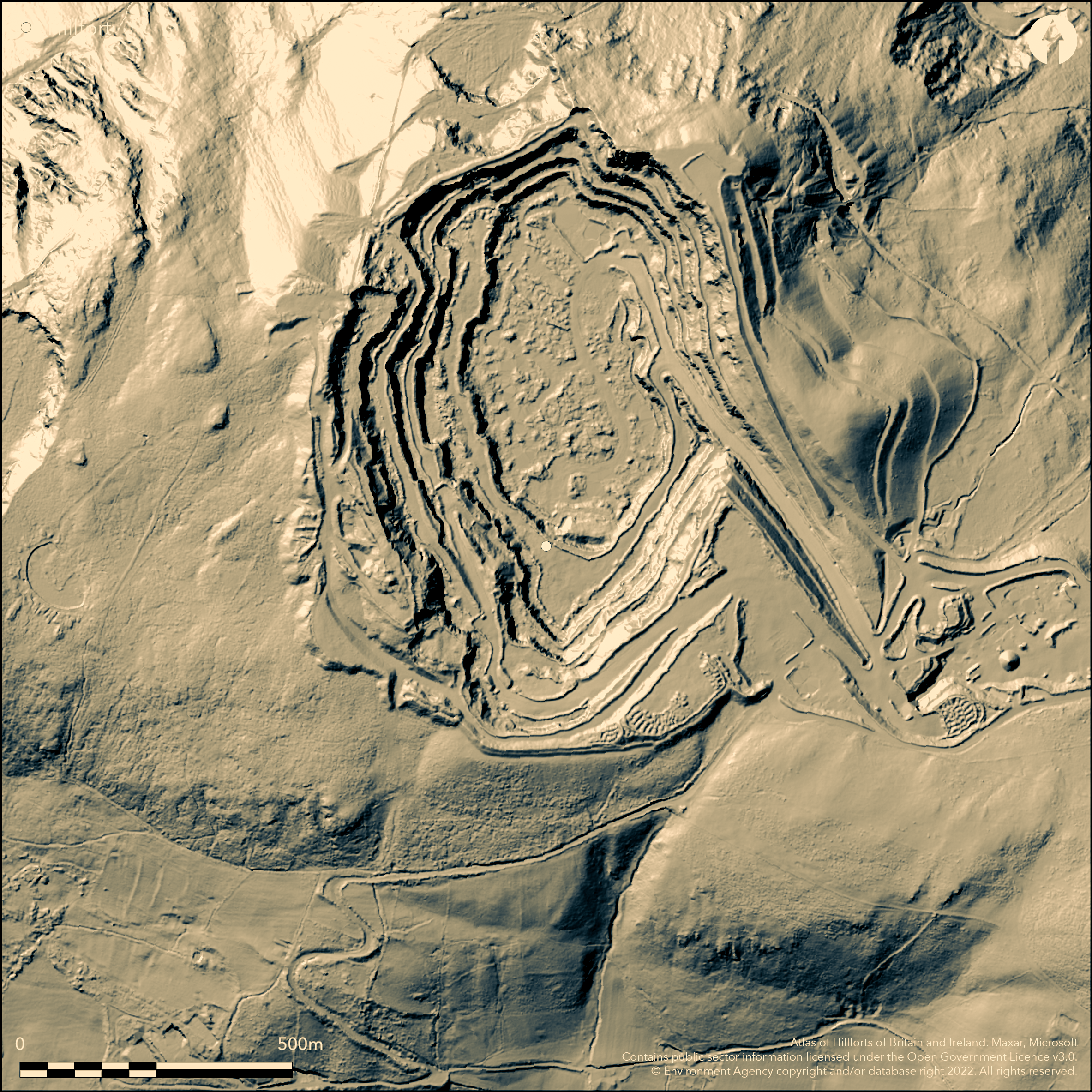
LiDAR 1m DTM Hillshade
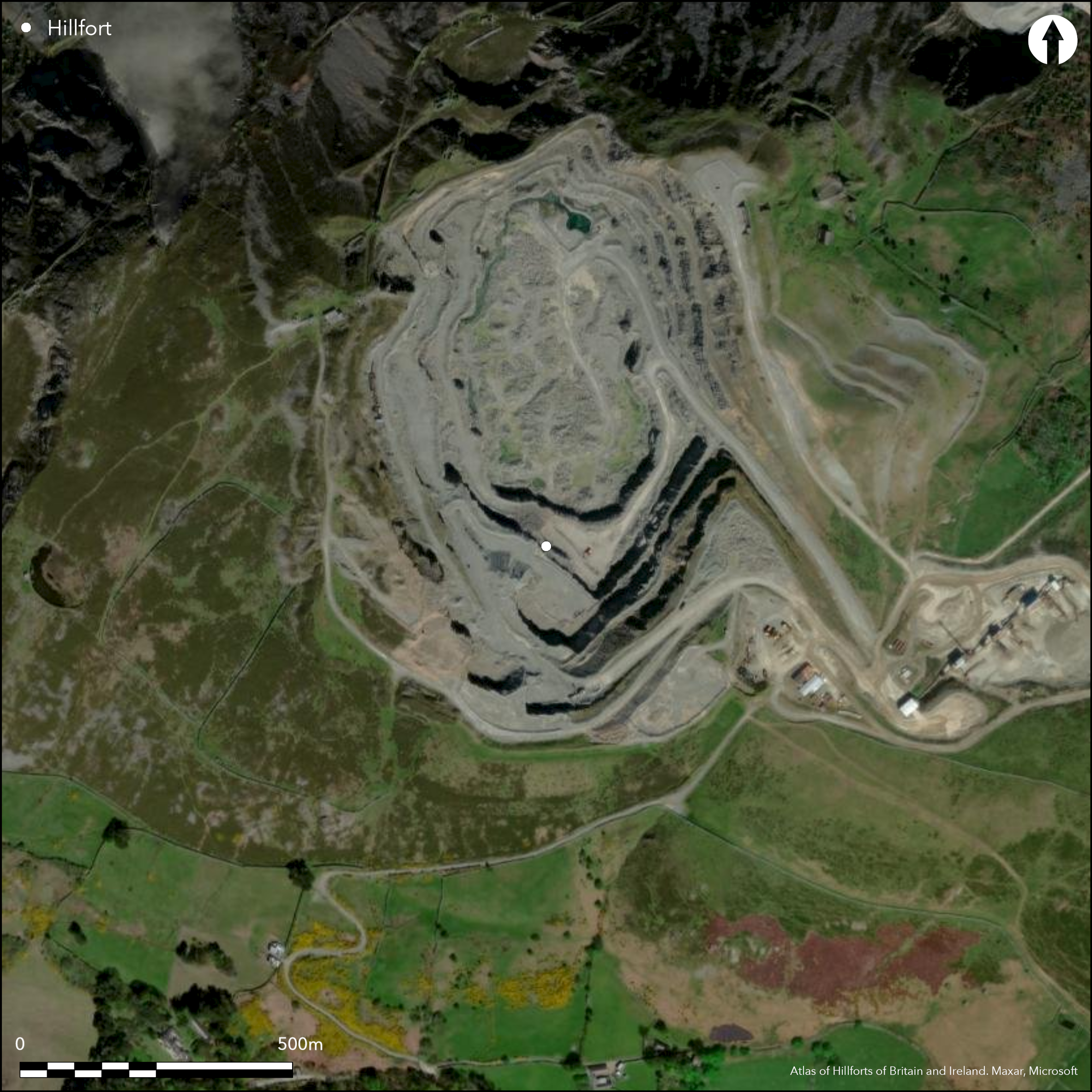
Satellite Imagery
LiDAR 1m DTM Hillshade
Satellite Imagery
Scroll left/right to view further images.
HER: Gwynedd 712 (None)
NMR: SH 77 NW (None)
SM: None
NGR: SH70107530
X: 270100 Y: 375300 (OSGB36)
Formerly, multivallate, probable partial contour hillfort located on granite outcrop of Penmaenmawr, overlooking Conwy Bay, now destroyed by a quarry without adequate modern excavation, this large and high stone-built fort was in an area of outstanding prehistoric landscape including the Neolithic Graig Lwyd stone axe factory. Nearest site is Bryngaer Dinas, Llanfairfechan (Atlas No. 1673) 1.3km away. As result exact details of site cannot be determined, but some information can be gleaned from the part, and early rescue, excavations undertaken by H.H. Hughes in 1920's. The site was defined by up to four massive rough coursed rubble ramparts, with no orthostats identified, no ditches. These rose to c. just under 3m high and to c. 4.5m thick. Some 90 huts mapped, mostly oval in plan and between 3m and 6m diameter, with walls to nearly 2m thick, and standing then to over 1m high. Enclosed 10.2ha. There were probably more and W.G. Haslam had mapped c. 150 in 1877. Finds suggest Romano-British occupation c. AD100-400, but site probably Iron Age and compares with the stone-built sites of the Ll_n, notably Tre'r Ceiri (Atlas No 1685) and Garn Boduan (Atlas No. 1681). Name shown on 1st Ed. Os map (1889) but not outline.
Citizen Science: ✗
Reliability of Data: Confirmed
Reliability of Interpretation: Confirmed
X: -439582 Y: 7031003 (EPSG: 3857)
Longitude: -3.9488341580391126 Latitude: 53.2587431819434 (EPSG:4326)
Country: Wales
Current County or Unitary Authority: Conwy
Historic County: Caernarfonshire
Current Parish/Community/Council/Townland: Penmaenmawr
Totally destroyed by quarry.
| Extant | ✗ |
| Cropmark | ✗ |
| Likely Destroyed | ✓ |
Quarry.
| Woodland | ✗ |
| Commercial Forestry Plantation | ✗ |
| Parkland | ✗ |
| Pasture (Grazing) | ✗ |
| Arable | ✗ |
| Scrub/Bracken | ✗ |
| Bare Outcrop | ✗ |
| Heather/Moorland | ✗ |
| Heath | ✗ |
| Built-up | ✗ |
| Coastal Grassland | ✗ |
| Other | ✓ |
Formerly, multivallate, probable partial contour hillfort located on granite outcrop of Penmaenmawr, overlooking Conwy Bay, now destroyed by quarry.
| Contour Fort | ✗ |
| Partial Contour Fort | ✓ |
| Promontory Fort | ✗ |
| Hillslope Fort | ✗ |
| Level Terrain Fort | ✗ |
| Marsh Fort | ✗ |
| Multiple Enclosure Fort | ✗ |
| Hilltop | ✓ |
| Coastal Promontory | ✗ |
| Inland Promontory | ✗ |
| Valley Bottom | ✗ |
| Knoll/Hillock/Outcrop | ✗ |
| Ridge | ✗ |
| Cliff/Plateau-edge/Scarp | ✗ |
| Hillslope | ✗ |
| Lowland | ✗ |
| Spur | ✗ |
Dominant Topographic Feature: Hill top
| North | ✗ |
| Northeast | ✗ |
| East | ✗ |
| Southeast | ✓ |
| South | ✗ |
| Southwest | ✗ |
| West | ✗ |
| Northwest | ✗ |
| Level | ✗ |
Altitude: 466.0m
N/A
Dated by excavation to between AD100-400, and probably of single period construction. Roman pottery and coins, found in 1922, suggest either long period of occupation, or Romano-British or Roman re-use of Iron Age site similar to Dinorben to E (Atlas No. 1168), but not proven and only conjecture. Four cairns on summit and another to W.
Reliability: B - Medium
| Pre 1200BC | ✗ |
| 1200BC - 800BC | ✗ |
| 800BC - 400BC | ✗ |
| 400BC - AD50 | ✓ |
| AD50 - AD400 | ✓ |
| AD400 - AD 800 | ✗ |
| Post AD800 | ✗ |
| Unknown | ✗ |
| Pre Hillfort: | None |
| Post Hillfort: | None |
| Artefactual: | Pottery and coins. |
Mention in Cambrian Travellers Guide - no details. Name shown on 1st Ed. OS map (1889) but not outline. Excavations H.H. Hughes 1920's. Ordnance Survey observations 1948, 1952, 1969, 1970.
| 1st Identified Written Reference (1813): | Mention in Cambrian Travellers Guide - no details. |
| 1st Identified Map Depiction (1889): | OS map. |
| Excavation (None): | H.H. Hughes |
| Other (None): | Ordnance Survey observations. |
Some 90 hut sites identified (possibly more). Roman Samian ware pottery and four to six coins found 1922. All found between mid and outer ramparts. Also saddle querns, but no rotary.
Possible well on summit of site.
| None | ✗ |
| Spring | ✗ |
| Stream | ✗ |
| Pool | ✗ |
| Flush | ✗ |
| Well | ✓ |
| Other | ✗ |
Some 90 stone huts mapped, mostly oval in plan and between 3m and 6m diameter, with walls to nearly 2m thick, and standing then to over 1m high.
| No Known Features | ✗ |
| Round Stone Structures | ✓ |
| Rectangular Stone Structures | ✗ |
| Curvilinear Platforms | ✓ |
| Other Roundhouse Evidence | ✓ |
| Pits | ✗ |
| Quarry Hollows | ✗ |
| Other | ✗ |
Huts identified.
| No Known Excavation | ✗ |
| Pits | ✗ |
| Postholes | ✗ |
| Roundhouses | ✓ |
| Rectangular Structures | ✗ |
| Roads/Tracks | ✗ |
| Quarry Hollows | ✗ |
| Other | ✗ |
| Nothing Found | ✗ |
None
| No Known Geophysics | ✓ |
| Pits | ✗ |
| Roundhouses | ✗ |
| Rectangular Structures | ✗ |
| Roads/Tracks | ✗ |
| Quarry Hollows | ✗ |
| Other | ✗ |
| Nothing Found | ✗ |
Roman Samian ware pottery and four to six coins found 1922. All found between mid and outer ramparts. Also saddle querns, but no rotary.
| No Known Finds | ✗ |
| Pottery | ✓ |
| Metal | ✗ |
| Metalworking | ✗ |
| Human Bones | ✗ |
| Animal Bones | ✗ |
| Lithics | ✗ |
| Environmental | ✗ |
| Other | ✓ |
None
| APs Not Checked | ✓ |
| None | ✗ |
| Roundhouses | ✗ |
| Rectangular Structures | ✗ |
| Pits | ✗ |
| Postholes | ✗ |
| Roads/Tracks | ✗ |
| Other | ✗ |
Total possible gaps in outer wall - Two in S; one in W and one in WNW. One gap in inner wall in SW quadrant. Possible entrances, on S and W, but conjecture only.
| 5: | Total possible gaps in outer wall - Two in S; one in W and one in WNW. One gap in inner wall in SW quadrant. |
| 2: | Possible entrances, but conjecture only. |
Guard Chambers: ✗
Chevaux de Frise: ✗
| 1. Simple Gap (South): | Most likely. |
| 2. Simple Gap (West): | Possible. |
Site destroyed, but site was defined by up to four massive rough coursed rubble ramparts, with no orthostats identified, no ditches. These rose to c. just under 3m high and to c. 4.5m thick.
| Area 1: | 10.2ha. |
| Total: | 10.2ha. |
Total Footprint Area: Noneha.
None
| ✗ | None |
| ✓ | Quadrants estimated at 1920's state. |
| NE Quadrant: | 4 |
| SE Quadrant: | 3 |
| SW Quadrant: | 3 |
| NW Quadrant: | 4 |
| Total: | 4 |
| Partial Univallate | ✗ |
| Univallate | ✗ |
| Partial Bivallate | ✗ |
| Bivallate | ✗ |
| Partial Multivallate | ✗ |
| Multivallate | ✓ |
| Unknown | ✗ |
| Partial Univallate | ✗ |
| Univallate | ✗ |
| Partial Bivallate | ✗ |
| Bivallate | ✗ |
| Partial Multivallate | ✗ |
| Multivallate | ✗ |
None
| None | ✓ |
| Earthen Bank | ✗ |
| Stone Wall | ✗ |
| Rubble | ✗ |
| Wall-walk | ✗ |
| Evidence of Timber | ✗ |
| Vitrification | ✗ |
| Other Burning | ✗ |
| Palisade | ✗ |
| Counter Scarp Bank | ✗ |
| Berm | ✗ |
| Unfinished | ✗ |
| Other | ✗ |
The site was defined by up to four massive rough coursed rubble ramparts, with no orthostats identified.
| None | ✗ |
| Earthen Bank | ✗ |
| Stone Wall | ✓ |
| Murus Duplex | ✗ |
| Timber-framed | ✗ |
| Timber-laced | ✗ |
| Vitrification | ✗ |
| Other Burning | ✗ |
| Palisade | ✗ |
| Counter Scarp Bank | ✗ |
| Berm | ✗ |
| Unfinished | ✗ |
| No Known Excavation | ✗ |
| Other | ✓ |
| ✗ | None |
| ✗ | None defined. |
Number of Ditches: 0
| ✗ | None |
Houlder, C. 1973. Wales: an archaeological guide, London: Faber and Faber, 62.
Hughes, H.H. 1861. Hill at Braich Y Dinas, Arch Camb, 149-50.
Hughes, H.H. 1912. Prehistoric Remains on Penmaen Mawr (Braich Y Dinas), Arch Camb, 6th Series XII, 169-82.
Hughes, H.H. 1913 Prehistoric Remains on Penmaen Mawr (Braich Y Dinas), ArchCamb 6th Series, XIII, 353-66.
Hughes, H.H. 1915 Prehistoric Remains on Penmaen Mawr (Braich Y Dinas), Arch Camb, 6th Series, XV, 17-39.
Hughes, H.H. 1922 Prehistoric Remains on Penmaen Mawr (Braich Y Dinas), Arch Camb, LXXVII, 346-59.
Hughes, H.H. 1923 Prehistoric Remains on Penmaen Mawr (Braich y Dinas), Arch Camb, LXXVIII, 243-68.
Hughes, H.H. 1934. Hillfort Braich Y Dinas, Archaeologia Cambrensis, P174
RCAHMW 1956. Caernarvonshire Vol I: East, A survey and inventory by the Royal Commission on Ancient and Historical Monuments in Wales and Monmouthshire, No 252, London: HMSO.
Williams, J. LL. and Davidson, A. 2002. Arch in Wales, 42, 3-15.
Atlas of Hillforts:
Wikidata:
This work is licensed under CC BY-SA 4.0

 and should be cited as:
Lock, Gary and Ralston, Ian. 2024. Atlas of Hillforts of Britain and Ireland. Available at: https://hillforts.arch.ox.ac.uk
Document Version 1.1