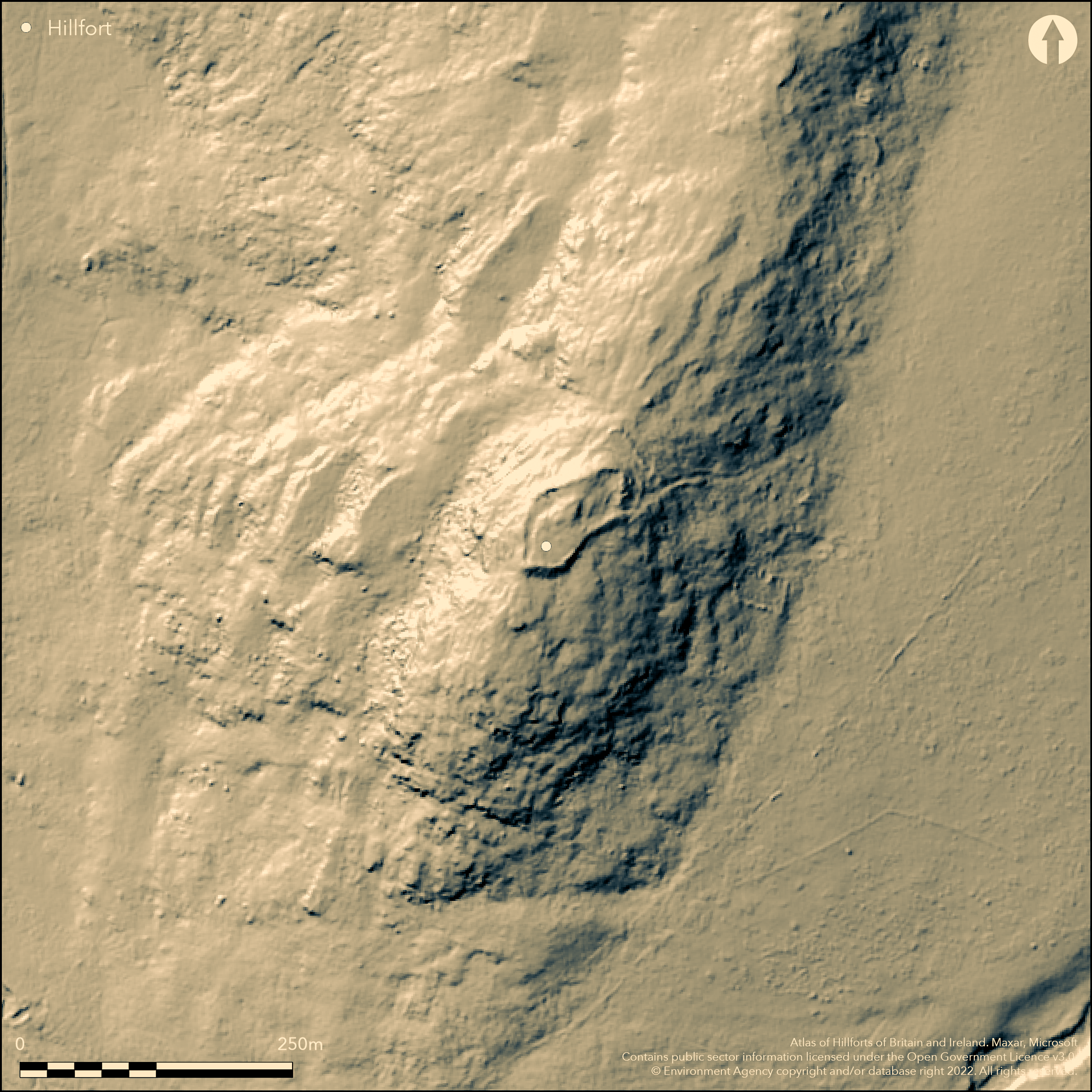
LiDAR 1m DTM Hillshade
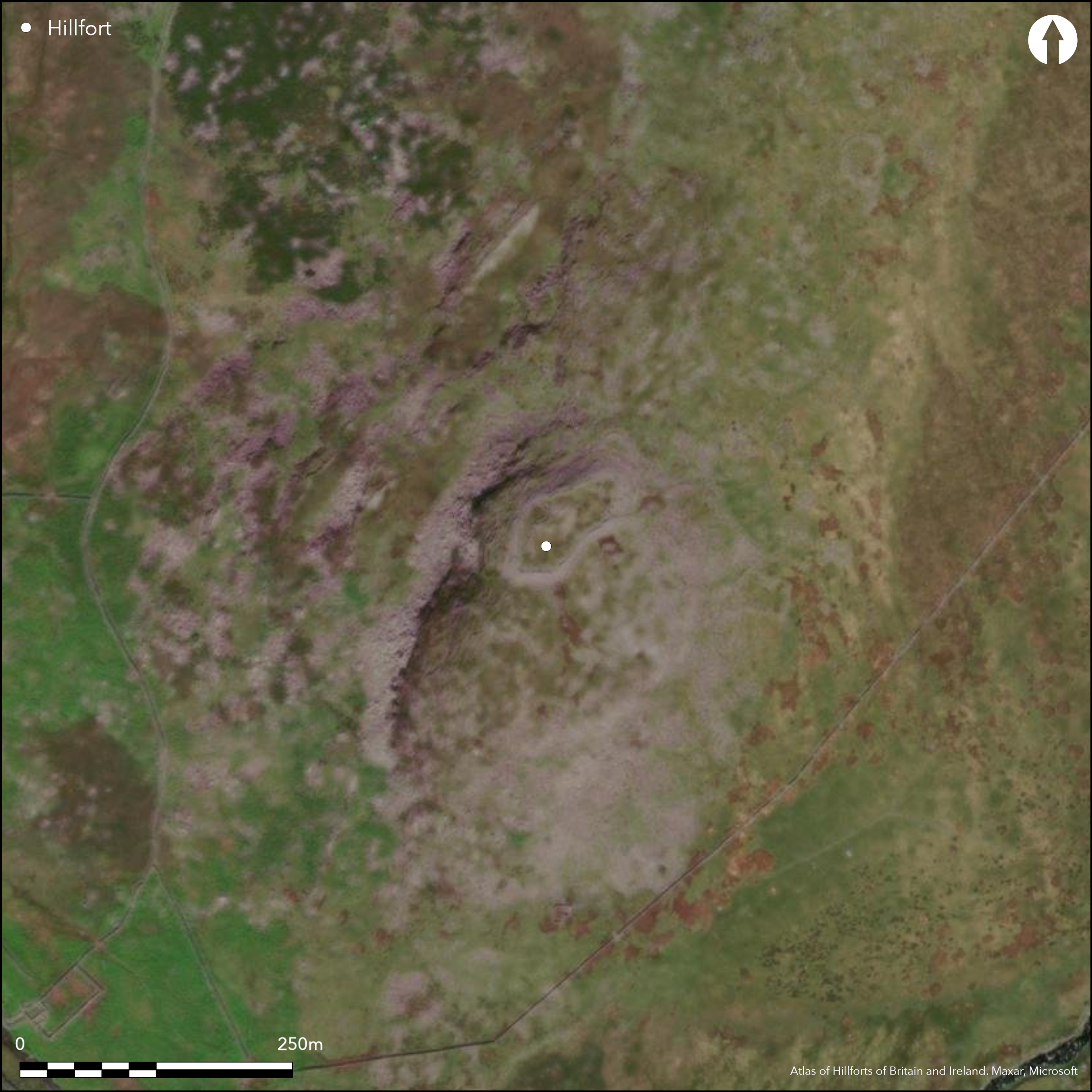
Satellite Imagery
LiDAR 1m DTM Hillshade
Satellite Imagery
Scroll left/right to view further images.
HER: Gwynedd 1107 (None)
NMR: SH 62 SW 5 (55991)
SM: ME020
NGR: SH62432300
X: 262430 Y: 323000 (OSGB36)
Small partial contour hillfort located on a rocky knoll of spur high above the deep Afon Ysgethin stream valley to E and S. Surrounding slopes steep to N and S, moderate to strong to E and W very steep. Small knoll, c. 91 m long by 46 m wide, with internal area 0.19ha, almost continuous circuit of massive dry-stone wall c. 2.4 m thick, but now mainly a collapsed and jumbled scree and inside of circuit obscured by a modern inside stone wall, although well-preserved section of outer face visible to the S and SE. The construction is similar to Craig y Castell I near Llyn Gwernan (Atlas No.1695) , with a double face to the wall in the S and SW corners, as well as entrance design. At N end two extra lines of weak walling outworks face the neck of land joining the spur with main mountain mass. Curving around to S and linking with N entrance wall, probably stock enclosures. No ditches. Elaborate and impressive entrance on SE side a particular feature, with wall on SE curving outwards to form a bastion flanking an oblique narrow passage. Stone clearance and walling for approach trackway visible to E and SE of entrance. A grassy shelf in the interior could have been the site of some structure, albeit temporary. Signs of shepherds huts here and there in the walling, but no hut circles, though many in surrounding district and five hut circles lie below it to E. Foundations of three or four huts visible in the main wall of fort and a few cavities indicate mural chambers, but date of all these features uncertain and could be modern. Between the inner and second ramparts, not far from the gateway of the fort are the remains of a structure and outside the second rampart, built partly into its face is another of a similar size, dates uncertain. Craggy rough grazing with much bare rock. On 1st Ed. OS map (1888-89). Minimal investigations, undated.
Citizen Science: ✗
Reliability of Data: Confirmed
Reliability of Interpretation: Confirmed
X: -449890 Y: 6943690 (EPSG: 3857)
Longitude: -4.041428496429881 Latitude: 52.78696960023856 (EPSG:4326)
Country: Wales
Current County or Unitary Authority: Gwynedd
Historic County: Merioneth
Current Parish/Community/Council/Townland: Dyffryn Ardudwy
Modern stone wall, built within, obscures the inside of the dry-stone circuit.
| Extant | ✓ |
| Cropmark | ✗ |
| Likely Destroyed | ✗ |
Craggy rough grazing with much bare rock.
| Woodland | ✗ |
| Commercial Forestry Plantation | ✗ |
| Parkland | ✗ |
| Pasture (Grazing) | ✗ |
| Arable | ✗ |
| Scrub/Bracken | ✓ |
| Bare Outcrop | ✗ |
| Heather/Moorland | ✗ |
| Heath | ✗ |
| Built-up | ✗ |
| Coastal Grassland | ✗ |
| Other | ✗ |
Small partial contour hillfort located on a rocky knoll of spur high above the Afon Ysgethin stream valley to E and S. Surrounding slopes steep to N and S, moderate to strong to E and W very steep.
| Contour Fort | ✓ |
| Partial Contour Fort | ✗ |
| Promontory Fort | ✗ |
| Hillslope Fort | ✗ |
| Level Terrain Fort | ✗ |
| Marsh Fort | ✗ |
| Multiple Enclosure Fort | ✗ |
| Hilltop | ✗ |
| Coastal Promontory | ✗ |
| Inland Promontory | ✗ |
| Valley Bottom | ✗ |
| Knoll/Hillock/Outcrop | ✗ |
| Ridge | ✗ |
| Cliff/Plateau-edge/Scarp | ✗ |
| Hillslope | ✗ |
| Lowland | ✗ |
| Spur | ✓ |
Dominant Topographic Feature: Spur knoll
| North | ✗ |
| Northeast | ✗ |
| East | ✗ |
| Southeast | ✗ |
| South | ✗ |
| Southwest | ✓ |
| West | ✗ |
| Northwest | ✗ |
| Level | ✓ |
Altitude: 350.0m
N/A
None
Reliability: D - None
| Pre 1200BC | ✗ |
| 1200BC - 800BC | ✗ |
| 800BC - 400BC | ✗ |
| 400BC - AD50 | ✗ |
| AD50 - AD400 | ✗ |
| AD400 - AD 800 | ✗ |
| Post AD800 | ✗ |
| Unknown | ✓ |
| Pre Hillfort: | None |
| Post Hillfort: | None |
On 1st Ed. OS map (1888-89). GAT investigations 1982, 1988. GAT prehistoric defended enclosures survey 2005-2006.
| Other (1985): | Visited by Hillfort Study Group |
| 1st Identified Map Depiction (None): | OS map. |
| Other (None): | GAT investigations. |
| Other (None): | GAT prehistoric defended enclosures survey. |
Grassy shelf inside NW wall in the interior could have been the site of some structure, albeit temporary. Foundations of three or four huts visible in the main wall of fort and a few cavities indicate mural chambers, but date of all these features uncertain and could be modern. Between inner and second ramparts near are the remains of structure c. 2m plus long x nearly 1m wide internally, and outside the second rampart, built partly into its face is another of a similar size. Dates of both of these uncertain.
Stream 0.3km outside fort.
| None | ✓ |
| Spring | ✗ |
| Stream | ✗ |
| Pool | ✗ |
| Flush | ✗ |
| Well | ✗ |
| Other | ✗ |
Grassy shelf inside NW wall could have been the site of some structure, albeit temporary. Foundations of three or four huts visible in the main wall of fort and a few cavities indicate mural chambers, but date of all these features uncertain and could be modern. Between inner and second ramparts near are the remains of structure c. 2m long by nearly 1m wide internally, and outside the second rampart, built partly into its face is another of a similar size. Dates of both of these uncertain.
| No Known Features | ✗ |
| Round Stone Structures | ✗ |
| Rectangular Stone Structures | ✗ |
| Curvilinear Platforms | ✓ |
| Other Roundhouse Evidence | ✗ |
| Pits | ✗ |
| Quarry Hollows | ✗ |
| Other | ✓ |
None
| No Known Excavation | ✓ |
| Pits | ✗ |
| Postholes | ✗ |
| Roundhouses | ✗ |
| Rectangular Structures | ✗ |
| Roads/Tracks | ✗ |
| Quarry Hollows | ✗ |
| Other | ✗ |
| Nothing Found | ✗ |
None
| No Known Geophysics | ✓ |
| Pits | ✗ |
| Roundhouses | ✗ |
| Rectangular Structures | ✗ |
| Roads/Tracks | ✗ |
| Quarry Hollows | ✗ |
| Other | ✗ |
| Nothing Found | ✗ |
None
| No Known Finds | ✓ |
| Pottery | ✗ |
| Metal | ✗ |
| Metalworking | ✗ |
| Human Bones | ✗ |
| Animal Bones | ✗ |
| Lithics | ✗ |
| Environmental | ✗ |
| Other | ✗ |
None
| APs Not Checked | ✓ |
| None | ✗ |
| Roundhouses | ✗ |
| Rectangular Structures | ✗ |
| Pits | ✗ |
| Postholes | ✗ |
| Roads/Tracks | ✗ |
| Other | ✗ |
Elaborate and impressive entrance on SE side a particular feature, with wall on SE curving outwards to form a bastion flanking an oblique narrow passage. Stone clearance and walling for approach trackway visible to E and SE of entrance.
| None: | No estimate as detail obscured. |
| 2: | None |
Guard Chambers: ✗
Chevaux de Frise: ✗
| 1. Passage-way/Corridor (South east): | Flanking bastion. |
| 1. Oblique (South east): | Oblique narrow passage. |
lmost continuous circuit of massive dry-stone wall c. 2.4 m thick, but now mainly a collapsed and jumbled scree and inside of circuit obscured by a modern inside stone wall, although well-preserved section of outer face visible to the S and SE. . At N end two extra lines of weak walling face the neck of land joining the spur with main mountain mass. Curving around to S and linking with N entrance wall, probably stock enclosures. No ditches. 0.19ha.
| Area 1: | 0.19ha. |
| Total: | 0.19ha. |
Total Footprint Area: Noneha.
None
| ✗ | None |
| ✓ | Two outworks to NE. |
| NE Quadrant: | 1 |
| SE Quadrant: | 1 |
| SW Quadrant: | 1 |
| NW Quadrant: | 1 |
| Total: | 1 |
| Partial Univallate | ✗ |
| Univallate | ✓ |
| Partial Bivallate | ✗ |
| Bivallate | ✗ |
| Partial Multivallate | ✗ |
| Multivallate | ✗ |
| Unknown | ✗ |
| Partial Univallate | ✗ |
| Univallate | ✗ |
| Partial Bivallate | ✗ |
| Bivallate | ✗ |
| Partial Multivallate | ✗ |
| Multivallate | ✗ |
None
| None | ✗ |
| Earthen Bank | ✗ |
| Stone Wall | ✓ |
| Rubble | ✓ |
| Wall-walk | ✗ |
| Evidence of Timber | ✗ |
| Vitrification | ✗ |
| Other Burning | ✗ |
| Palisade | ✗ |
| Counter Scarp Bank | ✗ |
| Berm | ✗ |
| Unfinished | ✗ |
| Other | ✗ |
None
| None | ✗ |
| Earthen Bank | ✗ |
| Stone Wall | ✗ |
| Murus Duplex | ✗ |
| Timber-framed | ✗ |
| Timber-laced | ✗ |
| Vitrification | ✗ |
| Other Burning | ✗ |
| Palisade | ✗ |
| Counter Scarp Bank | ✗ |
| Berm | ✗ |
| Unfinished | ✗ |
| No Known Excavation | ✓ |
| Other | ✗ |
| ✗ | None |
| ✗ | None |
Number of Ditches: 0
| ✗ | None |
Bowen E.G. and Gresham, C.A. 1967. History of Merioneth, 1, Dolgellau, 158-60.
RCAHMW 1921. An inventory of the ancient monuments in Wales and Monmouthshire, VI, County of Merioneth, 263, London: HMSO.
Smith, G.H. 2006. A survey of prehistoric defended enclosures in north-west Wales 2005-2006: Gwynedd Dwyfor and Meirionnydd. Report No 634. Part I: Survey Report. Bangor: Gwynedd Archaeological Trust.
Waddington, K. 2013. The Settlements of Northwest Wales: From the Late Bronze Age to the Early Medieval Period, Cardiff: University of Wales Press.
Atlas of Hillforts:
Wikidata:
This work is licensed under CC BY-SA 4.0

 and should be cited as:
Lock, Gary and Ralston, Ian. 2024. Atlas of Hillforts of Britain and Ireland. Available at: https://hillforts.arch.ox.ac.uk
Document Version 1.1