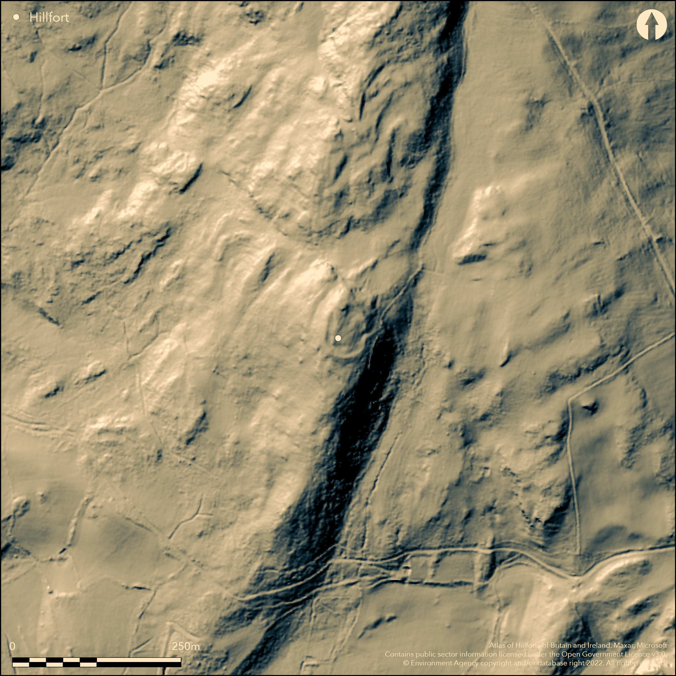
LiDAR 1m DTM Hillshade
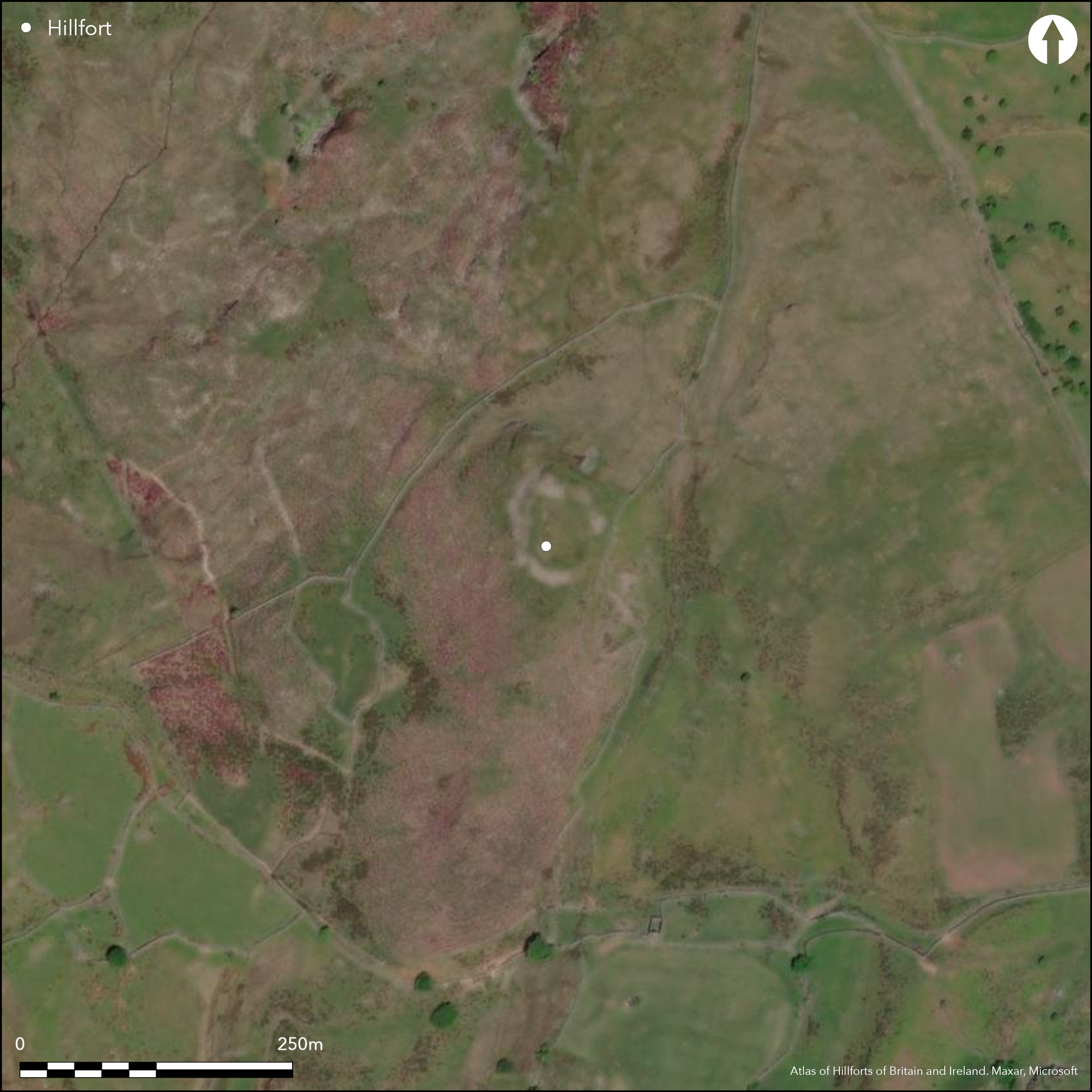
Satellite Imagery
LiDAR 1m DTM Hillshade
Satellite Imagery
Scroll left/right to view further images.
HER: Gwynedd 1119 (None)
NMR: SH 62 SE 1 (302891)
SM: ME138
NGR: SH65072042
X: 265070 Y: 320420 (OSGB36)
Small hillfort located on a prominent, high and steep spur at the top of the gorge of the Afon Dwynant above the Mawddach Estuary. Steep surrounding slopes. Measures c.78m by 43m, with interior area 0.15ha. Single wall circa 1.5 m wide built of small stones set to an inner and outer face and now a reduced to its foundations visible as a tumbled scree. No ditch. No structures visible in the interior, but just to E of the summit a recess near the wall is a possible site. Entrance on E cutting obliquely into the fort. Wall thickened on each side of it and faced with large stones. Slope beyond wall on N probably scarped and bastion or small platform built half way down. Site resembles other forts in the vicinity; eg. Craig y Castell (Atlas No. 695) and Criag y Ddinas (Atlas No.1705). Recess against wall near N end only possible habitation site. Craggy upland rough grazing and bare rock. Walls now reduced to tumbled scree. On 1st Ed. OS map (1888-89). Minimal investigations, undated.
Citizen Science: ✗
Reliability of Data: Confirmed
Reliability of Interpretation: Confirmed
X: -445416 Y: 6939547 (EPSG: 3857)
Longitude: -4.00124336920624 Latitude: 52.76445719181839 (EPSG:4326)
Country: Wales
Current County or Unitary Authority: Gwynedd
Historic County: Merioneth
Current Parish/Community/Council/Townland: Llanelltyd
Walls now reduced to tumbled scree.
| Extant | ✓ |
| Cropmark | ✗ |
| Likely Destroyed | ✗ |
Craggy upland rough grazing and bare rock.
| Woodland | ✗ |
| Commercial Forestry Plantation | ✗ |
| Parkland | ✗ |
| Pasture (Grazing) | ✓ |
| Arable | ✗ |
| Scrub/Bracken | ✗ |
| Bare Outcrop | ✗ |
| Heather/Moorland | ✗ |
| Heath | ✗ |
| Built-up | ✗ |
| Coastal Grassland | ✗ |
| Other | ✗ |
Small hillfort located on a prominent, high and steep spur at the top of the gorge of the Afon Dwynant above the Mawddach Estuary. Steep surrounding slopes.
| Contour Fort | ✓ |
| Partial Contour Fort | ✗ |
| Promontory Fort | ✗ |
| Hillslope Fort | ✗ |
| Level Terrain Fort | ✗ |
| Marsh Fort | ✗ |
| Multiple Enclosure Fort | ✗ |
| Hilltop | ✗ |
| Coastal Promontory | ✗ |
| Inland Promontory | ✗ |
| Valley Bottom | ✗ |
| Knoll/Hillock/Outcrop | ✗ |
| Ridge | ✗ |
| Cliff/Plateau-edge/Scarp | ✗ |
| Hillslope | ✗ |
| Lowland | ✗ |
| Spur | ✓ |
Dominant Topographic Feature: Spur
| North | ✗ |
| Northeast | ✗ |
| East | ✗ |
| Southeast | ✗ |
| South | ✗ |
| Southwest | ✗ |
| West | ✗ |
| Northwest | ✗ |
| Level | ✓ |
Altitude: 300.0m
N/A
None
Reliability: D - None
| Pre 1200BC | ✗ |
| 1200BC - 800BC | ✗ |
| 800BC - 400BC | ✗ |
| 400BC - AD50 | ✗ |
| AD50 - AD400 | ✗ |
| AD400 - AD 800 | ✗ |
| Post AD800 | ✗ |
| Unknown | ✓ |
| Pre Hillfort: | None |
| Post Hillfort: | None |
On 1st Ed. OS map (1888-89). GAT prehistoric defended enclosures survey 2005-2006.
| 1st Identified Map Depiction (None): | OS map. |
| Other (None): | GAT prehistoric defended enclosures survey. |
Recess against wall near N end only possible habitation site.
None
| None | ✓ |
| Spring | ✗ |
| Stream | ✗ |
| Pool | ✗ |
| Flush | ✗ |
| Well | ✗ |
| Other | ✗ |
Recess against wall near N end only possible habitation site.
| No Known Features | ✗ |
| Round Stone Structures | ✗ |
| Rectangular Stone Structures | ✗ |
| Curvilinear Platforms | ✗ |
| Other Roundhouse Evidence | ✗ |
| Pits | ✗ |
| Quarry Hollows | ✗ |
| Other | ✓ |
None
| No Known Excavation | ✓ |
| Pits | ✗ |
| Postholes | ✗ |
| Roundhouses | ✗ |
| Rectangular Structures | ✗ |
| Roads/Tracks | ✗ |
| Quarry Hollows | ✗ |
| Other | ✗ |
| Nothing Found | ✗ |
None
| No Known Geophysics | ✓ |
| Pits | ✗ |
| Roundhouses | ✗ |
| Rectangular Structures | ✗ |
| Roads/Tracks | ✗ |
| Quarry Hollows | ✗ |
| Other | ✗ |
| Nothing Found | ✗ |
None
| No Known Finds | ✓ |
| Pottery | ✗ |
| Metal | ✗ |
| Metalworking | ✗ |
| Human Bones | ✗ |
| Animal Bones | ✗ |
| Lithics | ✗ |
| Environmental | ✗ |
| Other | ✗ |
None
| APs Not Checked | ✓ |
| None | ✗ |
| Roundhouses | ✗ |
| Rectangular Structures | ✗ |
| Pits | ✗ |
| Postholes | ✗ |
| Roads/Tracks | ✗ |
| Other | ✗ |
Entrance on the E cutting obliquely into the fort. Wall thickened on each side of it and faced with large stones.
| None: | No estimate as tumbled walls. |
| 2: | None |
Guard Chambers: ✗
Chevaux de Frise: ✗
| 1. Oblique (East): | Gap cuts obliquely into fort. |
Single wall circa 1.5 m wide built of small stones set to an inner and outer face and now a reduced to its foundations visible as a tumbled scree. No ditch. 0.15ha.
| Area 1: | 0.15ha. |
| Total: | 0.15ha. |
Total Footprint Area: Noneha.
None
| ✗ | None |
| ✓ | None |
| NE Quadrant: | 1 |
| SE Quadrant: | 1 |
| SW Quadrant: | 1 |
| NW Quadrant: | 1 |
| Total: | 1 |
| Partial Univallate | ✗ |
| Univallate | ✓ |
| Partial Bivallate | ✗ |
| Bivallate | ✗ |
| Partial Multivallate | ✗ |
| Multivallate | ✗ |
| Unknown | ✗ |
| Partial Univallate | ✗ |
| Univallate | ✗ |
| Partial Bivallate | ✗ |
| Bivallate | ✗ |
| Partial Multivallate | ✗ |
| Multivallate | ✗ |
Stone-walled/rubble site. Slope beyond wall on N probably scarped and bastion or small platform built half way down.
| None | ✗ |
| Earthen Bank | ✗ |
| Stone Wall | ✓ |
| Rubble | ✓ |
| Wall-walk | ✗ |
| Evidence of Timber | ✗ |
| Vitrification | ✗ |
| Other Burning | ✗ |
| Palisade | ✗ |
| Counter Scarp Bank | ✗ |
| Berm | ✗ |
| Unfinished | ✗ |
| Other | ✗ |
None
| None | ✗ |
| Earthen Bank | ✗ |
| Stone Wall | ✗ |
| Murus Duplex | ✗ |
| Timber-framed | ✗ |
| Timber-laced | ✗ |
| Vitrification | ✗ |
| Other Burning | ✗ |
| Palisade | ✗ |
| Counter Scarp Bank | ✗ |
| Berm | ✗ |
| Unfinished | ✗ |
| No Known Excavation | ✓ |
| Other | ✗ |
| ✗ | None |
| ✗ | No ditch visible |
Number of Ditches: 0
| ✗ | None |
Bowen E.G. and Gresham, C.A. 1967. History of Merioneth, 1, Dolgellau, 161-62.
Smith, G.H. 2006. A survey of prehistoric defended enclosures in north-west Wales 2005-2006: Gwynedd Dwyfor and Meirionnydd. Report No 634. Part I: Survey Report. Bangor: Gwynedd Archaeological Trust.
Waddington, K. 2013. The Settlements of Northwest Wales: From the Late Bronze Age to the Early Medieval Period, Cardiff: University of Wales Press.
Atlas of Hillforts:
Wikidata:
This work is licensed under CC BY-SA 4.0

 and should be cited as:
Lock, Gary and Ralston, Ian. 2024. Atlas of Hillforts of Britain and Ireland. Available at: https://hillforts.arch.ox.ac.uk
Document Version 1.1