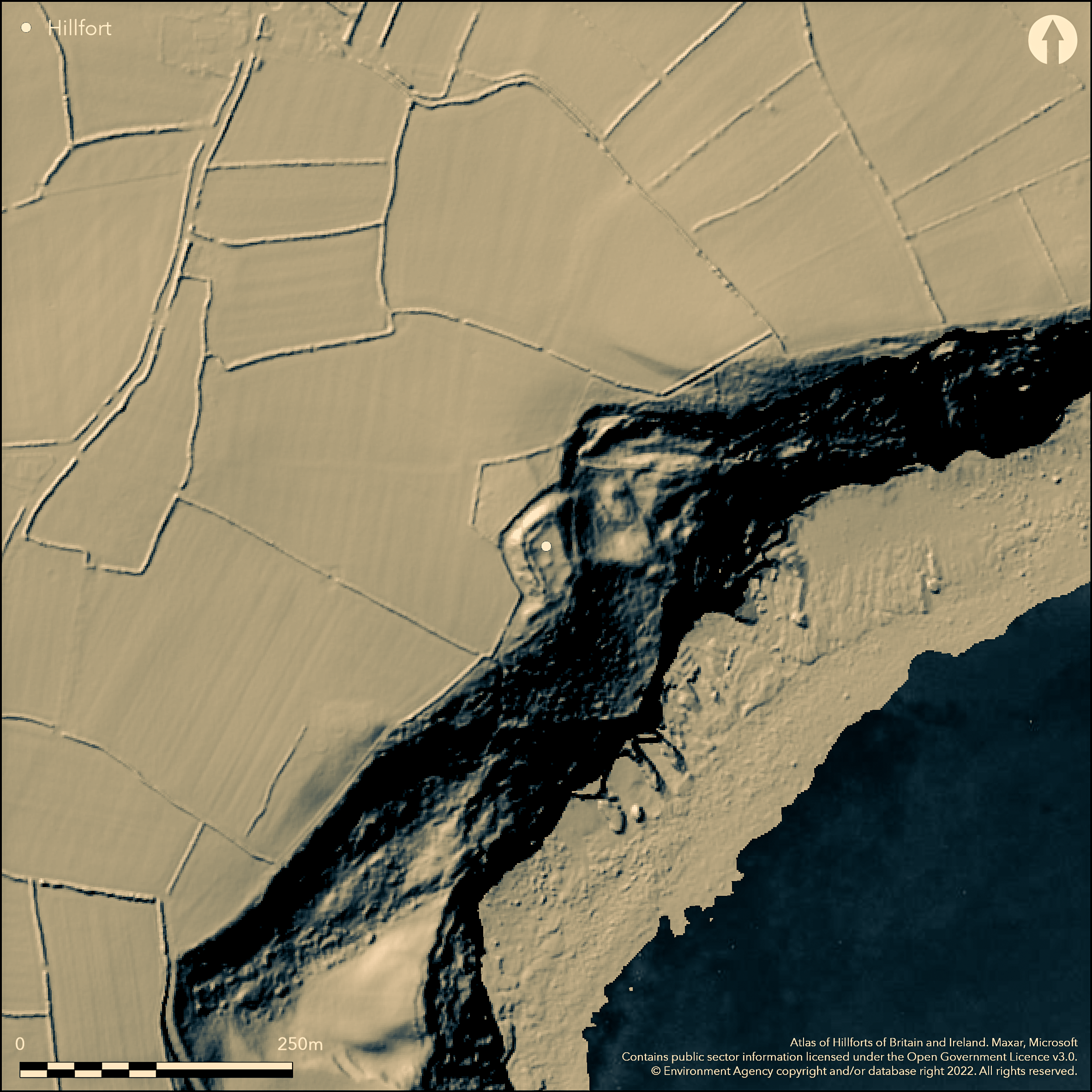
LiDAR 1m DTM Hillshade
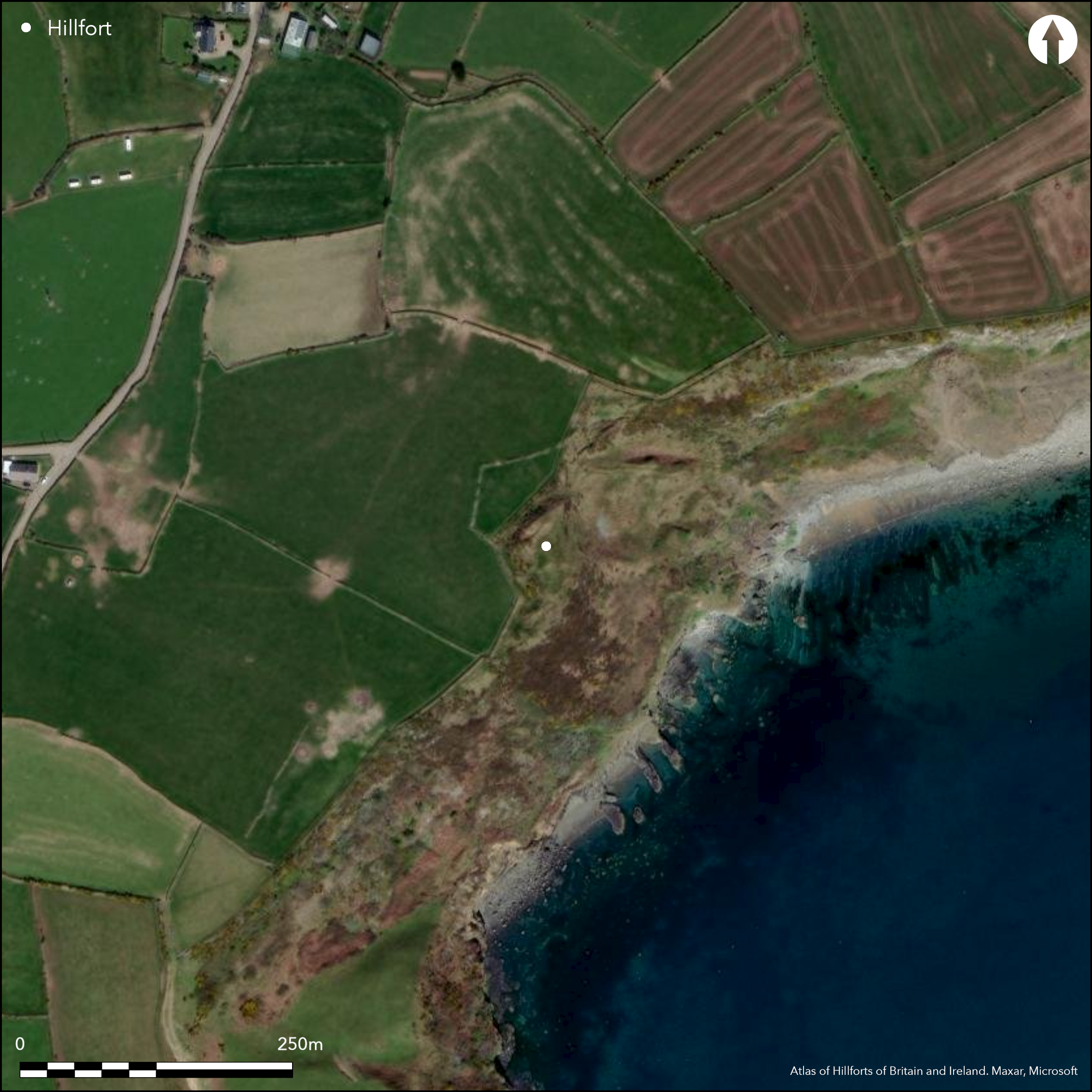
Satellite Imagery
LiDAR 1m DTM Hillshade
Satellite Imagery
Scroll left/right to view further images.
HER: Gwynedd 1235 (None)
NMR: SH 32 SW 2 (95330)
SM: CN103
NGR: SH30392468
X: 230390 Y: 324680 (OSGB36)
Very small, univallate, level terrain fort located on cliff edge directly above a beach on Porth Ceiriad Bay, Llanengan. Site rests on steep natural slopes above the sea cliffs on NE and opening onto a roughly 10m wide ledge above the cliffs on SE. Measures about 30m N-W to S-E by 24m with internal area 0.07ha. Defined by bank around the circuit with U-shaped rock-cut ditch on N and W landward sides where the bank is greater. Probable stone-walled. On S side cliff edge adequate beyond a smaller bank. Here site of the entrance leading onto narrow ledge above the cliff edge running to W. Bank cutting off seaward end of the ditch runs along top of this ledge away from SE corner providing a corridor into interior. Similar rampart once continued away from the fort to E but much now lost to coastal erosion. Round hut about halfway along the W side. This is marked by a low grassy bank and is about 22ft in diameter. Its entrance appears to have been on the east. On 1st Ed. OS map (1889). Minimal investigations, undated.
Citizen Science: ✗
Reliability of Data: Confirmed
Reliability of Interpretation: Confirmed
X: -502825 Y: 6944788 (EPSG: 3857)
Longitude: -4.51695741973681 Latitude: 52.79293757075397 (EPSG:4326)
Country: Wales
Current County or Unitary Authority: Gwynedd
Historic County: Caernarfonshire
Current Parish/Community/Council/Townland: Llanengan
Bank loss due to coastal erosion.
| Extant | ✓ |
| Cropmark | ✗ |
| Likely Destroyed | ✓ |
Coastal grassland.
| Woodland | ✗ |
| Commercial Forestry Plantation | ✗ |
| Parkland | ✗ |
| Pasture (Grazing) | ✗ |
| Arable | ✗ |
| Scrub/Bracken | ✗ |
| Bare Outcrop | ✗ |
| Heather/Moorland | ✗ |
| Heath | ✗ |
| Built-up | ✗ |
| Coastal Grassland | ✓ |
| Other | ✗ |
Very small, univallate, level terrain fort located on cliff edge directly above a beach on Porth Ceiriad Bay, Llanengan. Site rests on steep natural slopes above the sea cliffs on NE. Interior falls gently to E.
| Contour Fort | ✗ |
| Partial Contour Fort | ✗ |
| Promontory Fort | ✗ |
| Hillslope Fort | ✗ |
| Level Terrain Fort | ✓ |
| Marsh Fort | ✗ |
| Multiple Enclosure Fort | ✗ |
| Hilltop | ✗ |
| Coastal Promontory | ✓ |
| Inland Promontory | ✗ |
| Valley Bottom | ✗ |
| Knoll/Hillock/Outcrop | ✗ |
| Ridge | ✗ |
| Cliff/Plateau-edge/Scarp | ✓ |
| Hillslope | ✗ |
| Lowland | ✗ |
| Spur | ✗ |
Dominant Topographic Feature: Cliff edge
| North | ✗ |
| Northeast | ✗ |
| East | ✓ |
| Southeast | ✗ |
| South | ✗ |
| Southwest | ✗ |
| West | ✗ |
| Northwest | ✗ |
| Level | ✗ |
Altitude: 91.0m
N/A
Reliability: D - None
| Pre 1200BC | ✗ |
| 1200BC - 800BC | ✗ |
| 800BC - 400BC | ✗ |
| 400BC - AD50 | ✗ |
| AD50 - AD400 | ✗ |
| AD400 - AD 800 | ✗ |
| Post AD800 | ✗ |
| Unknown | ✓ |
| Pre Hillfort: | None |
| Post Hillfort: | None |
On 1st Ed. OS map (1889). Ordnance Survey observation 1972. GAT investigations 1987, 1994. GAT coastal erosion survey, Aberdaron to Aberdyfi 1996. GAT prehistoric defended enclosures survey 2005-2006.
| 1st Identified Map Depiction (1889): | OS map. |
| Other (1972): | Ordnance Survey observation. |
| Other (1996): | GAT coastal erosion survey. |
| Other (None): | GAT investigations. |
| Other (None): | GAT prehistoric defended enclosures survey. |
Round hut about halfway along the W side. Some ill-defined platforms.
None
| None | ✓ |
| Spring | ✗ |
| Stream | ✗ |
| Pool | ✗ |
| Flush | ✗ |
| Well | ✗ |
| Other | ✗ |
Round hut about halfway along the W side. Some ill-defined platforms.
| No Known Features | ✗ |
| Round Stone Structures | ✓ |
| Rectangular Stone Structures | ✗ |
| Curvilinear Platforms | ✓ |
| Other Roundhouse Evidence | ✗ |
| Pits | ✗ |
| Quarry Hollows | ✗ |
| Other | ✗ |
None
| No Known Excavation | ✓ |
| Pits | ✗ |
| Postholes | ✗ |
| Roundhouses | ✗ |
| Rectangular Structures | ✗ |
| Roads/Tracks | ✗ |
| Quarry Hollows | ✗ |
| Other | ✗ |
| Nothing Found | ✗ |
None
| No Known Geophysics | ✓ |
| Pits | ✗ |
| Roundhouses | ✗ |
| Rectangular Structures | ✗ |
| Roads/Tracks | ✗ |
| Quarry Hollows | ✗ |
| Other | ✗ |
| Nothing Found | ✗ |
None
| No Known Finds | ✓ |
| Pottery | ✗ |
| Metal | ✗ |
| Metalworking | ✗ |
| Human Bones | ✗ |
| Animal Bones | ✗ |
| Lithics | ✗ |
| Environmental | ✗ |
| Other | ✗ |
None
| APs Not Checked | ✓ |
| None | ✗ |
| Roundhouses | ✗ |
| Rectangular Structures | ✗ |
| Pits | ✗ |
| Postholes | ✗ |
| Roads/Tracks | ✗ |
| Other | ✗ |
On S side cliff edge adequate defence beyond a smaller bank. Here site of the entrance leading onto narrow ledge above the cliff edge running to W. Bank cutting off seaward end of the ditch runs along top of this ledge away from SE corner providing a defensible corridor into interior.
| 1: | Estimated. |
| 2: | None |
Guard Chambers: ✗
Chevaux de Frise: ✗
| 1. Passage-way/Corridor (South): | None |
Defined by bank around the circuit with U-shaped rock-cut ditch on N and W landward sides where the bank is greater. On
| Area 1: | 0.07ha. |
| Total: | 0.07ha. |
Total Footprint Area: Noneha.
None
| ✗ | None |
| ✓ | None |
| NE Quadrant: | 1 |
| SE Quadrant: | 1 |
| SW Quadrant: | 1 |
| NW Quadrant: | 1 |
| Total: | 1 |
| Partial Univallate | ✗ |
| Univallate | ✓ |
| Partial Bivallate | ✗ |
| Bivallate | ✗ |
| Partial Multivallate | ✗ |
| Multivallate | ✗ |
| Unknown | ✗ |
| Partial Univallate | ✗ |
| Univallate | ✗ |
| Partial Bivallate | ✗ |
| Bivallate | ✗ |
| Partial Multivallate | ✗ |
| Multivallate | ✗ |
Probable stone-walled rampart.
| None | ✗ |
| Earthen Bank | ✗ |
| Stone Wall | ✓ |
| Rubble | ✗ |
| Wall-walk | ✗ |
| Evidence of Timber | ✗ |
| Vitrification | ✗ |
| Other Burning | ✗ |
| Palisade | ✗ |
| Counter Scarp Bank | ✗ |
| Berm | ✗ |
| Unfinished | ✗ |
| Other | ✗ |
None
| None | ✗ |
| Earthen Bank | ✗ |
| Stone Wall | ✗ |
| Murus Duplex | ✗ |
| Timber-framed | ✗ |
| Timber-laced | ✗ |
| Vitrification | ✗ |
| Other Burning | ✗ |
| Palisade | ✗ |
| Counter Scarp Bank | ✗ |
| Berm | ✗ |
| Unfinished | ✗ |
| No Known Excavation | ✓ |
| Other | ✗ |
| ✗ | None |
| ✓ | U-shaped rock-cut ditch. |
Number of Ditches: 1
| ✗ | None |
RCAHMW 1964. Caernarvonshire Vol III: West, A survey and inventory by the Royal Commission on Ancient and Historical Monuments in Wales and Monmouthshire, No 1598, London: HMSO.
Dutton, L. A. & Gwyn, D. 1995 , Coastal Erosion Survey - Aberdaron to Aberdyfi, GAT Report No.198, Bangor: Gwynedd Archaeological Trust.
Smith, G.H. 2006. A survey of prehistoric defended enclosures in north-west Wales 2005-2006: Gwynedd Dwyfor and Meirionnydd. Report No 634. Part I: Survey Report. Bangor: Gwynedd Archaeological Trust.
Waddington, K. 2013. The Settlements of Northwest Wales: From the Late Bronze Age to the Early Medieval Period, Cardiff: University of Wales Press.
Atlas of Hillforts:
Wikidata:
This work is licensed under CC BY-SA 4.0

 and should be cited as:
Lock, Gary and Ralston, Ian. 2024. Atlas of Hillforts of Britain and Ireland. Available at: https://hillforts.arch.ox.ac.uk
Document Version 1.1