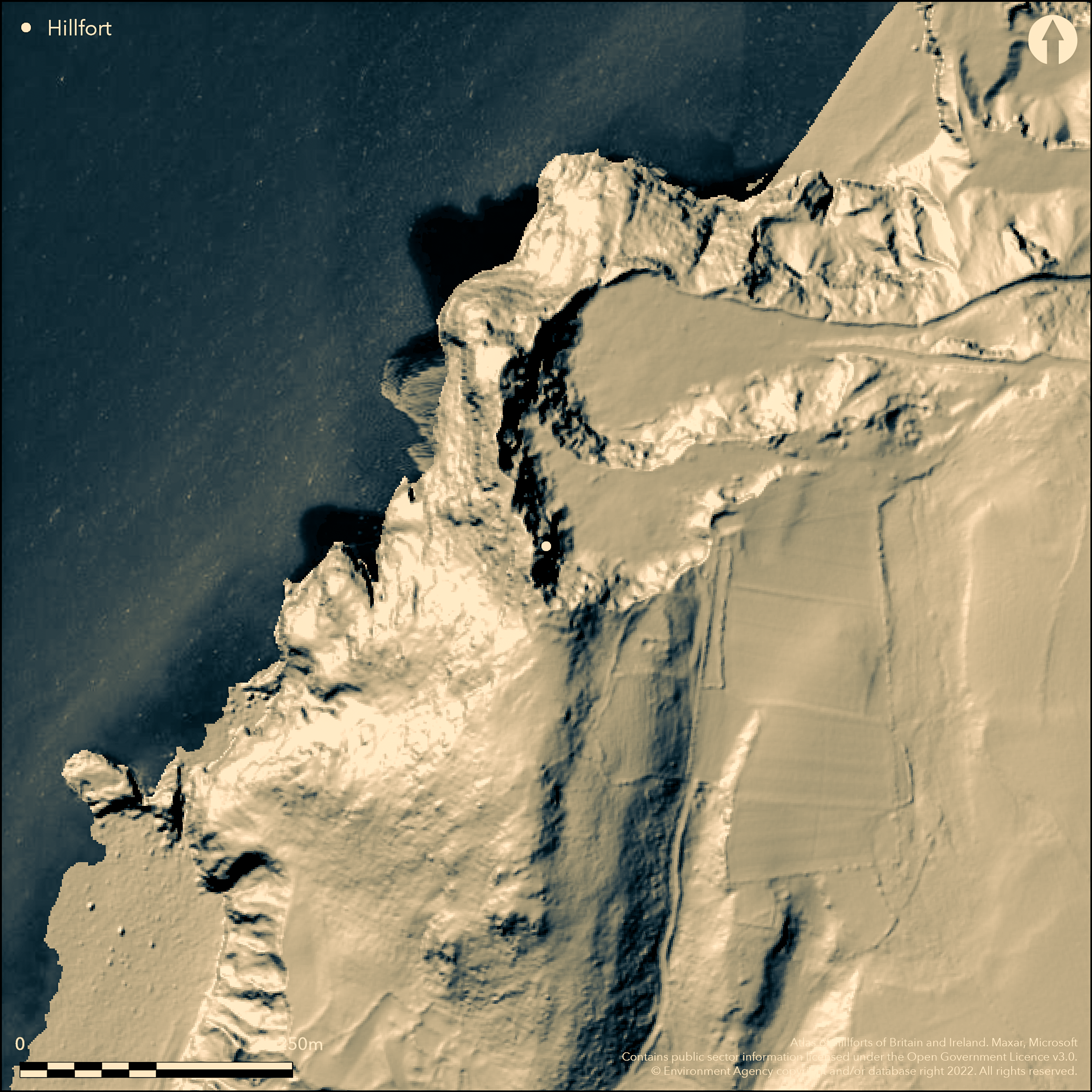
LiDAR 1m DTM Hillshade
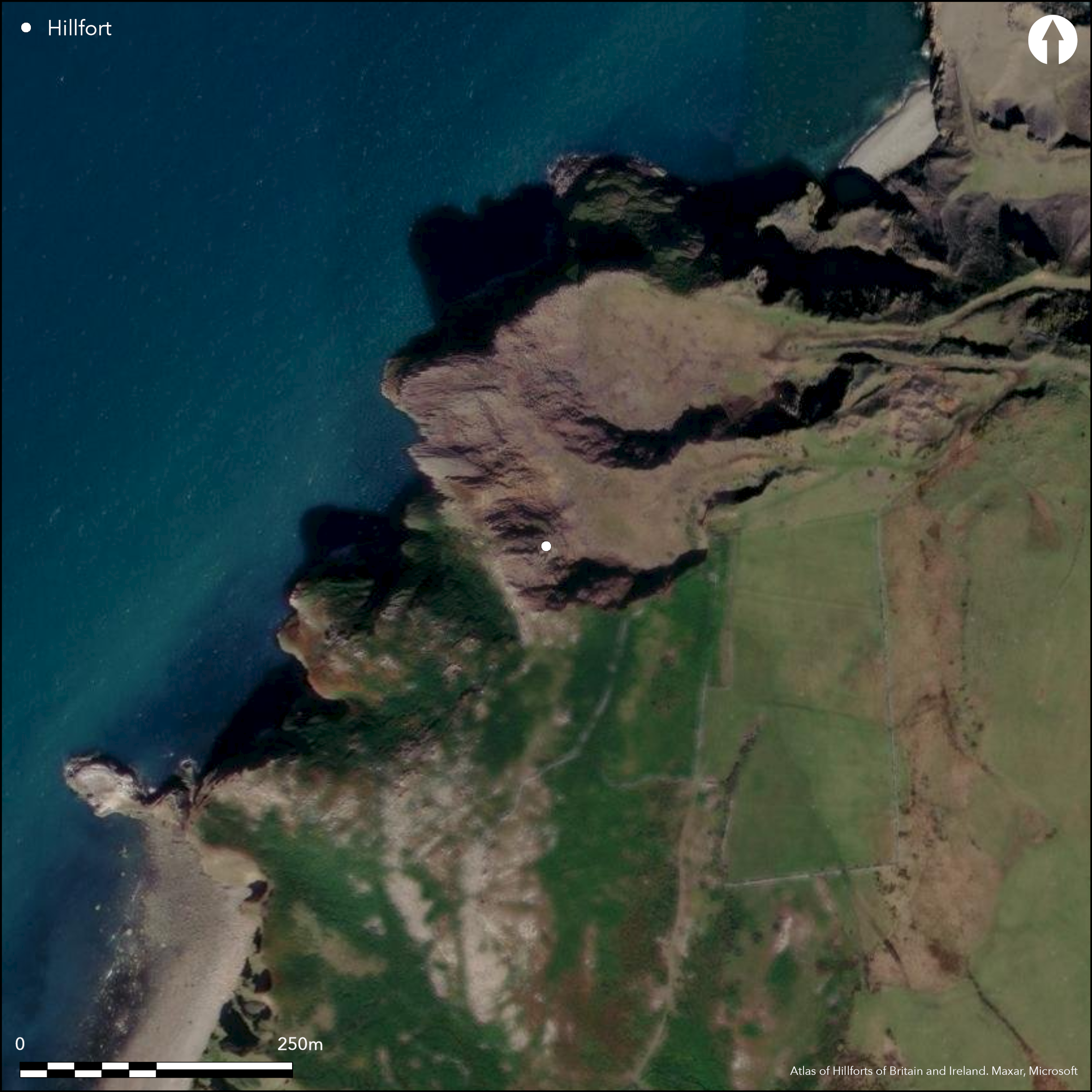
Satellite Imagery
LiDAR 1m DTM Hillshade
Satellite Imagery
Scroll left/right to view further images.
HER: Gwynedd 1261 (None)
NMR: SH 34 SW 1 (None)
SM: None
NGR: SH33404365
X: 233400 Y: 343650 (OSGB36)
Destroyed, small, probable coastal promontory hillfort formerly located at N end of rocky ridge of Penrhyn Glas headland SW of Porth y Nant and NE of Nefyn, Ll_n. Sea cliff on W steep and precipitous, gentler to N to Porth Howel and to E and S beyond a narrow saddle inland hills rise gently. Rescue excavation 1954 by A.H.A. Hogg on behalf of Royal Commission and fully destroyed by 1960. Two dry-stone walls enclosed area c. 34m N-S by 12m. Inner c. 3.7m wide rubble faced with laid masonry. 9m outside this was smaller rubble rampart, outer face built of large blocks, and 15m to ridge on S crossed by third rampart then reduced to grassy scarp. No ditches. Possible annexe to N ,where wall c. 2m wide extended NW of main enclosure to define triangular area with sea cliffs as W boundary. Outer simple gap gate on SE approached by trackway 3m-3.7m wide on E terraced and edged with large boulders. From outer gate was an approach uphill to inner gate, here a ruined passage c. 3m wide reduced at outer end by projecting piers. Hut found at N end of inner enclosure using the rampart as part wall where here 3m-4.3m thick. Circular in plan, 6m-6.4m diameter, with 1.8m entrance on SW. Paved floor with hearth. Finds included pebbles and beach boulders, two small worked stone balls, and few fragments of 8th to 9th century pottery and site suggested of similar function to a small castle and has been likened to Tal-y-Gareg, Tonfanau Quarry, Towyn (Atlas No 4346). Questions remain. DESCRIPTION SmallhillfortonclifftopatCarregyLlaninitiallydiscoveredbyW.J.Hemp[<1>]. <2> In 1954 its destruction by quarrying became imminent and in October excavations were carried out by Hogg on behalf of RCAHM. Remains consisted of oval enclosed area with a single large hut built onto the inner line of two ramparts (possibly a third rampart also existed). Various finds include flint, pebbles, and pottery (possibly early medieval). <2> Carreg y Llan, quarrying in the 1950's destroyed a fortified hut located on the rocky ridge abutting the northern end of the property (see map below). Prior to its removal the site was excavated by A.H.A Hogg for the Royal Commission who discovered a bivallate structure with a third grass grown bank running across the ridge 50ft to the south (Hogg 1957). The inner wall enclosed an oval area 110ft N-S by 40ft and was 12ft wide of _________ rubble faced with masonry. Circular hut 20-21ft in diameter was set into the northern end. The floor of the hut was roughly paved except where the bedrock was exposed and on this there was a hearth. The entrance to the inner enclosure was greatly ruined but appeared to consist of a passage 10ft wide reduced at the outer end to 5 feet by projecting piers. The entrance to the outer wall was much simpler with no evidence of structural features it was approached by a terraced trackway. Finds consist of beach pebbles and boulders, two small worked balls and a few fragments of Post Roman pottery, probably of 8th - 9th century date. <5> Nothing remains of the hillfort now, and no associated features were seen. (Riley & Smith 1993) EVIDENCE DOCUMENTARY EVIDENCE CONDITION INFORMATION CONDITION: Destroyed CONDITION RATING: Destroyed DESCRIPTION: RELATED EVENT PRN: 40016 YEAR: 1993 STATUS NoneRecorded ASSOCIATED EVENTS GAT41807 A Fortified Round Hut at Carreg Y Llam 1954 GAT40016 Coastal Erosion Survey: Aberdaron Bay to the Great Orme 1993 ASSOCIATED ARTEFACTS FIND: 4 Flint Flake COLLECTION: None recorded DESCRIPTION: 3 red & 1 red scrap. Not worked FIND: 0 Pottery Fragment COLLECTION: None recorded DESCRIPTION: Soft, non-gritty ware. Interpreted as C8-C9. FIND: 2 Stone Ball COLLECTION: None recorded DESCRIPTION: Pair, c.1.25ins diam each. Felspathic grit, oolerite FIND: 0 Stone Pebble COLLECTION: None recorded DESCRIPTION: Beach pebbles and other boulders SOURCES Report Riley, H. & Smith, G. 1993 Coastal Erosion Survey: Aberdaron Bay to the Great Orme GAT Report No.079 Plunkett Dillon, E. 1992 , Pistyll North Wales, P.25, FIGS <5> Hogg, A. H. A. 1957 A fortified round hut at Carreg y Llam, near Nevin, Archaeologia Cambrensis, Vol. 106, pp46-55 <2> Royal Commission on Ancient and Historic Monuments 1964 , Caernarfonshire III, pp91-2, No.1699 <3> Ordnance Survey 1971 , SH34SW 1, <4> Hemp, W. J. 1934 , Archaeologia Cambrensis, p.18 *THIS IS THE PANT Y SAER EXCAVATION REPORT, QUOTED HERE FOR SIMILAR POTTERY TYPES* <1> DESCRIPTION SmallhillfortonclifftopatCarregyLlaninitiallydiscoveredbyW.J.Hemp[<1>]. <2> In 1954 its destruction by quarrying became imminent and in October excavations were carried out by Hogg on behalf of RCAHM. Remains consisted of oval enclosed area with a single large hut built onto the inner line of two ramparts (possibly a third rampart also existed). Various finds include flint, pebbles, and pottery (possibly early medieval). <2> Carreg y Llan, quarrying in the 1950's destroyed a fortified hut located on the rocky ridge abutting the northern end of the property (see map below). Prior to its removal the site was excavated by A.H.A Hogg for the Royal Commission who discovered a bivallate structure with a third grass grown bank running across the ridge 50ft to the south (Hogg 1957). The inner wall enclosed an oval area 110ft N-S by 40ft and was 12ft wide of _________ rubble faced with masonry. Circular hut 20-21ft in diameter was set into the northern end. The floor of the hut was roughly paved except where the bedrock was exposed and on this there was a hearth. The entrance to the inner enclosure was greatly ruined but appeared to consist of a passage 10ft wide reduced at the outer end to 5 feet by projecting piers. The entrance to the outer wall was much simpler with no evidence of structural features it was approached by a terraced trackway. Finds consist of beach pebbles and boulders, two small worked balls and a few fragments of Post Roman pottery, probably of 8th - 9th century date. <5> Nothing remains of the hillfort now, and no associated features were seen. (Riley & Smith 1993) EVIDENCE DOCUMENTARY EVIDENCE CONDITION INFORMATION CONDITION: Destroyed CONDITION RATING: Destroyed DESCRIPTION: RELATED EVENT PRN: 40016 YEAR: 1993 STATUS NoneRecorded ASSOCIATED EVENTS GAT41807 A Fortified Round Hut at Carreg Y Llam 1954 GAT40016 Coastal Erosion Survey: Aberdaron Bay to the Great Orme 1993 ASSOCIATED ARTEFACTS FIND: 4 Flint Flake COLLECTION: None recorded DESCRIPTION: 3 red & 1 red scrap. Not worked FIND: 0 Pottery Fragment COLLECTION: None recorded DESCRIPTION: Soft, non-gritty ware. Interpreted as C8-C9. FIND: 2 Stone Ball COLLECTION: None recorded DESCRIPTION: Pair, c.1.25ins diam each. Felspathic grit, oolerite FIND: 0 Stone Pebble COLLECTION: None recorded DESCRIPTION: Beach pebbles and other boulders SOURCES Report Riley, H. & Smith, G. 1993 Coastal Erosion Survey: Aberdaron Bay to the Great Orme GAT Report No.079 Plunkett Dillon, E. 1992 , Pistyll North Wales, P.25, FIGS <5> Hogg, A. H. A. 1957 A fortified round hut at Carreg y Llam, near Nevin, Archaeologia Cambrensis, Vol. 106, pp46-55 <2> Royal Commission on Ancient and Historic Monuments 1964 , Caernarfonshire III, pp91-2, No.1699 <3> Ordnance Survey 1971 , SH34SW 1, <4> Hemp, W. J. 1934 , Archaeologia Cambrensis, p.18 *THIS IS THE PANT Y SAER EXCAVATION REPORT, QUOTED HERE FOR SIMILAR POTTERY TYPES* <1> On 1st Ed. OS map (1889).
Citizen Science: ✗
Reliability of Data: Unconfirmed
Reliability of Interpretation: Confirmed
X: -498942 Y: 6976387 (EPSG: 3857)
Longitude: -4.482076045663575 Latitude: 52.96424758309138 (EPSG:4326)
Country: Wales
Current County or Unitary Authority: Gwynedd
Historic County: Caernarfonshire
Current Parish/Community/Council/Townland: Pistyll
NE destroyed by 1954 and total site destroyed by 1960.
| Extant | ✗ |
| Cropmark | ✗ |
| Likely Destroyed | ✓ |
Coastal grassland and bare rock before destruction.
| Woodland | ✗ |
| Commercial Forestry Plantation | ✗ |
| Parkland | ✗ |
| Pasture (Grazing) | ✗ |
| Arable | ✗ |
| Scrub/Bracken | ✗ |
| Bare Outcrop | ✗ |
| Heather/Moorland | ✗ |
| Heath | ✗ |
| Built-up | ✗ |
| Coastal Grassland | ✓ |
| Other | ✗ |
Small hillfort formerly located at N end of rocky ridge of Penrhyn Glas headland SW of Porth y Nant and NE of Nefyn, Llyn. Sea cliff on W steep and precipitous, gentler to N to Porth Howel and to E and S beyond a narrow saddle inland hills rise gently.
| Contour Fort | ✗ |
| Partial Contour Fort | ✗ |
| Promontory Fort | ✓ |
| Hillslope Fort | ✗ |
| Level Terrain Fort | ✗ |
| Marsh Fort | ✗ |
| Multiple Enclosure Fort | ✗ |
| Hilltop | ✗ |
| Coastal Promontory | ✓ |
| Inland Promontory | ✗ |
| Valley Bottom | ✗ |
| Knoll/Hillock/Outcrop | ✗ |
| Ridge | ✗ |
| Cliff/Plateau-edge/Scarp | ✗ |
| Hillslope | ✗ |
| Lowland | ✗ |
| Spur | ✗ |
Dominant Topographic Feature: Coastal headland.
| North | ✓ |
| Northeast | ✗ |
| East | ✗ |
| Southeast | ✗ |
| South | ✗ |
| Southwest | ✗ |
| West | ✗ |
| Northwest | ✗ |
| Level | ✗ |
Altitude: 120.0m
N/A
Date of site unknown, but few sherds of medieval pottery found and site suggested of similar function to a small castle. However, site could be Iron Age and site now destroyed.
Reliability: D - None
| Pre 1200BC | ✗ |
| 1200BC - 800BC | ✗ |
| 800BC - 400BC | ✗ |
| 400BC - AD50 | ✗ |
| AD50 - AD400 | ✗ |
| AD400 - AD 800 | ✗ |
| Post AD800 | ✗ |
| Unknown | ✓ |
| Pre Hillfort: | None |
| Post Hillfort: | 8th and 9th century pottery fragmants. |
| Artefactual: | Medieval pottery. |
Initially discovered by W.J. Hemp c. 1934. Excavation by A.H.A. Hogg 1954. RCAHMW investigation 1954-55. Ordnance Survey observation 1971. GAT Coastal Erosion Survey: Aberdaron Bay to the Great Orme 1993. GAT prehistoric defended enclosures survey 2005-2006.
| Excavation (1954): | A.H.A. Hogg. |
| Other (1971): | Ordnance Survey observation. |
| Other (1993): | GAT coastal erosion survey. |
| Other (None): | RCAHMW investigation. |
| Other (None): | GAT prehistoric defended enclosures survey. |
| Other (None): | W.J. Hemp initial discovery. |
Hut found at N end of inner enclosure using the rampart as part wall where here 3m-3.4 thick. Circular in plan 6m-6.4m diameter, with entrance on SW. Paved floor with hearth. One posthole near piers. Finds included pebbles and beach boulders, two small worked stone balls, and few fragments of 8th to 9th century pottery.
None
| None | ✓ |
| Spring | ✗ |
| Stream | ✗ |
| Pool | ✗ |
| Flush | ✗ |
| Well | ✗ |
| Other | ✗ |
Site destroyed.
| No Known Features | ✓ |
| Round Stone Structures | ✗ |
| Rectangular Stone Structures | ✗ |
| Curvilinear Platforms | ✗ |
| Other Roundhouse Evidence | ✗ |
| Pits | ✗ |
| Quarry Hollows | ✗ |
| Other | ✗ |
Hut found at N end of inner enclosure using the rampart as part wall where here 3m-3.4m thick. Circular in plan 6m-6.4m diameter, with entrance on SW. Paved floor with hearth. One posthole near piers.
| No Known Excavation | ✗ |
| Pits | ✗ |
| Postholes | ✓ |
| Roundhouses | ✓ |
| Rectangular Structures | ✗ |
| Roads/Tracks | ✗ |
| Quarry Hollows | ✗ |
| Other | ✓ |
| Nothing Found | ✗ |
None
| No Known Geophysics | ✓ |
| Pits | ✗ |
| Roundhouses | ✗ |
| Rectangular Structures | ✗ |
| Roads/Tracks | ✗ |
| Quarry Hollows | ✗ |
| Other | ✗ |
| Nothing Found | ✗ |
Finds included pebbles and beach boulders, two small worked stone balls, and few fragments of 8th to 9th century pottery.
| No Known Finds | ✗ |
| Pottery | ✓ |
| Metal | ✗ |
| Metalworking | ✗ |
| Human Bones | ✗ |
| Animal Bones | ✗ |
| Lithics | ✓ |
| Environmental | ✗ |
| Other | ✗ |
None
| APs Not Checked | ✓ |
| None | ✗ |
| Roundhouses | ✗ |
| Rectangular Structures | ✗ |
| Pits | ✗ |
| Postholes | ✗ |
| Roads/Tracks | ✗ |
| Other | ✗ |
Outer simple gap gate on SE approached by trackway 3m-3.7m wide on E terraced and edged with large boulders. From outer gate was an approach uphill to inner gate, here a ruined passage c. 3m wide reduced at outer end by projecting piers.
| 2: | None |
| 2: | None |
Guard Chambers: ✗
Chevaux de Frise: ✗
| 1. Simple Gap (South east): | Trackway approach to outer rampart gate. |
| 2. Passage-way/Corridor (South east): | Ruined passage c. 3m wide reduced at outer end by projecting piers. |
Two dry-stone walls enclosed area c. 34m N-S by 12m. Inner c. 3.7m wide rubble faced with laid masonry. 9m outside this was smaller rubble rampart, outer face built of large blocks, and 15m to ridge on S crossed by third rampart then reduced to grassy scarp. No ditches.
| Area 1: | 0.08ha. |
| Total: | 0.08ha. |
Total Footprint Area: Noneha.
None
| ✗ | Area estimated. Coastal erosion. |
| ✗ | Quadrants estimated. |
| NE Quadrant: | 1 |
| SE Quadrant: | 3 |
| SW Quadrant: | 0 |
| NW Quadrant: | 3 |
| Total: | 3 |
| Partial Univallate | ✓ |
| Univallate | ✗ |
| Partial Bivallate | ✗ |
| Bivallate | ✗ |
| Partial Multivallate | ✓ |
| Multivallate | ✗ |
| Unknown | ✗ |
| Partial Univallate | ✗ |
| Univallate | ✗ |
| Partial Bivallate | ✗ |
| Bivallate | ✗ |
| Partial Multivallate | ✗ |
| Multivallate | ✗ |
Site destroyed.
| None | ✓ |
| Earthen Bank | ✗ |
| Stone Wall | ✗ |
| Rubble | ✗ |
| Wall-walk | ✗ |
| Evidence of Timber | ✗ |
| Vitrification | ✗ |
| Other Burning | ✗ |
| Palisade | ✗ |
| Counter Scarp Bank | ✗ |
| Berm | ✗ |
| Unfinished | ✗ |
| Other | ✗ |
None
| None | ✗ |
| Earthen Bank | ✗ |
| Stone Wall | ✓ |
| Murus Duplex | ✗ |
| Timber-framed | ✗ |
| Timber-laced | ✗ |
| Vitrification | ✗ |
| Other Burning | ✗ |
| Palisade | ✗ |
| Counter Scarp Bank | ✗ |
| Berm | ✗ |
| Unfinished | ✗ |
| No Known Excavation | ✗ |
| Other | ✗ |
| ✗ | None |
| ✗ | No ditches. |
Number of Ditches: 0
| ✓ | Possible annexe to N ,where wall c. 2m wide extended NW of main enclosure to define triangular area with sea cliffs as W boundary. |
Hogg, A. H. A. 1957. A fortified round hut at Carreg y Llam, near Nevin, Arch Camb, Vol. 106, 46-55.
RCAHMW 1964. Caernarvonshire Vol III: West, A survey and inventory by the Royal Commission on Ancient and Historical Monuments in Wales and Monmouthshire, No 1699, London: HMSO.
Riley, H. and Smith, G. 1993. Coastal Erosion Survey: Aberdaron Bay to the Great Orme, GAT Report No. 079, Bangor: Gwynedd Archaeological Trust.
Smith, G.H. 2006. A survey of prehistoric defended enclosures in north-west Wales 2005-2006: Gwynedd Dwyfor and Meirionnydd. Report No 634. Part I: Survey Report. Bangor: Gwynedd Archaeological Trust.
Waddington, K. 2013. The Settlements of Northwest Wales: From the Late Bronze Age to the Early Medieval Period, Cardiff: University of Wales Press.
Atlas of Hillforts:
Wikidata:
This work is licensed under CC BY-SA 4.0

 and should be cited as:
Lock, Gary and Ralston, Ian. 2024. Atlas of Hillforts of Britain and Ireland. Available at: https://hillforts.arch.ox.ac.uk
Document Version 1.1