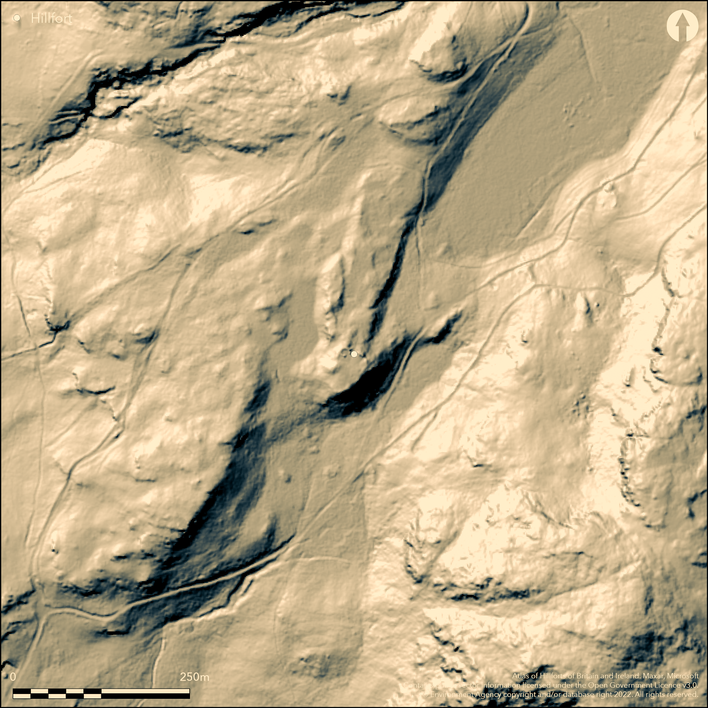
LiDAR 1m DTM Hillshade
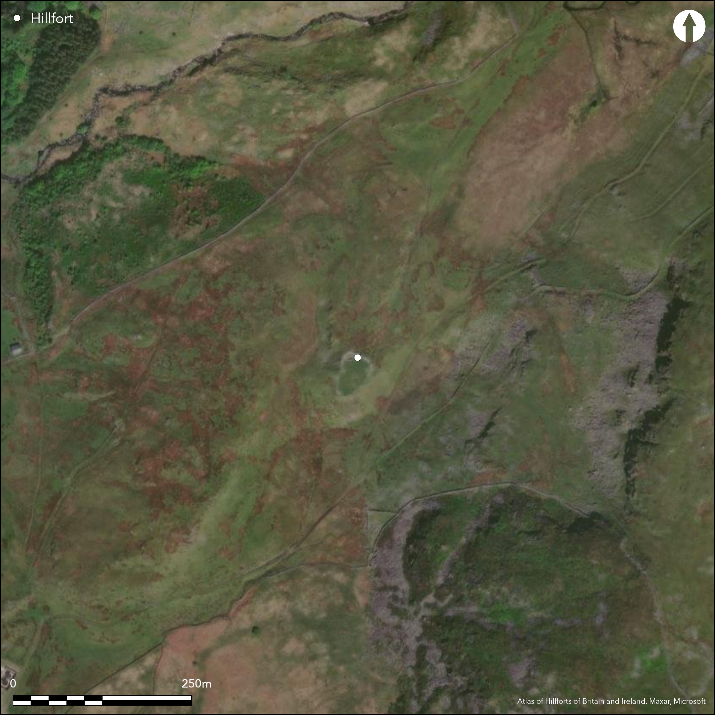
Satellite Imagery
LiDAR 1m DTM Hillshade
Satellite Imagery
Scroll left/right to view further images.
HER: Gwynedd 1489 (None)
NMR: SH 74 SW (95496)
SM: ME104
NGR: SH72824298
X: 272820 Y: 342980 (OSGB36)
Very small contour hillfort located on a prominent, high and steep hillock/knoll at the head of the Vale of Ffestiniog and above Cwm Teigl and Afon Teigl and Afon Gamallt to NW and Llyn Morwynion to SE. Surrounding slopes N, moderate to strong to N, S and W steep, E very steep. Measures 32m N-S by 24m with internal area 0.06ha. Single stone wall surrounds the edge of the grassy knoll, no ditch. Site fully excavated by Peter Crew of Snowdonia National Park 1975-85. Much evidence of metalworking and ramparts and stone building partially reconstructed. Large stone round hut, originally a conventional round hut, with SE doorway, subsequently altered to unusual 'snail-like' shape to facilitate metalworking. Two stake-wall huts also found and plenty of metalworking debris and slag on site as well as stone structures butting up against the fort wall. Interior largely cobbled with two iron furnaces found in S. Further furnace immediately outside N wall. Extensive dating evidence 370 cal BC to AD 200. Furnaces dated to between 50 BC and AD 50. Original 2 m wide entrance in NE corner later blocked and another constructed on W. About 30m to NE of fort, at foot of the knoll, further structure excavated and subsequently consolidated. This contained several furnaces, fired in the second to third century AD. It is not clear whether the fort was still occupied at this time. Bog ore to feed the furnaces probably from the extensive valley mire to NE.
Citizen Science: ✗
Reliability of Data: Confirmed
Reliability of Interpretation: Confirmed
X: -433619 Y: 6977272 (EPSG: 3857)
Longitude: -3.8952666878907696 Latitude: 52.96903246410777 (EPSG:4326)
Country: Wales; None
Current County or Unitary Authority: Gwynedd
Historic County: Merioneth
Current Parish/Community/Council/Townland: Ffestiniog
Public access. Good condition and part reconstructions for public display.
| Extant | ✓ |
| Cropmark | ✗ |
| Likely Destroyed | ✗ |
Grassy interior for public display.
| Woodland | ✗ |
| Commercial Forestry Plantation | ✗ |
| Parkland | ✗ |
| Pasture (Grazing) | ✗ |
| Arable | ✗ |
| Scrub/Bracken | ✗ |
| Bare Outcrop | ✗ |
| Heather/Moorland | ✗ |
| Heath | ✗ |
| Built-up | ✗ |
| Coastal Grassland | ✗ |
| Other | ✓ |
Very small contour hillfort located on a prominent, high and steep hillock/knoll at the head of the Vale of Ffestiniog and above Cwm Teigl and Afon Teigl and Afon Gamallt to NW and Llyn Morwynion to SE. Surrounding slopes N, moderate to strong to N, S and W steep, E very steep.
| Contour Fort | ✓ |
| Partial Contour Fort | ✗ |
| Promontory Fort | ✗ |
| Hillslope Fort | ✗ |
| Level Terrain Fort | ✗ |
| Marsh Fort | ✗ |
| Multiple Enclosure Fort | ✗ |
| Hilltop | ✗ |
| Coastal Promontory | ✗ |
| Inland Promontory | ✗ |
| Valley Bottom | ✗ |
| Knoll/Hillock/Outcrop | ✓ |
| Ridge | ✗ |
| Cliff/Plateau-edge/Scarp | ✗ |
| Hillslope | ✗ |
| Lowland | ✗ |
| Spur | ✗ |
Dominant Topographic Feature: Hillock/knoll
| North | ✗ |
| Northeast | ✗ |
| East | ✗ |
| Southeast | ✗ |
| South | ✗ |
| Southwest | ✗ |
| West | ✗ |
| Northwest | ✗ |
| Level | ✓ |
Altitude: 370.0m
Boundary Type: None
Extensive dating evidence 370 cal BC to AD 200. Furnaces dated to between 50 BC and AD 50.
Reliability: A - High
| Pre 1200BC | ✗ |
| 1200BC - 800BC | ✗ |
| 800BC - 400BC | ✗ |
| 400BC - AD50 | ✓ |
| AD50 - AD400 | ✓ |
| AD400 - AD 800 | ✗ |
| Post AD800 | ✗ |
| Unknown | ✗ |
| Pre Hillfort: | None |
| Post Hillfort: | None |
| C14: | Extensive dating evidence 370 cal BC to AD 200. |
| Other: | Extensive dating evidence. |
Excavation Peter Crew, Snowdonia National Park 1975-85. GAT investigation 1979, 1985, 1994. RCAHMW Uplands Initiative Project 2014. GAT prehistoric defended enclosures survey 2005-2006.
| Other (1985): | Visited by Hillfort Study Group |
| Other (2014): | RCAHMW Uplands Initiative Project. |
| Excavation (None): | Peter Crew, Snowdonia National Park. |
| Other (None): | GAT investigation |
| Other (None): | GAT prehistoric defended enclosures survey. |
Large stone round hut, formerly a conventional round hut, with SE doorway, subsequently altered to unusual 'snail-like' shape to facilitate metalworking. Two stake-wall huts also found and plenty of metalworking debris and slag on site as well as stone structures butting up against the fort wall. Pot fragments. Site now part reconstructed.
Stream 0.2km outside fort.
| None | ✓ |
| Spring | ✗ |
| Stream | ✗ |
| Pool | ✗ |
| Flush | ✗ |
| Well | ✗ |
| Other | ✗ |
Site now part reconstructed.
| No Known Features | ✗ |
| Round Stone Structures | ✓ |
| Rectangular Stone Structures | ✓ |
| Curvilinear Platforms | ✗ |
| Other Roundhouse Evidence | ✓ |
| Pits | ✗ |
| Quarry Hollows | ✗ |
| Other | ✗ |
Large stone round hut, formerly a conventional round hut, with SE doorway, subsequently altered to unusual 'snail-like' shape to facilitate metalworking. Two stake-wall huts also found and plenty of metalworking debris on site.
| No Known Excavation | ✗ |
| Pits | ✗ |
| Postholes | ✓ |
| Roundhouses | ✓ |
| Rectangular Structures | ✓ |
| Roads/Tracks | ✗ |
| Quarry Hollows | ✗ |
| Other | ✓ |
| Nothing Found | ✗ |
No details.
| No Known Geophysics | ✗ |
| Pits | ✗ |
| Roundhouses | ✗ |
| Rectangular Structures | ✗ |
| Roads/Tracks | ✗ |
| Quarry Hollows | ✗ |
| Other | ✓ |
| Nothing Found | ✗ |
Much metal working debris and slag. Pot fragments, glass and gaming boards.
| No Known Finds | ✗ |
| Pottery | ✓ |
| Metal | ✓ |
| Metalworking | ✓ |
| Human Bones | ✗ |
| Animal Bones | ✗ |
| Lithics | ✗ |
| Environmental | ✗ |
| Other | ✓ |
None
| APs Not Checked | ✓ |
| None | ✗ |
| Roundhouses | ✗ |
| Rectangular Structures | ✗ |
| Pits | ✗ |
| Postholes | ✗ |
| Roads/Tracks | ✗ |
| Other | ✗ |
Original 2 m wide entrance in NE corner, later blocked, and another constructed on W.
| 2: | None |
| 2: | None |
Guard Chambers: ✗
Chevaux de Frise: ✗
| 1. Simple Gap (West): | None |
| 2. Blocked (North east): | Original 2 m wide entrance in NE corner, later blocked. |
Single stone wall surrounds the edge of the grassy knoll. No ditch. 0.06ha.
| Area 1: | 0.06ha. |
| Total: | 0.06ha. |
Total Footprint Area: Noneha.
None
| ✗ | None |
| ✓ | Surrounding stone wall. |
| NE Quadrant: | 1 |
| SE Quadrant: | 1 |
| SW Quadrant: | 1 |
| NW Quadrant: | 1 |
| Total: | 1 |
| Partial Univallate | ✗ |
| Univallate | ✓ |
| Partial Bivallate | ✗ |
| Bivallate | ✗ |
| Partial Multivallate | ✗ |
| Multivallate | ✗ |
| Unknown | ✗ |
| Partial Univallate | ✗ |
| Univallate | ✗ |
| Partial Bivallate | ✗ |
| Bivallate | ✗ |
| Partial Multivallate | ✗ |
| Multivallate | ✗ |
Stone-walled site.
| None | ✗ |
| Earthen Bank | ✗ |
| Stone Wall | ✓ |
| Rubble | ✗ |
| Wall-walk | ✗ |
| Evidence of Timber | ✗ |
| Vitrification | ✗ |
| Other Burning | ✗ |
| Palisade | ✗ |
| Counter Scarp Bank | ✗ |
| Berm | ✗ |
| Unfinished | ✗ |
| Other | ✗ |
Stone walled site.
| None | ✗ |
| Earthen Bank | ✗ |
| Stone Wall | ✓ |
| Murus Duplex | ✗ |
| Timber-framed | ✗ |
| Timber-laced | ✗ |
| Vitrification | ✗ |
| Other Burning | ✗ |
| Palisade | ✗ |
| Counter Scarp Bank | ✗ |
| Berm | ✗ |
| Unfinished | ✗ |
| No Known Excavation | ✗ |
| Other | ✗ |
| ✗ | None |
| ✗ | No ditch. |
Number of Ditches: 0
| ✗ | None |
Blackford, J. J., Chambers, F. M., and Mighall, T. 1990. Bryn-y-Castell, Late Bronze Age Clearances or Climatic Change?, Arch in Wales, 30, 14-16.
Bowen E.G. and Gresham, C.A. 1967. History of Merioneth, 1, Dolgellau, 164.
Chambers, F. and Mighall, T. 1989. The Environmental Impact of Ironworking at Bryn Y Castell Hill Fort, Merioneth, Arch in Wales, 29, 17-21.
Crew, P. 1984. Prehistory: Bryn Y Castell, Arch in Wales, 24, 37-43.
Crew, P. 1986. Bryn y Castell hillfort, In eds Scott, B.G. and Cleere, H., The Crafts of the Blacksmith, UISPP Comite pour la Siderurgie Ancienne and the Ulster Museum, Belfast, 91-100
Lynch, F. 1995. A guide to ancient and historic Wales - Gwynedd, London: HMSO, 80-1.
Smith, G.H. 2006. A survey of prehistoric defended enclosures in north-west Wales 2005-2006: Gwynedd Dwyfor and Meirionnydd. Report No 634. Part I: Survey Report. Bangor: Gwynedd Archaeological Trust.
Waddington, K. 2013. The Settlements of Northwest Wales: From the Late Bronze Age to the Early Medieval Period, Cardiff: University of Wales Press.
Atlas of Hillforts:
Wikidata:
This work is licensed under CC BY-SA 4.0

 and should be cited as:
Lock, Gary and Ralston, Ian. 2024. Atlas of Hillforts of Britain and Ireland. Available at: https://hillforts.arch.ox.ac.uk
Document Version 1.1