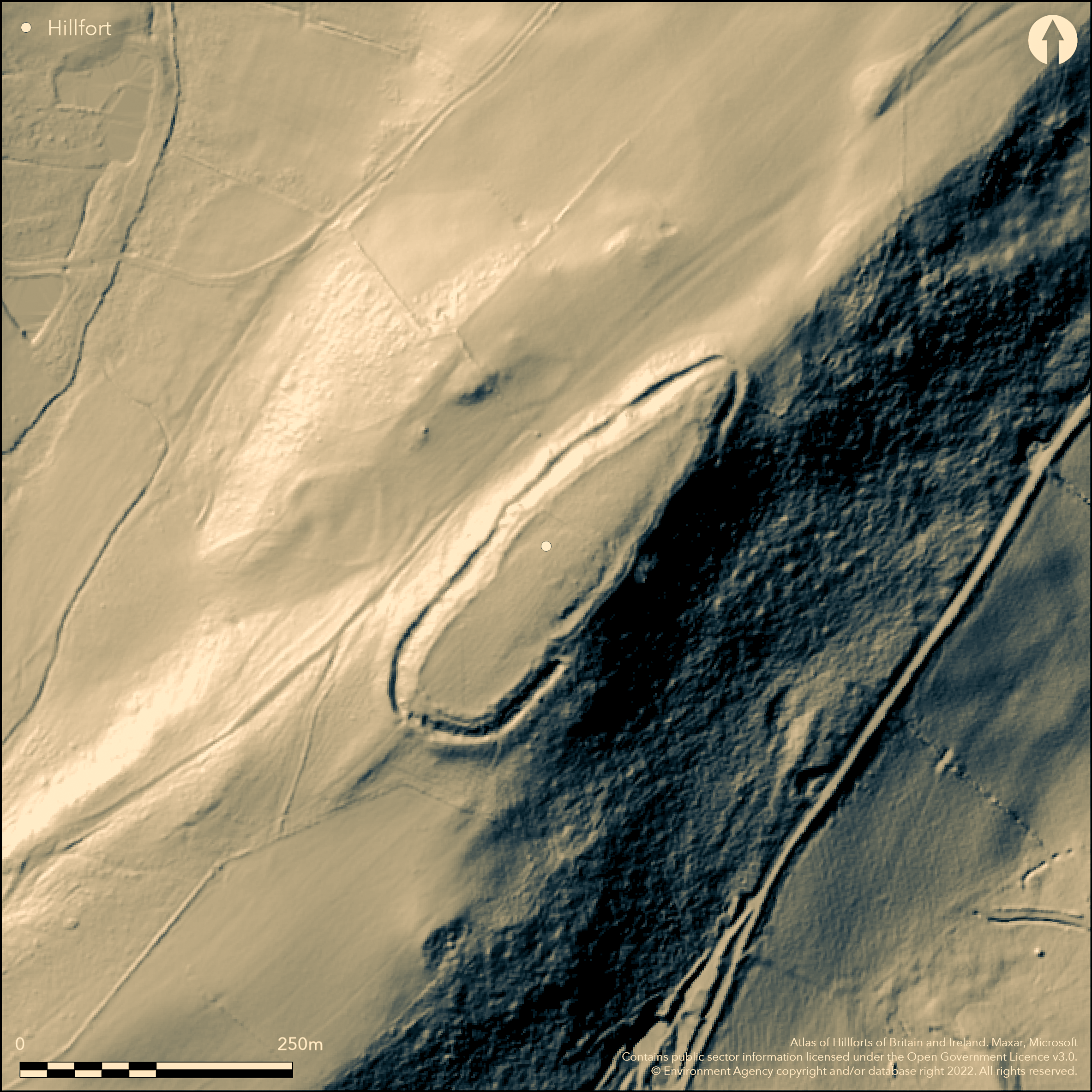
LiDAR 1m DTM Hillshade
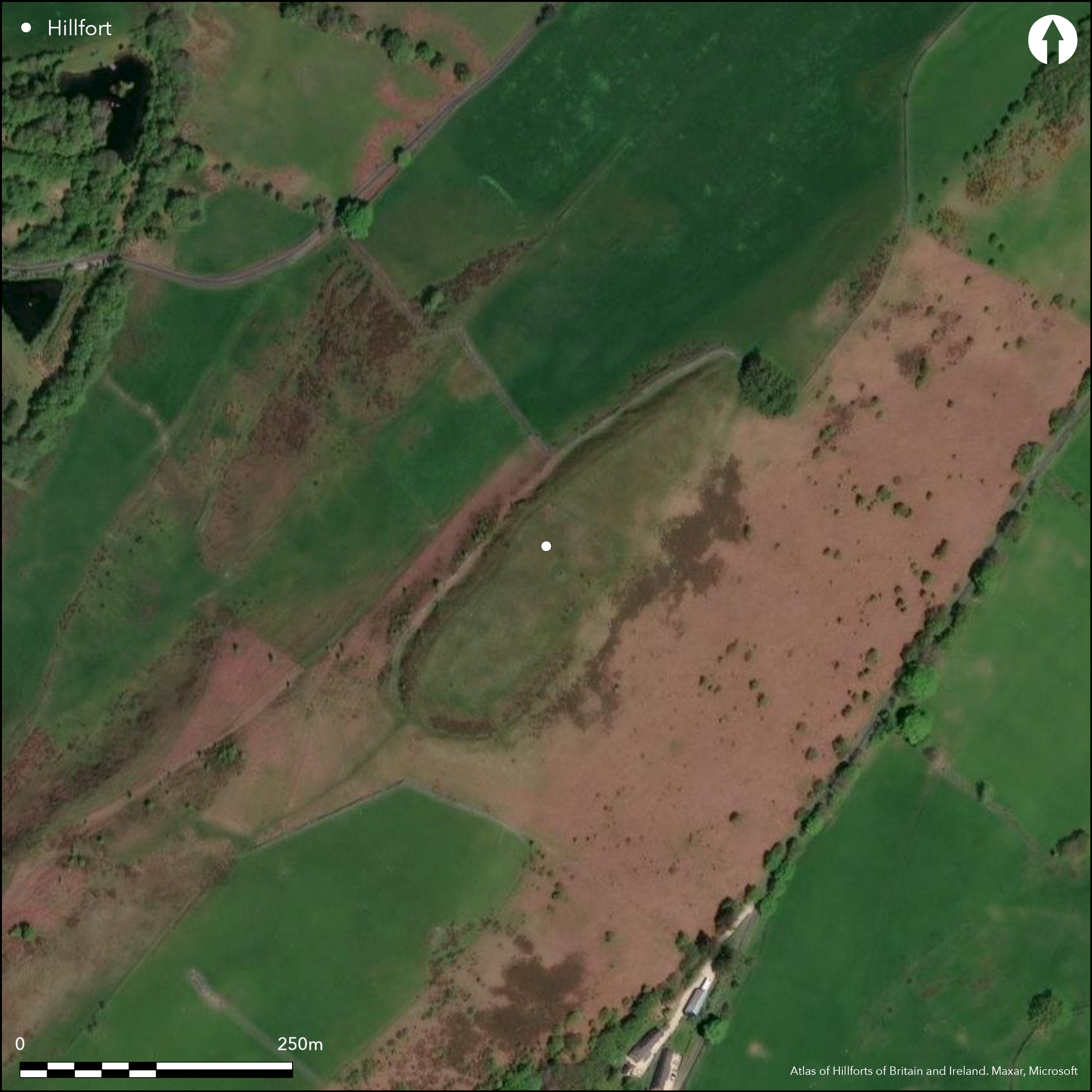
Satellite Imagery
LiDAR 1m DTM Hillshade
Satellite Imagery
Scroll left/right to view further images.
HER: Gwynedd 1580 (None)
NMR: SJ 04 SW (93712)
SM: ME015
NGR: SJ00054130
X: 300050 Y: 341300 (OSGB36)
Complex, partial contour hillfort occupying the NE end of the long narrow NE-SW ridge of Cefn Caer Euni above the River Dee, 3.8km to SE, and between Bala and Corwen. Moderate slopes to N and W, S moderate to strong and SE steep. Measures c. 216m by 58m with internal area 0.96ha. Shows two phases of development. Originally comprised narrow triangular enclosure along NE half of the ridge, with curving SW bank and entrance, at N apex with three gateways. The ramparts of this fort consisted of two banks scarped from the natural hill side with a medial ditch. Possible dry-stone wall running around interior of inner bank. Added later in a second phase, resulting in the oval enclosure of today, were ramparts on SW, and part of the earlier rampart was demolished for material. Here the rampart is higher and stonier with a deep rock-cut ditch and counterscarp. The principal feature of the second period earth works is this large rock-cut ditch, the stone from which was also used to build rampart. The obsolete cross-bank in the interior can be traced. A low bank, possibly remains of dry-stone wall, encircles the whole site linking up at N corner with the features of main gate. No new entrance was created, but one spine of rock left uncut to create an access point. There is rare evidence of possible vitrified stone in the NE ditch, suggesting that a timber-framed rampart was burnt here and superficial patches of burnt stones near SW corner confirmed in excavations by Hemphas (no details). The entrance is to the N and difficult to enter, the gap on the W being modern. Seemingly middle to late Iron Age date. There is a possible crossing point to the S. About 25 round hut sites of 4.5m-6m diameter have been found on aerial photographs. On 1st Ed. OS map (1887-89).
Citizen Science: ✗
Reliability of Data: Confirmed
Reliability of Interpretation: Confirmed
X: -388443 Y: 6975548 (EPSG: 3857)
Longitude: -3.4894415257554363 Latitude: 52.959707545266156 (EPSG:4326)
Country: Wales
Current County or Unitary Authority: Gwynedd
Historic County: Merioneth
Current Parish/Community/Council/Townland: Llandderfel
Fair condition.
| Extant | ✓ |
| Cropmark | ✗ |
| Likely Destroyed | ✗ |
Rough upland pasture and scrub. Trees on slopes to E.
| Woodland | ✗ |
| Commercial Forestry Plantation | ✗ |
| Parkland | ✗ |
| Pasture (Grazing) | ✓ |
| Arable | ✗ |
| Scrub/Bracken | ✗ |
| Bare Outcrop | ✗ |
| Heather/Moorland | ✗ |
| Heath | ✗ |
| Built-up | ✗ |
| Coastal Grassland | ✗ |
| Other | ✗ |
Important partial contour hillfort occupying the NE end of the long narrow NE-SW ridge of Cefn Caer Euni above the River Dee, 3.8km to SE, and between Bala and Corwen. Moderate slopes to N and W, S moderate to strong and SE steep.
| Contour Fort | ✗ |
| Partial Contour Fort | ✓ |
| Promontory Fort | ✗ |
| Hillslope Fort | ✗ |
| Level Terrain Fort | ✗ |
| Marsh Fort | ✗ |
| Multiple Enclosure Fort | ✗ |
| Hilltop | ✗ |
| Coastal Promontory | ✗ |
| Inland Promontory | ✗ |
| Valley Bottom | ✗ |
| Knoll/Hillock/Outcrop | ✗ |
| Ridge | ✓ |
| Cliff/Plateau-edge/Scarp | ✗ |
| Hillslope | ✗ |
| Lowland | ✗ |
| Spur | ✗ |
Dominant Topographic Feature: Ridge
| North | ✗ |
| Northeast | ✗ |
| East | ✗ |
| Southeast | ✗ |
| South | ✗ |
| Southwest | ✗ |
| West | ✗ |
| Northwest | ✗ |
| Level | ✓ |
Altitude: 365.0m
N/A
Dates 332 BC +/- 121 and 227 BC +/- 130.
Reliability: B - Medium
| Pre 1200BC | ✗ |
| 1200BC - 800BC | ✗ |
| 800BC - 400BC | ✗ |
| 400BC - AD50 | ✓ |
| AD50 - AD400 | ✗ |
| AD400 - AD 800 | ✗ |
| Post AD800 | ✗ |
| Unknown | ✗ |
| Pre Hillfort: | None |
| Post Hillfort: | None |
| C14: | Some C14 dating. |
On 1st Ed. OS map (1887-89). GAT investigations 1989, 1994. Excavations by Hemp - recent, no details. GAT prehistoric defended enclosures survey 2005-2006.
| 1st Identified Map Depiction (None): | OS map. |
| Other (None): | GAT investigations. |
| Other (None): | GAT prehistoric defended enclosures survey. |
| Other (None): | RCAHMW investigation. |
| Excavation (None): | Hemp excavation - no details. |
About 25 round hut sites of 4.5-6m diameter have been found on aerial photographs.
Stream 0.4kn outside fort.
| None | ✓ |
| Spring | ✗ |
| Stream | ✗ |
| Pool | ✗ |
| Flush | ✗ |
| Well | ✗ |
| Other | ✗ |
C. 25 round hut sites have been found.
| No Known Features | ✗ |
| Round Stone Structures | ✗ |
| Rectangular Stone Structures | ✗ |
| Curvilinear Platforms | ✗ |
| Other Roundhouse Evidence | ✓ |
| Pits | ✗ |
| Quarry Hollows | ✗ |
| Other | ✗ |
No details.
| No Known Excavation | ✗ |
| Pits | ✗ |
| Postholes | ✗ |
| Roundhouses | ✗ |
| Rectangular Structures | ✗ |
| Roads/Tracks | ✗ |
| Quarry Hollows | ✗ |
| Other | ✓ |
| Nothing Found | ✗ |
None
| No Known Geophysics | ✓ |
| Pits | ✗ |
| Roundhouses | ✗ |
| Rectangular Structures | ✗ |
| Roads/Tracks | ✗ |
| Quarry Hollows | ✗ |
| Other | ✗ |
| Nothing Found | ✗ |
None
| No Known Finds | ✓ |
| Pottery | ✗ |
| Metal | ✗ |
| Metalworking | ✗ |
| Human Bones | ✗ |
| Animal Bones | ✗ |
| Lithics | ✗ |
| Environmental | ✗ |
| Other | ✗ |
About 25 round hut sites of 4.5-6m diameter have been found on aerial photographs.
| APs Not Checked | ✗ |
| None | ✗ |
| Roundhouses | ✓ |
| Rectangular Structures | ✗ |
| Pits | ✗ |
| Postholes | ✗ |
| Roads/Tracks | ✗ |
| Other | ✗ |
Main entrance is at the NE, with outworks 40m beyond, and difficult to enter. No new entrance was created in second phase, but one spine of rock left uncut to create an access point. Gap on the W modern. There is a possible crossing point to the S.
| 2: | Gap on the W modern. |
| 2: | None |
Guard Chambers: ✗
Chevaux de Frise: ✗
| 1. Outworks (North east): | None |
Ramparts of earlier fort consisted of two banks scarped from the natural hill side with a medial ditch. Possible dry-stone wall running around interior of inner bank. Added later in a second phase, resulting in the oval enclosure of today, were defences on SW, and part of the earlier rampart was demolished for material. Here the rampart is higher and stonier with a deep rock-cut ditch and counterscarp. The principal feature of the second period earth works is this large rock cut ditch, the stone from which was also used to build rampart. The obsolete cross-bank in the interior can be traced. A low bank, possibly remains of dry-stone wall, encircles the whole site linking up at N corner with the features of main gate. 0.96ha.
| Area 1: | 0.96ha. |
| Total: | 0.96ha. |
Total Footprint Area: Noneha.
None
| ✓ | Two-phased development. |
| ✓ | Banks difficult to interpret and estimated. A low bank, possibly remains of dry-stone wall, encircles the whole site. |
| NE Quadrant: | 2 |
| SE Quadrant: | 2 |
| SW Quadrant: | 2 |
| NW Quadrant: | 2 |
| Total: | 2 |
| Partial Univallate | ✗ |
| Univallate | ✗ |
| Partial Bivallate | ✗ |
| Bivallate | ✓ |
| Partial Multivallate | ✗ |
| Multivallate | ✗ |
| Unknown | ✗ |
| Partial Univallate | ✗ |
| Univallate | ✓ |
| Partial Bivallate | ✗ |
| Bivallate | ✗ |
| Partial Multivallate | ✗ |
| Multivallate | ✗ |
Stone-walled site. Counterscarp to deep ditch.
| None | ✗ |
| Earthen Bank | ✗ |
| Stone Wall | ✓ |
| Rubble | ✗ |
| Wall-walk | ✗ |
| Evidence of Timber | ✗ |
| Vitrification | ✗ |
| Other Burning | ✗ |
| Palisade | ✗ |
| Counter Scarp Bank | ✓ |
| Berm | ✗ |
| Unfinished | ✗ |
| Other | ✗ |
There is rare evidence of possible vitrified stone in the NE ditch, suggesting that a timber-framed rampart was burnt here and superficial patches of burnt stones near SW corner confirmed in excavations by Hemphas.
| None | ✗ |
| Earthen Bank | ✗ |
| Stone Wall | ✗ |
| Murus Duplex | ✗ |
| Timber-framed | ✓ |
| Timber-laced | ✗ |
| Vitrification | ✓ |
| Other Burning | ✗ |
| Palisade | ✗ |
| Counter Scarp Bank | ✗ |
| Berm | ✗ |
| Unfinished | ✗ |
| No Known Excavation | ✗ |
| Other | ✗ |
| ✗ | None |
| ✓ | Two scarps on NW with a small ditch between. Rock-cut. |
Number of Ditches: 1
| ✗ | None |
Bowen, E.G. and Gresham, C.A. 1967. History of Merioneth 1, Dolgellau, 137-39.
Cadw 2009. Hillforts and Homesteads: A New View of the Iron Age , Heritage in Wales, No. 42, 9.
Flook, H. and Riley, H.F. 1994. Merllwyn Gwyn y Afon A 494 Trunk Road, Report, Gwynedd Archaeolgical Trust Bangor.
Hogg, A.H.A. 1965. Early Iron Age, in eds Foster, I.LL and Daniel, G., Prehistoric and Early Wales, 135, London: Routledge and Kegan Paul, 135.
RCAHMW 1921. An inventory of the ancient monuments in Wales and Monmouthshire, VI, County of Merioneth, 174, London: HMSO.
Houlder, C. 1974. Wales: an archaeological guide, London: Faber and Faber. 84-6.
Smith, G.H. 2006. A survey of prehistoric defended enclosures in north-west Wales 2005-2006: Gwynedd Dwyfor and Meirionnydd. Report No 634. Part I: Survey Report. Bangor: Gwynedd Archaeological Trust.
Waddington, K. 2013. The Settlements of Northwest Wales: From the Late Bronze Age to the Early Medieval Period, Cardiff: University of Wales Press.
Atlas of Hillforts:
Wikidata:
This work is licensed under CC BY-SA 4.0

 and should be cited as:
Lock, Gary and Ralston, Ian. 2024. Atlas of Hillforts of Britain and Ireland. Available at: https://hillforts.arch.ox.ac.uk
Document Version 1.1