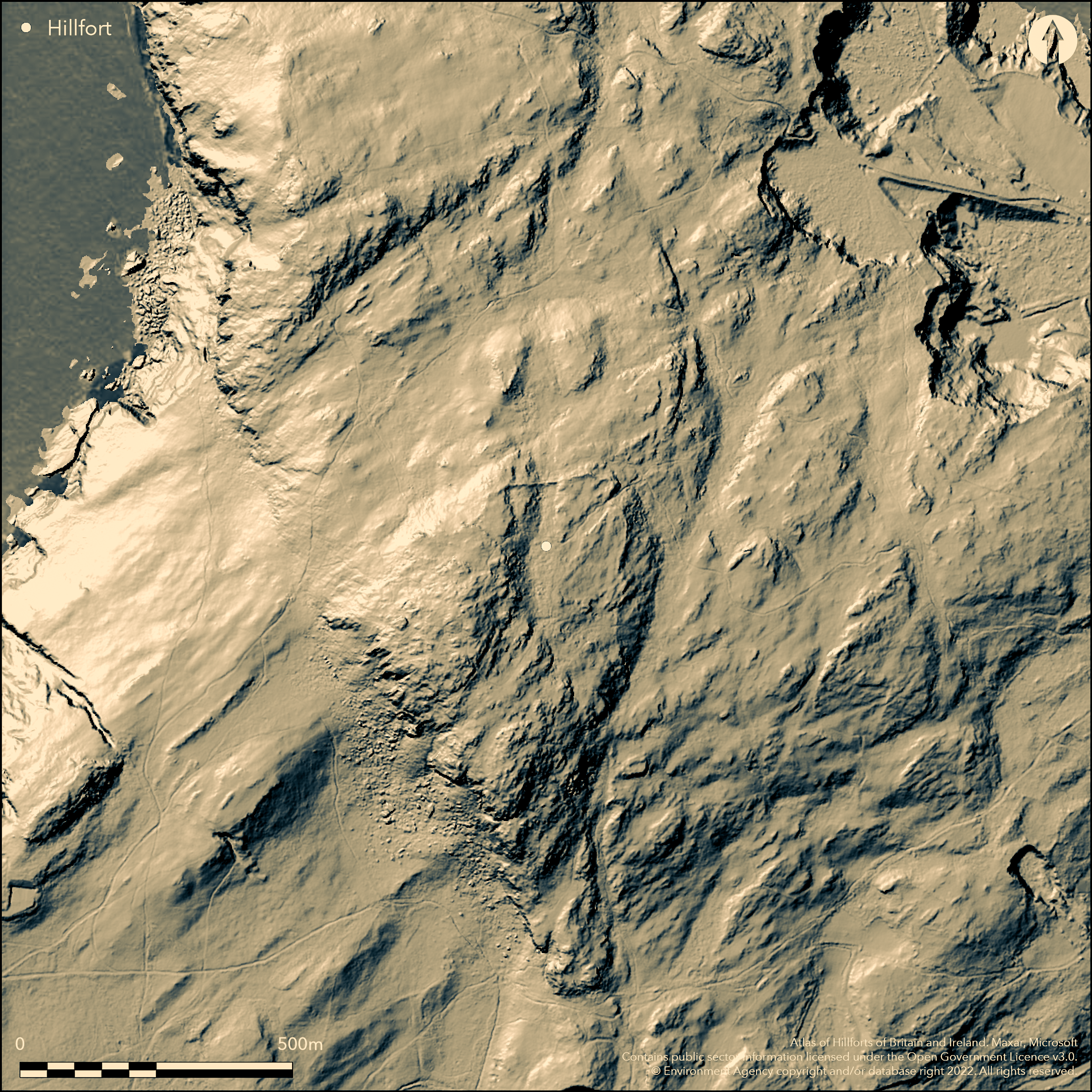
LiDAR 1m DTM Hillshade
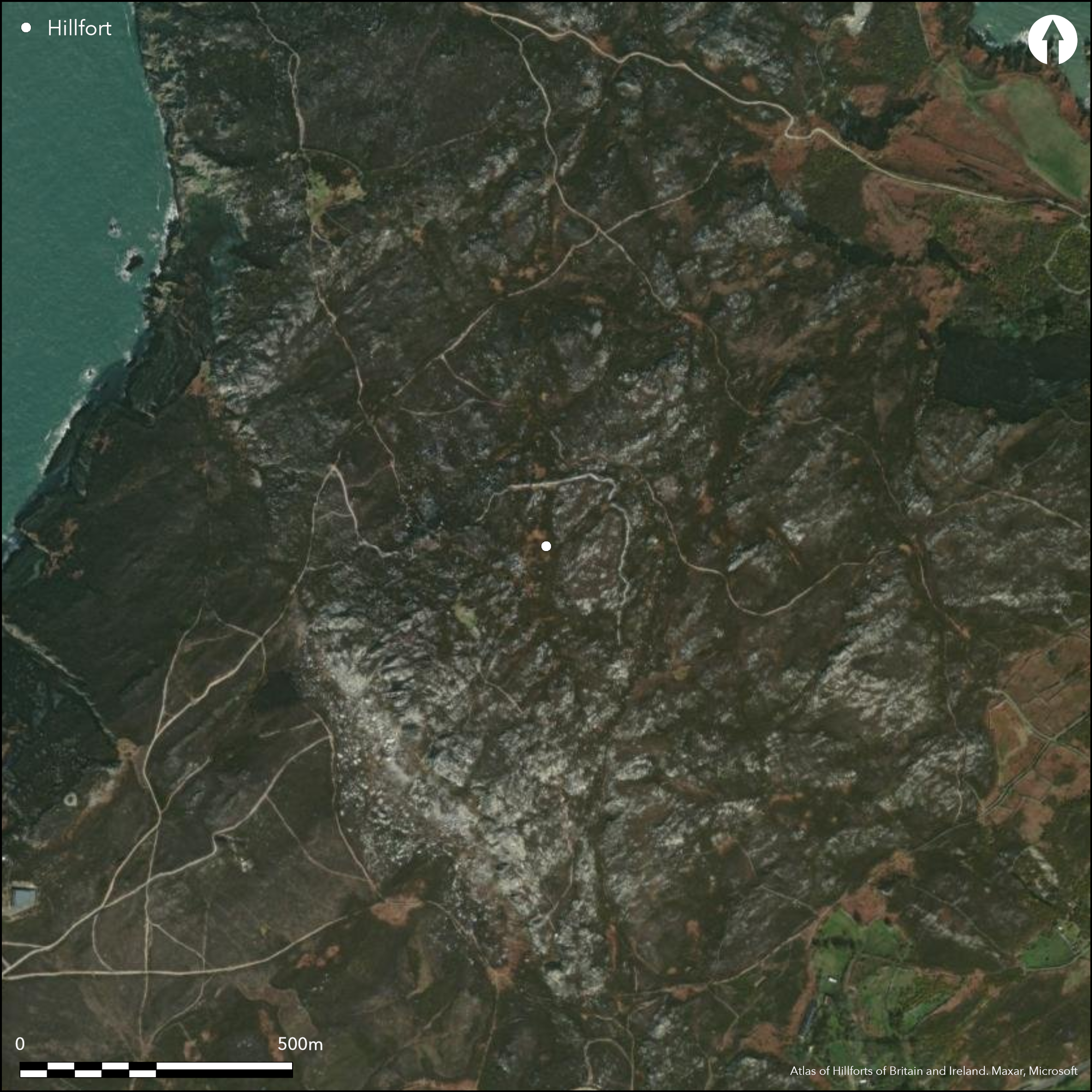
Satellite Imagery
LiDAR 1m DTM Hillshade
Satellite Imagery
Scroll left/right to view further images.
HER: Gwynedd 1760 (None)
NMR: SH 28 SW 5 (93839)
SM: AN019
NGR: SH219830
X: 221952 Y: 383016 (OSGB36)
Fine, large and very rocky partial contour hillfort located on Mynydd Twr (Holyhead Mountain), with steep bare crags to W but more sheltered on NE quarter. Single massive dry-built stone rampart of massive masonry with rubble core on N and E survives to 3.3m high where best, in places using natural rock as bastions. Rampart walkway on inner side and breastwork 2m thick, with possible double version as at Caer Drewyn near Corwen. To SW and SE steep precipice needs no works. Circuit defined around the 575m-650m contours. Excavations at highest point of interior on W summit revealed footings of a tower associated with 2nd to 4th century Roman material and thought to be a Roman signal station, with traces of a second building nearby (Lynch, 1995). This covered a Bronze Age cairn. Part of NW rampart seemingly deliberately destroyed in Roman period or by later Irish raiders. One rocky inturned entrance about 3 m wide at the NE corner within a rocky gully and much protected by natural rock. This continues inside the fort as an avenue flanked by rocky outcrops, opening out as broad flat area before rising again to summit. No huts visible. Gorse, heather and rocky pasture with bare rock outcrops. On 1st Ed. OS map (1889). Undated.
Citizen Science: ✗
Reliability of Data: Confirmed
Reliability of Interpretation: Confirmed
X: -520331 Y: 7041302 (EPSG: 3857)
Longitude: -4.674216507747826 Latitude: 53.314052104106544 (EPSG:4326)
Country: Wales
Current County or Unitary Authority: Isle of Anglesey
Historic County: Anglesey
Current Parish/Community/Council/Townland: Trearddur
Rather well defined for tumbled stone-walled site. Part of NW rampart seemingly deliberately destroyed in Roman period or by later Irish raiders. Public access. Taken into State care in 1913.
| Extant | ✓ |
| Cropmark | ✗ |
| Likely Destroyed | ✓ |
Gorse, heather and rocky pasture with bare rock outcrops.
| Woodland | ✗ |
| Commercial Forestry Plantation | ✗ |
| Parkland | ✗ |
| Pasture (Grazing) | ✓ |
| Arable | ✗ |
| Scrub/Bracken | ✓ |
| Bare Outcrop | ✗ |
| Heather/Moorland | ✓ |
| Heath | ✗ |
| Built-up | ✗ |
| Coastal Grassland | ✗ |
| Other | ✗ |
Fine, large and very rocky partial contour hillfort located on Holyhead Mountain with steep bare crags to the west but more sheltered on the NE quarter. Circuit follows 575m-650m contours, therefore not full contour site.
| Contour Fort | ✗ |
| Partial Contour Fort | ✓ |
| Promontory Fort | ✗ |
| Hillslope Fort | ✗ |
| Level Terrain Fort | ✗ |
| Marsh Fort | ✗ |
| Multiple Enclosure Fort | ✗ |
| Hilltop | ✓ |
| Coastal Promontory | ✗ |
| Inland Promontory | ✗ |
| Valley Bottom | ✗ |
| Knoll/Hillock/Outcrop | ✗ |
| Ridge | ✗ |
| Cliff/Plateau-edge/Scarp | ✗ |
| Hillslope | ✗ |
| Lowland | ✗ |
| Spur | ✗ |
Dominant Topographic Feature: Hill top
| North | ✗ |
| Northeast | ✗ |
| East | ✗ |
| Southeast | ✗ |
| South | ✗ |
| Southwest | ✗ |
| West | ✗ |
| Northwest | ✗ |
| Level | ✓ |
Altitude: 220.0m
N/A
Roman signal station covered a Bronze Age cairn - on W summit of possible 4th century AD date. Part of NW rampart seemingly deliberately destroyed in Roman period or by later Irish raiders.
Reliability: D - None
| Pre 1200BC | ✗ |
| 1200BC - 800BC | ✗ |
| 800BC - 400BC | ✗ |
| 400BC - AD50 | ✗ |
| AD50 - AD400 | ✗ |
| AD400 - AD 800 | ✗ |
| Post AD800 | ✗ |
| Unknown | ✓ |
| Pre Hillfort: | None |
| Post Hillfort: | None |
On 1st Ed. OS map (1889). Full RCAHMW Survey 1937 - no details. RCAHMW Aerial Reconnaissance 2005. Excavation at W summit. GAT prehistoric defended enclosures survey 2004-2005.
| 1st Identified Map Depiction (1889): | OS map. |
| Other (1937): | RCAHMW survey. |
| Other (2005): | RCAHMW Aerial Reconnaissance |
| Other (None): | GAT prehistoric defended enclosures survey. |
| Excavation (None): | Lynch (1995) refers. |
Roman signal station on W summit of possible fourth century AD date. Roman material from summit - no details.
Possible springs nearby.
| None | ✓ |
| Spring | ✗ |
| Stream | ✗ |
| Pool | ✗ |
| Flush | ✗ |
| Well | ✗ |
| Other | ✗ |
None
| No Known Features | ✓ |
| Round Stone Structures | ✗ |
| Rectangular Stone Structures | ✗ |
| Curvilinear Platforms | ✗ |
| Other Roundhouse Evidence | ✗ |
| Pits | ✗ |
| Quarry Hollows | ✗ |
| Other | ✗ |
Excavations at highest point of interior on W summit revealed footings of a tower associated with 2nd to 4th century Roman material and thought to be a Roman signal station, with traces of a second building nearby. This covered a Bronze Age cairn.
| No Known Excavation | ✗ |
| Pits | ✗ |
| Postholes | ✗ |
| Roundhouses | ✗ |
| Rectangular Structures | ✓ |
| Roads/Tracks | ✗ |
| Quarry Hollows | ✗ |
| Other | ✓ |
| Nothing Found | ✗ |
None
| No Known Geophysics | ✓ |
| Pits | ✗ |
| Roundhouses | ✗ |
| Rectangular Structures | ✗ |
| Roads/Tracks | ✗ |
| Quarry Hollows | ✗ |
| Other | ✗ |
| Nothing Found | ✗ |
Roman material from summit - no details.
| No Known Finds | ✗ |
| Pottery | ✗ |
| Metal | ✗ |
| Metalworking | ✗ |
| Human Bones | ✗ |
| Animal Bones | ✗ |
| Lithics | ✗ |
| Environmental | ✗ |
| Other | ✓ |
Roman signal station on W summit of possible fourth century AD date.
| APs Not Checked | ✗ |
| None | ✗ |
| Roundhouses | ✗ |
| Rectangular Structures | ✗ |
| Pits | ✗ |
| Postholes | ✗ |
| Roads/Tracks | ✗ |
| Other | ✓ |
One rocky inturned entrance about 3 m wide at the NE corner within a rocky gully and much protected by natural rock. This continues inside the fort as an avenue flanked by rocky outcrops, opening out as broad flat area before rising again to summit.
| None: | Gaps not defined as much rock outcrops utilised. |
| 2: | None |
Guard Chambers: ✗
Chevaux de Frise: ✗
| 1. In-turned (North east): | None |
Single massive stone rampart of massive masonry with rubble core on N and E survives to 3m in places using natural rock as bastions. Rampart walkway on inner side and breastwork 2m thick, with possible double version as at Caer Drewyn near Corwen. To SW and SE precipice needs no defences. No ditch. 6.8ha
| Area 1: | 6.8ha. |
| Total: | 6.8ha. |
Total Footprint Area: Noneha.
None
| ✗ | None |
| ✗ | None |
| NE Quadrant: | 1 |
| SE Quadrant: | 0 |
| SW Quadrant: | 0 |
| NW Quadrant: | 1 |
| Total: | 1 |
| Partial Univallate | ✓ |
| Univallate | ✗ |
| Partial Bivallate | ✗ |
| Bivallate | ✗ |
| Partial Multivallate | ✗ |
| Multivallate | ✗ |
| Unknown | ✗ |
| Partial Univallate | ✗ |
| Univallate | ✗ |
| Partial Bivallate | ✗ |
| Bivallate | ✗ |
| Partial Multivallate | ✗ |
| Multivallate | ✗ |
Stone-walled site. Single massive dry-built stone rampart of massive masonry with rubble core. Rampart walkway on inner side and breastwork 2m thick.
| None | ✗ |
| Earthen Bank | ✗ |
| Stone Wall | ✓ |
| Rubble | ✗ |
| Wall-walk | ✓ |
| Evidence of Timber | ✗ |
| Vitrification | ✗ |
| Other Burning | ✗ |
| Palisade | ✗ |
| Counter Scarp Bank | ✗ |
| Berm | ✗ |
| Unfinished | ✗ |
| Other | ✓ |
No detail.
| None | ✗ |
| Earthen Bank | ✗ |
| Stone Wall | ✗ |
| Murus Duplex | ✗ |
| Timber-framed | ✗ |
| Timber-laced | ✗ |
| Vitrification | ✗ |
| Other Burning | ✗ |
| Palisade | ✗ |
| Counter Scarp Bank | ✗ |
| Berm | ✗ |
| Unfinished | ✗ |
| No Known Excavation | ✗ |
| Other | ✓ |
| ✗ | None |
| ✗ | None |
Number of Ditches: 0
| ✗ | None |
Brown, I. 2009. Beacons in the landscape. The hillforts of England and Wales, Oxford: Windgather Press/Oxbow Books.
Gardner, W. 1934. Caer y Twr, a Hillfort on Holy Island, Anglesey, Arch Camb, 89 (1934), 156-73.
Hogg, A.H.A. 1965. Early Iron Age, in eds Foster, I.LL and Daniel, G., Prehistoric and Early Wales, London: Routledge and Kegan Paul, 136.
Houlder, C. 1974. Wales: an archaeological guide, 42-43, London and Boston: Faber and Faber, 42-3.
Lynch, F. 1991. Prehistoric Anglesey, Llangefni: Anglesey Antiquarian Society, 263-66.
Lynch, F. 1995. A guide to Ancient and Historic Wales - Gwynedd, London: HMSO, 66-7.
RCAHMW 1937 (reprinted 1960). Anglesey. A survey and inventory by the Royal Commission on Ancient and Historical Monuments in Wales and Monmouthshire, 24, 14, London: HMSO.
Smith, G.H. 2005 , A Survey of Prehistoric Defended Enclosures in North West Wales 2004-2005: West Conwy, Gwynedd (Arfon) and Anglesey, Bangor: Gwynedd Archaeological Trust.
Waddington, K. 2013. The Settlements of Northwest Wales: From the Late Bronze Age to the Early Medieval Period, Cardiff: University of Wales Press.
Atlas of Hillforts:
Wikidata:
This work is licensed under CC BY-SA 4.0

 and should be cited as:
Lock, Gary and Ralston, Ian. 2024. Atlas of Hillforts of Britain and Ireland. Available at: https://hillforts.arch.ox.ac.uk
Document Version 1.1