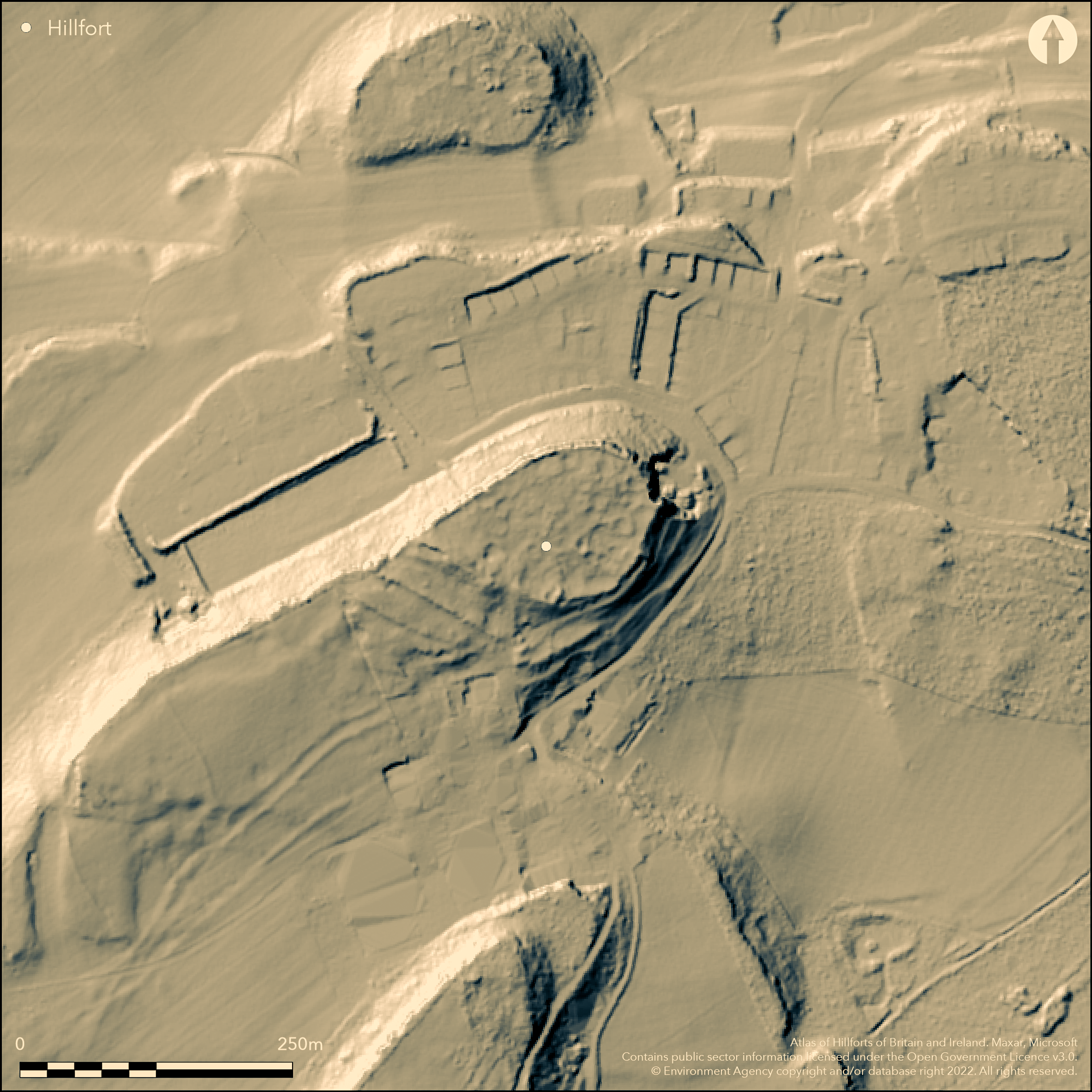
LiDAR 1m DTM Hillshade
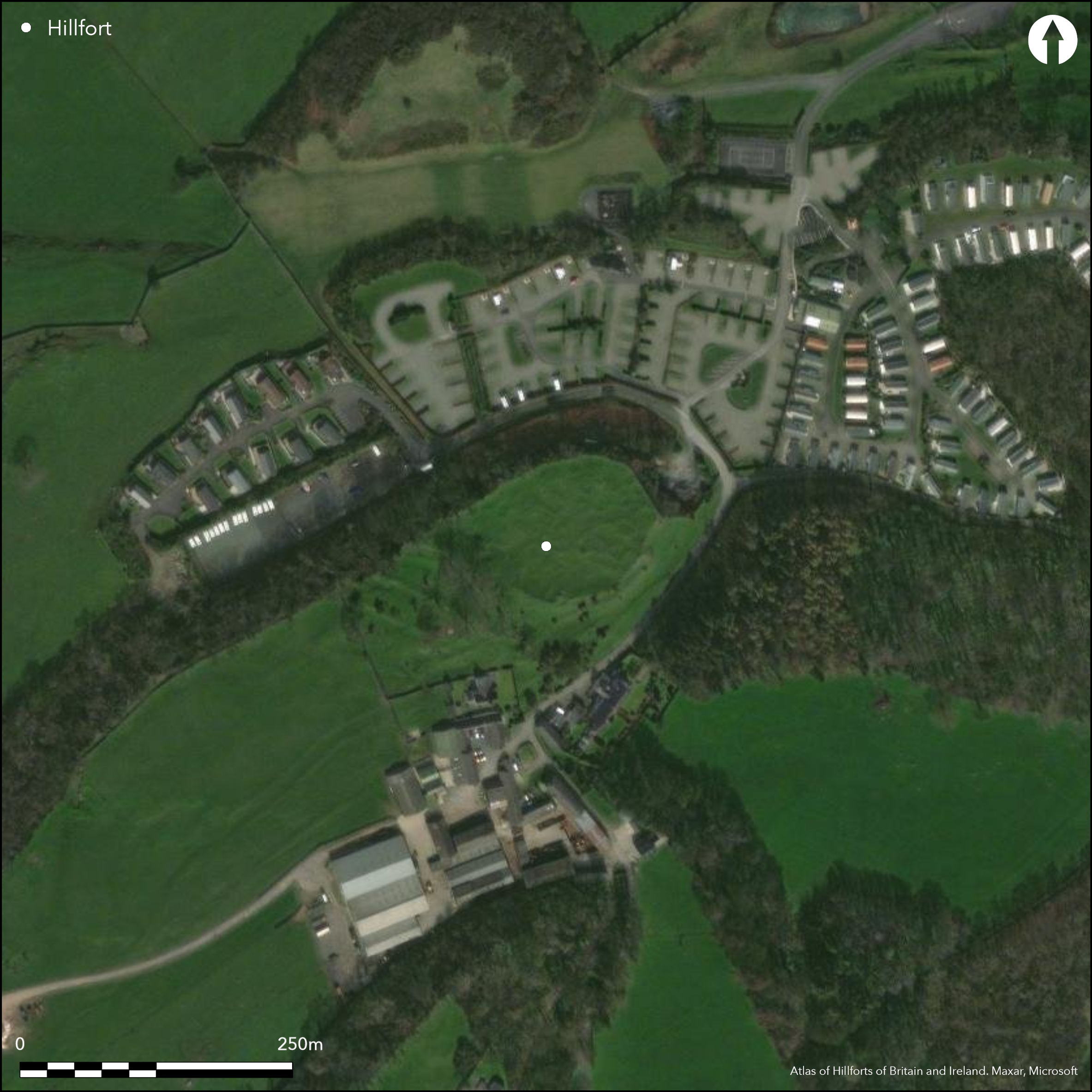
Satellite Imagery
LiDAR 1m DTM Hillshade
Satellite Imagery
Scroll left/right to view further images.
HER: Gwynedd 2203 (None)
NMR: SH 48 SE 1 (95548)
SM: AN041
NGR: SH49458467
X: 249450 Y: 384670 (OSGB36)
Inland promontory fort sited at NE end of a low limestone ridge overlooking Traith Bychan and Moelfre. Sheer cliffs on N and NW, steep to E. Roughly oval c.130m E-W by 80m with internal area 0.77ha. Series of three parallel walls and ditches for each cut off the promontory on the SW. These formerly walls of well-laid large stone blocks of increasing height (inner highest) and thickness with rock-cut ditches. Traces of banks to SE suggest defences on other sides, but not proven, if so fort is of contour type. Large number of hut foundations of c. 7.6m-8.2m diameter. S entrance with causeway through second rampart and inner ditch to gap in inner rampart. Excavations by Rev. Hugh Pritchard (1867) and E. Neil Baynes (1930). Floors of huts found less than 0.6m below ground surface of dark material containing animal bones, shells, charcoal and iron slag and fragments of late 3rd to early 4th century AD Romano-British pottery and tile, glass beads, and eight Roman coins dating to 280-325 AD. Box tile fragments could suggest Roman building on site. Enclosed settlement at Din Lligwy, 1.5km to N also produced Roman tiles, including box tile fragments. Interior pasture. Ramparts part-wooded. Setting affected and site surrounded by development. On 1st Ed. OS map (1889).
Citizen Science: ✗
Reliability of Data: Confirmed
Reliability of Interpretation: Confirmed
X: -474511 Y: 7045662 (EPSG: 3857)
Longitude: -4.262604167685181 Latitude: 53.33744406874063 (EPSG:4326)
Country: Wales
Current County or Unitary Authority: Isle of Anglesey
Historic County: Anglesey
Current Parish/Community/Council/Townland: Llaneugrad
Setting affected and site surrounded by development.
| Extant | ✓ |
| Cropmark | ✗ |
| Likely Destroyed | ✗ |
Interior pasture. Ramparts part-wooded.
| Woodland | ✓ |
| Commercial Forestry Plantation | ✗ |
| Parkland | ✗ |
| Pasture (Grazing) | ✓ |
| Arable | ✗ |
| Scrub/Bracken | ✗ |
| Bare Outcrop | ✗ |
| Heather/Moorland | ✗ |
| Heath | ✗ |
| Built-up | ✗ |
| Coastal Grassland | ✗ |
| Other | ✗ |
Good example of an inland promontory fort sited at NE end of a low limestone ridge overlooking Traith Bychan and Moelfre. Sheer cliffs on N and NW, steep to E. Roughly
| Contour Fort | ✗ |
| Partial Contour Fort | ✗ |
| Promontory Fort | ✓ |
| Hillslope Fort | ✗ |
| Level Terrain Fort | ✗ |
| Marsh Fort | ✗ |
| Multiple Enclosure Fort | ✗ |
| Hilltop | ✗ |
| Coastal Promontory | ✗ |
| Inland Promontory | ✓ |
| Valley Bottom | ✗ |
| Knoll/Hillock/Outcrop | ✗ |
| Ridge | ✓ |
| Cliff/Plateau-edge/Scarp | ✗ |
| Hillslope | ✗ |
| Lowland | ✗ |
| Spur | ✗ |
Dominant Topographic Feature: Ridge promontory..
| North | ✗ |
| Northeast | ✗ |
| East | ✗ |
| Southeast | ✓ |
| South | ✗ |
| Southwest | ✗ |
| West | ✗ |
| Northwest | ✗ |
| Level | ✗ |
Altitude: 99.0m
N/A
Probable Iron Age site but fragments of late 3rd to early 4th century AD Romano-British pottery and tile, glass beads, and eight Roman coins dating to 280-325 AD suggest either long period of use or later re-use of site.
Reliability: C - Low
| Pre 1200BC | ✗ |
| 1200BC - 800BC | ✗ |
| 800BC - 400BC | ✗ |
| 400BC - AD50 | ✓ |
| AD50 - AD400 | ✓ |
| AD400 - AD 800 | ✗ |
| Post AD800 | ✗ |
| Unknown | ✗ |
| Pre Hillfort: | None |
| Post Hillfort: | None |
| Artefactual: | Material from excavations. |
On 1st Ed. OS map (1889). Excavations by Rev. Hugh Pritchard (1867) and E. Neil Baynes (1923). Ordnance Survey observation 1970. GAT prehistoric defended enclosures survey 2004-2005.
| Excavation (1867): | Rev. Hugh Pritchard. |
| 1st Identified Map Depiction (1889): | OS map. |
| Excavation (1923): | E. Neil Baynes. |
| Other (1970): | Ordnance Survey observation. |
| Other (None): | GAT prehistoric defended enclosures survey. |
Animal bones, shells, charcoal and iron slag and fragments of late 3rd to early 4th century AD Romano-British pottery and tile, glass beads, and eight Roman coins dating to 280-325 AD.
Stream 0..35 outside fort.
| None | ✓ |
| Spring | ✗ |
| Stream | ✗ |
| Pool | ✗ |
| Flush | ✗ |
| Well | ✗ |
| Other | ✗ |
None
| No Known Features | ✓ |
| Round Stone Structures | ✗ |
| Rectangular Stone Structures | ✗ |
| Curvilinear Platforms | ✗ |
| Other Roundhouse Evidence | ✗ |
| Pits | ✗ |
| Quarry Hollows | ✗ |
| Other | ✗ |
No details.
| No Known Excavation | ✗ |
| Pits | ✗ |
| Postholes | ✗ |
| Roundhouses | ✗ |
| Rectangular Structures | ✗ |
| Roads/Tracks | ✗ |
| Quarry Hollows | ✗ |
| Other | ✗ |
| Nothing Found | ✓ |
None
| No Known Geophysics | ✓ |
| Pits | ✗ |
| Roundhouses | ✗ |
| Rectangular Structures | ✗ |
| Roads/Tracks | ✗ |
| Quarry Hollows | ✗ |
| Other | ✗ |
| Nothing Found | ✗ |
Animal bones (including horse), shells, charcoal and iron slag and fragments of late 3rd to early 4th century AD Romano-British pottery and tile, glass beads, and eight Roman coins dating to 280-325 AD.
| No Known Finds | ✗ |
| Pottery | ✓ |
| Metal | ✗ |
| Metalworking | ✓ |
| Human Bones | ✗ |
| Animal Bones | ✓ |
| Lithics | ✗ |
| Environmental | ✓ |
| Other | ✓ |
None
| APs Not Checked | ✓ |
| None | ✗ |
| Roundhouses | ✗ |
| Rectangular Structures | ✗ |
| Pits | ✗ |
| Postholes | ✗ |
| Roads/Tracks | ✗ |
| Other | ✗ |
S entrance with causeway through second rampart and inner ditch to gap in inner rampart.
| None: | None |
| 2: | None |
Guard Chambers: ✗
Chevaux de Frise: ✗
| 1. Simple Gap (South): | Causewayed approach. |
Series of three parallel walls and ditches for each cut off the promontory on the SW. These would have been walls of increasing height (inner highest) and thickness with rock-cut ditches from which the stone would have come. Traces of banks to SE suggest that there may have also been defences on the other sides of the fort. 0.77ha.
| Area 1: | 0.77ha. |
| Total: | 0.77ha. |
Total Footprint Area: Noneha.
None
| ✗ | None |
| ✗ | None |
| NE Quadrant: | 0 |
| SE Quadrant: | 0 |
| SW Quadrant: | 3 |
| NW Quadrant: | 0 |
| Total: | 3 |
| Partial Univallate | ✗ |
| Univallate | ✗ |
| Partial Bivallate | ✗ |
| Bivallate | ✗ |
| Partial Multivallate | ✓ |
| Multivallate | ✗ |
| Unknown | ✗ |
| Partial Univallate | ✗ |
| Univallate | ✗ |
| Partial Bivallate | ✗ |
| Bivallate | ✗ |
| Partial Multivallate | ✗ |
| Multivallate | ✗ |
Stone-walled site.
| None | ✗ |
| Earthen Bank | ✗ |
| Stone Wall | ✓ |
| Rubble | ✗ |
| Wall-walk | ✗ |
| Evidence of Timber | ✗ |
| Vitrification | ✗ |
| Other Burning | ✗ |
| Palisade | ✗ |
| Counter Scarp Bank | ✗ |
| Berm | ✗ |
| Unfinished | ✗ |
| Other | ✗ |
None
| None | ✗ |
| Earthen Bank | ✗ |
| Stone Wall | ✓ |
| Murus Duplex | ✗ |
| Timber-framed | ✗ |
| Timber-laced | ✗ |
| Vitrification | ✗ |
| Other Burning | ✗ |
| Palisade | ✗ |
| Counter Scarp Bank | ✗ |
| Berm | ✗ |
| Unfinished | ✗ |
| No Known Excavation | ✗ |
| Other | ✗ |
| ✗ | None |
| ✓ | Rock-cut dirches. |
Number of Ditches: 3
| ✗ | None |
Davidson, J. 2011. Parciau Home Farm, Marianglas, Ynys Mon, GAT Report 964, Bangor: Gwynedd Archaeological Trust.
Lynch, F. 1991. Prehistoric Anglesey, Llangefni: Anglesey Antiquarian Society, 273-76.
Neil Baynes, E. 1930. Notes on Excavations at Bryn Ddiol, Parciau, Arch Camb, 85 (1930), 409-10.
Prichard, H. 1867 Early Remains at Llaneugrad, Anglesey, Arch Camb, 3rd. Series, 8 (1867), 108-115.
RCAHMW 1937 (reprinted 1960). Anglesey. A survey and inventory by the Royal Commission on Ancient and Historical Monuments in Wales and Monmouthshire, 63, 3, London: HMSO.
Smith, G.H. 2005 , A Survey of Prehistoric Defended Enclosures in North West Wales 2004-2005: West Conwy, Gwynedd (Arfon) and Anglesey, Bangor: Gwynedd Archaeological Trust.
Waddington, K. 2013. The Settlements of Northwest Wales: From the Late Bronze Age to the Early Medieval Period, Cardiff: University of Wales Press.
Atlas of Hillforts:
Wikidata:
This work is licensed under CC BY-SA 4.0

 and should be cited as:
Lock, Gary and Ralston, Ian. 2024. Atlas of Hillforts of Britain and Ireland. Available at: https://hillforts.arch.ox.ac.uk
Document Version 1.1