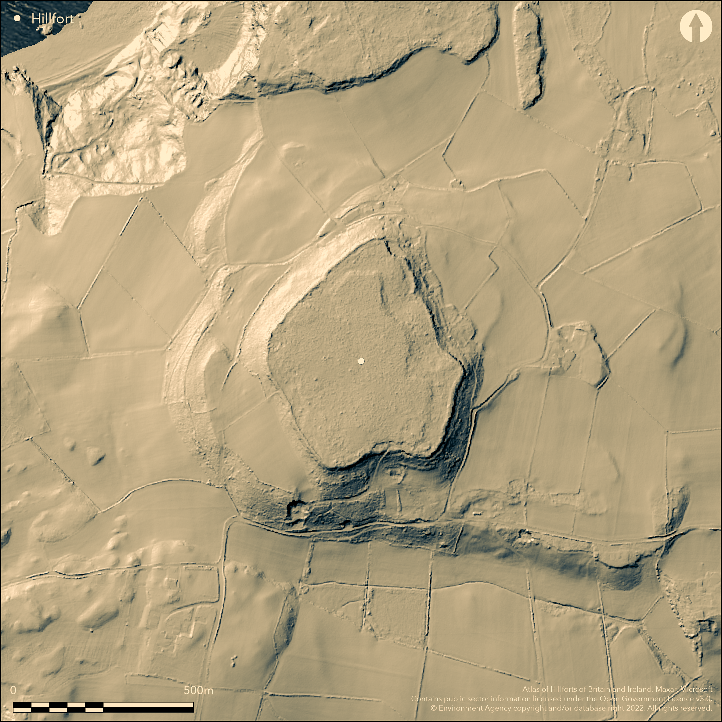
LiDAR 1m DTM Hillshade
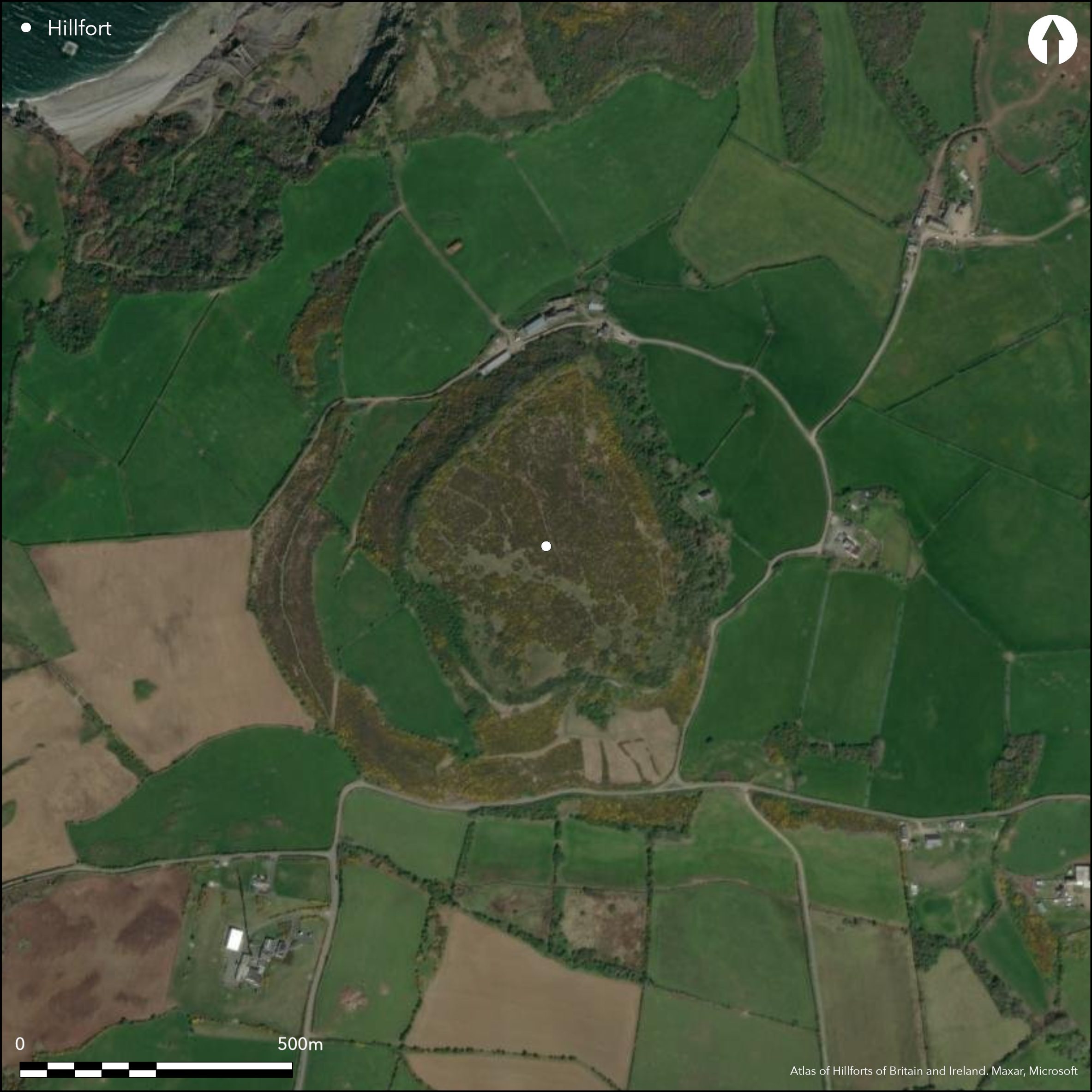
Satellite Imagery
LiDAR 1m DTM Hillshade
Satellite Imagery
Scroll left/right to view further images.
HER: Gwynedd 2595 (None)
NMR: SH 58 SE 2 (93842)
SM: AN024
NGR: SH58638146
X: 258630 Y: 381460 (OSGB36)
Large rocky hilltop contour hillfort dominating the sea at Red Wharf Bay. One of the major forts of Anglesey. Surrounding slopes N, E, and S moderate to strong, W steep with internal area 6.8ha. Single wall, generally under 2.5m thick, formerly encircled the hilltop, set back a little from the crest. Wall composed of upright limestone slabs with inner rubble core average nearly 3m thick. No ditch. Two original entrances through the wall in the centre of S side and on W, S more important and approached by a terraced trackway; W a mere steep gap. Possibly another entrance to NW. Vague indications of a number of hut sites, and on the S the remains of a semi-circular enclosure c. 14m across attached to the main wall. Rich assemblage of late Roman coins and pottery and metal objects and Iron Age pins suggest long occupation or later reuse. Antiquarian accounts (no details) record several other similar attached enclosures and isolated rectangular example, roughly 16m by 8.0m, in the interior. Heavily overgrown in part masking structure of site with quarrying on E and S sides. No excavations. On 1st Ed. OS map (1889). Minimal investigations, undated.
Citizen Science: ✗
Reliability of Data: Confirmed
Reliability of Interpretation: Confirmed
X: -459015 Y: 7040760 (EPSG: 3857)
Longitude: -4.123402850022156 Latitude: 53.31114346488362 (EPSG:4326)
Country: Wales
Current County or Unitary Authority: Isle of Anglesey
Historic County: Anglesey
Current Parish/Community/Council/Townland: Llandonna
Wall destroyed by quarrying to E and S. Farm buildings encroach on NE and NW.
| Extant | ✓ |
| Cropmark | ✗ |
| Likely Destroyed | ✓ |
Rough pasture overgrown with gorse and scrub which masks foundations. Quarrying.
| Woodland | ✗ |
| Commercial Forestry Plantation | ✗ |
| Parkland | ✗ |
| Pasture (Grazing) | ✓ |
| Arable | ✗ |
| Scrub/Bracken | ✓ |
| Bare Outcrop | ✗ |
| Heather/Moorland | ✗ |
| Heath | ✗ |
| Built-up | ✗ |
| Coastal Grassland | ✗ |
| Other | ✓ |
Large rocky hilltop contour hillfort dominating the sea Red Wharf Bay.
| Contour Fort | ✓ |
| Partial Contour Fort | ✗ |
| Promontory Fort | ✗ |
| Hillslope Fort | ✗ |
| Level Terrain Fort | ✗ |
| Marsh Fort | ✗ |
| Multiple Enclosure Fort | ✗ |
| Hilltop | ✓ |
| Coastal Promontory | ✗ |
| Inland Promontory | ✗ |
| Valley Bottom | ✗ |
| Knoll/Hillock/Outcrop | ✗ |
| Ridge | ✗ |
| Cliff/Plateau-edge/Scarp | ✗ |
| Hillslope | ✗ |
| Lowland | ✗ |
| Spur | ✗ |
Dominant Topographic Feature: Hill top
| North | ✗ |
| Northeast | ✗ |
| East | ✗ |
| Southeast | ✗ |
| South | ✗ |
| Southwest | ✗ |
| West | ✗ |
| Northwest | ✗ |
| Level | ✓ |
Altitude: 164.0m
N/A
Rich late Roman assemblage including coins of AD 364 -78 and pottery and metal objects and Iron Age pins 300-200 BC suggest long occupation or later reuse.
Reliability: C - Low
| Pre 1200BC | ✗ |
| 1200BC - 800BC | ✗ |
| 800BC - 400BC | ✗ |
| 400BC - AD50 | ✓ |
| AD50 - AD400 | ✓ |
| AD400 - AD 800 | ✗ |
| Post AD800 | ✗ |
| Unknown | ✗ |
| Pre Hillfort: | None |
| Post Hillfort: | None |
| Artefactual: | Iron Age and late Roman chance finds. |
On 1st Ed. OS map (1889). Ordnance Survey observations, 1967, 1070. GAT investigations 1986, 1988, 1990, 1992. GAT prehistoric defended enclosures survey 2004-2005.
| 1st Identified Map Depiction (1889): | OS map. |
| Other (None): | GAT prehistoric defended enclosures survey. |
| Other (None): | Ordnance Survey observations. |
| Other (None): | GAT investigations. |
| 1st Identified Written Reference (None): | Antiquarian records. |
Vague indications of a number of hut sites, and on the S the remains of a semi- circular enclosure some 18yds across attached to the main wall. Finds of Roman pottery and material of third and fourth century AD and copper and silver hoard with Roman coins found in 1831. Iron ring-headed pins of c. 300-200 BC and short length of hanging chain of near Conquest date also found. Iron hoe and iron spade shoe (metal detector finds).
Stream 0.25km outside fort.
| None | ✓ |
| Spring | ✗ |
| Stream | ✗ |
| Pool | ✗ |
| Flush | ✗ |
| Well | ✗ |
| Other | ✗ |
Vague indications of a number of hut sites, and on the S the remains of a semi-circular enclosure some 18yds across attached to the main wall.
| No Known Features | ✗ |
| Round Stone Structures | ✗ |
| Rectangular Stone Structures | ✗ |
| Curvilinear Platforms | ✗ |
| Other Roundhouse Evidence | ✓ |
| Pits | ✗ |
| Quarry Hollows | ✗ |
| Other | ✓ |
None
| No Known Excavation | ✓ |
| Pits | ✗ |
| Postholes | ✗ |
| Roundhouses | ✗ |
| Rectangular Structures | ✗ |
| Roads/Tracks | ✗ |
| Quarry Hollows | ✗ |
| Other | ✗ |
| Nothing Found | ✗ |
None
| No Known Geophysics | ✓ |
| Pits | ✗ |
| Roundhouses | ✗ |
| Rectangular Structures | ✗ |
| Roads/Tracks | ✗ |
| Quarry Hollows | ✗ |
| Other | ✗ |
| Nothing Found | ✗ |
Finds of Roman material of third and fourth century AD include pottery and copper and silver hoard with Roman coins found in 1831. Coins included issues by Nero, Vespasian, Constantius and Constantine. Iron ring-headed pins of circa 300-200 BC (rare in Wales) and short length of hanging chain of near Conquest date also found. Iron hoe and iron spade shoe (metal detector finds).
| No Known Finds | ✗ |
| Pottery | ✓ |
| Metal | ✓ |
| Metalworking | ✗ |
| Human Bones | ✗ |
| Animal Bones | ✗ |
| Lithics | ✗ |
| Environmental | ✗ |
| Other | ✓ |
None
| APs Not Checked | ✓ |
| None | ✗ |
| Roundhouses | ✗ |
| Rectangular Structures | ✗ |
| Pits | ✗ |
| Postholes | ✗ |
| Roads/Tracks | ✗ |
| Other | ✗ |
Two original entrances through the wall, c. 4.5m wide, in the centre of S side and on W. S more important and approached by a terraced trackway; W a mere steep gap, 2-3m wide. Possibly another and blocked entrance to NW.
| 3: | None |
| 2: | None |
Guard Chambers: ✗
Chevaux de Frise: ✗
| 1. Simple Gap (South): | Approached by terraced trackway. |
| 2. Simple Gap (West): | Steep gap. |
| 3. Blocked (North west): | Possible former entrance. |
Single wall formerly encircled the hilltop, set back a little from the crest. Wall composed of upright limestone slabs with inner rubble core average nearly 3m thick. No ditch. 6.8ha.
| Area 1: | 6.8ha. |
| Total: | 6.8ha. |
Total Footprint Area: Noneha.
None
| ✗ | None |
| ✓ | None |
| NE Quadrant: | 1 |
| SE Quadrant: | 1 |
| SW Quadrant: | 1 |
| NW Quadrant: | 1 |
| Total: | 1 |
| Partial Univallate | ✗ |
| Univallate | ✓ |
| Partial Bivallate | ✗ |
| Bivallate | ✗ |
| Partial Multivallate | ✗ |
| Multivallate | ✗ |
| Unknown | ✗ |
| Partial Univallate | ✗ |
| Univallate | ✗ |
| Partial Bivallate | ✗ |
| Bivallate | ✗ |
| Partial Multivallate | ✗ |
| Multivallate | ✗ |
Wall composed of upright limestone slabs with inner rubble core average nearly 3m thick.
| None | ✗ |
| Earthen Bank | ✗ |
| Stone Wall | ✓ |
| Rubble | ✓ |
| Wall-walk | ✗ |
| Evidence of Timber | ✗ |
| Vitrification | ✗ |
| Other Burning | ✗ |
| Palisade | ✗ |
| Counter Scarp Bank | ✗ |
| Berm | ✗ |
| Unfinished | ✗ |
| Other | ✗ |
None
| None | ✗ |
| Earthen Bank | ✗ |
| Stone Wall | ✗ |
| Murus Duplex | ✗ |
| Timber-framed | ✗ |
| Timber-laced | ✗ |
| Vitrification | ✗ |
| Other Burning | ✗ |
| Palisade | ✗ |
| Counter Scarp Bank | ✗ |
| Berm | ✗ |
| Unfinished | ✗ |
| No Known Excavation | ✓ |
| Other | ✗ |
| ✗ | None |
| ✗ | None |
Number of Ditches: 0
| ✗ | None |
Kelly, R. S. 1990. Prehistory. Anglesey. Bwrdd Arthur, Arch in Wales, 30, 41.
Lynch, F. 1991. Prehistoric Anglesey, Llangefni: Anglesey Antiquarian Society, 260-62.
RCAHMW 1937 (reprinted 1960). Anglesey. A survey and inventory by the Royal Commission on Ancient and Historical Monuments in Wales and Monmouthshire, 83, 2, London: HMSO.
Smith, G.H. 2005 , A Survey of Prehistoric Defended Enclosures in North West Wales 2004-2005: West Conwy, Gwynedd (Arfon) and Anglesey, Bangor: Gwynedd Archaeological Trust.
Waddington, K. 2013. The Settlements of Northwest Wales: From the Late Bronze Age to the Early Medieval Period, Cardiff: University of Wales Press.
Atlas of Hillforts:
Wikidata:
This work is licensed under CC BY-SA 4.0

 and should be cited as:
Lock, Gary and Ralston, Ian. 2024. Atlas of Hillforts of Britain and Ireland. Available at: https://hillforts.arch.ox.ac.uk
Document Version 1.1