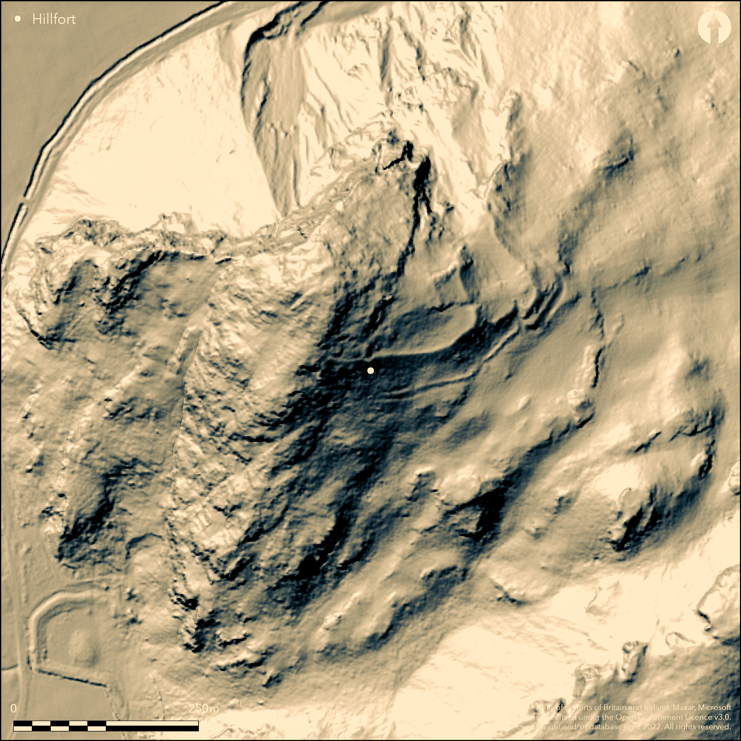
LiDAR 1m DTM Hillshade
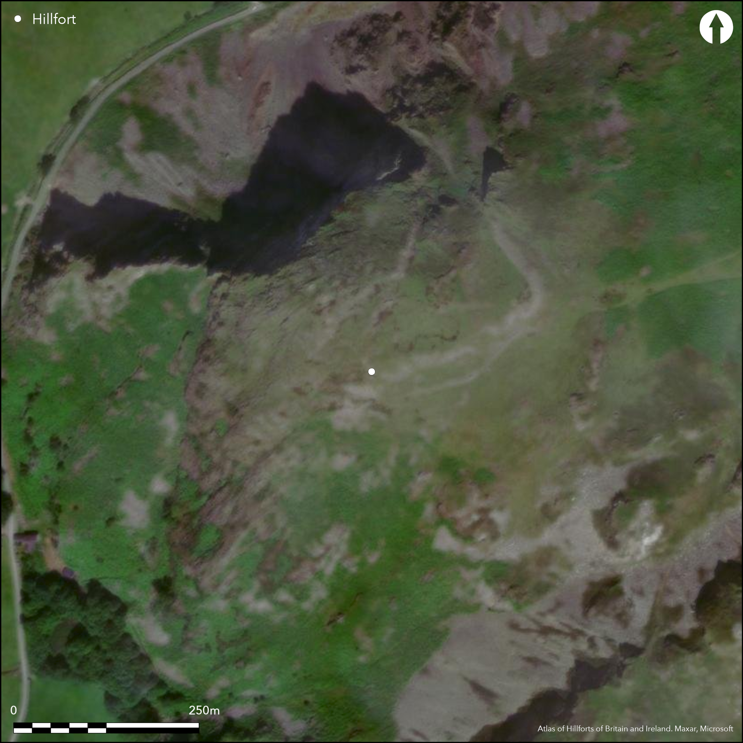
Satellite Imagery
LiDAR 1m DTM Hillshade
Satellite Imagery
Scroll left/right to view further images.
HER: Gwynedd 2963 (None)
NMR: SH 60 NW 1 (302862)
SM: ME075
NGR: SH64400680
X: 264400 Y: 306800 (OSGB36)
Contour hillfort sited on the landward SE col or saddle of ground against the prominent and towering crag of Craig-yr-Aderyn (Birds Rock), unusable as enclosure site, divided from the main massif by this col, and located above the Afon Dysynni valley to NW and near its confluence with the Nant Gwernol. Peaks of Cadair Idris to NE. Further to S lie two more impressive crags with scree, bare rock and quartz seams. On top of tallest is Bronze Age cairn. Precipitous on N, S and W, moderate to strong on E. Two construction phases of 0.6 ha and 1.6 ha. The earlier, smaller and inner upper fort of 100m by 55m has now turf-covered banks across the E and S slopes meeting at a right angle and giving restricted space for development. The second phase, lower fort, 119m by 170m, involved massive revetted stone wall running from the original S bank corner and swinging NE, thus running parallel with the E bank and up to the N precipice, with more space. A smaller bank and stone wall were added outside the E and S defences respectively, comprising an earthen terrace and outer ditch on SE and E sides to E of the main gate, and a tumbled stone wall running W of the main gate. At the back of the S bank a grassy shelf could have taken a structure. First slightly inturned phase entrance is on the E side being an uphill passage 2.4m-3 m wide. The second phase uphill entrance on the SE of c. 3m in width is elaborately inturned with portions of wall remaining. A 'cwt' or hut dug into by Wynne Ffoulkes c. 1874, not excavation. Finds included Roman pottery, weight or plumb bob of rolled sheet lead, part of curved lead bar, possibly an armlet. Weathered trenches visible in E angle of outer enclosure (no details). To W of main gate, rectangular structures or folds built from the stonework of the outer rampart at unknown date.
Citizen Science: ✗
Reliability of Data: Confirmed
Reliability of Interpretation: Confirmed
X: -445895 Y: 6917036 (EPSG: 3857)
Longitude: -4.005547342361203 Latitude: 52.641923482853905 (EPSG:4326)
Country: Wales
Current County or Unitary Authority: Gwynedd
Historic County: Merioneth
Current Parish/Community/Council/Townland: Llanfihangel-y-Pennant
Fallen walls but general good condition.
| Extant | ✓ |
| Cropmark | ✗ |
| Likely Destroyed | ✗ |
Upland rough grass and bare rock.
| Woodland | ✗ |
| Commercial Forestry Plantation | ✗ |
| Parkland | ✗ |
| Pasture (Grazing) | ✗ |
| Arable | ✗ |
| Scrub/Bracken | ✓ |
| Bare Outcrop | ✗ |
| Heather/Moorland | ✗ |
| Heath | ✗ |
| Built-up | ✗ |
| Coastal Grassland | ✗ |
| Other | ✗ |
Contour hillfort sited on the landward SE col or saddle of ground against the prominent and towering crag of Craig-yr-Aderyn, unusable as enclosure site, divided from the main massif by this col, and located above the Afon Dysynni valley to NW to coast and near its confluence with the Nant Gw. Peaks of Cadair Idris to E. Further to S lie two more impressive crags with scree, bare rock and quartz seams. On top of tallest is Bronze Age cairn. Precipitous on N, S and W, moderate to strong on E.
| Contour Fort | ✓ |
| Partial Contour Fort | ✗ |
| Promontory Fort | ✗ |
| Hillslope Fort | ✗ |
| Level Terrain Fort | ✗ |
| Marsh Fort | ✗ |
| Multiple Enclosure Fort | ✗ |
| Hilltop | ✓ |
| Coastal Promontory | ✗ |
| Inland Promontory | ✗ |
| Valley Bottom | ✗ |
| Knoll/Hillock/Outcrop | ✓ |
| Ridge | ✗ |
| Cliff/Plateau-edge/Scarp | ✗ |
| Hillslope | ✗ |
| Lowland | ✗ |
| Spur | ✗ |
Dominant Topographic Feature: Col
| North | ✗ |
| Northeast | ✗ |
| East | ✓ |
| Southeast | ✗ |
| South | ✗ |
| Southwest | ✗ |
| West | ✗ |
| Northwest | ✗ |
| Level | ✗ |
Altitude: 232.0m
N/A
Finds included Roman pottery suggesting long occupation or re-use from Iron Age.
Reliability: C - Low
| Pre 1200BC | ✗ |
| 1200BC - 800BC | ✗ |
| 800BC - 400BC | ✗ |
| 400BC - AD50 | ✓ |
| AD50 - AD400 | ✓ |
| AD400 - AD 800 | ✗ |
| Post AD800 | ✗ |
| Unknown | ✗ |
| Pre Hillfort: | None |
| Post Hillfort: | None |
| Artefactual: | Roman pottery. |
'Cwt' dug into by Wynne Ffoulkes c. 1874. Ordnance Survey observation 1972. GAT investigation 1988, 2002, 2004. GAT prehistoric defended enclosures survey 2005-2006.
| Other (1972): | Ordnance Survey observation 1972. |
| Other (None): | GAT investigation. |
| Other (None): | GAT prehistoric defended enclosures survey. |
| Other (None): | Wynne Ffoulkes |
To W of main gate, rectangular structures or folds built from the stonework of the outer rampart at unknown date. Finds included Roman pottery, weight or plumb bob of rolled sheet lead.
Stream 0.3km outside fort.
| None | ✓ |
| Spring | ✗ |
| Stream | ✗ |
| Pool | ✗ |
| Flush | ✗ |
| Well | ✗ |
| Other | ✗ |
None
| No Known Features | ✓ |
| Round Stone Structures | ✗ |
| Rectangular Stone Structures | ✗ |
| Curvilinear Platforms | ✗ |
| Other Roundhouse Evidence | ✗ |
| Pits | ✗ |
| Quarry Hollows | ✗ |
| Other | ✗ |
To W of main gate, rectangular structures or folds built from the stonework of the outer rampart at unknown date.
| No Known Excavation | ✗ |
| Pits | ✗ |
| Postholes | ✗ |
| Roundhouses | ✗ |
| Rectangular Structures | ✓ |
| Roads/Tracks | ✗ |
| Quarry Hollows | ✗ |
| Other | ✓ |
| Nothing Found | ✗ |
None
| No Known Geophysics | ✓ |
| Pits | ✗ |
| Roundhouses | ✗ |
| Rectangular Structures | ✗ |
| Roads/Tracks | ✗ |
| Quarry Hollows | ✗ |
| Other | ✗ |
| Nothing Found | ✗ |
Finds included Roman pottery, weight or plumb bob of rolled sheet lead.
| No Known Finds | ✗ |
| Pottery | ✓ |
| Metal | ✓ |
| Metalworking | ✗ |
| Human Bones | ✗ |
| Animal Bones | ✗ |
| Lithics | ✗ |
| Environmental | ✗ |
| Other | ✗ |
None
| APs Not Checked | ✓ |
| None | ✗ |
| Roundhouses | ✗ |
| Rectangular Structures | ✗ |
| Pits | ✗ |
| Postholes | ✗ |
| Roads/Tracks | ✗ |
| Other | ✗ |
First slightly inturned phase entrance is on the E side being an uphill passage 2.4m-3 m wide. A deep earthwork remains which may have been a formal walled corridor beneath a crossing bridge. The second phase uphill entrance on the SE of c. 3m in width is elaborately inturned with portions of wall remaining.
| 2: | None |
| 2: | None |
Guard Chambers: ✗
Chevaux de Frise: ✗
| 1. In-turned (East): | First phase entrance. |
| 1. Passage-way/Corridor (East): | None |
| 2. In-turned (South east): | Second phase entance. |
| 2. Passage-way/Corridor (South east): | None |
The earlier, smaller and inner upper fort of 100m by 55m has now turf-covered banks across the E and S slopes meeting at a right angle and giving restricted space for development. The second phase, lower fort, 119m by 170m, involved massive revetted stone wall running from the original S bank corner and swinging NE, thus running parallel with the E bank and up to the N precipice, with more space. A smaller bank and stone wall were added outside the E and S defences respectively, comprising an earthen terrace and outer ditch on SE and E sides to E of the main gate, and a tumbled stone wall running W of the main gate.
| Area 1: | 0.6ha. |
| Area 2: | 1.6ha. |
| Total: | 1.6ha. |
Total Footprint Area: Noneha.
None
| ✗ | Two construction phases. |
| ✗ | None |
| NE Quadrant: | 3 |
| SE Quadrant: | 3 |
| SW Quadrant: | 0 |
| NW Quadrant: | 0 |
| Total: | 3 |
| Partial Univallate | ✗ |
| Univallate | ✗ |
| Partial Bivallate | ✗ |
| Bivallate | ✗ |
| Partial Multivallate | ✓ |
| Multivallate | ✗ |
| Unknown | ✗ |
| Partial Univallate | ✗ |
| Univallate | ✗ |
| Partial Bivallate | ✗ |
| Bivallate | ✗ |
| Partial Multivallate | ✗ |
| Multivallate | ✗ |
Stone-walled site.
| None | ✗ |
| Earthen Bank | ✗ |
| Stone Wall | ✓ |
| Rubble | ✗ |
| Wall-walk | ✗ |
| Evidence of Timber | ✗ |
| Vitrification | ✗ |
| Other Burning | ✗ |
| Palisade | ✗ |
| Counter Scarp Bank | ✗ |
| Berm | ✗ |
| Unfinished | ✗ |
| Other | ✗ |
None
| None | ✗ |
| Earthen Bank | ✗ |
| Stone Wall | ✗ |
| Murus Duplex | ✗ |
| Timber-framed | ✗ |
| Timber-laced | ✗ |
| Vitrification | ✗ |
| Other Burning | ✗ |
| Palisade | ✗ |
| Counter Scarp Bank | ✗ |
| Berm | ✗ |
| Unfinished | ✗ |
| No Known Excavation | ✓ |
| Other | ✗ |
| ✗ | None |
| ✓ | None |
Number of Ditches: 1
| ✗ | None |
Bowen E.G. and Gresham, C.A. 1967. History of Merioneth, 1, Dolgellau, 142-144, 262.
RCAHMW 1921. An inventory of the ancient monuments in Wales and Monmouthshire, VI, County of Merioneth, 112, 348, London: HMSO.
Smith, G.H. 2006. A survey of prehistoric defended enclosures in north-west Wales 2005-2006: Gwynedd Dwyfor and Meirionnydd. Report No 634. Part I: Survey Report. Bangor: Gwynedd Archaeological Trust.
Waddington, K. 2013. The Settlements of Northwest Wales: From the Late Bronze Age to the Early Medieval Period, Cardiff: University of Wales Press.
Atlas of Hillforts:
Wikidata:
This work is licensed under CC BY-SA 4.0

 and should be cited as:
Lock, Gary and Ralston, Ian. 2024. Atlas of Hillforts of Britain and Ireland. Available at: https://hillforts.arch.ox.ac.uk
Document Version 1.1