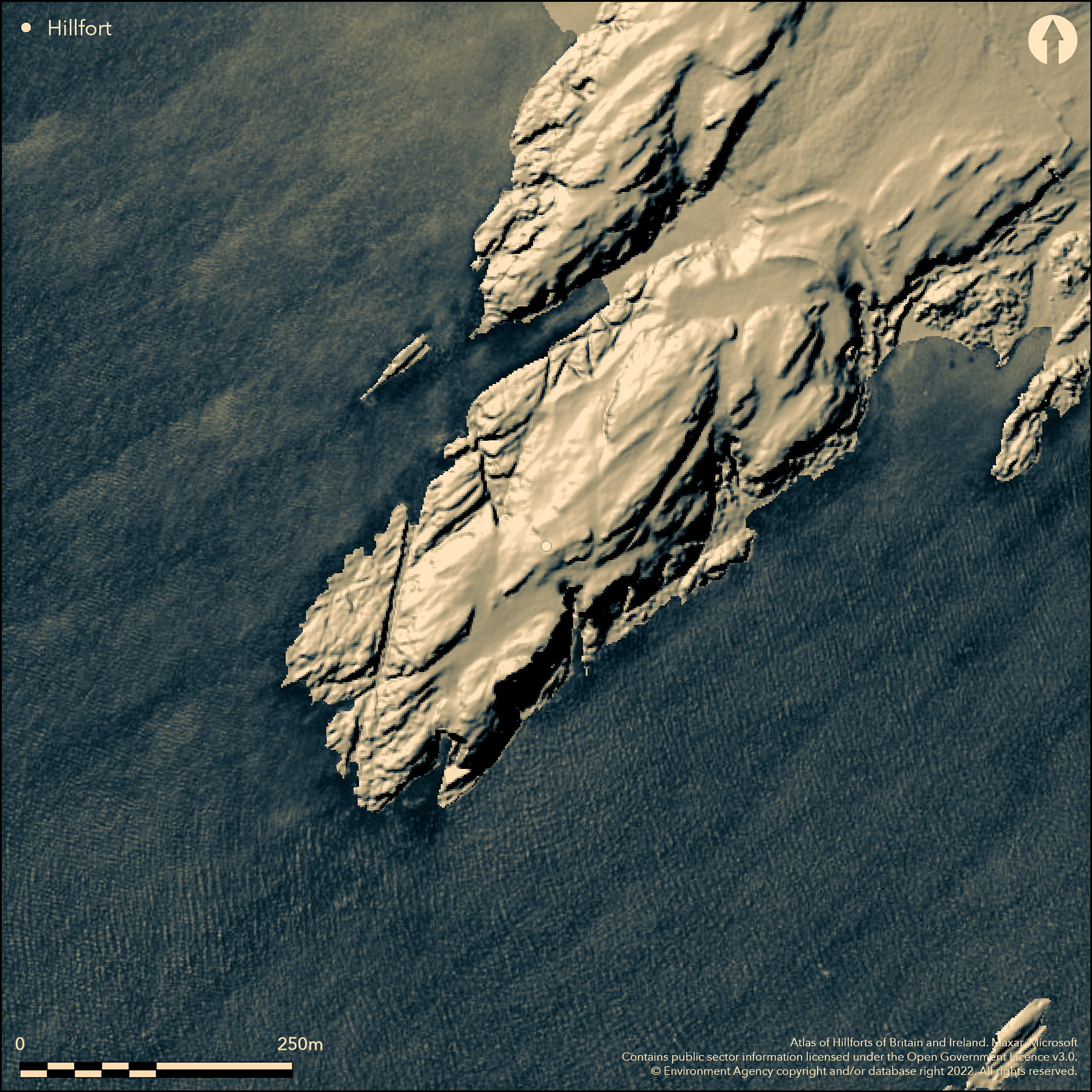
LiDAR 1m DTM Hillshade
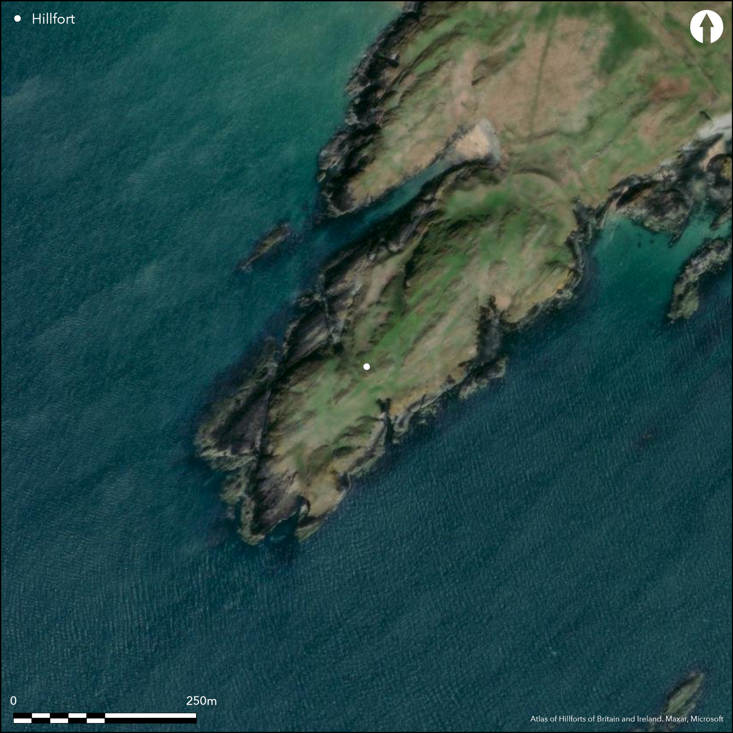
Satellite Imagery
LiDAR 1m DTM Hillshade
Satellite Imagery
Scroll left/right to view further images.
HER: Gwynedd 3024 (None)
NMR: SH 36 SE 1 (93864)
SM: AN049
NGR: SH36816492
X: 236810 Y: 364920 (OSGB36)
Coastal promontory fort dominating Aberffraw Bay to NW and Malltraeth Bay to SE, Anglesey. Precipitous sea cliffs on E, S and W, moderate to strong slope landward to NE. Ramparts cut off narrow neck of long promontory on landward NE side. Promontory roughly 350m long by max. 100m wide and fort internal area c. 3.8ha, but amount of this is bare rocky crags and only on E is occupation possible. However, considerable sea erosion probable since Iron Age and original site not like it is today. Main rampart massive 2.4m high bank running across 70m wide neck. Entrance gap at N end. Two outer ramparts or ruined walls, on N side of neck but only one to S where a crag rises on landward side. Ramparts vary in height from 0.3m-2.4m with some stone revetting walls along the N and NW sides. Entrance winds between these outer ramparts. Diggings in 1938 by Sir George Meyrick produced rim sherds of a 3rd/4th century Roman mortaria, iron spearhead and crucible fragment bearing traces of copper; all from immediately within the ramparts. On 1st Ed OS map (1885-1900).
Citizen Science: ✗
Reliability of Data: Confirmed
Reliability of Interpretation: Confirmed
X: -494497 Y: 7011966 (EPSG: 3857)
Longitude: -4.442138094381951 Latitude: 53.1563249501825 (EPSG:4326)
Country: Wales
Current County or Unitary Authority: Isle of Anglesey
Historic County: Anglesey
Current Parish/Community/Council/Townland: Bodorgan
Affected by coastal erosion.
| Extant | ✓ |
| Cropmark | ✗ |
| Likely Destroyed | ✓ |
Coastal grassland and bare rock.
| Woodland | ✗ |
| Commercial Forestry Plantation | ✗ |
| Parkland | ✗ |
| Pasture (Grazing) | ✗ |
| Arable | ✗ |
| Scrub/Bracken | ✗ |
| Bare Outcrop | ✗ |
| Heather/Moorland | ✗ |
| Heath | ✗ |
| Built-up | ✗ |
| Coastal Grassland | ✓ |
| Other | ✗ |
Coastal promontory fort dominating Aberffraw Bay to NW and Malltraeth Bay to SE, Anglesey. Precipitous sea cliffs on E, S and W, moderate to strong slope landward to NE.
| Contour Fort | ✗ |
| Partial Contour Fort | ✗ |
| Promontory Fort | ✓ |
| Hillslope Fort | ✗ |
| Level Terrain Fort | ✗ |
| Marsh Fort | ✗ |
| Multiple Enclosure Fort | ✗ |
| Hilltop | ✗ |
| Coastal Promontory | ✓ |
| Inland Promontory | ✗ |
| Valley Bottom | ✗ |
| Knoll/Hillock/Outcrop | ✗ |
| Ridge | ✗ |
| Cliff/Plateau-edge/Scarp | ✗ |
| Hillslope | ✗ |
| Lowland | ✗ |
| Spur | ✗ |
Dominant Topographic Feature: Coastal headland
| North | ✗ |
| Northeast | ✗ |
| East | ✗ |
| Southeast | ✗ |
| South | ✗ |
| Southwest | ✓ |
| West | ✗ |
| Northwest | ✗ |
| Level | ✗ |
Altitude: 10.0m
N/A
None
Reliability: D - None
| Pre 1200BC | ✗ |
| 1200BC - 800BC | ✗ |
| 800BC - 400BC | ✗ |
| 400BC - AD50 | ✗ |
| AD50 - AD400 | ✗ |
| AD400 - AD 800 | ✗ |
| Post AD800 | ✗ |
| Unknown | ✓ |
| Pre Hillfort: | None |
| Post Hillfort: | Roman pottery of 3rd/4th century AD. |
On 1st Ed OS map (1885-1900). Diggings in 1938 by Sir George Meyrick. Ordnance Survey observations. 1963, 1970. GAT investigations 1986, 1992. GAT Coastal Erosion Survey: Anglesey 1997. GAT prehistoric defended enclosures survey 2004-2005.
| Excavation (1938): | Sir George Meyrick. |
| Other (1997): | GAT Coastal Erosion Survey: Anglesey. |
| 1st Identified Map Depiction (None): | OS map. |
| Other (None): | Ordnance Survey observations. |
| Other (None): | GAT investigations. |
| Other (None): | GAT prehistoric defended enclosures survey. |
Rim sherds of a 3rd/4th century Roman mortaria, iron spearhead and crucible fragment bearing traces of copper; all from immediately within the ramparts. Pottery pot boiler.
None
| None | ✓ |
| Spring | ✗ |
| Stream | ✗ |
| Pool | ✗ |
| Flush | ✗ |
| Well | ✗ |
| Other | ✗ |
None
| No Known Features | ✓ |
| Round Stone Structures | ✗ |
| Rectangular Stone Structures | ✗ |
| Curvilinear Platforms | ✗ |
| Other Roundhouse Evidence | ✗ |
| Pits | ✗ |
| Quarry Hollows | ✗ |
| Other | ✗ |
None
| No Known Excavation | ✗ |
| Pits | ✗ |
| Postholes | ✗ |
| Roundhouses | ✗ |
| Rectangular Structures | ✗ |
| Roads/Tracks | ✗ |
| Quarry Hollows | ✗ |
| Other | ✗ |
| Nothing Found | ✓ |
None
| No Known Geophysics | ✓ |
| Pits | ✗ |
| Roundhouses | ✗ |
| Rectangular Structures | ✗ |
| Roads/Tracks | ✗ |
| Quarry Hollows | ✗ |
| Other | ✗ |
| Nothing Found | ✗ |
Rim sherds of a third-fourth century Roman mortaria, iron spearhead and crucible fragment bearing traces of copper; all from immediately within the ramparts. Pottery pot boiler.
| No Known Finds | ✗ |
| Pottery | ✓ |
| Metal | ✓ |
| Metalworking | ✓ |
| Human Bones | ✗ |
| Animal Bones | ✗ |
| Lithics | ✗ |
| Environmental | ✗ |
| Other | ✗ |
None
| APs Not Checked | ✓ |
| None | ✗ |
| Roundhouses | ✗ |
| Rectangular Structures | ✗ |
| Pits | ✗ |
| Postholes | ✗ |
| Roads/Tracks | ✗ |
| Other | ✗ |
Gap at N end. Entrance winds between outer ramparts.
| 1: | None |
| 2: | None |
Guard Chambers: ✗
Chevaux de Frise: ✗
| 1. Simple Gap (North east): | None |
| 1. Simple Gap (North east): | Entrance winds between outer ramparts. |
Main rampart massive 2.4m high bank running across 70m wide neck. Two outer ramparts or ruined walls, on N side of neck but only one to S where a crag rises on landward side. Ramparts vary in height from 0.3-2.4m with some stone revetting walls along the N and NW sides. No ditch. 3.8ha.
| Area 1: | 3.8ha. |
| Total: | 3.8ha. |
Total Footprint Area: Noneha.
None
| ✗ | None |
| ✗ | None |
| NE Quadrant: | 3 |
| SE Quadrant: | 0 |
| SW Quadrant: | 0 |
| NW Quadrant: | 0 |
| Total: | 3 |
| Partial Univallate | ✗ |
| Univallate | ✗ |
| Partial Bivallate | ✗ |
| Bivallate | ✗ |
| Partial Multivallate | ✓ |
| Multivallate | ✗ |
| Unknown | ✗ |
| Partial Univallate | ✗ |
| Univallate | ✗ |
| Partial Bivallate | ✗ |
| Bivallate | ✗ |
| Partial Multivallate | ✗ |
| Multivallate | ✗ |
Stone walls with some stone revetting walls along the N and NW sides.
| None | ✗ |
| Earthen Bank | ✗ |
| Stone Wall | ✓ |
| Rubble | ✗ |
| Wall-walk | ✗ |
| Evidence of Timber | ✗ |
| Vitrification | ✗ |
| Other Burning | ✗ |
| Palisade | ✗ |
| Counter Scarp Bank | ✗ |
| Berm | ✗ |
| Unfinished | ✗ |
| Other | ✗ |
No details of 1938 diggings.
| None | ✓ |
| Earthen Bank | ✗ |
| Stone Wall | ✗ |
| Murus Duplex | ✗ |
| Timber-framed | ✗ |
| Timber-laced | ✗ |
| Vitrification | ✗ |
| Other Burning | ✗ |
| Palisade | ✗ |
| Counter Scarp Bank | ✗ |
| Berm | ✗ |
| Unfinished | ✗ |
| No Known Excavation | ✗ |
| Other | ✗ |
| ✗ | None |
| ✗ | None |
Number of Ditches: 0
| ✗ | None |
Jones, S. 1997. Coastal Erosion Survey - Anglesey, Report No. 251, Bangor: Gwynedd Archaeological Trust.
Lynch, F. 1991. Prehistoric Anglesey, Llangefni: Anglesey Antiquarian Society.
RCAHMW 1937 (reprinted 1960). Anglesey. A survey and inventory by the Royal Commission on Ancient and Historical Monuments in Wales and Monmouthshire, 87-8, 4, London: HMSO
Smith, G.H. 2005 , A Survey of Prehistoric Defended Enclosures in North West Wales 2004-2005: West Conwy, Gwynedd (Arfon) and Anglesey, Bangor: Gwynedd Archaeological Trust.
Waddington, K. 2013. The Settlements of Northwest Wales: From the Late Bronze Age to the Early Medieval Period, Cardiff: University of Wales Press.
Williams, I. 1945. Recent Finds in Anglesey, Trans Anglesey Antiquarian Soc and Field Club, for 1945, 21-2.
Atlas of Hillforts:
Wikidata:
This work is licensed under CC BY-SA 4.0

 and should be cited as:
Lock, Gary and Ralston, Ian. 2024. Atlas of Hillforts of Britain and Ireland. Available at: https://hillforts.arch.ox.ac.uk
Document Version 1.1