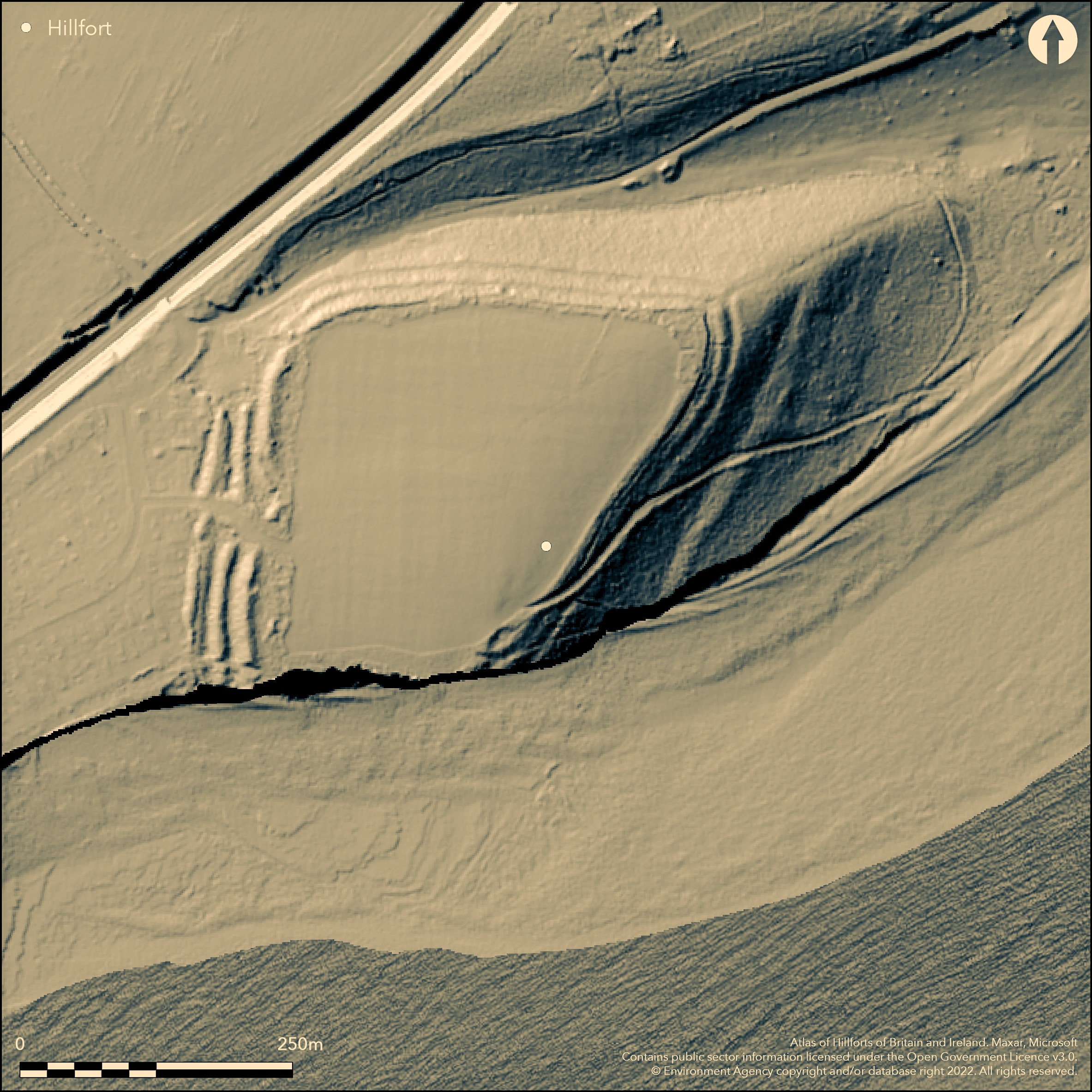
LiDAR 1m DTM Hillshade
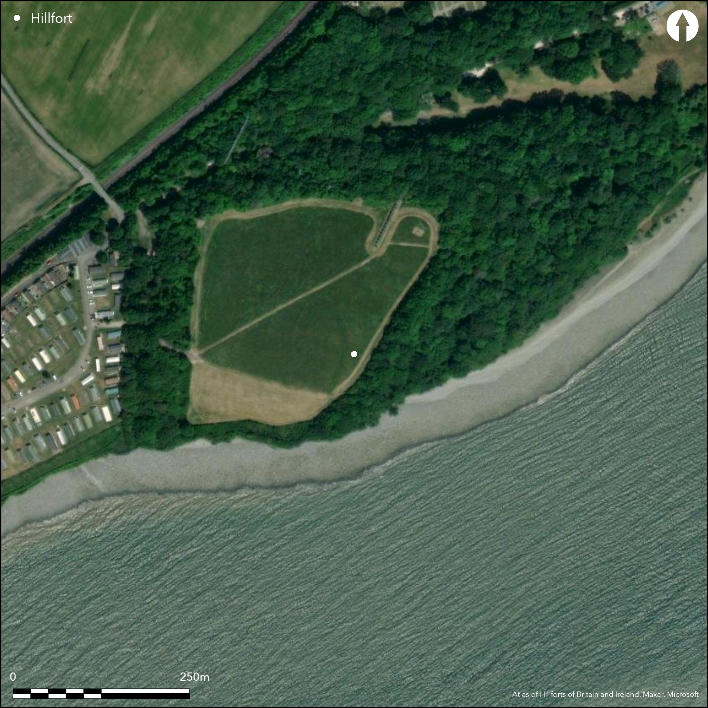
Satellite Imagery
LiDAR 1m DTM Hillshade
Satellite Imagery
Scroll left/right to view further images.
HER: Glamorgan Gwent 00523s (None)
NMR: ST 06 NE (93015)
SM: GM029
NGR: ST08206630
X: 308200 Y: 166300 (OSGB36)
Large and important, multivallate, coastal promontory fort, strategically located on a blunt W-facing promontory on the Bristol Channel and overlooking now silted-up creek of Porthkerry and looking towards Bridgewater Bay. Surrounding slopes moderate to strong to N, precipitous to S and E and W level. Measures c. 230 N-S, and 250 along N tapering to 120m on S. with internal area of 4.1ha. Sea cliffs define eroded S boundary, and on N and E by steep drops, but W approach is level where main defences found of an outer ditch and two massive close-set ditched banks extending to c. 50m overall. Banks tend to be reduced to terraces on N and E. Only entrance in middle of W side where simple gaps through ramparts and causeways across ditches, but entrance passageway slightly oblique to ramparts. Excavation unearthed three successive rectangular buildings behind innermost W rampart, one tentatively Iron Age the other two c. first to fourth centuries AD, indicative of use well into Roman period (Davies 1973). Geophysical survey carried out as part of GGAT 61 Coastal hillforts survey identified parts of what appear to be ten stone huts appearing as positive anomalies. Also assessed to see whether it might be an interrupted-ditch enclosure. Likely that coastal erosion has taken its toll and that the site was originally complete circuit. On 1st Ed. OS map (1879).
Citizen Science: ✗
Reliability of Data: Confirmed
Reliability of Interpretation: Confirmed
X: -369661 Y: 6690259 (EPSG: 3857)
Longitude: -3.3207195331721517 Latitude: 51.38824179710127 (EPSG:4326)
Country: Wales
Current County or Unitary Authority: Vale of Glamorgan
Historic County: Glamorgan
Current Parish/Community/Council/Townland: Rhoose
Likely that coastal erosion has taken its toll and that the site was originally complete circuit. Footpath goes through possible, but eroded, original entrance.
| Extant | ✓ |
| Cropmark | ✗ |
| Likely Destroyed | ✗ |
Site overgrown.
| Woodland | ✗ |
| Commercial Forestry Plantation | ✗ |
| Parkland | ✗ |
| Pasture (Grazing) | ✗ |
| Arable | ✗ |
| Scrub/Bracken | ✓ |
| Bare Outcrop | ✗ |
| Heather/Moorland | ✗ |
| Heath | ✗ |
| Built-up | ✗ |
| Coastal Grassland | ✓ |
| Other | ✗ |
Large and important, multivallate, coastal promontory fort, strategically located on a blunt W-facing promontory on the Bristol Channel and overlooking now silted-up creek of Porthkerry and looking towards Bridgewater Bay. Surrounding slopes moderate to strong to N, precipitous to S and E and W level.
| Contour Fort | ✗ |
| Partial Contour Fort | ✗ |
| Promontory Fort | ✓ |
| Hillslope Fort | ✗ |
| Level Terrain Fort | ✗ |
| Marsh Fort | ✗ |
| Multiple Enclosure Fort | ✗ |
| Hilltop | ✗ |
| Coastal Promontory | ✓ |
| Inland Promontory | ✗ |
| Valley Bottom | ✗ |
| Knoll/Hillock/Outcrop | ✗ |
| Ridge | ✗ |
| Cliff/Plateau-edge/Scarp | ✗ |
| Hillslope | ✗ |
| Lowland | ✗ |
| Spur | ✗ |
Dominant Topographic Feature: Coastal headland
| North | ✗ |
| Northeast | ✗ |
| East | ✗ |
| Southeast | ✗ |
| South | ✗ |
| Southwest | ✗ |
| West | ✗ |
| Northwest | ✗ |
| Level | ✓ |
Altitude: 50.0m
N/A
Excavation unearthed three rectangular buildings behind innermost W rampart of possible Iron Age for one with c. first to fourth centuries AD for other two, indicative of use well into Roman period
Reliability: B - Medium
| Pre 1200BC | ✗ |
| 1200BC - 800BC | ✗ |
| 800BC - 400BC | ✗ |
| 400BC - AD50 | ✓ |
| AD50 - AD400 | ✓ |
| AD400 - AD 800 | ✗ |
| Post AD800 | ✗ |
| Unknown | ✗ |
| Pre Hillfort: | None |
| Post Hillfort: | None |
| Other: | None |
On 1st Ed. OS map (1879). Investigation by Willoughby Gardner 1935. RCAHMW investigation 1966. Rescue excavation on behalf of Dept Environment by J.L. Davies 1968. Geophysical survey as part of GGAT 61 Coastal hillforts survey. GGAT Prehistoric defended enclosures in Glamorgan survey 2005.
| 1st Identified Map Depiction (1879): | OS map. |
| Other (1935): | Willoghby Gardner |
| Other (1966): | RCAHMW investigation.. |
| Excavation (1968): | J.L. Davies |
| Other (2005): | GGAT Prehistoric defended enclosures in Glamorgan survey. |
| Geophysical Survey (None): | GGAT coastal hillforts survey. |
Excavation unearthed three rectangular buildings behind inner rampart of c. first to fourth centuries AD, indicative of use well into Roman period.
None
| None | ✓ |
| Spring | ✗ |
| Stream | ✗ |
| Pool | ✗ |
| Flush | ✗ |
| Well | ✗ |
| Other | ✗ |
None
| No Known Features | ✓ |
| Round Stone Structures | ✗ |
| Rectangular Stone Structures | ✗ |
| Curvilinear Platforms | ✗ |
| Other Roundhouse Evidence | ✗ |
| Pits | ✗ |
| Quarry Hollows | ✗ |
| Other | ✗ |
Excavation unearthed three rectangular buildings behind inner rampart of possible Iron Age to c. first to fourth centuries AD, indicative of use well into Roman period.
| No Known Excavation | ✗ |
| Pits | ✗ |
| Postholes | ✗ |
| Roundhouses | ✗ |
| Rectangular Structures | ✓ |
| Roads/Tracks | ✗ |
| Quarry Hollows | ✗ |
| Other | ✗ |
| Nothing Found | ✗ |
identified parts of what appear to be ten stone huts appearing as positive anomalies.
| No Known Geophysics | ✗ |
| Pits | ✗ |
| Roundhouses | ✗ |
| Rectangular Structures | ✗ |
| Roads/Tracks | ✗ |
| Quarry Hollows | ✗ |
| Other | ✓ |
| Nothing Found | ✗ |
None
| No Known Finds | ✓ |
| Pottery | ✗ |
| Metal | ✗ |
| Metalworking | ✗ |
| Human Bones | ✗ |
| Animal Bones | ✗ |
| Lithics | ✗ |
| Environmental | ✗ |
| Other | ✗ |
None
| APs Not Checked | ✓ |
| None | ✗ |
| Roundhouses | ✗ |
| Rectangular Structures | ✗ |
| Pits | ✗ |
| Postholes | ✗ |
| Roads/Tracks | ✗ |
| Other | ✗ |
Footpath goes through possible, but eroded, original entrance in middle of W side where simple gaps through ramparts and causeways across ditches, but entrance passageway slightly oblique to ramparts.
| 1: | None |
| 2: | None |
Guard Chambers: ✗
Chevaux de Frise: ✗
| 1. Simple Gap (West): | None |
| 1. Oblique (West): | Entrance passageway slightly oblique to ramparts. |
| 1. Passage-way/Corridor (West): | Entrance passageway slightly oblique to ramparts. |
Sea cliffs define eroded S boundary, and on N and E by steep drops, but W approach is level where main defences found of an outer ditch and two massive close-set ditched banks extending to c. 50m overall. Banks tend to be reduced to terraces on N and E.
| Area 1: | 4.1ha. |
| Total: | 4.1ha. |
Total Footprint Area: Noneha.
None
| ✗ | None |
| ✗ | Absent to S. |
| NE Quadrant: | 3 |
| SE Quadrant: | 3 |
| SW Quadrant: | 3 |
| NW Quadrant: | 3 |
| Total: | 3 |
| Partial Univallate | ✗ |
| Univallate | ✗ |
| Partial Bivallate | ✗ |
| Bivallate | ✗ |
| Partial Multivallate | ✗ |
| Multivallate | ✓ |
| Unknown | ✗ |
| Partial Univallate | ✗ |
| Univallate | ✗ |
| Partial Bivallate | ✗ |
| Bivallate | ✗ |
| Partial Multivallate | ✗ |
| Multivallate | ✗ |
None
| None | ✗ |
| Earthen Bank | ✓ |
| Stone Wall | ✗ |
| Rubble | ✗ |
| Wall-walk | ✗ |
| Evidence of Timber | ✗ |
| Vitrification | ✗ |
| Other Burning | ✗ |
| Palisade | ✗ |
| Counter Scarp Bank | ✗ |
| Berm | ✗ |
| Unfinished | ✗ |
| Other | ✗ |
None
| None | ✗ |
| Earthen Bank | ✓ |
| Stone Wall | ✗ |
| Murus Duplex | ✗ |
| Timber-framed | ✗ |
| Timber-laced | ✗ |
| Vitrification | ✗ |
| Other Burning | ✗ |
| Palisade | ✗ |
| Counter Scarp Bank | ✗ |
| Berm | ✗ |
| Unfinished | ✗ |
| No Known Excavation | ✗ |
| Other | ✗ |
| ✗ | None |
| ✓ | None |
Number of Ditches: 3
| ✗ | None |
Davies, J.L 1973. An excavation at the Bulwarks, Porthkerry, Gl;amorgan, Arch Camb, 122, 85-98.
Gerrard, C., Wiggins, H., and Evans, E. 2006. Prehistoric defended enclosures in Glamorgan with recommendations for fieldwork: Year 3 Report, GGAT Report No. 2006/089, Project No. GGAT78, Swansea: GGAT.
RCAHMW 1976. An inventory of the ancient monuments in Glamorgan, Vol I: Pre-Norman, Part II The Iron Age and the Roman occupation, No. 671, Cardiff: HMSO.
Savory, H.N. 1949. List of hill-forts in Wales, Bull Board Celtic Stud, 13, 154.
Whittle, E. 1992: A guide to ancient and historic Wales, Glamorgan and Gwent, London: HMSO, 41.
Gardner, W. 1935. The Bulwarks: a promontory fort at Porthkerry, Glamorgan , Arch Camb, 90 (1935), 135-40.
Atlas of Hillforts:
Wikidata:
This work is licensed under CC BY-SA 4.0

 and should be cited as:
Lock, Gary and Ralston, Ian. 2024. Atlas of Hillforts of Britain and Ireland. Available at: https://hillforts.arch.ox.ac.uk
Document Version 1.1