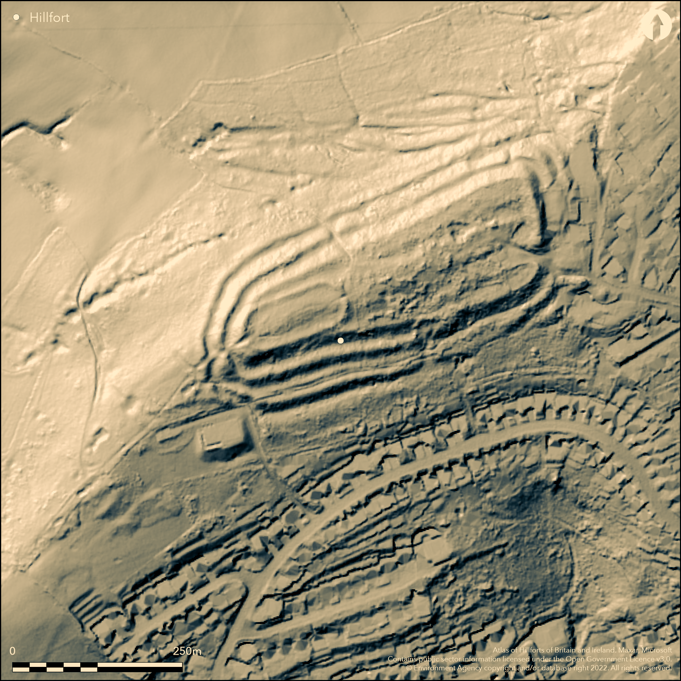
LiDAR 1m DTM Hillshade
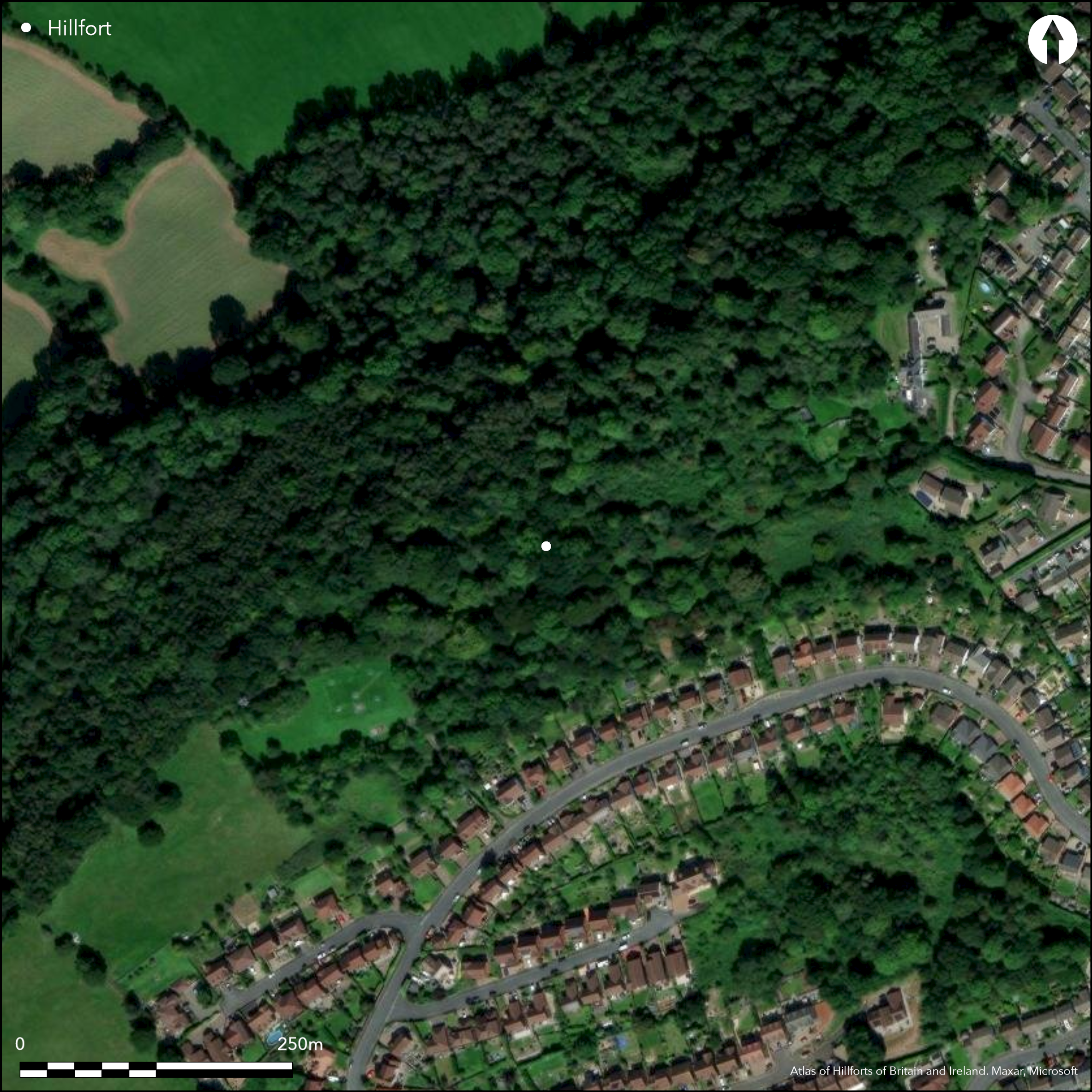
Satellite Imagery
LiDAR 1m DTM Hillshade
Satellite Imagery
Scroll left/right to view further images.
HER: Glamorgan Gwent 00597g (None)
NMR: ST 39 SW (93396)
SM: MM023
NGR: ST32309130
X: 332300 Y: 191300 (OSGB36)
Commanding, large and complex oblong contour hillfort sited on an isolated Old Red Sandstone ridge running WSW-ENE and overlooking Caerleon and significant bends and mouth of the River Usk and E reach of Severn Estuary, and at the confluence of the Usk and Afon Llwyd. To NW and to lesser extent S, steep surrounding slopes from ridge summit, from E and SW moderate. Measures c. 400m by 300m in extent, along ridge, with 2.2ha interior area. Mostly defined by three, but up to five banks and ditch on S side (seemingly incorporating earlier line between second and third ramparts of W end of S side). Other additional banks to W and N additional lengths of bank and ditch. Generally well-defined, especially to W, but damaged on E. Stone-revetted original W entrance with guard chamber at rear and flanked by massive banks, and probably one at SE corner where modern track into interior. Former, originally blocked then re-established, but possibly not till Roman or later use of site. Latter probably main entrance for much of life of fort. Inner elliptical enclosure c. 100m by 50m at W end, with entrance gaps at either end, but whether this pre- or post-dates hillfort uncertain. All this complexity suggests phased construction. Site probably originally univallate, then additional defences in 5th to 4th century BC. Excavation at W end (Pollard et. al 2006) found timber-laced earth and rubble banks and middle and late Iron Age and Romano-British finds. Lies close to Roman legionary fortress of Caerleon. Now wooded. On 1st Ed. OS map (1886).
Citizen Science: ✗
Reliability of Data: Confirmed
Reliability of Interpretation: Confirmed
X: -331647 Y: 6731059 (EPSG: 3857)
Longitude: -2.979233009751064 Latitude: 51.616391527234725 (EPSG:4326)
Country: Wales
Current County or Unitary Authority: Newport
Historic County: Monmouthshire
Current Parish/Community/Council/Townland: Caerleon
Ramparts generally well-defined, especially to W, but E defences and possible SE entrance lost to Lodge Farm. Setting despoiled by development within 100m of S earthworks. Public footpaths cross fort.
| Extant | ✓ |
| Cropmark | ✗ |
| Likely Destroyed | ✗ |
Wooded with scrub clearings.
| Woodland | ✓ |
| Commercial Forestry Plantation | ✗ |
| Parkland | ✗ |
| Pasture (Grazing) | ✗ |
| Arable | ✗ |
| Scrub/Bracken | ✓ |
| Bare Outcrop | ✗ |
| Heather/Moorland | ✗ |
| Heath | ✗ |
| Built-up | ✗ |
| Coastal Grassland | ✗ |
| Other | ✗ |
Commanding, large and complex oblong contour hillfort sited on an isolated Old Red Sandstone ridge WSW-ENE and overlooking Caerleon and significant bends and mouth of the River Usk and E reach of Severn Estuary, and at the confluence of the Usk and Afon Llwyd.
| Contour Fort | ✓ |
| Partial Contour Fort | ✗ |
| Promontory Fort | ✗ |
| Hillslope Fort | ✗ |
| Level Terrain Fort | ✗ |
| Marsh Fort | ✗ |
| Multiple Enclosure Fort | ✗ |
| Hilltop | ✗ |
| Coastal Promontory | ✗ |
| Inland Promontory | ✗ |
| Valley Bottom | ✗ |
| Knoll/Hillock/Outcrop | ✗ |
| Ridge | ✓ |
| Cliff/Plateau-edge/Scarp | ✗ |
| Hillslope | ✗ |
| Lowland | ✗ |
| Spur | ✗ |
Dominant Topographic Feature: Ridge
| North | ✗ |
| Northeast | ✗ |
| East | ✗ |
| Southeast | ✗ |
| South | ✗ |
| Southwest | ✗ |
| West | ✗ |
| Northwest | ✗ |
| Level | ✓ |
Altitude: 120.0m
N/A
Excavation - middle and late Iron Age pottery, briquetage, worked stone (discs, pounder, rubber), metalworking debris. La Tene I brooch (fourth century BC). Romano-British pottery. Complexity suggests phased construction. Site probably originally univallate, then additional defences in 5th to 4th century BC.
Reliability: B - Medium
| Pre 1200BC | ✗ |
| 1200BC - 800BC | ✗ |
| 800BC - 400BC | ✓ |
| 400BC - AD50 | ✓ |
| AD50 - AD400 | ✗ |
| AD400 - AD 800 | ✗ |
| Post AD800 | ✗ |
| Unknown | ✗ |
| Pre Hillfort: | None |
| Post Hillfort: | None |
| Artefactual: | Pottery and other finds. |
| Morphology/Earthwork/Typology: | Digging of quarry hollows for bank. Site probably originally univallate, then additional defences in 5th to 4th century BC. |
Earliest plan and written reference by William Coxe in An Historical Tour of Monmouthshire, 1801. On 1st Ed. OS map (1886). Unpublished survey E.A. Downman, 1910. Limited excavation at W end 2000 by J. Pollard et al. GGAT Prehistoric defended enclosures in Glamorgan survey 2005.
| 1st Identified Map Depiction (1801): | William Coxe. |
| 1st Identified Written Reference (1801): | William Coxe. |
| Other (1833): | OS map. |
| Other (1886): | OS map. |
| Other (1910): | E.A. Downman, schematic survey, unpublished. |
| Other (1991): | Visited by Hillfort Study Group |
| Excavation (2000): | J. Pollard et al. |
| Excavation (2000): | J. Pollard et al. |
| Other (2005): | GGAT Prehistoric defended enclosures in Glamorgan survey. |
Post holes of possible four-post structures and small rectangular structure. Pottery, briquetage, worked stone (discs, pounder, rubber), metalworking debris. La Tene I brooch. Small iron fittings. Wood and charcoal assemblage. Single wheat grain. Cremated animal bone. Worked flints.
Modern pond to E at Lodge Farm.
| None | ✓ |
| Spring | ✗ |
| Stream | ✗ |
| Pool | ✗ |
| Flush | ✗ |
| Well | ✗ |
| Other | ✗ |
None
| No Known Features | ✗ |
| Round Stone Structures | ✗ |
| Rectangular Stone Structures | ✗ |
| Curvilinear Platforms | ✗ |
| Other Roundhouse Evidence | ✗ |
| Pits | ✗ |
| Quarry Hollows | ✓ |
| Other | ✗ |
Post holes of possible four-post structures and small rectangular structure. Slight Roman timber structure.
| No Known Excavation | ✗ |
| Pits | ✗ |
| Postholes | ✓ |
| Roundhouses | ✗ |
| Rectangular Structures | ✓ |
| Roads/Tracks | ✗ |
| Quarry Hollows | ✓ |
| Other | ✗ |
| Nothing Found | ✗ |
None
| No Known Geophysics | ✓ |
| Pits | ✗ |
| Roundhouses | ✗ |
| Rectangular Structures | ✗ |
| Roads/Tracks | ✗ |
| Quarry Hollows | ✗ |
| Other | ✗ |
| Nothing Found | ✗ |
Pottery, briquetage, worked stone (discs, pounder, rubber), metalworking debris. La Tene I brooch. Small iron fittings. Wood and charcoal assemblage. Single wheat grain. Cremated animal bone. Worked flints.
| No Known Finds | ✗ |
| Pottery | ✓ |
| Metal | ✓ |
| Metalworking | ✓ |
| Human Bones | ✗ |
| Animal Bones | ✓ |
| Lithics | ✓ |
| Environmental | ✓ |
| Other | ✗ |
None
| APs Not Checked | ✓ |
| None | ✗ |
| Roundhouses | ✗ |
| Rectangular Structures | ✗ |
| Pits | ✗ |
| Postholes | ✗ |
| Roads/Tracks | ✗ |
| Other | ✗ |
Stone-revetted original W entrance with guard chamber at rear and flanked by massive banks, and probably one at SE corner where modern track into interior. Former, originally blocked then re-established, but possibly not till Roman or later use of site. Latter probably main entrance for much of life of fort.
| 2: | None |
| 2: | None |
Guard Chambers: ✓
Chevaux de Frise: ✗
| 1. Blocked (West): | Simple passageway, but heightened banks. Originally blocked then re-established, |
| 1. Recesses/Guard Chambers (West): | None |
| 2. Oblique (South east): | Probable oblique entrance. |
Mostly defined by three, but up to five banks and ditch on S side (seemingly incorporating earlier line between second and third ramparts of W end of S side). Other additional banks to W and N additional lengths of bank and ditch.
| Area 1: | 0.4ha. |
| Area 2: | 2.2ha. |
| Total: | 2.2ha. |
Total Footprint Area: Noneha.
None
| ✓ | Inner enclosure c. 0.4ha; outer 2.2ha. |
| ✓ | None |
| NE Quadrant: | 3 |
| SE Quadrant: | 2 |
| SW Quadrant: | 5 |
| NW Quadrant: | 3 |
| Total: | 5 |
| Partial Univallate | ✗ |
| Univallate | ✗ |
| Partial Bivallate | ✓ |
| Bivallate | ✗ |
| Partial Multivallate | ✓ |
| Multivallate | ✗ |
| Unknown | ✗ |
| Partial Univallate | ✗ |
| Univallate | ✓ |
| Partial Bivallate | ✗ |
| Bivallate | ✗ |
| Partial Multivallate | ✗ |
| Multivallate | ✗ |
None
| None | ✗ |
| Earthen Bank | ✓ |
| Stone Wall | ✗ |
| Rubble | ✓ |
| Wall-walk | ✗ |
| Evidence of Timber | ✗ |
| Vitrification | ✗ |
| Other Burning | ✗ |
| Palisade | ✗ |
| Counter Scarp Bank | ✗ |
| Berm | ✗ |
| Unfinished | ✗ |
| Other | ✗ |
Timber-laced earth and rubble banks. Revetting.
| None | ✗ |
| Earthen Bank | ✓ |
| Stone Wall | ✓ |
| Murus Duplex | ✗ |
| Timber-framed | ✗ |
| Timber-laced | ✓ |
| Vitrification | ✗ |
| Other Burning | ✗ |
| Palisade | ✗ |
| Counter Scarp Bank | ✗ |
| Berm | ✗ |
| Unfinished | ✗ |
| No Known Excavation | ✗ |
| Other | ✗ |
| ✗ | None |
| ✓ | Some V-shaped. |
Number of Ditches: 5
| ✗ | None |
Coxe, W. 1801. An Historical Tour of Monmouthshire.
Gerrard, C., Wiggins, H., and Evans, E. 2006. Prehistoric defended enclosures in Glamorgan with recommendations for fieldwork: Year 3 Report, GGAT Report No. 2006/089, Project No. GGAT78, Swansea: GGAT.
Howell, R. 2006. Searching for the Silures, an Iron Age tribe in south-east Wales, Stroud: Tempus.
Pollard, J, Howell, R, Chadwick, A. and Leaver, A. 2006. Lodge Hill Camp, Caerleon and the hillforts of Gwent, British Archaeological Reports, BAR British Series 407, Oxford.
Savory, H.N. 1950. List of hill-fort and other earthworks in Wales, II. Monmouthshire, Bull Board Celtic Stud, 13, 233.
Whittle, E. 1992. A Guide to ancient and historic Wales - Glamorgan and Gwent, London: HMSO.
Atlas of Hillforts:
Wikidata:
This work is licensed under CC BY-SA 4.0

 and should be cited as:
Lock, Gary and Ralston, Ian. 2024. Atlas of Hillforts of Britain and Ireland. Available at: https://hillforts.arch.ox.ac.uk
Document Version 1.1