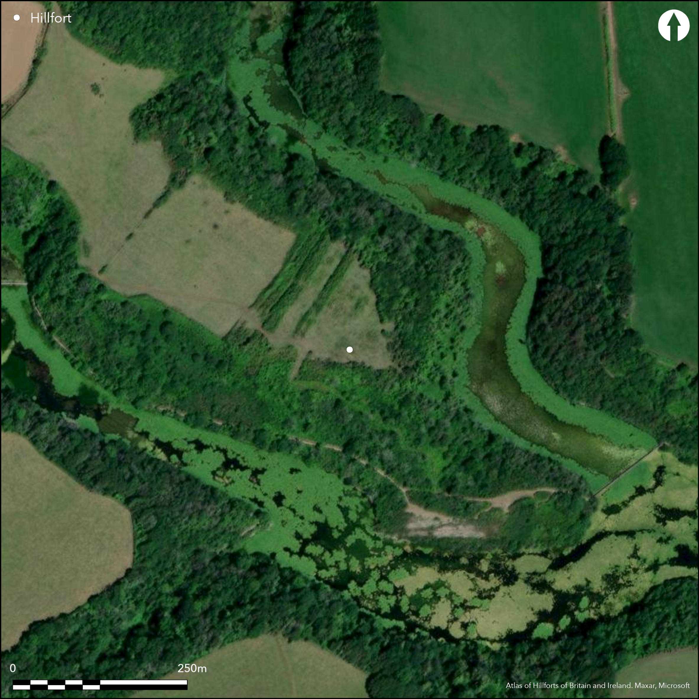
Satellite Imagery
Satellite Imagery
HER: Dyfed 629 (None)
NMR: SR 99 SE (305433)
SM: PE112(PEM)
NGR: SR 9715 9480
X: 197150 Y: 194800 (OSGB36)
Unusually sited inland promontory fort located on SE-facing promontory above the present Bosherton Liiy Pools, but probably formerly between two coastal creeks now cut off at Broad Haven to form the Bosherton Lakes. E, S and W sides precipitous to lakes, moderate landward to N. Roughly square interior measures c. 110m NW-SE from behind main banks and 115m SW-NE., with internal area c. 2.1ha. Naturally defended on E, S and W by precipitous slopes, promontory, now much eroded, cut off by complex defences landward on NW, possibly of two phases. Substantial main defence is 180m of double bank and ditch with simple entrance towards S end. An inner bank, with no ditch, lies 30m inside the promontory, with smaller lateral banks attaching it to the main defences. Inside still are a slighter, and possibly earlier, bank and ditch, probably of a later phase. Part excavation by Lethbridge in 1927 found terraces for timber roundhouses in the interior and a midden in corner of the main ditch with animal bone and a ring-headed pin. Bracken and scrub covered. On 1st Ed. OS map (1865).
Citizen Science: ✗
Reliability of Data: Confirmed
Reliability of Interpretation: Confirmed
X: -548967 Y: 6730871 (EPSG: 3857)
Longitude: -4.931454475653881 Latitude: 51.61533944920179 (EPSG:4326)
Country: Wales
Current County or Unitary Authority: Pembrokeshire
Historic County: Pembrokeshire
Current Parish/Community/Council/Townland: Stackpole
Promontory now much eroded. National Trust site.
| Extant | ✓ |
| Cropmark | ✗ |
| Likely Destroyed | ✗ |
Bracken and scrub covered.
| Woodland | ✗ |
| Commercial Forestry Plantation | ✗ |
| Parkland | ✗ |
| Pasture (Grazing) | ✗ |
| Arable | ✗ |
| Scrub/Bracken | ✓ |
| Bare Outcrop | ✗ |
| Heather/Moorland | ✓ |
| Heath | ✗ |
| Built-up | ✗ |
| Coastal Grassland | ✗ |
| Other | ✗ |
Unusually sited inland promontory fort located on SE-facing promontory above the present Liiy Pools, but probably formerly between two coastal creeks now cut off at Broad Haven to form the Bosherton Lakes. E, S and W sides precipitous to lakes, moderate landward to N.
| Contour Fort | ✗ |
| Partial Contour Fort | ✗ |
| Promontory Fort | ✓ |
| Hillslope Fort | ✗ |
| Level Terrain Fort | ✗ |
| Marsh Fort | ✗ |
| Multiple Enclosure Fort | ✗ |
| Hilltop | ✗ |
| Coastal Promontory | ✗ |
| Inland Promontory | ✓ |
| Valley Bottom | ✗ |
| Knoll/Hillock/Outcrop | ✗ |
| Ridge | ✗ |
| Cliff/Plateau-edge/Scarp | ✗ |
| Hillslope | ✗ |
| Lowland | ✗ |
| Spur | ✓ |
Dominant Topographic Feature: Spur promontory
| North | ✗ |
| Northeast | ✗ |
| East | ✗ |
| Southeast | ✓ |
| South | ✗ |
| Southwest | ✗ |
| West | ✗ |
| Northwest | ✗ |
| Level | ✗ |
Altitude: 25.0m
N/A
None
Reliability: D - None
| Pre 1200BC | ✗ |
| 1200BC - 800BC | ✗ |
| 800BC - 400BC | ✗ |
| 400BC - AD50 | ✗ |
| AD50 - AD400 | ✗ |
| AD400 - AD 800 | ✗ |
| Post AD800 | ✗ |
| Unknown | ✓ |
| Pre Hillfort: | None |
| Post Hillfort: | None |
On 1st Ed. OS map (1865). Part Excavation Lethbridge 1927 - no details. Field Observation OS 1969. Field Observation DAT 1981, 1994. Field Observation CADW 1993,1998, 2002. Cambria Archaeology defended enclosures survey 2006-2007.
| 1st Identified Map Depiction (1865): | OS map. |
| Excavation (1927): | Lethbridge. |
| Other (1969): | Field observation OS. |
| Other (None): | Field observation DAT. |
| Other (None): | Field observation CADW. |
| Other (None): | Cambria Archaeology defended enclosures survey |
Terraces for timber roundhouses have been found in the interior. A midden was found in the main ditch in which was unearthed a ring-headed pin.
None
| None | ✓ |
| Spring | ✗ |
| Stream | ✗ |
| Pool | ✗ |
| Flush | ✗ |
| Well | ✗ |
| Other | ✗ |
Terraces for timber roundhouses have been found in the interior.
| No Known Features | ✗ |
| Round Stone Structures | ✗ |
| Rectangular Stone Structures | ✗ |
| Curvilinear Platforms | ✗ |
| Other Roundhouse Evidence | ✓ |
| Pits | ✗ |
| Quarry Hollows | ✗ |
| Other | ✗ |
A midden was found in the main ditch in which was unearthed a ring-headed pin.
| No Known Excavation | ✗ |
| Pits | ✗ |
| Postholes | ✗ |
| Roundhouses | ✓ |
| Rectangular Structures | ✗ |
| Roads/Tracks | ✗ |
| Quarry Hollows | ✗ |
| Other | ✓ |
| Nothing Found | ✗ |
None
| No Known Geophysics | ✓ |
| Pits | ✗ |
| Roundhouses | ✗ |
| Rectangular Structures | ✗ |
| Roads/Tracks | ✗ |
| Quarry Hollows | ✗ |
| Other | ✗ |
| Nothing Found | ✗ |
Animal bone and ring-headed pin.
| No Known Finds | ✗ |
| Pottery | ✗ |
| Metal | ✓ |
| Metalworking | ✗ |
| Human Bones | ✗ |
| Animal Bones | ✓ |
| Lithics | ✗ |
| Environmental | ✗ |
| Other | ✗ |
None
| APs Not Checked | ✓ |
| None | ✗ |
| Roundhouses | ✗ |
| Rectangular Structures | ✗ |
| Pits | ✗ |
| Postholes | ✗ |
| Roads/Tracks | ✗ |
| Other | ✗ |
Main defence is 180m of double bank and ditch with simple entrance towards S end.
| 1: | None |
| 2: | None |
Guard Chambers: ✗
Chevaux de Frise: ✗
| 1. Simple Gap (North west): | None |
Main defence is 180m of double bank and ditch with simple entrance towards S end. An inner bank, with no ditch, lies 30m inside the promontory, with smaller lateral banks attaching it to the main defences. Inside still are a slighter, and possibly earlier, bank and ditch, probably of a later phase.
| Area 1: | 2.1ha. |
| Total: | 2.1ha. |
Total Footprint Area: Noneha.
None
| ✓ | Slighter, and possibly earlier, bank and ditch, probably of a later phase, but no details. |
| ✗ | None |
| NE Quadrant: | 0 |
| SE Quadrant: | 0 |
| SW Quadrant: | 0 |
| NW Quadrant: | 4 |
| Total: | 4 |
| Partial Univallate | ✗ |
| Univallate | ✗ |
| Partial Bivallate | ✗ |
| Bivallate | ✗ |
| Partial Multivallate | ✓ |
| Multivallate | ✗ |
| Unknown | ✗ |
| Partial Univallate | ✗ |
| Univallate | ✗ |
| Partial Bivallate | ✗ |
| Bivallate | ✗ |
| Partial Multivallate | ✗ |
| Multivallate | ✗ |
None
| None | ✗ |
| Earthen Bank | ✓ |
| Stone Wall | ✗ |
| Rubble | ✗ |
| Wall-walk | ✗ |
| Evidence of Timber | ✗ |
| Vitrification | ✗ |
| Other Burning | ✗ |
| Palisade | ✗ |
| Counter Scarp Bank | ✗ |
| Berm | ✗ |
| Unfinished | ✗ |
| Other | ✗ |
None
| None | ✓ |
| Earthen Bank | ✗ |
| Stone Wall | ✗ |
| Murus Duplex | ✗ |
| Timber-framed | ✗ |
| Timber-laced | ✗ |
| Vitrification | ✗ |
| Other Burning | ✗ |
| Palisade | ✗ |
| Counter Scarp Bank | ✗ |
| Berm | ✗ |
| Unfinished | ✗ |
| No Known Excavation | ✗ |
| Other | ✗ |
| ✗ | None |
| ✓ | Inner bank has no ditch. |
Number of Ditches: 2
| ✗ | None |
Barker, L. and Driver, T., 2011. Close to the Edge: New Perspectives on the Architecture, Function and Regional Geographies of the Coastal Promontory Forts of the Castlemartin Peninsula, South Pembrokeshire, Wales. Proc Prehist Soc, 77, 65-87.
Crossley, D.W. 1963. List of Hill-Forts and other earthworks in Pembrokeshire, Bull Board Celtic Stud, 20, 181.
Hogg, A.H.A. 1965. in Foster, I.LL and Daniel, G., Prehistory in early Wales, 134, London: Routledge and Kegan Paul.
Murphy, K., Ramsey, R., Poucher, P. and Page, M. 2007. A Survey of Defended Enclosures in Pembrokeshire, 2006-2007: Gazetteer of Ordnance Survey Grid Squares SR89, SR99, SS09 and SS19, Cambria Archaeology Report No. 2007/01, Project Record No. 54269, Llandeilo: Cambria Archaeology.
Rees, S. 1992. A guide to ancient and historic Wales - Dyfed, London: HMSO, 80-1.
Atlas of Hillforts:
Wikidata:
This work is licensed under CC BY-SA 4.0

 and should be cited as:
Lock, Gary and Ralston, Ian. 2024. Atlas of Hillforts of Britain and Ireland. Available at: https://hillforts.arch.ox.ac.uk
Document Version 1.1