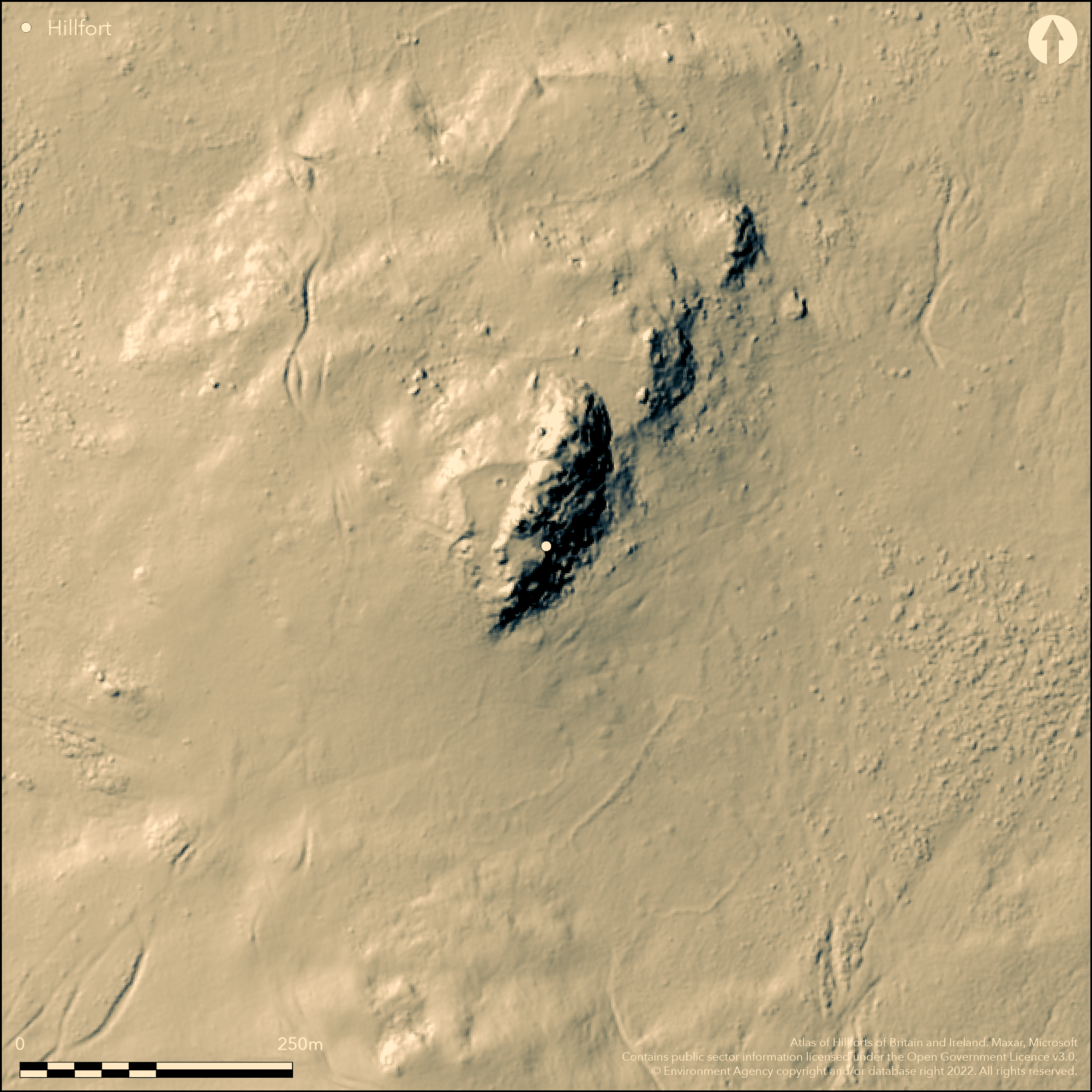
LiDAR 1m DTM Hillshade
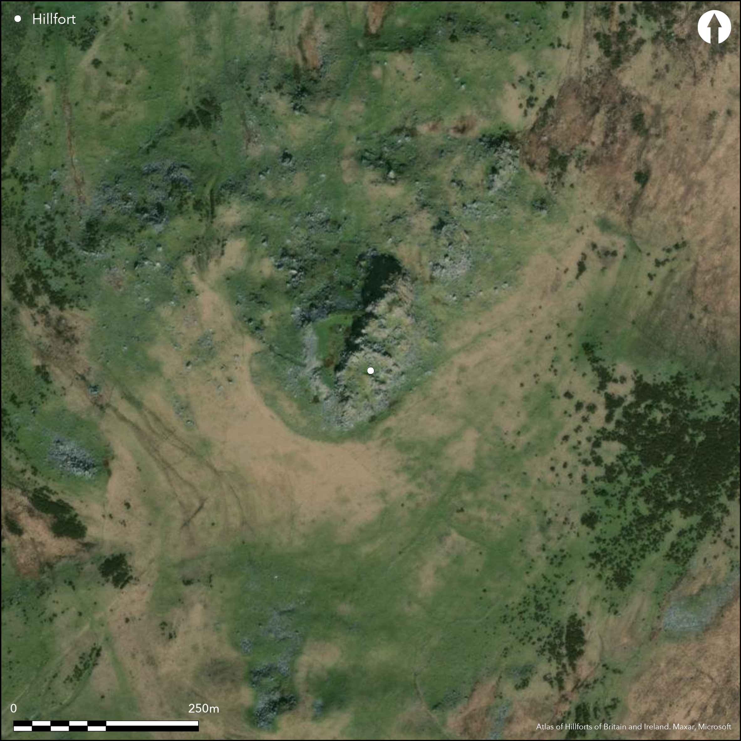
Satellite Imagery
LiDAR 1m DTM Hillshade
Satellite Imagery
Scroll left/right to view further images.
HER: Dyfed 1036 (None)
NMR: SN 13 SW 17 (94240)
SM: PE375(PEM)
NGR: SN 1390 3370
X: 213900 Y: 233700 (OSGB36)
Small, rocky, oval partial contour hillfort located 1.7km from Foel Drygarn (Atlas No 1895) on the lower slopes of the Preseli Hills. Moderate to strong on N, and W, steep on S, precipitous on E. Roughly triangular enclosure measures c. 66m N-S by 38m, with internal area 0.19ha. Defined by simple dry-stone wall, with no evident ditch, incorporating rock outcrops and fronting onto precipitous slopes of Carn Alw on E. Some facework still visible, but now mostly collapsed stone. Site notable for its fine chevaux de frise to SW and W sited in an arc around the entrance with stone-lined pathway. No signs of habitation, but evidence of many enclosures, huts and fields in the area. Small enclosures on either side of the entranceway probably medieval or later. Carn Meini, the source of the Stonehenge 'bluestones' is due S. Extensive and associated complex of features SE-NW about site. Tumbled stone walls and scree in extensive rough moorland. Minimal investigations, undated.
Citizen Science: ✗
Reliability of Data: Confirmed
Reliability of Interpretation: Confirmed
X: -524392 Y: 6794793 (EPSG: 3857)
Longitude: -4.710693165798105 Latitude: 51.970497206844634 (EPSG:4326)
Country: Wales
Current County or Unitary Authority: Pembrokeshire
Historic County: Pembrokeshire
Current Parish/Community/Council/Townland: Eglwyswrw
Tumbled stone walls and scree.
| Extant | ✓ |
| Cropmark | ✗ |
| Likely Destroyed | ✗ |
Very rocky rough moorland site.
| Woodland | ✗ |
| Commercial Forestry Plantation | ✗ |
| Parkland | ✗ |
| Pasture (Grazing) | ✗ |
| Arable | ✗ |
| Scrub/Bracken | ✗ |
| Bare Outcrop | ✗ |
| Heather/Moorland | ✓ |
| Heath | ✓ |
| Built-up | ✗ |
| Coastal Grassland | ✗ |
| Other | ✗ |
Small, rocky, oval partial contour located 1.7km from Foel Drygarn (Atlas No X) on the lower slopes of the Preseli Hills. Moderate to strong on N, and W, steep on S, precipitous on E.
| Contour Fort | ✗ |
| Partial Contour Fort | ✓ |
| Promontory Fort | ✗ |
| Hillslope Fort | ✗ |
| Level Terrain Fort | ✗ |
| Marsh Fort | ✗ |
| Multiple Enclosure Fort | ✗ |
| Hilltop | ✗ |
| Coastal Promontory | ✗ |
| Inland Promontory | ✗ |
| Valley Bottom | ✗ |
| Knoll/Hillock/Outcrop | ✓ |
| Ridge | ✗ |
| Cliff/Plateau-edge/Scarp | ✗ |
| Hillslope | ✗ |
| Lowland | ✗ |
| Spur | ✗ |
Dominant Topographic Feature: Rock outcrop
| North | ✗ |
| Northeast | ✗ |
| East | ✗ |
| Southeast | ✗ |
| South | ✗ |
| Southwest | ✗ |
| West | ✗ |
| Northwest | ✓ |
| Level | ✗ |
Altitude: 243.0m
N/A
None
Reliability: D - None
| Pre 1200BC | ✗ |
| 1200BC - 800BC | ✗ |
| 800BC - 400BC | ✗ |
| 400BC - AD50 | ✗ |
| AD50 - AD400 | ✗ |
| AD400 - AD 800 | ✗ |
| Post AD800 | ✗ |
| Unknown | ✓ |
| Pre Hillfort: | None |
| Post Hillfort: | None |
Field Observation OS 1974. Field Observation AMB 1981. Field Observation CADW 1986, 1991, 1996, 1998. Full survey H. Mytum and C.J. Webster 1989. Cambria Archaeology defended enclosures survey 2006-2007.
| Other (1973): | Visited by Hillfort Study Group |
| Other (1974): | Field observation OS. |
| Other (1981): | Field observation AMB. |
| Other (1989): | Full survey H. Mytum and C.J. Webster. |
| Other (2011): | Visited by Hillfort Study Group |
| Other (None): | Field observations CADW. |
| Other (None): | Cambria Archaeology defended enclosures survey 2006-2007. |
None
None
| None | ✓ |
| Spring | ✗ |
| Stream | ✗ |
| Pool | ✗ |
| Flush | ✗ |
| Well | ✗ |
| Other | ✗ |
None
| No Known Features | ✓ |
| Round Stone Structures | ✗ |
| Rectangular Stone Structures | ✗ |
| Curvilinear Platforms | ✗ |
| Other Roundhouse Evidence | ✗ |
| Pits | ✗ |
| Quarry Hollows | ✗ |
| Other | ✗ |
None
| No Known Excavation | ✓ |
| Pits | ✗ |
| Postholes | ✗ |
| Roundhouses | ✗ |
| Rectangular Structures | ✗ |
| Roads/Tracks | ✗ |
| Quarry Hollows | ✗ |
| Other | ✗ |
| Nothing Found | ✗ |
None
| No Known Geophysics | ✓ |
| Pits | ✗ |
| Roundhouses | ✗ |
| Rectangular Structures | ✗ |
| Roads/Tracks | ✗ |
| Quarry Hollows | ✗ |
| Other | ✗ |
| Nothing Found | ✗ |
None
| No Known Finds | ✓ |
| Pottery | ✗ |
| Metal | ✗ |
| Metalworking | ✗ |
| Human Bones | ✗ |
| Animal Bones | ✗ |
| Lithics | ✗ |
| Environmental | ✗ |
| Other | ✗ |
None
| APs Not Checked | ✓ |
| None | ✗ |
| Roundhouses | ✗ |
| Rectangular Structures | ✗ |
| Pits | ✗ |
| Postholes | ✗ |
| Roads/Tracks | ✗ |
| Other | ✗ |
Fine long stone-lined passageway on SW with chevaux de frise.
| 1: | None |
| 2: | None |
Guard Chambers: ✗
Chevaux de Frise: ✓
The site is notable for its fine chevaux de frise on SW and W sited in an arc around the entrance with stone-lined pathway.
| 1. Passage-way/Corridor (South west): | Long stone-lined passage. |
Defined by simple dry-stone wall, with no evident ditch, incorporating rock outcrops and fronting onto precipitous slopes of Carn Alw on E. Some facework still visible, but now mostly collapsed stone.
| Area 1: | 0.19ha. |
| Total: | 0.19ha. |
Total Footprint Area: Noneha.
None
| ✗ | None |
| ✓ | None |
| NE Quadrant: | 1 |
| SE Quadrant: | 1 |
| SW Quadrant: | 1 |
| NW Quadrant: | 1 |
| Total: | 1 |
| Partial Univallate | ✗ |
| Univallate | ✓ |
| Partial Bivallate | ✗ |
| Bivallate | ✗ |
| Partial Multivallate | ✗ |
| Multivallate | ✗ |
| Unknown | ✗ |
| Partial Univallate | ✗ |
| Univallate | ✗ |
| Partial Bivallate | ✗ |
| Bivallate | ✗ |
| Partial Multivallate | ✗ |
| Multivallate | ✗ |
Stone-walled site.
| None | ✗ |
| Earthen Bank | ✗ |
| Stone Wall | ✓ |
| Rubble | ✗ |
| Wall-walk | ✗ |
| Evidence of Timber | ✗ |
| Vitrification | ✗ |
| Other Burning | ✗ |
| Palisade | ✗ |
| Counter Scarp Bank | ✗ |
| Berm | ✗ |
| Unfinished | ✗ |
| Other | ✗ |
None
| None | ✗ |
| Earthen Bank | ✗ |
| Stone Wall | ✗ |
| Murus Duplex | ✗ |
| Timber-framed | ✗ |
| Timber-laced | ✗ |
| Vitrification | ✗ |
| Other Burning | ✗ |
| Palisade | ✗ |
| Counter Scarp Bank | ✗ |
| Berm | ✗ |
| Unfinished | ✗ |
| No Known Excavation | ✓ |
| Other | ✗ |
| ✗ | None |
| ✗ | No ditch evident. |
Number of Ditches: 0
| ✗ | None |
Murphy, K., Ramsey, R., Poucher, P. and Page, M. 2007. A Survey of Defended Enclosures in Pembrokeshire, 2006-2007: Gazetteer of Ordnance Survey Grid Squares SN03, SN13 and SN23. Cambria Archaeology Report No. 2007/01, Project Record No. 54269, Llandeilo: Cambria Archaeology.
Mytum, H. and Webster, C.J. 1989. A survey of the Iron Age enclosure and chevaux-de-frise at Carn Alw, Dyfed, Proc Prehist Soc, 55, 263-7.
Rees, S. 1992. A guide to ancient and historic Wales - Dyfed, London: HMSO, 60-1.
Atlas of Hillforts:
Wikidata:
This work is licensed under CC BY-SA 4.0![]()
![]()
![]() and should be cited as:
and should be cited as:
Lock, Gary and Ralston, Ian. 2024. Atlas of Hillforts of Britain and Ireland. Available at: https://hillforts.arch.ox.ac.uk
Document Version 1.1