LiDAR 1m DTM Hillshade
Satellite Imagery
LiDAR 1m DTM Hillshade
Satellite Imagery
Scroll left/right to view further images.
HER: Dyfed 1538 (None)
NMR: SN 03 SW 9 (304365)
SM: PE407(PEM)
NGR: SN01733416
X: 201730 Y: 234160 (OSGB36)
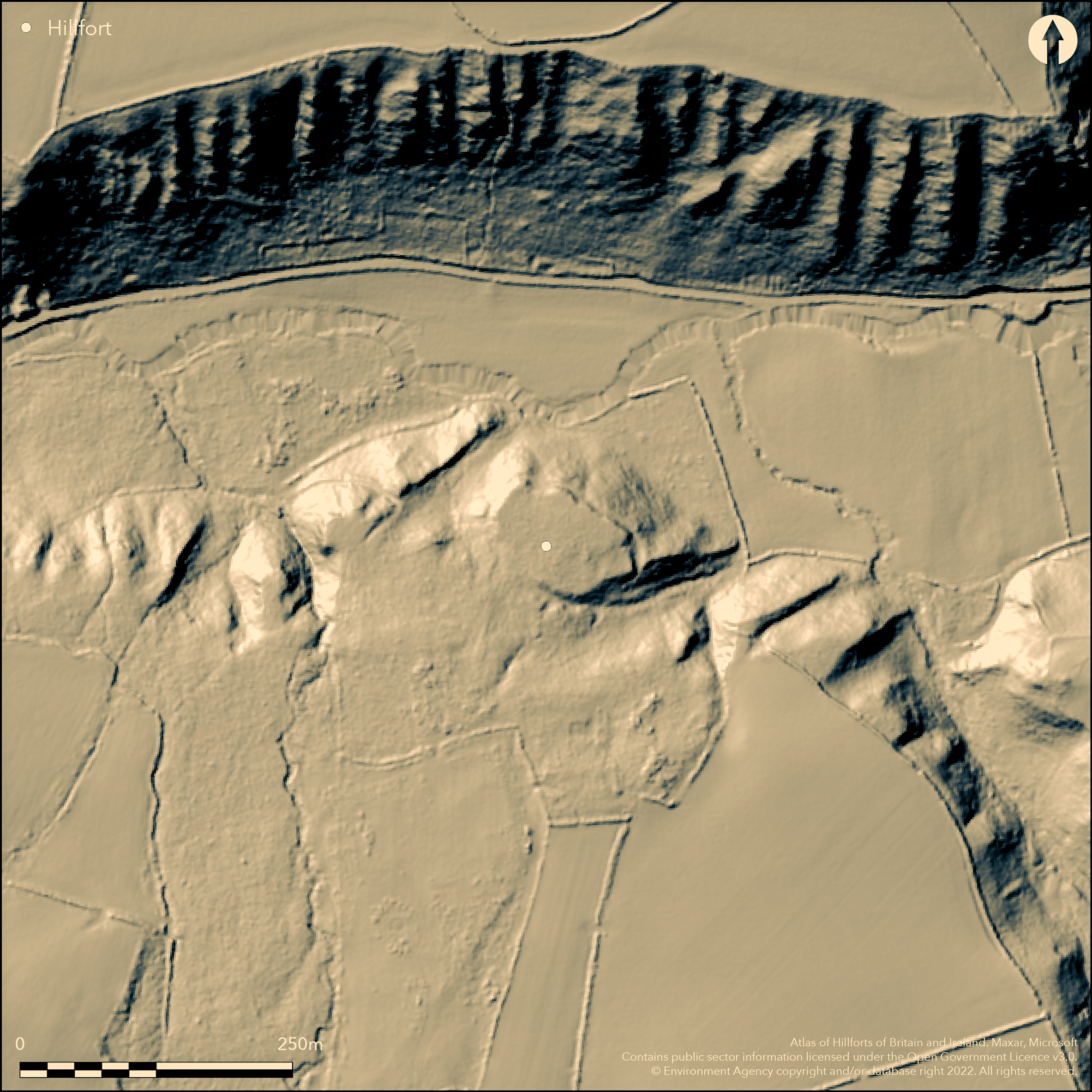
Possible small inland promontory fort located on N-facing promontory in Kilkiffeth Wood above confluence of Afon Gwaun and Pontfaen Brook to N. Steep surrounding slopes (steepest on W) with gentler rising ground to S. Internal area measures c. 80m E-W by 54m, with area c. 0.43ha. Overlooked from S. defined by single bank and ditch to S, bank rising to 2m above ditch, but only 0.4m above interior. Rubble on S may be relict stone wall. SW entrance lined by few large boulders. Probable promontory fort although Fenton (1994) associates it with medieval figure of Dafydd. Wooded with brambles and scrub. On 1st Ed. OS map (1889). Minimal investigations, undated.
Citizen Science: ✗
Reliability of Data: Unconfirmed
Reliability of Interpretation: Unconfirmed
X: -544118 Y: 6794779 (EPSG: 3857)
Longitude: -4.887895663396957 Latitude: 51.970418853212486 (EPSG:4326)
Country: Wales
Current County or Unitary Authority: Pembrokeshire
Historic County: Pembrokeshire
Current Parish/Community/Council/Townland: Cwm Gwaun
None
| Extant | ✓ |
| Cropmark | ✗ |
| Likely Destroyed | ✗ |
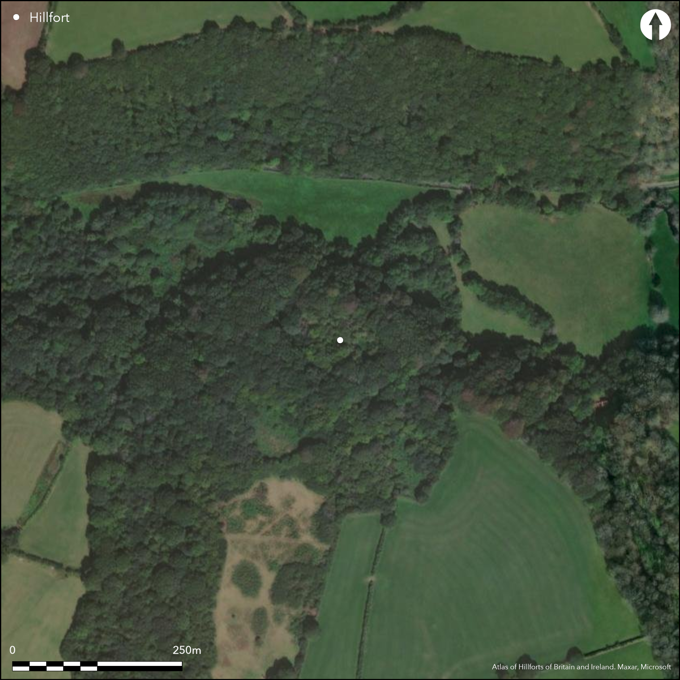
Woodland, brambles and scrub.
| Woodland | ✓ |
| Commercial Forestry Plantation | ✗ |
| Parkland | ✗ |
| Pasture (Grazing) | ✗ |
| Arable | ✗ |
| Scrub/Bracken | ✓ |
| Bare Outcrop | ✗ |
| Heather/Moorland | ✗ |
| Heath | ✗ |
| Built-up | ✗ |
| Coastal Grassland | ✗ |
| Other | ✗ |
Possible small inland promontory fort located on N-facing promontory in Kilkiffeth Wood above confluence of Afon Gwaun ad Pontfaen Brook to N. Steep surrounding slopes (steepest on W) with gentler rising ground to S.
| Contour Fort | ✗ |
| Partial Contour Fort | ✗ |
| Promontory Fort | ✓ |
| Hillslope Fort | ✗ |
| Level Terrain Fort | ✗ |
| Marsh Fort | ✗ |
| Multiple Enclosure Fort | ✗ |
| Hilltop | ✗ |
| Coastal Promontory | ✗ |
| Inland Promontory | ✓ |
| Valley Bottom | ✗ |
| Knoll/Hillock/Outcrop | ✗ |
| Ridge | ✗ |
| Cliff/Plateau-edge/Scarp | ✗ |
| Hillslope | ✗ |
| Lowland | ✗ |
| Spur | ✓ |
Dominant Topographic Feature: Spur
| North | ✓ |
| Northeast | ✗ |
| East | ✗ |
| Southeast | ✗ |
| South | ✗ |
| Southwest | ✗ |
| West | ✗ |
| Northwest | ✗ |
| Level | ✗ |
Altitude: 99.0m
N/A
None
Reliability: D - None
| Pre 1200BC | ✗ |
| 1200BC - 800BC | ✗ |
| 800BC - 400BC | ✗ |
| 400BC - AD50 | ✗ |
| AD50 - AD400 | ✗ |
| AD400 - AD 800 | ✗ |
| Post AD800 | ✗ |
| Unknown | ✓ |
| Pre Hillfort: | None |
| Post Hillfort: | Medieval connotations have been suggested in past, but no evidence for this. |
On 1st Ed. OS map (1889). Field Observation OS 1964. Field Observation CADW 1981, 1994, 1998. Cambria Archaeology defended enclosures survey 2006-2007.
| 1st Identified Map Depiction (1889): | OS map. |
| Other (1964): | Field Observation OS. |
| Other (None): | Field Observation CADW. |
| Other (None): | Cambria Archaeology defended enclosures survey. |
None
None
| None | ✓ |
| Spring | ✗ |
| Stream | ✗ |
| Pool | ✗ |
| Flush | ✗ |
| Well | ✗ |
| Other | ✗ |
None
| No Known Features | ✓ |
| Round Stone Structures | ✗ |
| Rectangular Stone Structures | ✗ |
| Curvilinear Platforms | ✗ |
| Other Roundhouse Evidence | ✗ |
| Pits | ✗ |
| Quarry Hollows | ✗ |
| Other | ✗ |
None
| No Known Excavation | ✓ |
| Pits | ✗ |
| Postholes | ✗ |
| Roundhouses | ✗ |
| Rectangular Structures | ✗ |
| Roads/Tracks | ✗ |
| Quarry Hollows | ✗ |
| Other | ✗ |
| Nothing Found | ✗ |
None
| No Known Geophysics | ✓ |
| Pits | ✗ |
| Roundhouses | ✗ |
| Rectangular Structures | ✗ |
| Roads/Tracks | ✗ |
| Quarry Hollows | ✗ |
| Other | ✗ |
| Nothing Found | ✗ |
None
| No Known Finds | ✓ |
| Pottery | ✗ |
| Metal | ✗ |
| Metalworking | ✗ |
| Human Bones | ✗ |
| Animal Bones | ✗ |
| Lithics | ✗ |
| Environmental | ✗ |
| Other | ✗ |
None
| APs Not Checked | ✓ |
| None | ✗ |
| Roundhouses | ✗ |
| Rectangular Structures | ✗ |
| Pits | ✗ |
| Postholes | ✗ |
| Roads/Tracks | ✗ |
| Other | ✗ |
SW entrance lined by few large boulders.
| 1: | None |
| 2: | None |
Guard Chambers: ✗
Chevaux de Frise: ✗
| 1. Simple Gap (South west): | None |
Defined by single bank and ditch to S, bank rising to 2m above ditch, but only 0.4m above interior. Rubble on S may be relict stone wall
| Area 1: | 0.43ha. |
| Total: | 0.43ha. |
Total Footprint Area: Noneha.
None
| ✗ | None |
| ✗ | None |
| NE Quadrant: | 0 |
| SE Quadrant: | 1 |
| SW Quadrant: | 1 |
| NW Quadrant: | 0 |
| Total: | 1 |
| Partial Univallate | ✓ |
| Univallate | ✗ |
| Partial Bivallate | ✗ |
| Bivallate | ✗ |
| Partial Multivallate | ✗ |
| Multivallate | ✗ |
| Unknown | ✗ |
| Partial Univallate | ✗ |
| Univallate | ✗ |
| Partial Bivallate | ✗ |
| Bivallate | ✗ |
| Partial Multivallate | ✗ |
| Multivallate | ✗ |
Rubble on S may be relict stone wall.
| None | ✗ |
| Earthen Bank | ✓ |
| Stone Wall | ✓ |
| Rubble | ✗ |
| Wall-walk | ✗ |
| Evidence of Timber | ✗ |
| Vitrification | ✗ |
| Other Burning | ✗ |
| Palisade | ✗ |
| Counter Scarp Bank | ✗ |
| Berm | ✗ |
| Unfinished | ✗ |
| Other | ✗ |
None
| None | ✗ |
| Earthen Bank | ✗ |
| Stone Wall | ✗ |
| Murus Duplex | ✗ |
| Timber-framed | ✗ |
| Timber-laced | ✗ |
| Vitrification | ✗ |
| Other Burning | ✗ |
| Palisade | ✗ |
| Counter Scarp Bank | ✗ |
| Berm | ✗ |
| Unfinished | ✗ |
| No Known Excavation | ✓ |
| Other | ✗ |
| ✗ | None |
| ✓ | None |
Number of Ditches: 1
| ✗ | None |
Fenton, R.A. 1994. A historical tour through Pembrokeshire, Haverfordwest: Reprinted by Cyngor Sir Dyfed County Council , Cultural Services Department.
Murphy, K., Ramsey, R., Poucher, P. and Page, M. 2007. A Survey of Defended Enclosures in Pembrokeshire, 2006-2007: Gazetteer of Ordnance Survey Grid Squares SN03, SN13 and SN23, Cambria Archaeology Report No. 2007/01, Project Record No. 54269, Llandeilo: Cambria Archaeology.
Atlas of Hillforts:
Wikidata:
This work is licensed under CC BY-SA 4.0![]()
![]()
![]() and should be cited as:
and should be cited as:
Lock, Gary and Ralston, Ian. 2024. Atlas of Hillforts of Britain and Ireland. Available at: https://hillforts.arch.ox.ac.uk
Document Version 1.1