LiDAR 1m DTM Hillshade
Satellite Imagery
LiDAR 1m DTM Hillshade
Satellite Imagery
Scroll left/right to view further images.
HER: Dyfed 1600 (None)
NMR: SN 04 SE (304392)
SM: PE160(PEM)
NGR: SN 082 401
X: 208200 Y: 240100 (OSGB36)
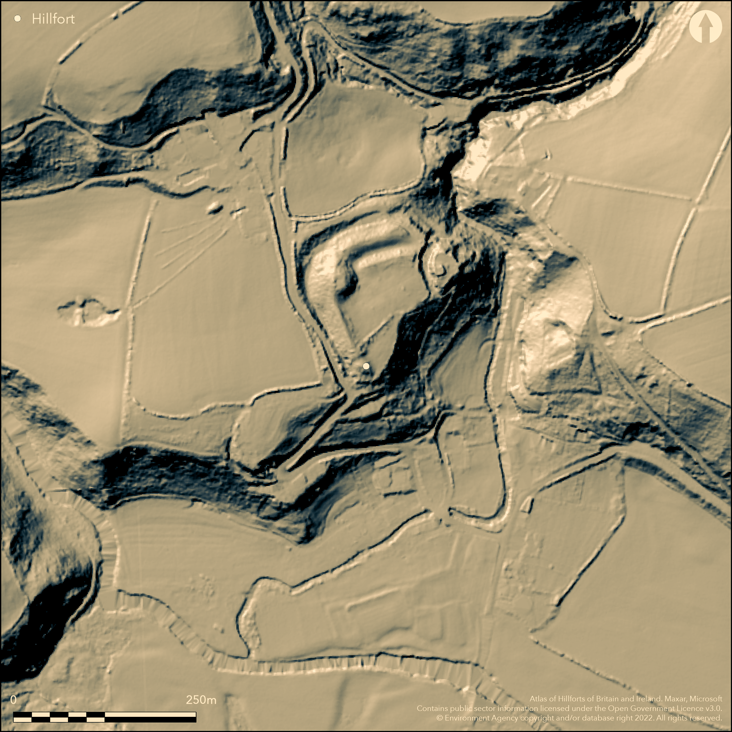
Mulitivallate inland promontory fort, reused as a medieval castle, located on spur above the Afon Gammon 30m below on E and S and Afon Nyfer further to W. Steep slopes to E and S, to W deep natural gully. Roughly triangular interior measures c. 100m E-W by 80m, with area c. 0.8ha. On gentle to flat to N and NE sides three massive banks and ditches, at highest top of rampart 7.5m above ditch bottom. Possible silted ditch E-W across interior. No entrance defined. Fine motte and bailey castle of 1191 AD lies over defences on NW. Stone tower on E side of promontory. Interior under rough grass and scrub with scrub on banks. Motte and surrounding slopes wooded. Excavations on castle site by C. Caple 2008-2010. On 1st Ed. OS map (1889). Undated.
Citizen Science: ✗
Reliability of Data: Confirmed
Reliability of Interpretation: Confirmed
X: -534016 Y: 6804834 (EPSG: 3857)
Longitude: -4.797151837423497 Latitude: 52.02603208193987 (EPSG:4326)
Country: Wales
Current County or Unitary Authority: Pembrokeshire
Historic County: Pembrokeshire
Current Parish/Community/Council/Townland: Nevern
Massive banks intact. Fine motte and bailey castle of 1191 AD lies over defences on NW. Stone tower on E side of promontory.
| Extant | ✓ |
| Cropmark | ✗ |
| Likely Destroyed | ✗ |
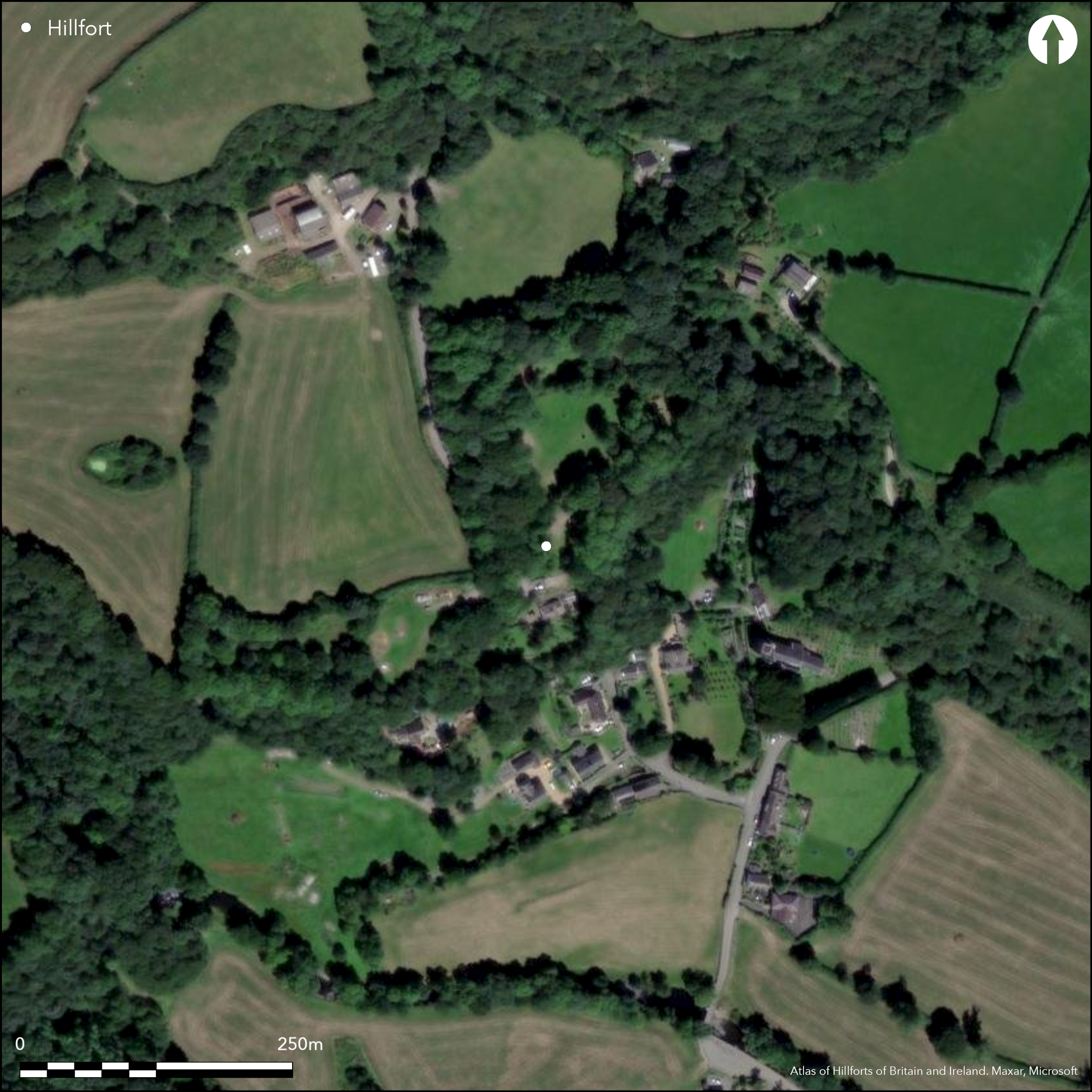
Interior under rough grass and scrub with scrub on banks. Motte and surrounding slopes wooded.
| Woodland | ✓ |
| Commercial Forestry Plantation | ✗ |
| Parkland | ✗ |
| Pasture (Grazing) | ✓ |
| Arable | ✗ |
| Scrub/Bracken | ✓ |
| Bare Outcrop | ✗ |
| Heather/Moorland | ✗ |
| Heath | ✗ |
| Built-up | ✓ |
| Coastal Grassland | ✗ |
| Other | ✓ |
Mulitivallate inland promontory fort, reused as a medieval castle, located on spur above the Afon Nanhyfer 30m below on E and S. Steep slopes to E and S, to W deep natural gully.
| Contour Fort | ✗ |
| Partial Contour Fort | ✗ |
| Promontory Fort | ✓ |
| Hillslope Fort | ✗ |
| Level Terrain Fort | ✗ |
| Marsh Fort | ✗ |
| Multiple Enclosure Fort | ✗ |
| Hilltop | ✗ |
| Coastal Promontory | ✗ |
| Inland Promontory | ✓ |
| Valley Bottom | ✗ |
| Knoll/Hillock/Outcrop | ✗ |
| Ridge | ✗ |
| Cliff/Plateau-edge/Scarp | ✗ |
| Hillslope | ✗ |
| Lowland | ✗ |
| Spur | ✗ |
Dominant Topographic Feature: Spur
| North | ✗ |
| Northeast | ✓ |
| East | ✗ |
| Southeast | ✗ |
| South | ✗ |
| Southwest | ✗ |
| West | ✗ |
| Northwest | ✗ |
| Level | ✗ |
Altitude: 50.0m
N/A
None
Reliability: D - None
| Pre 1200BC | ✗ |
| 1200BC - 800BC | ✗ |
| 800BC - 400BC | ✗ |
| 400BC - AD50 | ✗ |
| AD50 - AD400 | ✗ |
| AD400 - AD 800 | ✗ |
| Post AD800 | ✗ |
| Unknown | ✓ |
| Pre Hillfort: | None |
| Post Hillfort: | Fine motte and bailey castle of 1191 AD lies over defences on NW. Stone tower on E side of promontory. Excavations on castle site by C. Caple 2008-2010. |
On 1st Ed. OS map (1889). Field Observation OS 1974. Field Observation AMB 1981. Field Observation CADW 1992, 2003. Cambria Archaeology defended enclosures survey 2006-2007. Excavations on castle site by C. Caple 2008-2010.
| 1st Identified Map Depiction (1889): | OS map. |
| Other (1974): | Field observation OS. |
| Other (1981): | Field observation 1981. |
| Other (2011): | Visited by Hillfort Study Group |
| Other (None): | Field observation CADW. |
| Other (None): | Cambria Archaeology defended enclosures survey |
| Excavation (None): | None |
None
None
| None | ✓ |
| Spring | ✗ |
| Stream | ✗ |
| Pool | ✗ |
| Flush | ✗ |
| Well | ✗ |
| Other | ✗ |
None
| No Known Features | ✓ |
| Round Stone Structures | ✗ |
| Rectangular Stone Structures | ✗ |
| Curvilinear Platforms | ✗ |
| Other Roundhouse Evidence | ✗ |
| Pits | ✗ |
| Quarry Hollows | ✗ |
| Other | ✗ |
None
| No Known Excavation | ✓ |
| Pits | ✗ |
| Postholes | ✗ |
| Roundhouses | ✗ |
| Rectangular Structures | ✗ |
| Roads/Tracks | ✗ |
| Quarry Hollows | ✗ |
| Other | ✗ |
| Nothing Found | ✗ |
None
| No Known Geophysics | ✓ |
| Pits | ✗ |
| Roundhouses | ✗ |
| Rectangular Structures | ✗ |
| Roads/Tracks | ✗ |
| Quarry Hollows | ✗ |
| Other | ✗ |
| Nothing Found | ✗ |
None
| No Known Finds | ✓ |
| Pottery | ✗ |
| Metal | ✗ |
| Metalworking | ✗ |
| Human Bones | ✗ |
| Animal Bones | ✗ |
| Lithics | ✗ |
| Environmental | ✗ |
| Other | ✗ |
None
| APs Not Checked | ✓ |
| None | ✗ |
| Roundhouses | ✗ |
| Rectangular Structures | ✗ |
| Pits | ✗ |
| Postholes | ✗ |
| Roads/Tracks | ✗ |
| Other | ✗ |
No entrance defined.
| 0: | None |
| 2: | None |
Guard Chambers: ✗
Chevaux de Frise: ✗
On gentle to flat to N and NE side three massive banks and ditches, at highest top of rampart 7.5m above ditch bottom. Possible silted ditch E-W across interior.
| Area 1: | 0.8ha. |
| Total: | 0.8ha. |
Total Footprint Area: Noneha.
None
| ✗ | None |
| ✗ | None |
| NE Quadrant: | 3 |
| SE Quadrant: | 0 |
| SW Quadrant: | 0 |
| NW Quadrant: | 3 |
| Total: | 3 |
| Partial Univallate | ✗ |
| Univallate | ✗ |
| Partial Bivallate | ✗ |
| Bivallate | ✗ |
| Partial Multivallate | ✓ |
| Multivallate | ✗ |
| Unknown | ✗ |
| Partial Univallate | ✗ |
| Univallate | ✗ |
| Partial Bivallate | ✗ |
| Bivallate | ✗ |
| Partial Multivallate | ✗ |
| Multivallate | ✗ |
None
| None | ✗ |
| Earthen Bank | ✓ |
| Stone Wall | ✗ |
| Rubble | ✗ |
| Wall-walk | ✗ |
| Evidence of Timber | ✗ |
| Vitrification | ✗ |
| Other Burning | ✗ |
| Palisade | ✗ |
| Counter Scarp Bank | ✗ |
| Berm | ✗ |
| Unfinished | ✗ |
| Other | ✗ |
None
| None | ✗ |
| Earthen Bank | ✗ |
| Stone Wall | ✗ |
| Murus Duplex | ✗ |
| Timber-framed | ✗ |
| Timber-laced | ✗ |
| Vitrification | ✗ |
| Other Burning | ✗ |
| Palisade | ✗ |
| Counter Scarp Bank | ✗ |
| Berm | ✗ |
| Unfinished | ✗ |
| No Known Excavation | ✓ |
| Other | ✗ |
| ✗ | None |
| ✓ | Possible silted ditch E-W across interior. |
Number of Ditches: 3
| ✗ | None |
Caple, C. 2008, 2009, 2010. Nevern Castle excavations, Interim reports, Arch in Wales, 48 (2008), 49 (2009), 50 (2010).
Driver, T. 2007. Pembrokeshire: Historic Landscapes from the Air, Aberystwyth: RCAHMW, 152.
King, D.J.C. and Perks, J.C. 1951. Castell Nanhyfer, Nevern (Pemb.), Arch Camb, 101, 123-28.
Murphy, K., Ramsey, R., Poucher, P. and Page, M. 2007. A Survey of Defended Enclosures in Pembrokeshire, 2006-2007: Gazetteer of Ordnance Survey Grid Squares SN04 and SN14, Cambria Archaeology Report No. 2007/01, Project Record No. 54269, Llandeilo: Cambria Archaeology.
Turvey, R. 1989. Nevern Castle: a new interpretation, J Pemb Hist Soc, 3, 65.
Atlas of Hillforts:
Wikidata:
This work is licensed under CC BY-SA 4.0![]()
![]()
![]() and should be cited as:
and should be cited as:
Lock, Gary and Ralston, Ian. 2024. Atlas of Hillforts of Britain and Ireland. Available at: https://hillforts.arch.ox.ac.uk
Document Version 1.1