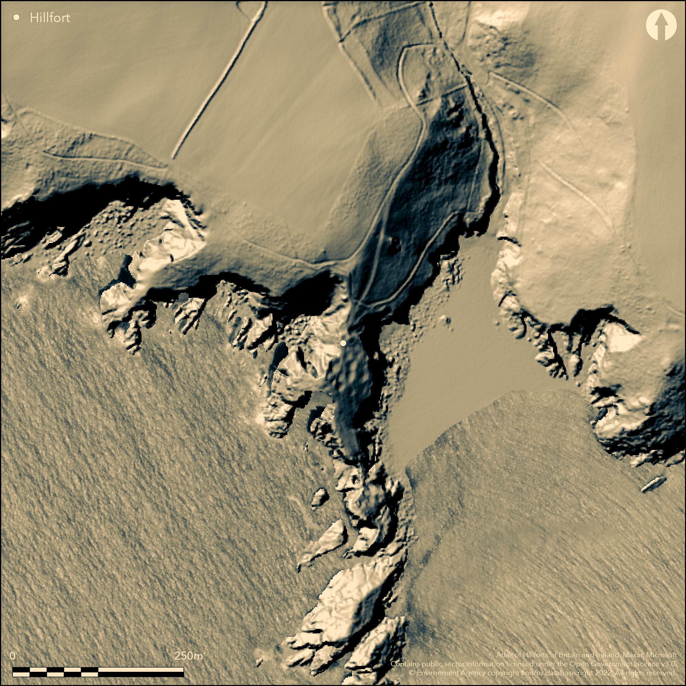
LiDAR 1m DTM Hillshade
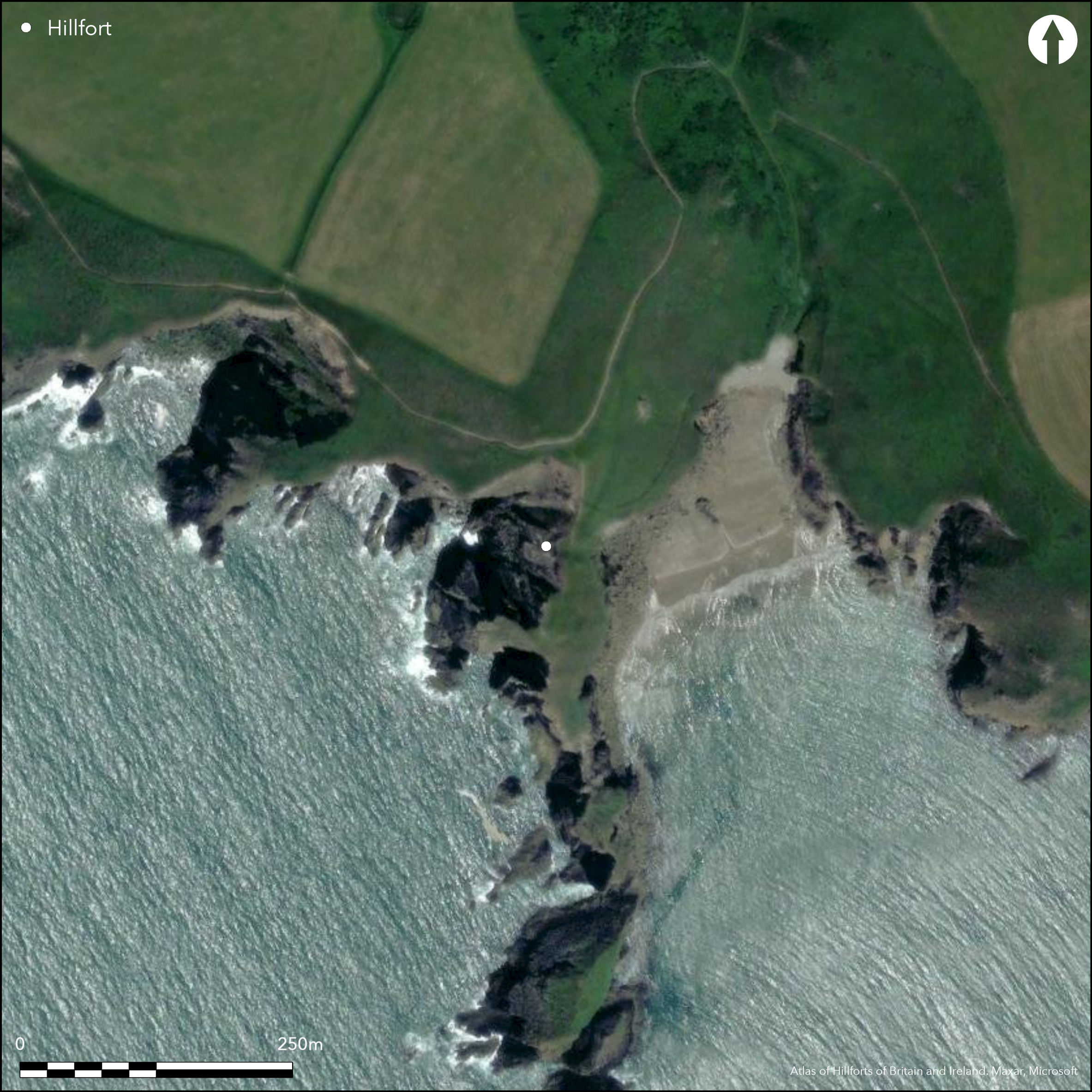
Satellite Imagery
LiDAR 1m DTM Hillshade
Satellite Imagery
Scroll left/right to view further images.
HER: Dyfed 2784 (None)
NMR: SM 82 SW (305329)
SM: PE539(PEM)
NGR: SM 8257 2293
X: 182570 Y: 222930 (OSGB36)
Coastal promontory fort located on prominent sinuous S-facing, eroded and rocky, promontory to E of Pen Dinas headland and Solva harbour entrance. Sea cliffs to 10m-20m high, on E, S and W, rising steeply landward to coastal plateau on N at c. 80m A.S.L. Site probably larger in prehistory and areas cut into by sea. Defined by single bank, to 4m wide and 0.5m high internally, with ditch to 6m wide and 2m deep cutting off the 20m-25m wide promontory neck on N. Slightly staggered causewayed entrance through gap in centre of ditch and bank. Grassy interior is steeply sloping from E-W, with c. 14 circular platforms cut into the slope c. 5m-10m diameter immediately S of entrance - probably round stone-built hut sites. Investigation of these building platforms by W.F. Grimes in 1939, produced Samian (Roman fine-ware pottery) and occupation debris. Rough coastal grass and bare rock.
Citizen Science: ✗
Reliability of Data: Confirmed
Reliability of Interpretation: Confirmed
X: -574331 Y: 6775291 (EPSG: 3857)
Longitude: -5.1593024905815 Latitude: 51.862438273890405 (EPSG:4326)
Country: Wales
Current County or Unitary Authority: Pembrokeshire
Historic County: Pembrokeshire
Current Parish/Community/Council/Townland: Brawdy
Site probably larger in prehistory and areas cut into by sea.
| Extant | ✓ |
| Cropmark | ✗ |
| Likely Destroyed | ✓ |
Rough coastal grass and bare rock.
| Woodland | ✗ |
| Commercial Forestry Plantation | ✗ |
| Parkland | ✗ |
| Pasture (Grazing) | ✗ |
| Arable | ✗ |
| Scrub/Bracken | ✗ |
| Bare Outcrop | ✗ |
| Heather/Moorland | ✗ |
| Heath | ✗ |
| Built-up | ✗ |
| Coastal Grassland | ✓ |
| Other | ✗ |
Coastal promontory fort located on prominent sinuous S-facing, eroded and rocky, promontory to E of Pen Dinas headland and Solva harbour entrance. Sea cliffs to 10m-20m high, on E, S and W, rising steeply landward to coastal plateau on N at c. 80m A.S.L.
| Contour Fort | ✗ |
| Partial Contour Fort | ✗ |
| Promontory Fort | ✓ |
| Hillslope Fort | ✗ |
| Level Terrain Fort | ✗ |
| Marsh Fort | ✗ |
| Multiple Enclosure Fort | ✗ |
| Hilltop | ✗ |
| Coastal Promontory | ✓ |
| Inland Promontory | ✗ |
| Valley Bottom | ✗ |
| Knoll/Hillock/Outcrop | ✗ |
| Ridge | ✗ |
| Cliff/Plateau-edge/Scarp | ✗ |
| Hillslope | ✗ |
| Lowland | ✗ |
| Spur | ✗ |
Dominant Topographic Feature: Coastal promontory
| North | ✗ |
| Northeast | ✗ |
| East | ✗ |
| Southeast | ✗ |
| South | ✓ |
| Southwest | ✗ |
| West | ✗ |
| Northwest | ✗ |
| Level | ✗ |
Altitude: 20.0m
N/A
Samian (Roman fine-ware pottery) found.
Reliability: C - Low
| Pre 1200BC | ✗ |
| 1200BC - 800BC | ✗ |
| 800BC - 400BC | ✗ |
| 400BC - AD50 | ✗ |
| AD50 - AD400 | ✓ |
| AD400 - AD 800 | ✗ |
| Post AD800 | ✗ |
| Unknown | ✗ |
| Pre Hillfort: | None |
| Post Hillfort: | None |
| Artefactual: | Samian ware. |
Investigation of building platforms by W.F. Grimes in 1939. Field Observation OS 1973. Field Observation DAT 1994, 2006. Cambria Archaeology defended enclosures survey 2006-2007.
| Excavation (1939): | W.F. Grimes |
| Other (1973): | Field observation OS. |
| Other (None): | Field observation DAT. |
| Other (None): | Cambria Archaeology defended enclosures survey. |
Grassy interior is steeply sloping from E-W, with c. 14 circular platforms cut into the slope c. 5m-10m diameter immediately S of entrance - probably round stone-built hut sites. Investigation of building platforms (PPS 5 (1939), 258) produced Samian (Roman fine-ware pottery) and occupation debris.
None
| None | ✓ |
| Spring | ✗ |
| Stream | ✗ |
| Pool | ✗ |
| Flush | ✗ |
| Well | ✗ |
| Other | ✗ |
Grassy interior is steeply sloping from E-W, with c. 14 circular platforms cut into the slope c. 5m-10m diameter immediately S of entrance - probably round stone-built hut sites.
| No Known Features | ✗ |
| Round Stone Structures | ✓ |
| Rectangular Stone Structures | ✗ |
| Curvilinear Platforms | ✓ |
| Other Roundhouse Evidence | ✗ |
| Pits | ✗ |
| Quarry Hollows | ✗ |
| Other | ✗ |
Investigation of building platforms 1939.
| No Known Excavation | ✗ |
| Pits | ✗ |
| Postholes | ✗ |
| Roundhouses | ✓ |
| Rectangular Structures | ✗ |
| Roads/Tracks | ✗ |
| Quarry Hollows | ✗ |
| Other | ✗ |
| Nothing Found | ✗ |
None
| No Known Geophysics | ✓ |
| Pits | ✗ |
| Roundhouses | ✗ |
| Rectangular Structures | ✗ |
| Roads/Tracks | ✗ |
| Quarry Hollows | ✗ |
| Other | ✗ |
| Nothing Found | ✗ |
Investigation of building platforms (PPS 5 (1939), 258) produced Samian (Roman fine-ware pottery) and occupation debris.
| No Known Finds | ✗ |
| Pottery | ✓ |
| Metal | ✗ |
| Metalworking | ✗ |
| Human Bones | ✗ |
| Animal Bones | ✗ |
| Lithics | ✗ |
| Environmental | ✗ |
| Other | ✓ |
None
| APs Not Checked | ✓ |
| None | ✗ |
| Roundhouses | ✗ |
| Rectangular Structures | ✗ |
| Pits | ✗ |
| Postholes | ✗ |
| Roads/Tracks | ✗ |
| Other | ✗ |
Slightly staggered causewayed entrance through gap in centre of ditch and bank.
| 1: | None |
| 2: | None |
Guard Chambers: ✗
Chevaux de Frise: ✗
| 1. Over-lapping (North): | Slightly staggered causewayed entrance. |
Defined by single bank, to 4m wide and 0.5m high internally, with ditch to 6m wide and 2m deep cutting off the 25m wide promontory neck on N.
| Area 1: | 0.38ha. |
| Total: | 0.38ha. |
Total Footprint Area: Noneha.
None
| ✗ | Coastal erosion, sea stacks off seaward end |
| ✗ | None |
| NE Quadrant: | 1 |
| SE Quadrant: | 0 |
| SW Quadrant: | 0 |
| NW Quadrant: | 1 |
| Total: | 1 |
| Partial Univallate | ✓ |
| Univallate | ✗ |
| Partial Bivallate | ✗ |
| Bivallate | ✗ |
| Partial Multivallate | ✗ |
| Multivallate | ✗ |
| Unknown | ✗ |
| Partial Univallate | ✗ |
| Univallate | ✗ |
| Partial Bivallate | ✗ |
| Bivallate | ✗ |
| Partial Multivallate | ✗ |
| Multivallate | ✗ |
Probable stone wall.
| None | ✗ |
| Earthen Bank | ✗ |
| Stone Wall | ✓ |
| Rubble | ✗ |
| Wall-walk | ✗ |
| Evidence of Timber | ✗ |
| Vitrification | ✗ |
| Other Burning | ✗ |
| Palisade | ✗ |
| Counter Scarp Bank | ✗ |
| Berm | ✗ |
| Unfinished | ✗ |
| Other | ✗ |
None
| None | ✓ |
| Earthen Bank | ✗ |
| Stone Wall | ✗ |
| Murus Duplex | ✗ |
| Timber-framed | ✗ |
| Timber-laced | ✗ |
| Vitrification | ✗ |
| Other Burning | ✗ |
| Palisade | ✗ |
| Counter Scarp Bank | ✗ |
| Berm | ✗ |
| Unfinished | ✗ |
| No Known Excavation | ✗ |
| Other | ✗ |
| ✗ | None |
| ✓ | None |
Number of Ditches: 1
| ✗ | None |
Leask, H.G., Clark, J.G.D., Estyn Evans, E., Gordon Childe V. and Grimes W.F. (1939). Notes on excavations in Eire, England, Northern Ireland, Scotland and Wales during 1939, Proc Prehist Soc, 5(2), 258.
Murphy, K., Ramsey, R., Poucher, P. and Page, M. 2007. A Survey of Defended Enclosures in Pembrokeshire, 2006-2007: Gazetteer of Ordnance Survey Grid Squares SM72 and SM82, Cambria Archaeology Report No. 2007/01, Project Record No. 54269, Llandeilo: Cambria Archaeology.
Atlas of Hillforts:
Wikidata:
This work is licensed under CC BY-SA 4.0

 and should be cited as:
Lock, Gary and Ralston, Ian. 2024. Atlas of Hillforts of Britain and Ireland. Available at: https://hillforts.arch.ox.ac.uk
Document Version 1.1