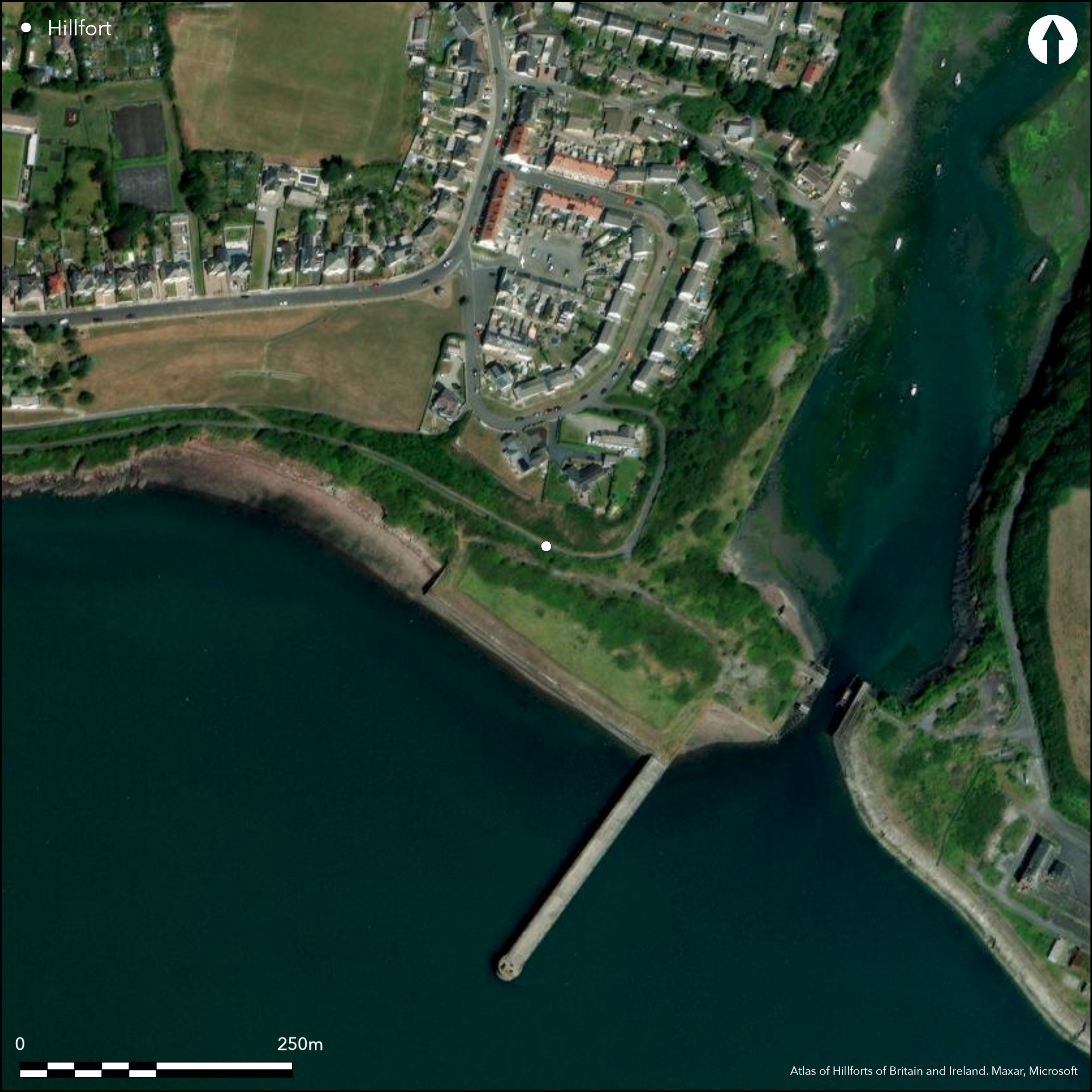
Satellite Imagery
Satellite Imagery
HER: Dyfed 3170 (None)
NMR: SM 90 NW (103144)
SM: None
NGR: SM 9120 0548
X: 191200 Y: 205480 (OSGB36)
Possible coastal promontory fort, now completely destroyed, located on SE-facing promontory overlooking Milford Haven and where the minor inlet of Castle Pill enters the tideway. Surrounds affected by development, road and railway line. Bank and ditch shown on the 1st Ed. OS 1:2500 map of 1885, as was a rectangular earthwork platform behind defences - probably a later gun platform. and described on the Royal Commission inventory of 1925 as an earthwork bank and ditch enclosing the triangular promontory. Originally the bank and ditch seems to have enclosed an area c. 70m N-S by 90m, with internal area c. 0.6ha. Development on the site occurred during 20th century and site finally built on in 1980's. Possibly Iron Age promontory fort, but Civil War fortifications on Milford Haven have resulted in site considered later as possible gun platform at entrance to Castle Pill. Site now developed.
Citizen Science: ✗
Reliability of Data: Irreconciled issues
Reliability of Interpretation: Irreconciled issues
X: -559231 Y: 6747689 (EPSG: 3857)
Longitude: -5.0236535499297545 Latitude: 51.70905809789303 (EPSG:4326)
Country: Wales
Current County or Unitary Authority: Pembrokeshire
Historic County: Pembrokeshire
Current Parish/Community/Council/Townland: Milford
Development on the site occurred during 20th century and site finally built on in 1980's.
| Extant | ✗ |
| Cropmark | ✗ |
| Likely Destroyed | ✓ |
Site developed and surrounds also affected by development, road and railway line. Possible gun platform
| Woodland | ✗ |
| Commercial Forestry Plantation | ✗ |
| Parkland | ✗ |
| Pasture (Grazing) | ✗ |
| Arable | ✗ |
| Scrub/Bracken | ✗ |
| Bare Outcrop | ✗ |
| Heather/Moorland | ✗ |
| Heath | ✗ |
| Built-up | ✓ |
| Coastal Grassland | ✗ |
| Other | ✓ |
Possible coastal promontory fort, now completely destroyed, located on SE-facing promontory overlooking Milford Haven and where the minor inlet of Castle Pill enters the tideway.
| Contour Fort | ✗ |
| Partial Contour Fort | ✗ |
| Promontory Fort | ✓ |
| Hillslope Fort | ✗ |
| Level Terrain Fort | ✗ |
| Marsh Fort | ✗ |
| Multiple Enclosure Fort | ✗ |
| Hilltop | ✗ |
| Coastal Promontory | ✓ |
| Inland Promontory | ✗ |
| Valley Bottom | ✗ |
| Knoll/Hillock/Outcrop | ✗ |
| Ridge | ✗ |
| Cliff/Plateau-edge/Scarp | ✗ |
| Hillslope | ✗ |
| Lowland | ✗ |
| Spur | ✗ |
Dominant Topographic Feature: Coastal promontory.
| North | ✗ |
| Northeast | ✗ |
| East | ✗ |
| Southeast | ✓ |
| South | ✗ |
| Southwest | ✗ |
| West | ✗ |
| Northwest | ✗ |
| Level | ✗ |
Altitude: 20.0m
N/A
Possibly Iron Age promontory fort, but Civil War fortifications on Milford Haven have resulted in site considered later as possible gun platform at entrance to Castle Pill. No proof - possibly both.
Reliability: D - None
| Pre 1200BC | ✗ |
| 1200BC - 800BC | ✗ |
| 800BC - 400BC | ✗ |
| 400BC - AD50 | ✗ |
| AD50 - AD400 | ✗ |
| AD400 - AD 800 | ✗ |
| Post AD800 | ✗ |
| Unknown | ✓ |
| Pre Hillfort: | None |
| Post Hillfort: | Possible site of Civil War gun platform. |
| Morphology/Earthwork/Typology: | Possibly Iron Age promontory fort. |
On 1st Ed. OS map (1885). Archaeological test pitting by DAT 1984 confirmed site long destroyed. Field Observation OS 1965, 1975. Field observation G.H. Williams 1987. Field Observation DAT 1994, 2006. Cambria Archaeology defended enclosures survey 2006-2007.
| 1st Identified Map Depiction (1885): | OS map. |
| Excavation (1984): | Archaeological test pitting by DAT. |
| Other (1987): | Field observation G.H. Williams. |
| Other (None): | Field observation OS. |
| Other (None): | Field observation DAT. |
| Other (None): | Cambria Archaeology defended enclosures survey. |
Site destroyed.
None
| None | ✓ |
| Spring | ✗ |
| Stream | ✗ |
| Pool | ✗ |
| Flush | ✗ |
| Well | ✗ |
| Other | ✗ |
None
| No Known Features | ✓ |
| Round Stone Structures | ✗ |
| Rectangular Stone Structures | ✗ |
| Curvilinear Platforms | ✗ |
| Other Roundhouse Evidence | ✗ |
| Pits | ✗ |
| Quarry Hollows | ✗ |
| Other | ✗ |
None
| No Known Excavation | ✓ |
| Pits | ✗ |
| Postholes | ✗ |
| Roundhouses | ✗ |
| Rectangular Structures | ✗ |
| Roads/Tracks | ✗ |
| Quarry Hollows | ✗ |
| Other | ✗ |
| Nothing Found | ✗ |
None
| No Known Geophysics | ✓ |
| Pits | ✗ |
| Roundhouses | ✗ |
| Rectangular Structures | ✗ |
| Roads/Tracks | ✗ |
| Quarry Hollows | ✗ |
| Other | ✗ |
| Nothing Found | ✗ |
None
| No Known Finds | ✓ |
| Pottery | ✗ |
| Metal | ✗ |
| Metalworking | ✗ |
| Human Bones | ✗ |
| Animal Bones | ✗ |
| Lithics | ✗ |
| Environmental | ✗ |
| Other | ✗ |
None
| APs Not Checked | ✓ |
| None | ✗ |
| Roundhouses | ✗ |
| Rectangular Structures | ✗ |
| Pits | ✗ |
| Postholes | ✗ |
| Roads/Tracks | ✗ |
| Other | ✗ |
Site destroyed.
| 0: | None |
| 2: | None |
Guard Chambers: ✗
Chevaux de Frise: ✗
Originally possibly bank and ditch cutting off the promontory on NW. Site now destroyed.
| Area 1: | Noneha. |
| Total: | Noneha. |
Total Footprint Area: Noneha.
None
| ✗ | None |
| ✗ | None |
| NE Quadrant: | 0 |
| SE Quadrant: | 0 |
| SW Quadrant: | 0 |
| NW Quadrant: | 1 |
| Total: | 1 |
| Partial Univallate | ✓ |
| Univallate | ✗ |
| Partial Bivallate | ✗ |
| Bivallate | ✗ |
| Partial Multivallate | ✗ |
| Multivallate | ✗ |
| Unknown | ✗ |
| Partial Univallate | ✗ |
| Univallate | ✗ |
| Partial Bivallate | ✗ |
| Bivallate | ✗ |
| Partial Multivallate | ✗ |
| Multivallate | ✗ |
Site destroyed.
| None | ✗ |
| Earthen Bank | ✓ |
| Stone Wall | ✗ |
| Rubble | ✗ |
| Wall-walk | ✗ |
| Evidence of Timber | ✗ |
| Vitrification | ✗ |
| Other Burning | ✗ |
| Palisade | ✗ |
| Counter Scarp Bank | ✗ |
| Berm | ✗ |
| Unfinished | ✗ |
| Other | ✗ |
None
| None | ✗ |
| Earthen Bank | ✗ |
| Stone Wall | ✗ |
| Murus Duplex | ✗ |
| Timber-framed | ✗ |
| Timber-laced | ✗ |
| Vitrification | ✗ |
| Other Burning | ✗ |
| Palisade | ✗ |
| Counter Scarp Bank | ✗ |
| Berm | ✗ |
| Unfinished | ✗ |
| No Known Excavation | ✓ |
| Other | ✗ |
| ✗ | None |
| ✓ | None |
Number of Ditches: 1
| ✗ | None |
Murphy, K., Ramsey, R., Poucher, P. and Page, M. 2007. A Survey of Defended Enclosures in Pembrokeshire, 2006-2007: Gazetteer of Ordnance Survey Grid Squares SM90 and SN00, Cambria Archaeology Report No. 2007/01, Project Record No. 54269, Llandeilo: Cambria Archaeology.
Atlas of Hillforts:
Wikidata:
This work is licensed under CC BY-SA 4.0

 and should be cited as:
Lock, Gary and Ralston, Ian. 2024. Atlas of Hillforts of Britain and Ireland. Available at: https://hillforts.arch.ox.ac.uk
Document Version 1.1