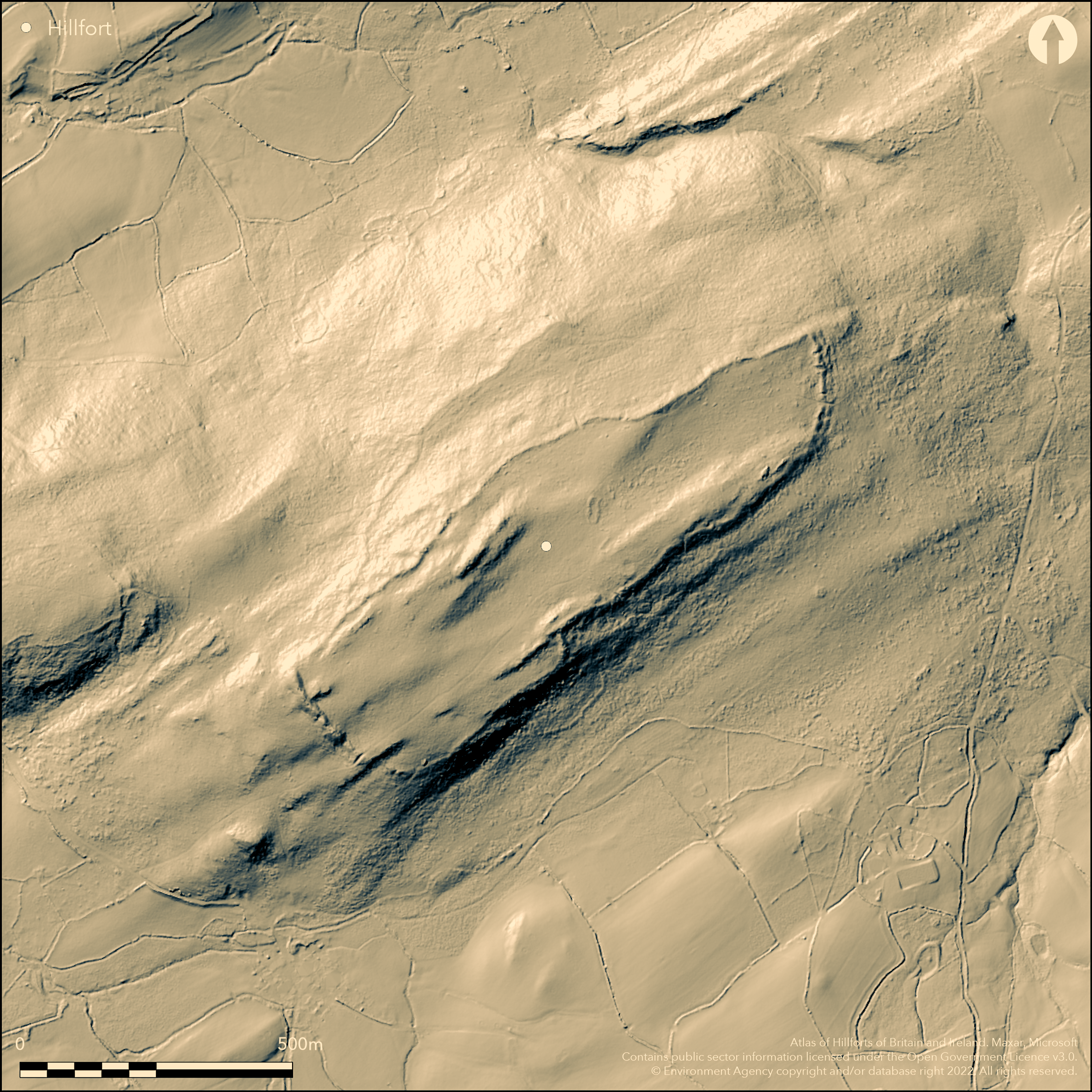
LiDAR 1m DTM Hillshade
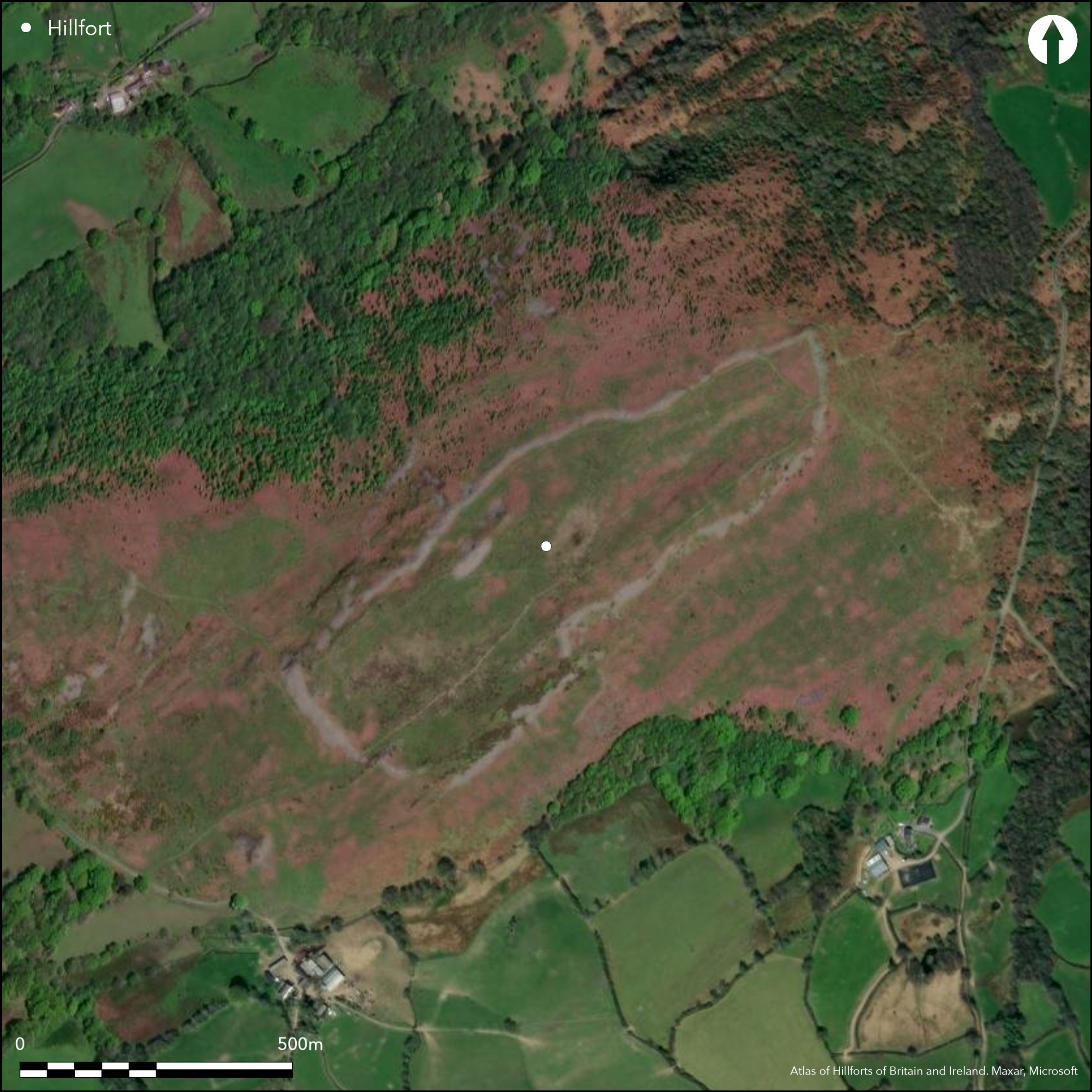
Satellite Imagery
LiDAR 1m DTM Hillshade
Satellite Imagery
Scroll left/right to view further images.
HER: Dyfed 887 (None)
NMR: SN 62 SE (100866)
SM: CM037a(CAM)
NGR: SN69122432
X: 269120 Y: 224320 (OSGB36)
Large contour hillfort located in a commanding position on W part of the sandstone Garn Goch ridge overlooking and commanding the Tywi valley NE of Llandeilo. Opposite the confluence of the Afon Tywi and Afon Dulais. Larger of the two hillforts in close proximity on the ridge; Y Gaer Fach (Atlas No. 2140) c. 0.15km to SW. Very steep surrounding slopes to N, moderate to strong to S, E and W. Oval in shape measuring c. 680m NE-SW by 130m-190m, and at c. 11ha largest hillfort in SW Wales. Three phased construction suggested by Hogg (1974). Massive (now fallen) stone wall with an additional stone rampart on NW surrounds the hilltop. To W main rampart is 6.5m high and 25m wide; less elsewhere to 1.5m high. Some stonework survives on W. Outer wall to the N branches out to form an annexe, aerial photographs indicating once continued E to connect with NE angle of main fort. No ditch. At least eight gateways have been identified. Main gate on NE, with a double portal, and single broad gateway on SW, but present layout of these entrances modern, with original gates now partly concealed by collapse within the stony ramparts. Six postern gates, four on NW and two SE, all lined with upright slabs, probably original and possibly roofed with lintels as at Tre'r Ceiri on the Ll_n (Atlas No.1685), to which the site is similar. Traces of single roundhouse as almost circular levelled platform, 14m diameter on S. Two roughly rectangular structures stand in centre of the hillfort, possibly medieval house and fold. Possible standing stone in S part of the interior identified by RCAHMW 2009. Large Bronze Age/Neolithic cairn in the interior. Rocky rough upland grazing with bracken. On 1st Ed. OS map (1887). Minimal investigations, undated.
Citizen Science: ✗
Reliability of Data: Confirmed
Reliability of Interpretation: Confirmed
X: -434569 Y: 6782419 (EPSG: 3857)
Longitude: -3.9038027007060196 Latitude: 51.90196661177282 (EPSG:4326)
Country: Wales
Current County or Unitary Authority: Carmarthenshire
Historic County: Carmarthenshire
Current Parish/Community/Council/Townland: Llangadog
Ramparts of tumbled stone. Common land. Bracken obscures features.
| Extant | ✓ |
| Cropmark | ✗ |
| Likely Destroyed | ✗ |
Rocky upland rough grazing and bracken. Possible medieval structures.
| Woodland | ✗ |
| Commercial Forestry Plantation | ✗ |
| Parkland | ✗ |
| Pasture (Grazing) | ✓ |
| Arable | ✗ |
| Scrub/Bracken | ✓ |
| Bare Outcrop | ✗ |
| Heather/Moorland | ✗ |
| Heath | ✗ |
| Built-up | ✗ |
| Coastal Grassland | ✗ |
| Other | ✓ |
Fine and important and large contour hillfort located in a commanding position on W part of the sandstone Garn Goch ridge overlooking and commanding the Tywi valley NE of Llandeilo. Opposite the confluence of the Afon Tywi and Afon Dulais. Very steep surrounding slopes to N, moderate to strong to S, E and W.
| Contour Fort | ✓ |
| Partial Contour Fort | ✗ |
| Promontory Fort | ✗ |
| Hillslope Fort | ✗ |
| Level Terrain Fort | ✗ |
| Marsh Fort | ✗ |
| Multiple Enclosure Fort | ✗ |
| Hilltop | ✓ |
| Coastal Promontory | ✗ |
| Inland Promontory | ✗ |
| Valley Bottom | ✗ |
| Knoll/Hillock/Outcrop | ✗ |
| Ridge | ✓ |
| Cliff/Plateau-edge/Scarp | ✗ |
| Hillslope | ✗ |
| Lowland | ✗ |
| Spur | ✗ |
Dominant Topographic Feature: Hill top
| North | ✗ |
| Northeast | ✗ |
| East | ✗ |
| Southeast | ✗ |
| South | ✗ |
| Southwest | ✗ |
| West | ✗ |
| Northwest | ✗ |
| Level | ✓ |
Altitude: 220.0m
N/A
None. Long Bronze Age/Neolithic cairn in the interior, c. 55m long by 20m. Two roughly rectangular structures stand in centre of the hillfort, possibly medieval house and fold.
Reliability: D - None
| Pre 1200BC | ✗ |
| 1200BC - 800BC | ✗ |
| 800BC - 400BC | ✗ |
| 400BC - AD50 | ✗ |
| AD50 - AD400 | ✗ |
| AD400 - AD 800 | ✗ |
| Post AD800 | ✗ |
| Unknown | ✓ |
| Pre Hillfort: | Long Bronze Age/Neolithic cairn in the interior, |
| Post Hillfort: | Possible medieval structures. |
On 1st Ed. OS map (1887). Field Observation OS 1969. Field Observation CADW 1986, 1992, 1998, 2003. Dyfed Archaeological Trust defended enclosures survey 2007-2008. RCAHMW investigation 2009.
| 1st Identified Map Depiction (1887): | OS map. |
| Other (1969): | Field observation OS. |
| Other (1988): | Visited by Hillfort Study Group |
| Other (2009): | RCAHMW investigation. |
| Other (None): | Field observation CADW. |
| Other (None): | Dyfed Archaeological Trust defended enclosures survey. |
Traces of single roundhouse as almost circular levelled platform, 14m diameter on S. Two roughly rectangular structures stand in centre of the hillfort, possibly medieval house and fold. Possible standing stone in S part of the interior identified by RCAHMW 2009. Pottery fragment, possibly wheel-turned, found in the saddle W of the fort.
Pool on site.
| None | ✗ |
| Spring | ✗ |
| Stream | ✗ |
| Pool | ✓ |
| Flush | ✗ |
| Well | ✗ |
| Other | ✗ |
Traces of single roundhouse as almost circular levelled platform, 14m diameter on S. Two roughly rectangular structures stand in centre of the hillfort, possibly medieval house and fold. Possible standing stone in S part of the interior identified by RCAHMW 2009.
| No Known Features | ✗ |
| Round Stone Structures | ✗ |
| Rectangular Stone Structures | ✓ |
| Curvilinear Platforms | ✗ |
| Other Roundhouse Evidence | ✓ |
| Pits | ✗ |
| Quarry Hollows | ✗ |
| Other | ✓ |
None
| No Known Excavation | ✓ |
| Pits | ✗ |
| Postholes | ✗ |
| Roundhouses | ✗ |
| Rectangular Structures | ✗ |
| Roads/Tracks | ✗ |
| Quarry Hollows | ✗ |
| Other | ✗ |
| Nothing Found | ✗ |
None
| No Known Geophysics | ✓ |
| Pits | ✗ |
| Roundhouses | ✗ |
| Rectangular Structures | ✗ |
| Roads/Tracks | ✗ |
| Quarry Hollows | ✗ |
| Other | ✗ |
| Nothing Found | ✗ |
Pottery fragment, possibly wheel-turned, found in the saddle W of the fort. Later deposited at Derwydd Manor.
| No Known Finds | ✗ |
| Pottery | ✓ |
| Metal | ✗ |
| Metalworking | ✗ |
| Human Bones | ✗ |
| Animal Bones | ✗ |
| Lithics | ✗ |
| Environmental | ✗ |
| Other | ✗ |
None
| APs Not Checked | ✓ |
| None | ✗ |
| Roundhouses | ✗ |
| Rectangular Structures | ✗ |
| Pits | ✗ |
| Postholes | ✗ |
| Roads/Tracks | ✗ |
| Other | ✗ |
At least eight gateways have been identified. Main gate on NE, with a double portal, and single broad gateway on SW, but present layout of these entrances modern, with original gates now partly concealed by collapse within the stony ramparts. Six postern gates, four on NW and two SE, all lined with upright slabs, probably original and possibly roofed with lintels as at Tre'r Ceiri on the Ll_n (Atlas No.1685), to which the site is similar.
| 8: | At least eight gaps. Present layout of main entrance gaps on NE and SW modern, with original gates now partly concealed by collapse within the stony ramparts. |
| 2: | NE and SW main original gates now partly concealed by collapse within the stony ramparts. 6 postern gates. |
Guard Chambers: ✗
Chevaux de Frise: ✗
| 1. Simple Gap (North east): | Main gate with double portal, but present layout modern and original gates now partly concealed by collapse within the stony ramparts. |
| 2. Simple Gap (South west): | Second, broad, principal entrance, but but present layout modern and original gates now partly concealed by collapse within the stony ramparts. |
| 3. Postern Gate (North west): | Postern gate on NW lined with upright slabs. |
| 4. Postern Gate (South east): | Postern gate lined with upright slabs. |
| 5. Postern Gate (South east): | Postern gate lined with upright slabs. |
| 6. Postern Gate (North west): | Postern gate lined with upright slabs. |
| 7. Postern Gate (North west): | Postern gate lined with upright slabs. |
| 8. Postern Gate (North west): | Postern gate lined with upright slabs. |
Massive (now fallen) stone wall with an additional stone rampart on NW surrounds the hilltop. To W main rampart is 6.5m high and 25m wide, less elsewhere to 1.5m high. Some stonework survives on W. No ditch
| Area 1: | 11.0ha. |
| Total: | 11.0ha. |
Total Footprint Area: Noneha.
None
| ✓ | Three phased construction suggested by Hogg (1974). |
| ✓ | None |
| NE Quadrant: | 1 |
| SE Quadrant: | 1 |
| SW Quadrant: | 1 |
| NW Quadrant: | 2 |
| Total: | 2 |
| Partial Univallate | ✓ |
| Univallate | ✗ |
| Partial Bivallate | ✓ |
| Bivallate | ✗ |
| Partial Multivallate | ✗ |
| Multivallate | ✗ |
| Unknown | ✗ |
| Partial Univallate | ✗ |
| Univallate | ✓ |
| Partial Bivallate | ✗ |
| Bivallate | ✗ |
| Partial Multivallate | ✗ |
| Multivallate | ✗ |
Stone-walled site, some stonework surviving on W.
| None | ✗ |
| Earthen Bank | ✗ |
| Stone Wall | ✓ |
| Rubble | ✗ |
| Wall-walk | ✗ |
| Evidence of Timber | ✗ |
| Vitrification | ✗ |
| Other Burning | ✗ |
| Palisade | ✗ |
| Counter Scarp Bank | ✗ |
| Berm | ✗ |
| Unfinished | ✗ |
| Other | ✗ |
None
| None | ✗ |
| Earthen Bank | ✗ |
| Stone Wall | ✗ |
| Murus Duplex | ✗ |
| Timber-framed | ✗ |
| Timber-laced | ✗ |
| Vitrification | ✗ |
| Other Burning | ✗ |
| Palisade | ✗ |
| Counter Scarp Bank | ✗ |
| Berm | ✗ |
| Unfinished | ✗ |
| No Known Excavation | ✓ |
| Other | ✗ |
| ✗ | None |
| ✗ | None |
Number of Ditches: 0
| ✓ | Outer wall to the N branches out to form an annexe, aerial photographs indicating once continued E to connect with NE angle of main fort. |
Hogg, A.H.A 1974. Carn Goch, Carmarthenshire, Arch Camb, 123, 46-48.
Murphy, F., Ramsey, R., Page, M. and Murphy, K. 2008. A Survey of Defended Enclosures in Carmarthenshire, 2007-08: Gazetteer of Ordnance Survey Grid Squares SN61, SN62, SN63 and SN64,, Dyfed Archaeological Trust Report No. 2007/27, Project Record No. 62767, Llandeilo: Dyfed Archaeological Trust.
Rees, S. 1992. A guide to ancient and historic Wales - Dyfed, 85-6, London: HMSO, 85-6.
Royal Commission on the ancient and historical monuments and constructions in Wales and Monmouthshire 1917. An inventory of the ancient monuments in Wales and Monmouthshire, V, Carmarthen, 427, London: HMSO.
Savory, H.N. 1954. List of hill-forts and other earthworks in Carmarthenshire. Bull Board Celtic Stud, 16, 56.
Atlas of Hillforts:
Wikidata:
This work is licensed under CC BY-SA 4.0

 and should be cited as:
Lock, Gary and Ralston, Ian. 2024. Atlas of Hillforts of Britain and Ireland. Available at: https://hillforts.arch.ox.ac.uk
Document Version 1.1