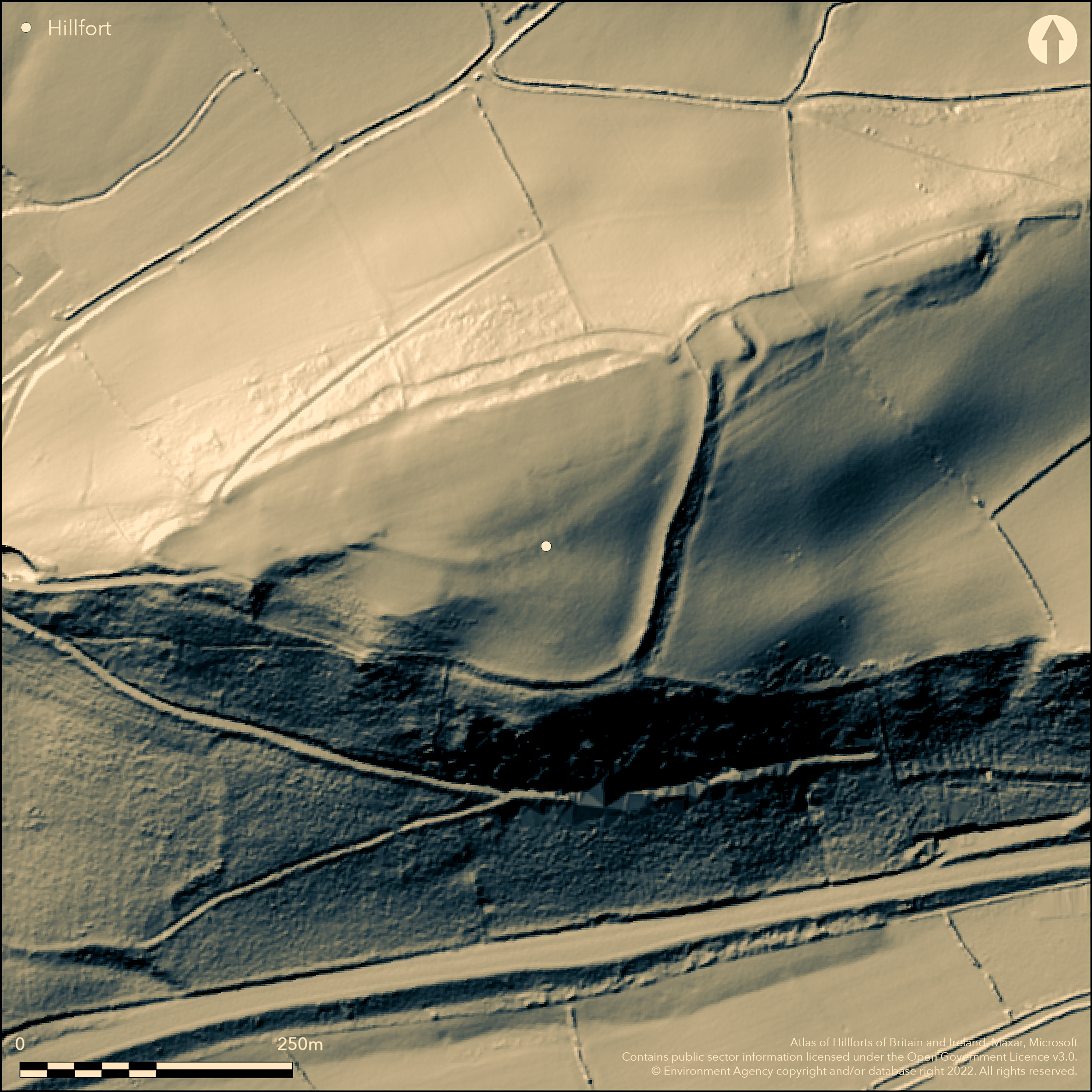
LiDAR 1m DTM Hillshade
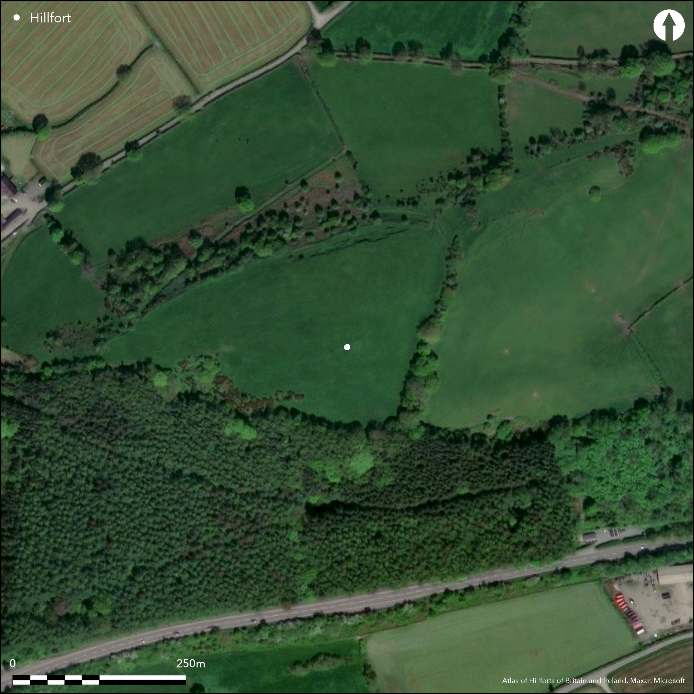
Satellite Imagery
LiDAR 1m DTM Hillshade
Satellite Imagery
Scroll left/right to view further images.
HER: Dyfed 1745 (None)
NMR: SN 42 SE 2 (92889)
SM: CM231(CAM)
NGR: SN45502150
X: 245500 Y: 221500 (OSGB36)
Large contour site on prominent flat-topped hill dominating the confluence of the Afon Gwili and Afon Tywi and Afon Arnall and Afon Tywi. Surrounding slopes to N, E and W moderate to strong, S very steep. Triangular in shape, measuring c. 300m E-W by 180m, with internal area 4ha. Only recorded for the first time by Savory (1954) and surveyed by S. Grealey 1971. Essentially defined by single massive rampart and intermittent ditch, especially on E, an additional rock-cut scarp and ditch also visible, especially on N side. Two entrances, to NE and SW. The complex NE corner entrance is flanked by a boss at N and sharp inturn to S, and is defended by a massive barbican type outwork c. 24m across. SW entrance much simpler. Phased construction proved by DAT in 1980's when investigating track. Sections cut through ramparts, with an earlier 1ha enclosure sited on NE two-thirds of the site suggested, and occupation layer pre-dating rampart giving C14 dates of 360-60BC and 150-70BC. Rampart itself probably simple dump, perhaps with some form of revetment, of one phase only. Pasture interior with scattered scrub/trees.
Citizen Science: ✗
Reliability of Data: Confirmed
Reliability of Interpretation: Confirmed
X: -472618 Y: 6776758 (EPSG: 3857)
Longitude: -4.245599934315871 Latitude: 51.87057942686609 (EPSG:4326)
Country: Wales
Current County or Unitary Authority: Carmarthenshire
Historic County: Carmarthenshire
Current Parish/Community/Council/Townland: Abergwili
Good condition, but ploughed in past.
| Extant | ✓ |
| Cropmark | ✗ |
| Likely Destroyed | ✗ |
Pasture interior with scattered scrub/trees. Allt Bryn-Myrddin wood to S and tree lines to E and NW.
| Woodland | ✗ |
| Commercial Forestry Plantation | ✗ |
| Parkland | ✗ |
| Pasture (Grazing) | ✓ |
| Arable | ✗ |
| Scrub/Bracken | ✗ |
| Bare Outcrop | ✗ |
| Heather/Moorland | ✗ |
| Heath | ✓ |
| Built-up | ✗ |
| Coastal Grassland | ✗ |
| Other | ✗ |
Large contour site on prominent flat-topped hill dominating the confluence of the Afon Gwili and Afon Tywi and Afon Arnall and Afon Tywi. Surrounding slopes to N, E and W moderate to strong, S very steep.
| Contour Fort | ✓ |
| Partial Contour Fort | ✗ |
| Promontory Fort | ✗ |
| Hillslope Fort | ✗ |
| Level Terrain Fort | ✗ |
| Marsh Fort | ✗ |
| Multiple Enclosure Fort | ✗ |
| Hilltop | ✓ |
| Coastal Promontory | ✗ |
| Inland Promontory | ✗ |
| Valley Bottom | ✗ |
| Knoll/Hillock/Outcrop | ✗ |
| Ridge | ✗ |
| Cliff/Plateau-edge/Scarp | ✗ |
| Hillslope | ✗ |
| Lowland | ✗ |
| Spur | ✗ |
Dominant Topographic Feature: Hill top
| North | ✗ |
| Northeast | ✗ |
| East | ✗ |
| Southeast | ✗ |
| South | ✗ |
| Southwest | ✗ |
| West | ✗ |
| Northwest | ✗ |
| Level | ✓ |
Altitude: 150.0m
N/A
C14 dates of 360-60BC and 150-70BC from below rampart. Also investigation of eroding sections has suggested an Iron Age date.
Reliability: B - Medium
| Pre 1200BC | ✗ |
| 1200BC - 800BC | ✗ |
| 800BC - 400BC | ✗ |
| 400BC - AD50 | ✓ |
| AD50 - AD400 | ✗ |
| AD400 - AD 800 | ✗ |
| Post AD800 | ✗ |
| Unknown | ✗ |
| Pre Hillfort: | None |
| Post Hillfort: | None |
| C14: | Dates from below rampart. |
| Morphology/Earthwork/Typology: | Investigation of eroding sections. |
Field observation OS 1971. Full survey S. Grealey 1971. Field observation DAT 1983, 1986, 1994. DAT sections through ramparts investigation 1980's. Field observation CADW 2002. Dyfed Archaeological Trust defended enclosures survey 2007-2008. DAT sections through ramparts investigation 1080's.
| Other (1971): | Field observation OS. |
| Other (1971): | Full survey S. Grealey. |
| Other (2002): | Field observation CADW. |
| Excavation (None): | DAT sections through ramparts investigation. |
| Other (None): | Field observation DAT. |
| Other (None): | Dyfed Archaeological Trust defended enclosures survey. |
None
Stream 0.6km outside fort.
| None | ✓ |
| Spring | ✗ |
| Stream | ✗ |
| Pool | ✗ |
| Flush | ✗ |
| Well | ✗ |
| Other | ✗ |
None
| No Known Features | ✓ |
| Round Stone Structures | ✗ |
| Rectangular Stone Structures | ✗ |
| Curvilinear Platforms | ✗ |
| Other Roundhouse Evidence | ✗ |
| Pits | ✗ |
| Quarry Hollows | ✗ |
| Other | ✗ |
None
| No Known Excavation | ✓ |
| Pits | ✗ |
| Postholes | ✗ |
| Roundhouses | ✗ |
| Rectangular Structures | ✗ |
| Roads/Tracks | ✗ |
| Quarry Hollows | ✗ |
| Other | ✗ |
| Nothing Found | ✗ |
None
| No Known Geophysics | ✓ |
| Pits | ✗ |
| Roundhouses | ✗ |
| Rectangular Structures | ✗ |
| Roads/Tracks | ✗ |
| Quarry Hollows | ✗ |
| Other | ✗ |
| Nothing Found | ✗ |
None
| No Known Finds | ✓ |
| Pottery | ✗ |
| Metal | ✗ |
| Metalworking | ✗ |
| Human Bones | ✗ |
| Animal Bones | ✗ |
| Lithics | ✗ |
| Environmental | ✗ |
| Other | ✗ |
None
| APs Not Checked | ✓ |
| None | ✗ |
| Roundhouses | ✗ |
| Rectangular Structures | ✗ |
| Pits | ✗ |
| Postholes | ✗ |
| Roads/Tracks | ✗ |
| Other | ✗ |
Complex NE corner entrance flanked by boss at N and sharp inturn to S and defended by a massive barbican type outwork c. 24m across; a 'display' entrance. SW entrance much simpler.
| 2: | None |
| 2: | None |
Guard Chambers: ✗
Chevaux de Frise: ✗
| 1. Barbican (North east): | Massive barbican type outwork c. 24m across. |
| 1. In-turned (North east): | Sharp inturn to S. |
| 2. Simple Gap (South west): | SW entrance much simpler. |
Essentially defined by single massive rampart and intermittent ditch, especially on E, an additional rock-cut scarp and ditch also visible, especially on N side.
| Area 1: | 1.0ha. |
| Area 2: | 4.0ha. |
| Total: | 4.0ha. |
Total Footprint Area: Noneha.
None
| ✓ | Phased construction proved by DAT in 1980's, with earlier 1ha enclosure on NE two-thirds of the site suggested, with occupation layer pre-dating rampart, and providing C14 dates of 360_60BC and 150_70BC. But rampart itself probably simple dump, perhaps with some form of revetment, of one phase only. |
| ✓ | None |
| NE Quadrant: | 2 |
| SE Quadrant: | 1 |
| SW Quadrant: | 1 |
| NW Quadrant: | 2 |
| Total: | 2 |
| Partial Univallate | ✓ |
| Univallate | ✗ |
| Partial Bivallate | ✓ |
| Bivallate | ✗ |
| Partial Multivallate | ✗ |
| Multivallate | ✗ |
| Unknown | ✗ |
| Partial Univallate | ✗ |
| Univallate | ✓ |
| Partial Bivallate | ✗ |
| Bivallate | ✗ |
| Partial Multivallate | ✗ |
| Multivallate | ✗ |
None
| None | ✗ |
| Earthen Bank | ✓ |
| Stone Wall | ✗ |
| Rubble | ✗ |
| Wall-walk | ✗ |
| Evidence of Timber | ✗ |
| Vitrification | ✗ |
| Other Burning | ✗ |
| Palisade | ✗ |
| Counter Scarp Bank | ✗ |
| Berm | ✗ |
| Unfinished | ✗ |
| Other | ✗ |
Rampart itself probably simple dump, perhaps with some form of revetment, of one phase only. Not full excavation.
| None | ✗ |
| Earthen Bank | ✓ |
| Stone Wall | ✓ |
| Murus Duplex | ✗ |
| Timber-framed | ✗ |
| Timber-laced | ✗ |
| Vitrification | ✗ |
| Other Burning | ✗ |
| Palisade | ✗ |
| Counter Scarp Bank | ✗ |
| Berm | ✗ |
| Unfinished | ✗ |
| No Known Excavation | ✗ |
| Other | ✗ |
| ✗ | None |
| ✓ | Outer ditch rock-cut. |
Number of Ditches: 2
| ✗ | None |
Darke, I., Isaac, J., Parry, C. and Williams, G. 1988. Recent work on Merlin's Hill, Abergwili, Carmarthen Ant, 24, 5-13.
Grealey, S. 1971. The hill fortress on Merlin's Hill, Abergwili, Carmarthenshire, Carmarthen Ant, 7, 98-101.
Murphy, F., Ramsey, R., Page, M. and Murphy, K. 2008. A Survey of Defended Enclosures in Carmarthenshire, 2007-08: Gazetteer of Ordnance Survey Grid Squares SN40, SN41, SN42, SN43 and SN44, Dyfed Archaeological Trust Report No. 2007/27, Project Record No. 62767, Llandeilo: Dyfed Archaeological Trust.
Savory, H.N. 1954. List of hill-forts and other earthworks in Carmarthenshire. Bull Board Celtic Stud, 16, 56.
Atlas of Hillforts:
Wikidata:
This work is licensed under CC BY-SA 4.0

 and should be cited as:
Lock, Gary and Ralston, Ian. 2024. Atlas of Hillforts of Britain and Ireland. Available at: https://hillforts.arch.ox.ac.uk
Document Version 1.1