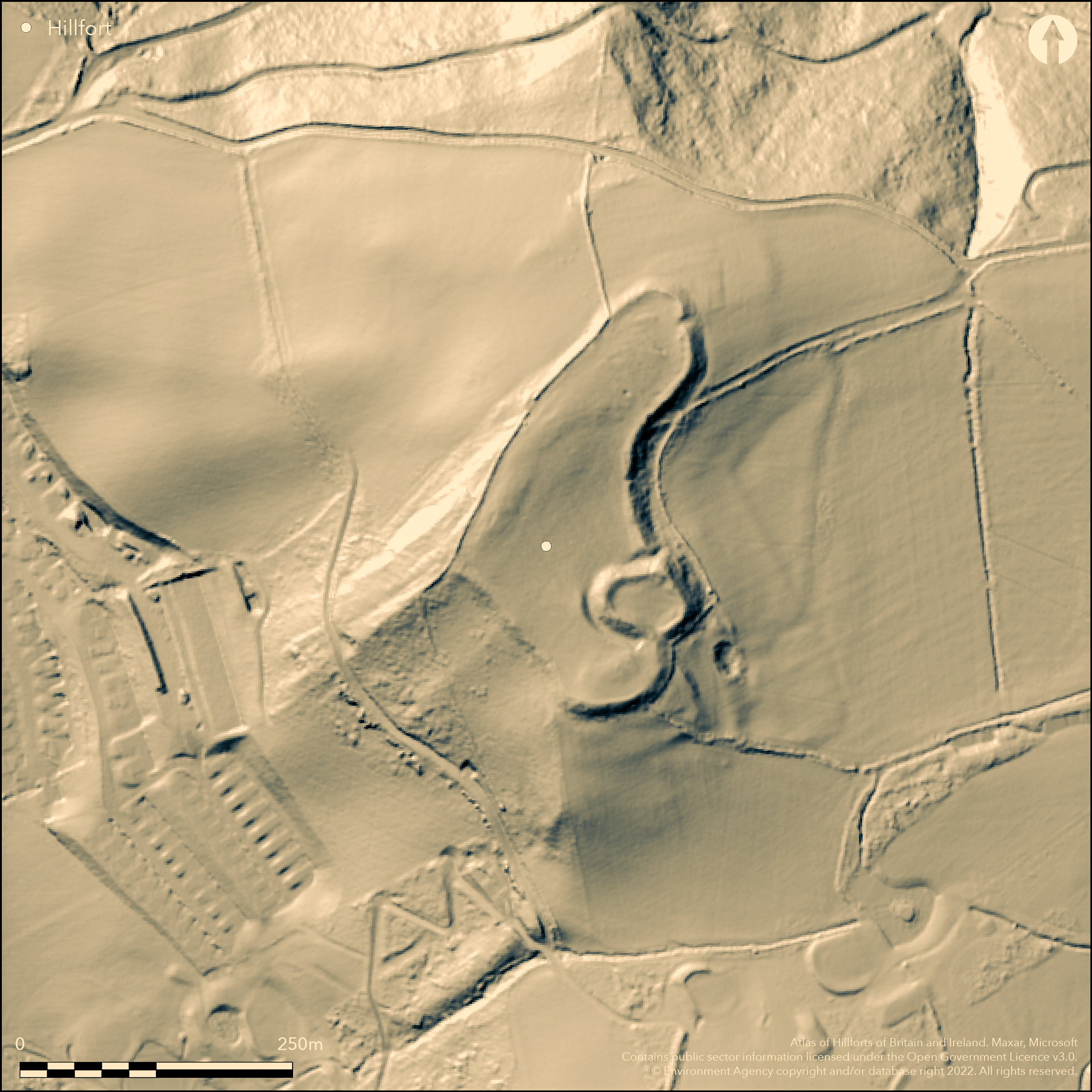
LiDAR 1m DTM Hillshade
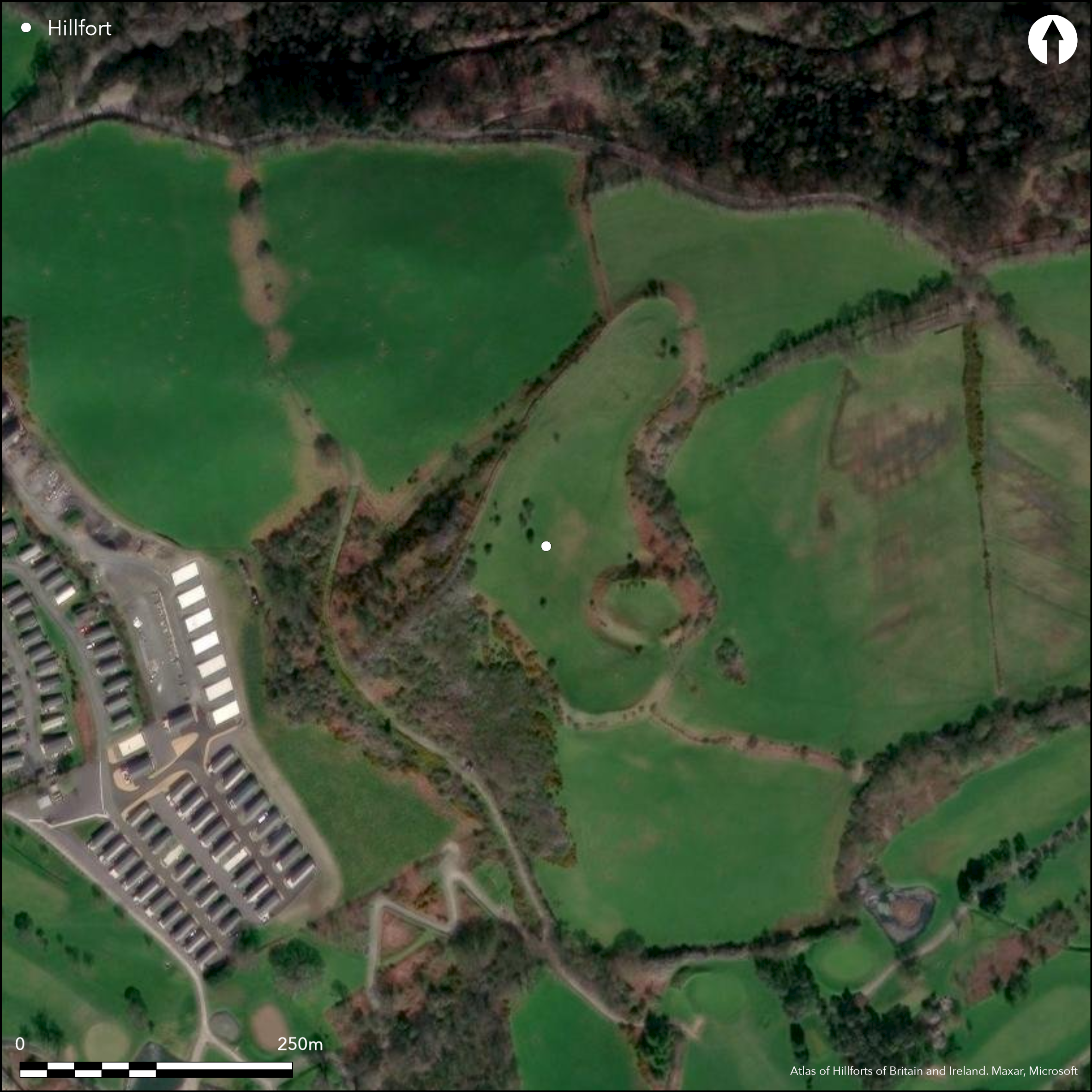
Satellite Imagery
LiDAR 1m DTM Hillshade
Satellite Imagery
Scroll left/right to view further images.
HER: Dyfed 1196 (None)
NMR: SN 56 NE (300770)
SM: CD094
NGR: SN55206955
X: 255200 Y: 269550 (OSGB36)
Complex and large remains, with site recorded as medieval castle built by Cadwaladr ap Gruffydd 1148, with ringwork possibly constructed over an Iron Age contour hillfort which was modified in medieval period. Strategically located on rounded hill above confluence of the Afon Wyre and Wyre Fach to WNW, the steep, narrow and wooded Cwm Wyre to N and the narrow Cwm Mabws to SW. Estuary of the Afon Wyre at Llanrhystud to W. Triangular in shape, measures c. 230m N-S by 80m. Although disputed the earlier enclosure appears clear. Defended by bank and ditch with evidence on aerial photographs of partial outer ditch on E. Aerial photographs also show possible cropmark annexe at N end of the fort. The medieval ringwork is more massive and is built across the defences of the fort on the SE. It is bounded by a rock-cut ditch on S and W sides. It measures c. 44m by 26m internally. Two elements to the enclosure have been suggested by RCAHMW (Coflein): Firstly the massive, but simple, triangular fortification with simple terminal-defined entrance at NE tip enclosing c. 4.2ha. Second, the substantial ringwork built across the SE rampart as above.. Although the relationship between the ringwork and earlier enclosure is ambiguous, this cutting through of the E rampart is clear. Feasible that the Iron Age rampart modified in places during the medieval occupation, and fresh walling still visible towards the top of E rampart may also date from this period. Original rampart stonework noted along S rampart. Aerial photography by RCAHMW in dry summers shows parch-marks of possible Iron Age double ditch system on E flanks of the fort. Improved pasture with some scrub on banks. On 1st Ed. OS map (1888). Minimal investigations, undated.
Citizen Science: ✗
Reliability of Data: Unconfirmed
Reliability of Interpretation: Unconfirmed
X: -459218 Y: 6855443 (EPSG: 3857)
Longitude: -4.125229552592863 Latitude: 52.30489396879777 (EPSG:4326)
Country: Wales
Current County or Unitary Authority: Ceredigion
Historic County: Cardiganshire
Current Parish/Community/Council/Townland: Llanrhystyd Mefenydd
Site below ringwork and medieval castle remains.
| Extant | ✓ |
| Cropmark | ✗ |
| Likely Destroyed | ✗ |
Improved pasture with some scrub on banks. Ringwork and medieval castle remains.
| Woodland | ✗ |
| Commercial Forestry Plantation | ✗ |
| Parkland | ✗ |
| Pasture (Grazing) | ✓ |
| Arable | ✗ |
| Scrub/Bracken | ✓ |
| Bare Outcrop | ✗ |
| Heather/Moorland | ✗ |
| Heath | ✗ |
| Built-up | ✓ |
| Coastal Grassland | ✗ |
| Other | ✓ |
Complex and large remains, with site recorded as medieval castle built by Cadwaladr ap Gruffydd 1148, with ringwork possibly constructed over an Iron Age contour hillfort which was modified in medieval period. Strategically located on rounded hill above confluence of the Afon Wyre and Wyre Fach to WNW, the steep, narrow and wooded Cwm Wyre to N and the narrow Cwm Mabws to SW. Estuary of the Afon Wyre at Llanrhystud to W.
| Contour Fort | ✓ |
| Partial Contour Fort | ✗ |
| Promontory Fort | ✗ |
| Hillslope Fort | ✗ |
| Level Terrain Fort | ✗ |
| Marsh Fort | ✗ |
| Multiple Enclosure Fort | ✗ |
| Hilltop | ✓ |
| Coastal Promontory | ✗ |
| Inland Promontory | ✗ |
| Valley Bottom | ✗ |
| Knoll/Hillock/Outcrop | ✗ |
| Ridge | ✗ |
| Cliff/Plateau-edge/Scarp | ✗ |
| Hillslope | ✗ |
| Lowland | ✗ |
| Spur | ✗ |
Dominant Topographic Feature: Hill top
| North | ✗ |
| Northeast | ✗ |
| East | ✗ |
| Southeast | ✗ |
| South | ✗ |
| Southwest | ✗ |
| West | ✗ |
| Northwest | ✗ |
| Level | ✓ |
Altitude: 140.0m
N/A
Probably Iron Age date.
Reliability: D - None
| Pre 1200BC | ✗ |
| 1200BC - 800BC | ✗ |
| 800BC - 400BC | ✗ |
| 400BC - AD50 | ✗ |
| AD50 - AD400 | ✗ |
| AD400 - AD 800 | ✗ |
| Post AD800 | ✗ |
| Unknown | ✓ |
| Pre Hillfort: | None |
| Post Hillfort: | Medieval ringwork and castle of 1148. |
| Morphology/Earthwork/Typology: | RCAHMW investigation. |
On 1st Ed. OS map (1888). Recorded as medieval castle built by Cadwaladr ap Gruffydd 1148. On 1st ED. OS map (1889). RCAHMW investigation 2002. Cambria Archaeology defended enclosures survey 2006.
| 1st Identified Map Depiction (1888): | OS map. |
| Other (2002): | RCAHMW investigation. |
| Other (2006): | Cambria Archaeology defended enclosures survey |
None
None
| None | ✓ |
| Spring | ✗ |
| Stream | ✗ |
| Pool | ✗ |
| Flush | ✗ |
| Well | ✗ |
| Other | ✗ |
None
| No Known Features | ✓ |
| Round Stone Structures | ✗ |
| Rectangular Stone Structures | ✗ |
| Curvilinear Platforms | ✗ |
| Other Roundhouse Evidence | ✗ |
| Pits | ✗ |
| Quarry Hollows | ✗ |
| Other | ✗ |
None
| No Known Excavation | ✓ |
| Pits | ✗ |
| Postholes | ✗ |
| Roundhouses | ✗ |
| Rectangular Structures | ✗ |
| Roads/Tracks | ✗ |
| Quarry Hollows | ✗ |
| Other | ✗ |
| Nothing Found | ✗ |
None
| No Known Geophysics | ✓ |
| Pits | ✗ |
| Roundhouses | ✗ |
| Rectangular Structures | ✗ |
| Roads/Tracks | ✗ |
| Quarry Hollows | ✗ |
| Other | ✗ |
| Nothing Found | ✗ |
None
| No Known Finds | ✓ |
| Pottery | ✗ |
| Metal | ✗ |
| Metalworking | ✗ |
| Human Bones | ✗ |
| Animal Bones | ✗ |
| Lithics | ✗ |
| Environmental | ✗ |
| Other | ✗ |
NO APPARENT FEATURES
| APs Not Checked | ✓ |
| None | ✗ |
| Roundhouses | ✗ |
| Rectangular Structures | ✗ |
| Pits | ✗ |
| Postholes | ✗ |
| Roads/Tracks | ✗ |
| Other | ✗ |
Simple terminal-defined entrance at NE tip.
| 1: | None |
| 2: | None |
Guard Chambers: ✗
Chevaux de Frise: ✗
| 1. Simple Gap (North east): | None |
Defended by bank and ditch with evidence on aerial photographs of partial outer ditch on E. The medieval ringwork is more massive and is built across the defences of the fort on the SE. It is bounded by a rock-cut ditch on S and W sides.
| Area 1: | 4.2ha. |
| Total: | 4.2ha. |
Total Footprint Area: Noneha.
None
| ✗ | None |
| ✓ | None |
| NE Quadrant: | 1 |
| SE Quadrant: | 1 |
| SW Quadrant: | 1 |
| NW Quadrant: | 1 |
| Total: | 1 |
| Partial Univallate | ✗ |
| Univallate | ✓ |
| Partial Bivallate | ✗ |
| Bivallate | ✗ |
| Partial Multivallate | ✗ |
| Multivallate | ✗ |
| Unknown | ✗ |
| Partial Univallate | ✗ |
| Univallate | ✗ |
| Partial Bivallate | ✗ |
| Bivallate | ✗ |
| Partial Multivallate | ✗ |
| Multivallate | ✗ |
Original rampart stonework noted along S rampart.
| None | ✗ |
| Earthen Bank | ✗ |
| Stone Wall | ✓ |
| Rubble | ✓ |
| Wall-walk | ✗ |
| Evidence of Timber | ✗ |
| Vitrification | ✗ |
| Other Burning | ✗ |
| Palisade | ✗ |
| Counter Scarp Bank | ✗ |
| Berm | ✗ |
| Unfinished | ✗ |
| Other | ✗ |
None
| None | ✗ |
| Earthen Bank | ✗ |
| Stone Wall | ✗ |
| Murus Duplex | ✗ |
| Timber-framed | ✗ |
| Timber-laced | ✗ |
| Vitrification | ✗ |
| Other Burning | ✗ |
| Palisade | ✗ |
| Counter Scarp Bank | ✗ |
| Berm | ✗ |
| Unfinished | ✗ |
| No Known Excavation | ✓ |
| Other | ✗ |
| ✗ | None |
| ✓ | Partial outer ditch on E. |
Number of Ditches: 1
| ✓ | Aerial photographs also show possible cropmark annexe at N end of the fort. |
Murphy, K, Ramsey, R. and Page, M. 2006. A survey of defended enclosures in Ceredigion 2006: Gazetteer of Ordnance Survey Grid Squares SN 56, SN 57, and SN 58, Project Report No. 2006/20, Project Record No. 54269, Llandeilo: Cambria Archaeology.
Atlas of Hillforts:
Wikidata:
This work is licensed under CC BY-SA 4.0

 and should be cited as:
Lock, Gary and Ralston, Ian. 2024. Atlas of Hillforts of Britain and Ireland. Available at: https://hillforts.arch.ox.ac.uk
Document Version 1.1