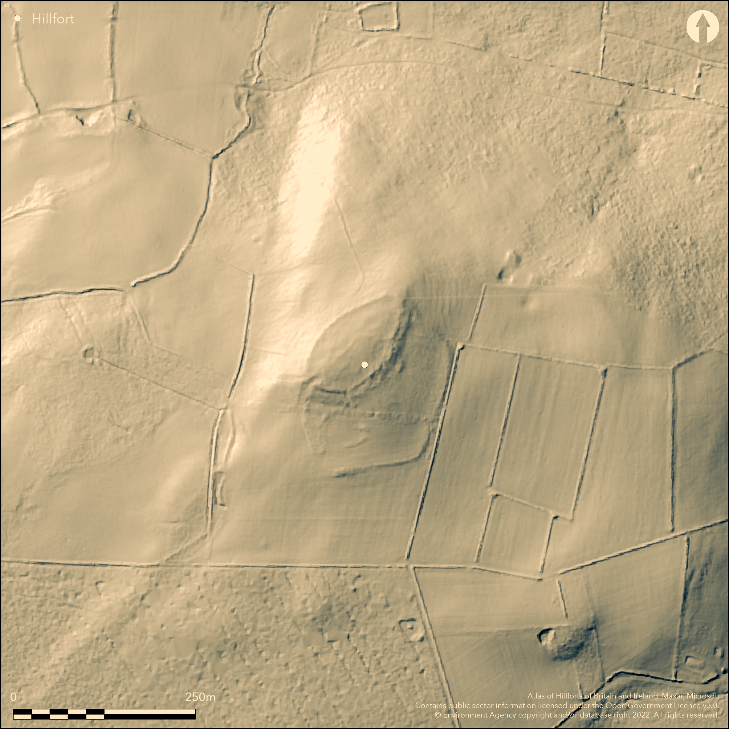
LiDAR 1m DTM Hillshade
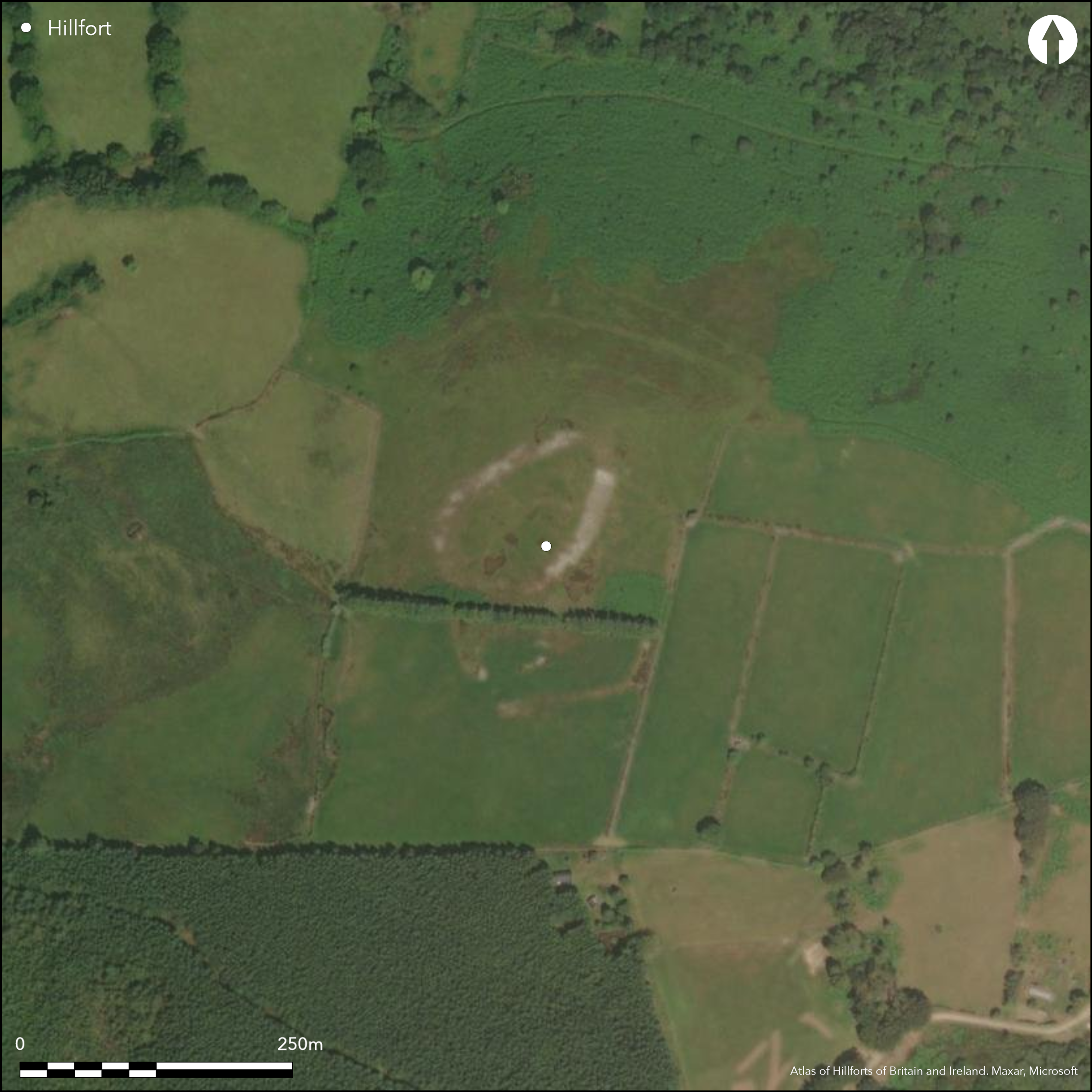
Satellite Imagery
LiDAR 1m DTM Hillshade
Satellite Imagery
Scroll left/right to view further images.
HER: Dyfed 1919 (None)
NMR: SN 64 NW (92307)
SM: CD114
NGR: SN62244795
X: 262240 Y: 247950 (OSGB36)
Small, univallate contour hillfort sited on a distinct hill above the Ffrwd Cynon valley and above the Afon Teifi. Opposite to Castell allt-goch hillfort (Atlas No. 2366). Strong position with surrounding slopes precipitous to N and E, moderate to strong to W and moderate to S. An egg-shaped enclosure in NW of larger site, measures c. 100m NE-SW by 64m, with internal area 0.44ha. Defined by heavily robbed stone wall and ditch, now scree-like, but traces of original rampart face visible. A less substantial outer circuit encloses an area of c. 0.85ha and c. 60m max. and c. 36m min. across on E and S sides of main enclosure as an annexe, terraced to N, with entrance on W. Possible traces of in-situ dividing wall running NE-SW encloses the higher SE part of this enclosure, with possible gap entrance between. Entrance approached by a hollow way on SW side with second entrance on NW. Blocked entrance and fire destroyed on NE. Four semi-circular building platforms lie in the interior. Excavations between 1984 and 1989 by St. David's University College, Lampeter recorded details of the blocked NE-facing entrance (C14 dated 5th-4th centuries BC), and examined an area of the interior, with the remains of two circular structures, one of which was multiphase, its sequence interrupted by a four-post structure. Possible quarry scoops. Various finds mainly of bone and charcoal, with some glass beads and few pottery sherds. Occupation may have extended into the Roman period, with subsequent re-use (or continuing use). Rocky upland grassy moorland and scrub. On 1st Ed. OS map (1888).
Citizen Science: ✗
Reliability of Data: Confirmed
Reliability of Interpretation: Confirmed
X: -446753 Y: 6820516 (EPSG: 3857)
Longitude: -4.013249597320241 Latitude: 52.11263059702191 (EPSG:4326)
Country: Wales
Current County or Unitary Authority: Ceredigion
Historic County: Cardiganshire
Current Parish/Community/Council/Townland: Llanfair Clydogan
Tumbled walls now scree-like, but well-preserved. Probably robbed for post-medieval field walls. Affected by post-medieval field boundaries and partial moorland reclamation.
| Extant | ✓ |
| Cropmark | ✗ |
| Likely Destroyed | ✗ |
Rocky upland grassy moorland and scrub.
| Woodland | ✗ |
| Commercial Forestry Plantation | ✗ |
| Parkland | ✗ |
| Pasture (Grazing) | ✓ |
| Arable | ✗ |
| Scrub/Bracken | ✓ |
| Bare Outcrop | ✗ |
| Heather/Moorland | ✓ |
| Heath | ✗ |
| Built-up | ✗ |
| Coastal Grassland | ✗ |
| Other | ✗ |
Small, univallate contour hillfort sited on a distinct hill above the Ffrwd Cynon valley and above the Afon Teifi. Surrounding slopes precipitous to N and E, moderate to strong to W and moderate to S. Strong position.
| Contour Fort | ✓ |
| Partial Contour Fort | ✗ |
| Promontory Fort | ✗ |
| Hillslope Fort | ✗ |
| Level Terrain Fort | ✗ |
| Marsh Fort | ✗ |
| Multiple Enclosure Fort | ✗ |
| Hilltop | ✓ |
| Coastal Promontory | ✗ |
| Inland Promontory | ✗ |
| Valley Bottom | ✗ |
| Knoll/Hillock/Outcrop | ✗ |
| Ridge | ✗ |
| Cliff/Plateau-edge/Scarp | ✗ |
| Hillslope | ✗ |
| Lowland | ✗ |
| Spur | ✗ |
Dominant Topographic Feature: Hill top
| North | ✗ |
| Northeast | ✗ |
| East | ✗ |
| Southeast | ✗ |
| South | ✗ |
| Southwest | ✗ |
| West | ✗ |
| Northwest | ✗ |
| Level | ✓ |
Altitude: 290.0m
N/A
Occupation may have extended into the Roman period, with subsequent re-use (or continuing use), and later possible medieval occupation. Two samples of C14 dates of 2360+/-70 BP (CAR-968) and 2580+/-70 BP (CAR-969) at blocked NE gate.
Reliability: B - Medium
| Pre 1200BC | ✗ |
| 1200BC - 800BC | ✗ |
| 800BC - 400BC | ✓ |
| 400BC - AD50 | ✓ |
| AD50 - AD400 | ✓ |
| AD400 - AD 800 | ✓ |
| Post AD800 | ✗ |
| Unknown | ✗ |
| Pre Hillfort: | None |
| Post Hillfort: | None |
| Artefactual: | Various deposits. |
| C14: | Two samples of C14 dates of 2360+/-70 BP (CAR-968) and 2580+/-70 BP (CAR-969) at blocked NE gate. |
On 1st Ed. OS map (1888). Excavations between 1984 and 1989 by St. David's University College, Lampeter. Cambria Archaeology defended enclosures survey 2006.
| 1st Identified Map Depiction (1888): | OS map. |
| Other (1988): | Visited by Hillfort Study Group |
| Other (2006): | Cambria Archaeology defended enclosures survey. |
| Excavation (None): | St. David's University College, Lampeter. |
Four semi-circular building platforms lie in the interior. Remains of two circular structures investigated, one multiphase and its sequence interrupted by a four-post structure. Postholes. Possible timber structure S of gate. Calcined bone of pig, sheep/goat and cattle and dog. and charcoal. Iron slag. Few pot sherds and fired clay. Amber and glass beads. Shale disc. Few charred seeds and grains.
Ffrwd Cynon 0.4 km outside fort.
| None | ✓ |
| Spring | ✗ |
| Stream | ✗ |
| Pool | ✗ |
| Flush | ✗ |
| Well | ✗ |
| Other | ✗ |
Four semi-circular building platforms lie in the interior. Possible quarry scoops.
| No Known Features | ✗ |
| Round Stone Structures | ✗ |
| Rectangular Stone Structures | ✗ |
| Curvilinear Platforms | ✓ |
| Other Roundhouse Evidence | ✗ |
| Pits | ✗ |
| Quarry Hollows | ✓ |
| Other | ✗ |
Remains of two circular structures investigated, one multiphase and its sequence interrupted by a four-post structure. Postholes. Possible timber structure S of gate.
| No Known Excavation | ✗ |
| Pits | ✗ |
| Postholes | ✓ |
| Roundhouses | ✓ |
| Rectangular Structures | ✗ |
| Roads/Tracks | ✗ |
| Quarry Hollows | ✓ |
| Other | ✓ |
| Nothing Found | ✗ |
None
| No Known Geophysics | ✓ |
| Pits | ✗ |
| Roundhouses | ✗ |
| Rectangular Structures | ✗ |
| Roads/Tracks | ✗ |
| Quarry Hollows | ✗ |
| Other | ✗ |
| Nothing Found | ✗ |
Calcined bone of pig, sheep/goat and cattle and dog. and charcoal. Iron slag. Few pot sherds and fired clay. Amber and glass beads. Shale disc. Few charred seeds and grains.
| No Known Finds | ✗ |
| Pottery | ✓ |
| Metal | ✗ |
| Metalworking | ✓ |
| Human Bones | ✗ |
| Animal Bones | ✓ |
| Lithics | ✗ |
| Environmental | ✓ |
| Other | ✓ |
None
| APs Not Checked | ✓ |
| None | ✗ |
| Roundhouses | ✗ |
| Rectangular Structures | ✗ |
| Pits | ✗ |
| Postholes | ✗ |
| Roads/Tracks | ✗ |
| Other | ✗ |
Entrance approached by track or hollow way on SW side with possible second entrance on NW. Blocked and fire-destroyed entrance on NE.
| 3: | None |
| 2: | Possibly two. |
Guard Chambers: ✗
Chevaux de Frise: ✗
| 1. Hollow Way (South west): | Approached by track or hollow way. |
| 1. Simple Gap (South west): | Approached by track or hollow way. |
| 2. Simple Gap (North west): | Possibly not original feature. |
| 3. Blocked (North east): | Fire-destroyed and phased to 6-post gate. |
Egg-shaped main enclosure to NW defined by heavily robbed stone wall and ditch, now scree-like, but traces of original rampart face visible. Possible traces of dividing wall enclosing higher SE part of this main enclosure. A less substantial outer circuit encloses an area c. 60m across on E and S sides of main enclosure, with entrance on W, to N of which is possible oval stony banked and terraced enclosure, c. 36m across, all abutting the main circuit as an annexe of 0.85ha. Entrance
| Area 1: | 0.44ha. |
| Total: | 0.44ha. |
Total Footprint Area: 1.29ha.
None
| ✓ | Total internal area of 1.29ha includes the annexe. Probable phased construction of rampart in places. |
| ✓ | None |
| NE Quadrant: | 1 |
| SE Quadrant: | 1 |
| SW Quadrant: | 1 |
| NW Quadrant: | 1 |
| Total: | 1 |
| Partial Univallate | ✗ |
| Univallate | ✓ |
| Partial Bivallate | ✗ |
| Bivallate | ✗ |
| Partial Multivallate | ✗ |
| Multivallate | ✗ |
| Unknown | ✗ |
| Partial Univallate | ✗ |
| Univallate | ✗ |
| Partial Bivallate | ✗ |
| Bivallate | ✗ |
| Partial Multivallate | ✗ |
| Multivallate | ✗ |
Defined by heavily robbed stone wall and ditch.
| None | ✗ |
| Earthen Bank | ✗ |
| Stone Wall | ✓ |
| Rubble | ✗ |
| Wall-walk | ✗ |
| Evidence of Timber | ✗ |
| Vitrification | ✗ |
| Other Burning | ✗ |
| Palisade | ✗ |
| Counter Scarp Bank | ✗ |
| Berm | ✗ |
| Unfinished | ✗ |
| Other | ✗ |
Structure of rampart investigated revealing variations in phased construction of walls of boulders of varying size and better quality coursed build and fine dry-stone walling.
| None | ✗ |
| Earthen Bank | ✗ |
| Stone Wall | ✓ |
| Murus Duplex | ✗ |
| Timber-framed | ✗ |
| Timber-laced | ✗ |
| Vitrification | ✗ |
| Other Burning | ✗ |
| Palisade | ✗ |
| Counter Scarp Bank | ✗ |
| Berm | ✗ |
| Unfinished | ✗ |
| No Known Excavation | ✗ |
| Other | ✗ |
| ✗ | None |
| ✓ | None |
Number of Ditches: 1
| ✓ | An insubstantial outer circuit encloses an area c. 60m across on E and S sides of main enclosure, with entrance on W, to N of which is possible oval stony banked and terraced enclosure, c. 36m across, all abutting the main circuit as an annexe of 0.85ha. |
Austin, D., Bell, M., Burnham, B. and Young, R. 1984-88. The Caer Cadwgan project, Interim reports of 1984-88, Lampeter: St David's University College.
Daves, J.L. and Hogg, A.H.A. 1994. The Iron Age, in eds Davies, J.L and Kirby, D.P. From the earliest times to the coming of the Normans, Cardiganshire County History, Vol 1, Cardiff: University of Wales Press, 220-74.
Murphy, K, Ramsey, R. and Page, M. 2006. A survey of defended enclosures in Ceredigion 2006: Gazetteer of Ordnance Survey Grid Squares SN64, SN65 and SN66, Project Report No. 2006/20, Project Record No. 54269, Llandeilo: Cambria Archaeology.
Atlas of Hillforts:
Wikidata:
This work is licensed under CC BY-SA 4.0

 and should be cited as:
Lock, Gary and Ralston, Ian. 2024. Atlas of Hillforts of Britain and Ireland. Available at: https://hillforts.arch.ox.ac.uk
Document Version 1.1