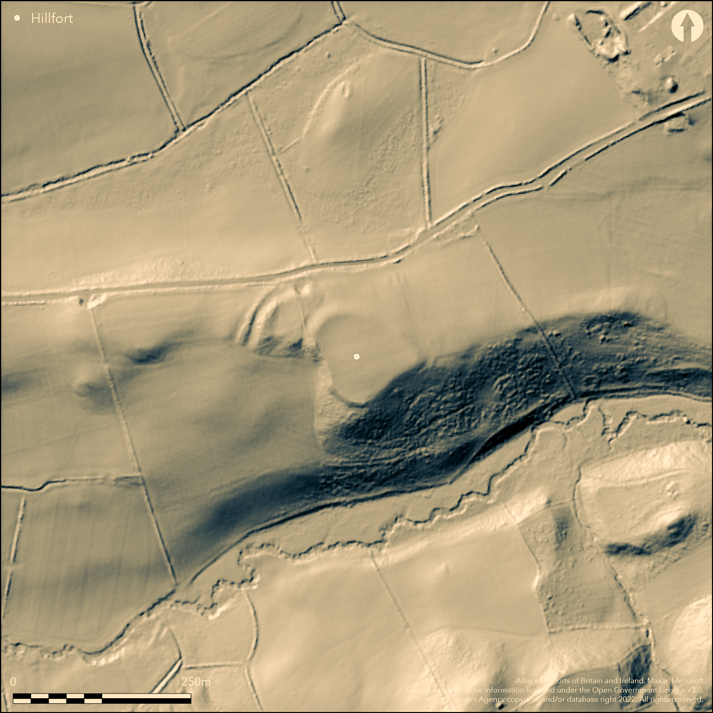
LiDAR 1m DTM Hillshade
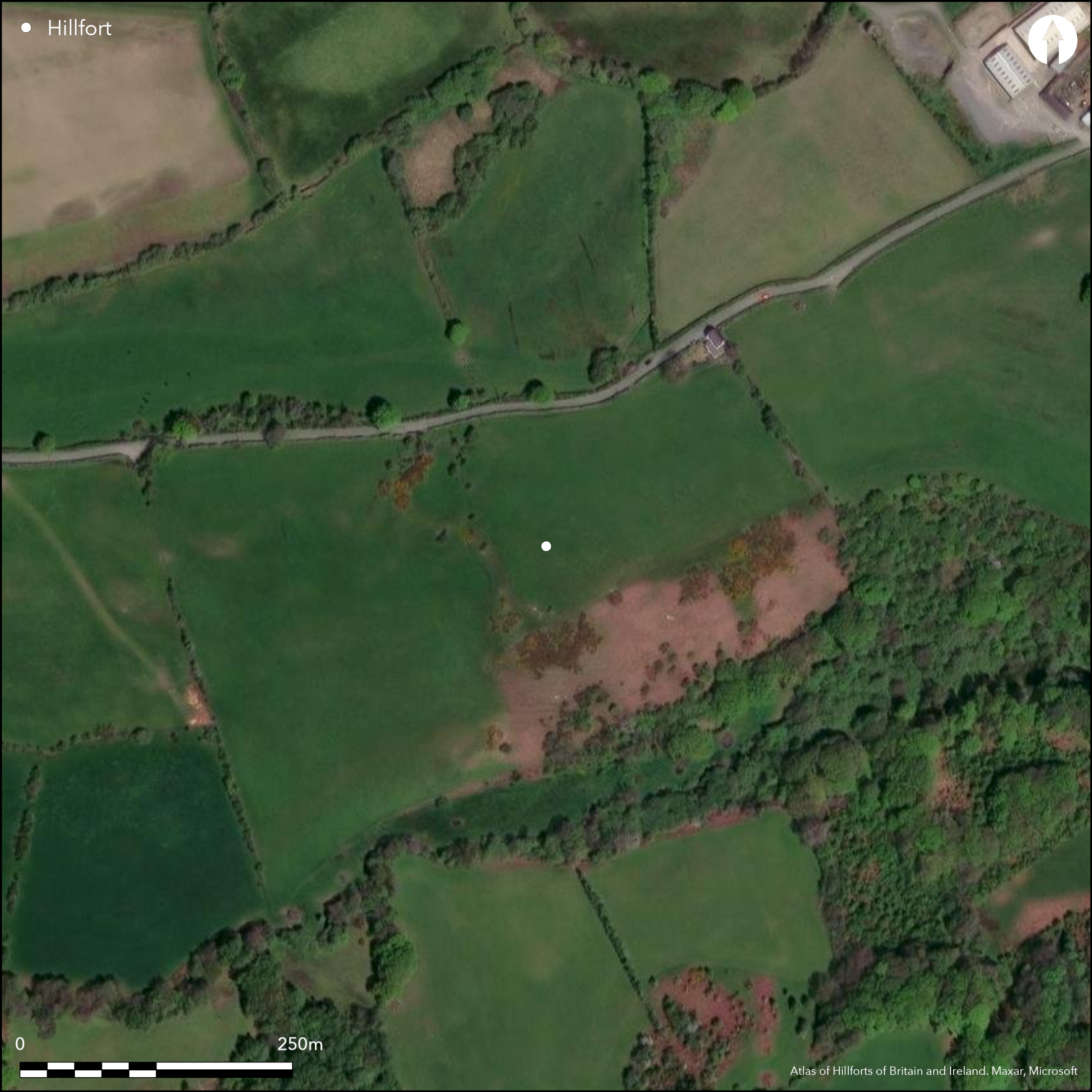
Satellite Imagery
LiDAR 1m DTM Hillshade
Satellite Imagery
Scroll left/right to view further images.
HER: Dyfed 1996 (None)
NMR: SN 67 SW (302037)
SM: CD051
NGR: SN61627099
X: 261620 Y: 270990 (OSGB36)
Univallate partial contour hillfort with in prominent position with good ramparts and annexes located on rounded ridge summit just above the Afon Wyre 50m below to S. On a possible route to the Afon Ystwyth. Moderate surrounding slopes to N, E and W, moderate to strong to S, sloping to river. Polygonal in plan measuring c. 89m by 84m, with total interior area including annexes 1.3ha. Main enclosure defined by single rampart to 2m high and 15m across. Rectangular annexe on NW, with single bank except on NW where two ramparts and ditches. Possible additional annexe with palisade, running for 107m from edge of promontory overlooking Cwm Wyre, around to N side. Entrance position uncertain. Under improved pasture. On 1st Ed. OS map (1888). Minimal investigations, undated.
Citizen Science: ✗
Reliability of Data: Confirmed
Reliability of Interpretation: Confirmed
X: -448810 Y: 6858100 (EPSG: 3857)
Longitude: -4.031725025884872 Latitude: 52.31948819392165 (EPSG:4326)
Country: Wales
Current County or Unitary Authority: Ceredigion
Historic County: Cardiganshire
Current Parish/Community/Council/Townland: Llangwyryfon
Badly damaged by ploughing in past. Possibly affected by a lane to N.
| Extant | ✓ |
| Cropmark | ✗ |
| Likely Destroyed | ✗ |
Under improved pasture, with some gorse scrub on annexe banks.
| Woodland | ✗ |
| Commercial Forestry Plantation | ✗ |
| Parkland | ✗ |
| Pasture (Grazing) | ✓ |
| Arable | ✗ |
| Scrub/Bracken | ✓ |
| Bare Outcrop | ✗ |
| Heather/Moorland | ✗ |
| Heath | ✗ |
| Built-up | ✗ |
| Coastal Grassland | ✗ |
| Other | ✗ |
Univallate partial contour hillfort with strong defences and annexes located on rounded ridge summit just above the Afon Wyre 50m below to S. On a possible route to the Afon Ystwyth. Moderate surrounding slopes to N, E and W, moderate to strong to S, sloping to river.
| Contour Fort | ✗ |
| Partial Contour Fort | ✓ |
| Promontory Fort | ✗ |
| Hillslope Fort | ✗ |
| Level Terrain Fort | ✗ |
| Marsh Fort | ✗ |
| Multiple Enclosure Fort | ✗ |
| Hilltop | ✗ |
| Coastal Promontory | ✗ |
| Inland Promontory | ✗ |
| Valley Bottom | ✗ |
| Knoll/Hillock/Outcrop | ✗ |
| Ridge | ✓ |
| Cliff/Plateau-edge/Scarp | ✗ |
| Hillslope | ✗ |
| Lowland | ✗ |
| Spur | ✗ |
Dominant Topographic Feature: Ridge
| North | ✗ |
| Northeast | ✗ |
| East | ✗ |
| Southeast | ✗ |
| South | ✗ |
| Southwest | ✓ |
| West | ✗ |
| Northwest | ✗ |
| Level | ✗ |
Altitude: 160.0m
N/A
None
Reliability: D - None
| Pre 1200BC | ✗ |
| 1200BC - 800BC | ✗ |
| 800BC - 400BC | ✗ |
| 400BC - AD50 | ✗ |
| AD50 - AD400 | ✗ |
| AD400 - AD 800 | ✗ |
| Post AD800 | ✗ |
| Unknown | ✓ |
| Pre Hillfort: | None |
| Post Hillfort: | None |
On 1st Ed. OS map (1888). Cambria Archaeology defended enclosures survey 2006.
| 1st Identified Map Depiction (1888): | OS map. |
| Other (2006): | Cambria Archaeology defended enclosures survey |
None
Afon Wyre 0.2 km outside fort.
| None | ✓ |
| Spring | ✗ |
| Stream | ✗ |
| Pool | ✗ |
| Flush | ✗ |
| Well | ✗ |
| Other | ✗ |
None
| No Known Features | ✓ |
| Round Stone Structures | ✗ |
| Rectangular Stone Structures | ✗ |
| Curvilinear Platforms | ✗ |
| Other Roundhouse Evidence | ✗ |
| Pits | ✗ |
| Quarry Hollows | ✗ |
| Other | ✗ |
None
| No Known Excavation | ✓ |
| Pits | ✗ |
| Postholes | ✗ |
| Roundhouses | ✗ |
| Rectangular Structures | ✗ |
| Roads/Tracks | ✗ |
| Quarry Hollows | ✗ |
| Other | ✗ |
| Nothing Found | ✗ |
None
| No Known Geophysics | ✓ |
| Pits | ✗ |
| Roundhouses | ✗ |
| Rectangular Structures | ✗ |
| Roads/Tracks | ✗ |
| Quarry Hollows | ✗ |
| Other | ✗ |
| Nothing Found | ✗ |
None
| No Known Finds | ✓ |
| Pottery | ✗ |
| Metal | ✗ |
| Metalworking | ✗ |
| Human Bones | ✗ |
| Animal Bones | ✗ |
| Lithics | ✗ |
| Environmental | ✗ |
| Other | ✗ |
None
| APs Not Checked | ✓ |
| None | ✗ |
| Roundhouses | ✗ |
| Rectangular Structures | ✗ |
| Pits | ✗ |
| Postholes | ✗ |
| Roads/Tracks | ✗ |
| Other | ✗ |
No entrance defined.
| 0: | None |
| 2: | None |
Guard Chambers: ✗
Chevaux de Frise: ✗
Main enclosure defined by single rampart to 2m high and 15m across.
| Area 1: | 0.45ha. |
| Total: | 0.45ha. |
Total Footprint Area: 1.3ha.
None
| ✗ | 0.45ha main fort. 0.14 annexe - 1.3 ha total including additional palisaded annexe. |
| ✓ | None |
| NE Quadrant: | 1 |
| SE Quadrant: | 1 |
| SW Quadrant: | 1 |
| NW Quadrant: | 1 |
| Total: | 1 |
| Partial Univallate | ✗ |
| Univallate | ✓ |
| Partial Bivallate | ✗ |
| Bivallate | ✗ |
| Partial Multivallate | ✗ |
| Multivallate | ✗ |
| Unknown | ✗ |
| Partial Univallate | ✗ |
| Univallate | ✗ |
| Partial Bivallate | ✗ |
| Bivallate | ✗ |
| Partial Multivallate | ✗ |
| Multivallate | ✗ |
Possible additional annexe with palisade.
| None | ✗ |
| Earthen Bank | ✓ |
| Stone Wall | ✗ |
| Rubble | ✗ |
| Wall-walk | ✗ |
| Evidence of Timber | ✗ |
| Vitrification | ✗ |
| Other Burning | ✗ |
| Palisade | ✓ |
| Counter Scarp Bank | ✗ |
| Berm | ✗ |
| Unfinished | ✗ |
| Other | ✗ |
None
| None | ✗ |
| Earthen Bank | ✗ |
| Stone Wall | ✗ |
| Murus Duplex | ✗ |
| Timber-framed | ✗ |
| Timber-laced | ✗ |
| Vitrification | ✗ |
| Other Burning | ✗ |
| Palisade | ✗ |
| Counter Scarp Bank | ✗ |
| Berm | ✗ |
| Unfinished | ✗ |
| No Known Excavation | ✓ |
| Other | ✗ |
| ✗ | None |
| ✓ | Ditches to annexe. None defined to main enclosure; possibly buried feature. |
Number of Ditches: 1
| ✓ | Rectangular annexe on NW, with single bank, except on NW, where two ramparts and ditches. Parch-marks on aerial photographs show additional ramparts beyond fort to E visible as irregular palisade trench running for 107m from edge of the promontory overlooking Cwm Wyre, around to N side, effectively forming additional annexe below fort. |
Hughes, I.T. 1926. A regional survey of the prehistoric earthworks of North Cardiganshire, Trans Cardiganshire Ant Soc, 4 (1926), 22-56.
Murphy, K, Ramsey, R. and Page, M. 2006. A survey of defended enclosures in Ceredigion 2006: Gazetteer of Ordnance Survey Grid Square SN67, Project Report No. 2006/20, Project Record No. 54269, Llandeilo: Cambria Archaeology.
Atlas of Hillforts:
Wikidata:
This work is licensed under CC BY-SA 4.0

 and should be cited as:
Lock, Gary and Ralston, Ian. 2024. Atlas of Hillforts of Britain and Ireland. Available at: https://hillforts.arch.ox.ac.uk
Document Version 1.1