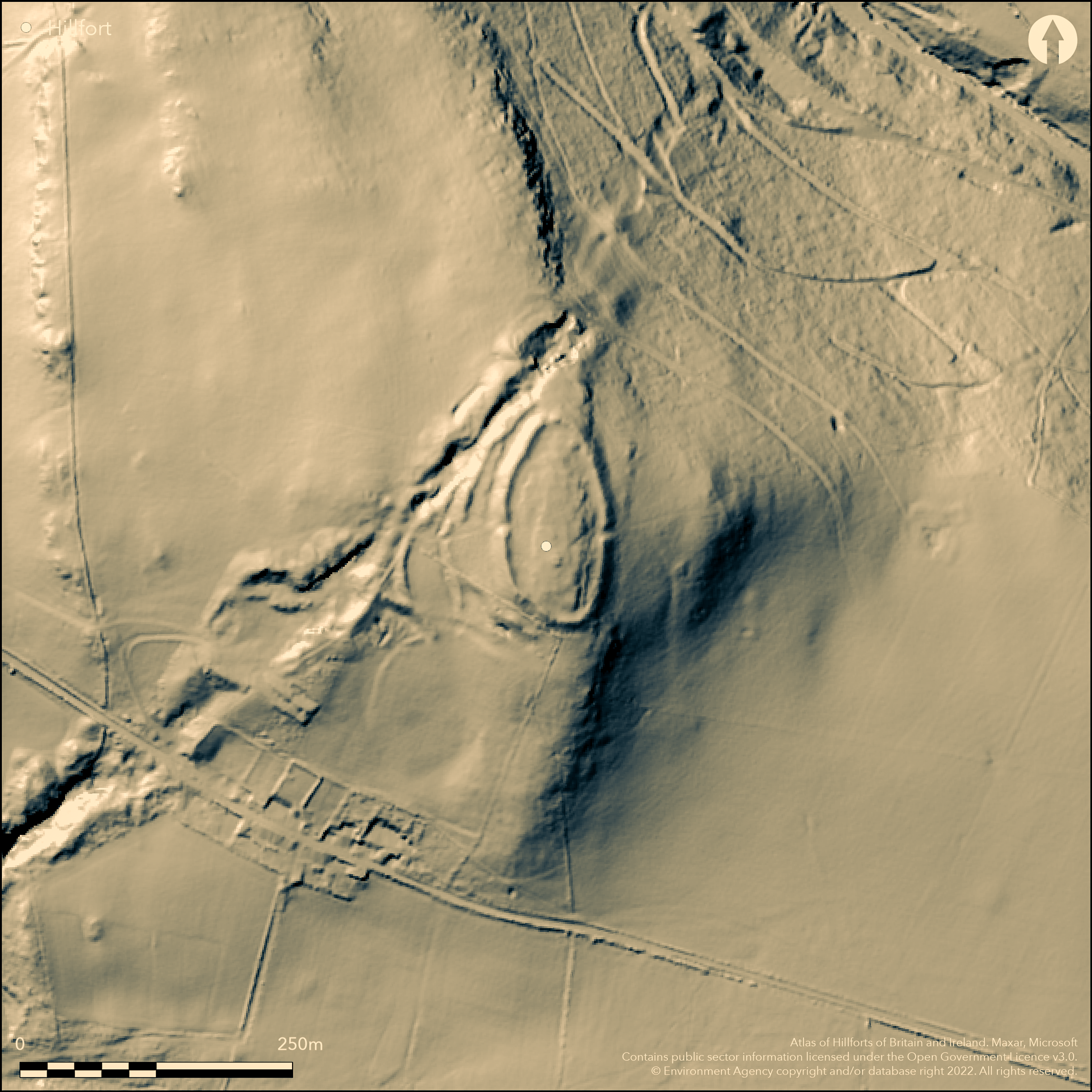
LiDAR 1m DTM Hillshade
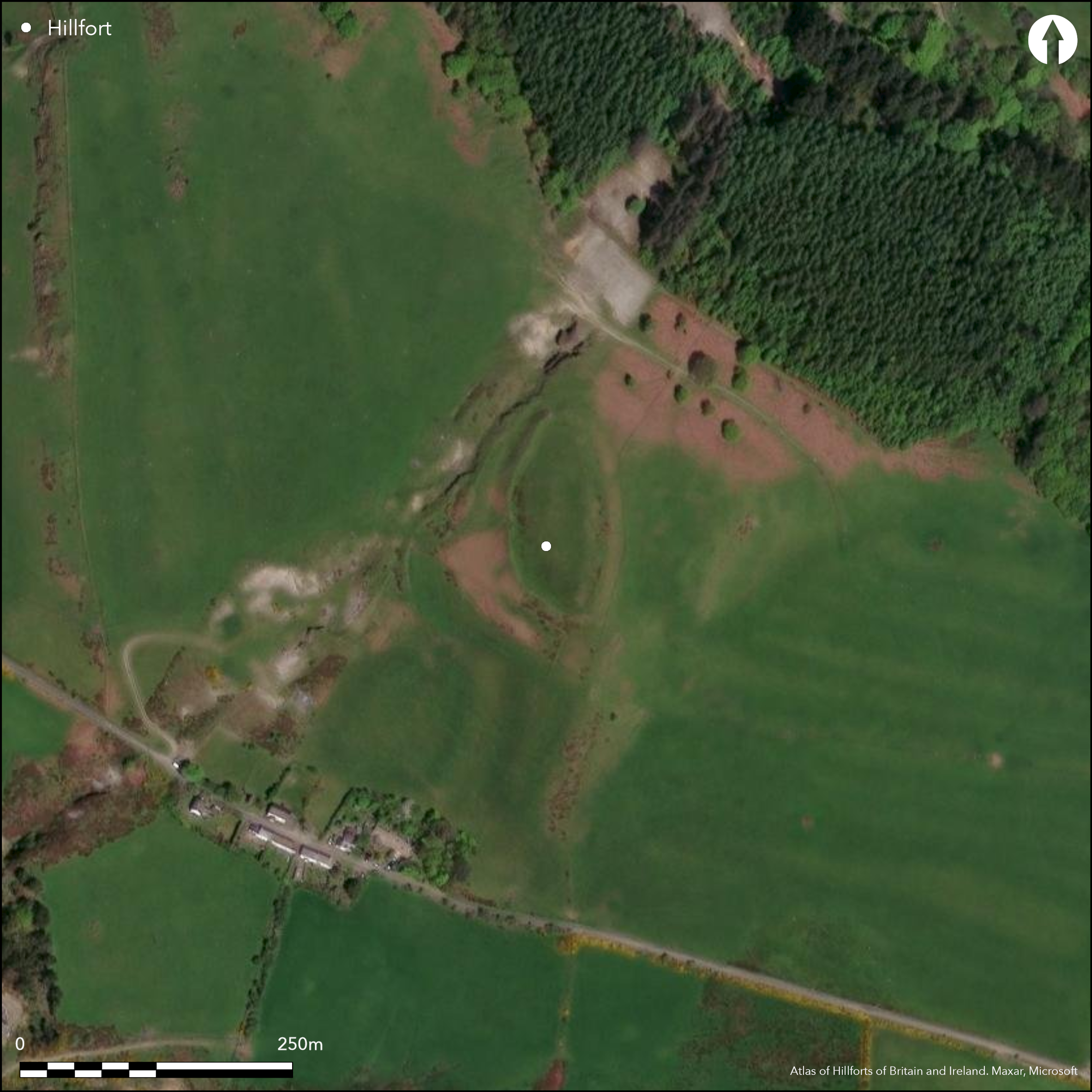
Satellite Imagery
LiDAR 1m DTM Hillshade
Satellite Imagery
Scroll left/right to view further images.
HER: Dyfed 2023 (None)
NMR: SN 68 SE (303592)
SM: CD028
NGR: SN67898301
X: 267890 Y: 283010 (OSGB36)
Prominent contour fort on summit of rocky hill above Nant Silo. In an area of 'old mines' on the OS map. Steep surrounding slopes, especially to N above Nant Silo. Oval shaped measuring 108m N-S by 56m, with internal area 0.45ha. Style of ramparts suggest possible phased construction. Large single rampart to 4.5m high defined enclosure. Wide quarry ditch. Four additional outwork banks and ditch on the W effectively form an annexe, circa 24m and 55 m from inner rampart, and also cut off this more accessible side and entrance. Three original simple entrances, main on W and opposing on E, another on N side. Small excavations (Timberlake and Driver 2005) recorded section of revetment wall exposed by severe erosion within gate terminal. Small cordoned pot sherd recovered. At least 10 hut platforms and terraces visible in interior. Early Bronze Age cairn on summit, with possibly another nearby. Plan of site obscured by medieval mining. On 1st Ed. OS map (1887). Undated.
Citizen Science: ✗
Reliability of Data: Confirmed
Reliability of Interpretation: Confirmed
X: -439103 Y: 6878075 (EPSG: 3857)
Longitude: -3.944530535227118 Latitude: 52.42903541007703 (EPSG:4326)
Country: Wales
Current County or Unitary Authority: Ceredigion
Historic County: Cardiganshire
Current Parish/Community/Council/Townland: Trefeurig
Fair condition but site obscured by medieval mining.
| Extant | ✓ |
| Cropmark | ✗ |
| Likely Destroyed | ✗ |
Rough pasture. Medieval mining.
| Woodland | ✗ |
| Commercial Forestry Plantation | ✗ |
| Parkland | ✗ |
| Pasture (Grazing) | ✓ |
| Arable | ✗ |
| Scrub/Bracken | ✗ |
| Bare Outcrop | ✗ |
| Heather/Moorland | ✗ |
| Heath | ✗ |
| Built-up | ✗ |
| Coastal Grassland | ✗ |
| Other | ✓ |
Prominent contour fort on summit of rocky hill above Nant Silo. In an area of 'old mines' on the OS map. Steep surrounding slopes, especially to N above Nant Silo.
| Contour Fort | ✓ |
| Partial Contour Fort | ✗ |
| Promontory Fort | ✗ |
| Hillslope Fort | ✗ |
| Level Terrain Fort | ✗ |
| Marsh Fort | ✗ |
| Multiple Enclosure Fort | ✗ |
| Hilltop | ✓ |
| Coastal Promontory | ✗ |
| Inland Promontory | ✗ |
| Valley Bottom | ✗ |
| Knoll/Hillock/Outcrop | ✗ |
| Ridge | ✗ |
| Cliff/Plateau-edge/Scarp | ✗ |
| Hillslope | ✗ |
| Lowland | ✗ |
| Spur | ✗ |
Dominant Topographic Feature: Hill top
| North | ✗ |
| Northeast | ✗ |
| East | ✗ |
| Southeast | ✗ |
| South | ✗ |
| Southwest | ✗ |
| West | ✗ |
| Northwest | ✗ |
| Level | ✓ |
Altitude: 290.0m
N/A
Possible late Bronze Age/Early Iron Age date (RCAHMW Coflein).
Reliability: D - None
| Pre 1200BC | ✗ |
| 1200BC - 800BC | ✗ |
| 800BC - 400BC | ✗ |
| 400BC - AD50 | ✗ |
| AD50 - AD400 | ✗ |
| AD400 - AD 800 | ✗ |
| Post AD800 | ✗ |
| Unknown | ✓ |
| Pre Hillfort: | Early Bronze Age cairn on summit, with possibly another nearby. |
| Post Hillfort: | Plan of site obscured by medieval mining. |
On 1st Ed. OS map (1887). Ceredigion Archaeological Survey survey in 1980s (Thorburn 1987). RCAHMW detailed 1:1000 survey and adjacent mine workings, 2005, prior to small scale excavation by the Early Mines Research Group (Timberlake and Driver 2005). Cambria Archaeology defended enclosures survey 2006.
| 1st Identified Map Depiction (1887): | OS map. |
| Excavation (1996): | T. Driver. |
| Other (2005): | RCAHMW survey. |
| Excavation (2005): | Early Mines Research Group. |
| Other (2006): | Cambria Archaeology defended enclosures survey |
| Other (None): | Ceredigion Archaeological Survey survey. |
At least 10 hut platforms and terraces visible in interior. Small cordoned pot sherd from excavation 1996 has Late Bronze Age parallels, type similar to that from the early Y Breiddin hillfort.
None
| None | ✓ |
| Spring | ✗ |
| Stream | ✗ |
| Pool | ✗ |
| Flush | ✗ |
| Well | ✗ |
| Other | ✗ |
At least 10 hut platforms and terraces visible in interior. Broad quarry ditch.
| No Known Features | ✗ |
| Round Stone Structures | ✗ |
| Rectangular Stone Structures | ✗ |
| Curvilinear Platforms | ✓ |
| Other Roundhouse Evidence | ✗ |
| Pits | ✗ |
| Quarry Hollows | ✓ |
| Other | ✗ |
None
| No Known Excavation | ✗ |
| Pits | ✗ |
| Postholes | ✗ |
| Roundhouses | ✗ |
| Rectangular Structures | ✗ |
| Roads/Tracks | ✗ |
| Quarry Hollows | ✗ |
| Other | ✗ |
| Nothing Found | ✓ |
None
| No Known Geophysics | ✓ |
| Pits | ✗ |
| Roundhouses | ✗ |
| Rectangular Structures | ✗ |
| Roads/Tracks | ✗ |
| Quarry Hollows | ✗ |
| Other | ✗ |
| Nothing Found | ✗ |
Small cordoned pot sherd from excavation 1996 has Late Bronze Age parallels, type similar to that from the early Y Breiddin hillfort.
| No Known Finds | ✗ |
| Pottery | ✓ |
| Metal | ✗ |
| Metalworking | ✗ |
| Human Bones | ✗ |
| Animal Bones | ✗ |
| Lithics | ✗ |
| Environmental | ✗ |
| Other | ✗ |
None
| APs Not Checked | ✓ |
| None | ✗ |
| Roundhouses | ✗ |
| Rectangular Structures | ✗ |
| Pits | ✗ |
| Postholes | ✗ |
| Roads/Tracks | ✗ |
| Other | ✗ |
Three original simple entrances, main on W, opposing on E, another on N side.
| 3: | None |
| 2: | None |
Guard Chambers: ✗
Chevaux de Frise: ✗
| 1. Simple Gap (West): | Main entrance. |
| 2. Simple Gap (East): | None |
| 3. Simple Gap (North): | None |
Single rampart to 4.5m high defined enclosure, single ditch.
| Area 1: | 0.45ha. |
| Total: | 0.45ha. |
Total Footprint Area: Noneha.
None
| ✓ | Style of defences suggest possible phased construction, but no details. |
| ✓ | None |
| NE Quadrant: | 1 |
| SE Quadrant: | 1 |
| SW Quadrant: | 1 |
| NW Quadrant: | 1 |
| Total: | 1 |
| Partial Univallate | ✗ |
| Univallate | ✓ |
| Partial Bivallate | ✗ |
| Bivallate | ✗ |
| Partial Multivallate | ✗ |
| Multivallate | ✗ |
| Unknown | ✗ |
| Partial Univallate | ✗ |
| Univallate | ✗ |
| Partial Bivallate | ✗ |
| Bivallate | ✗ |
| Partial Multivallate | ✗ |
| Multivallate | ✗ |
Revetment exposed at W gate.
| None | ✗ |
| Earthen Bank | ✓ |
| Stone Wall | ✓ |
| Rubble | ✗ |
| Wall-walk | ✗ |
| Evidence of Timber | ✗ |
| Vitrification | ✗ |
| Other Burning | ✗ |
| Palisade | ✗ |
| Counter Scarp Bank | ✗ |
| Berm | ✗ |
| Unfinished | ✗ |
| Other | ✗ |
Revetment evidence at W gate, exposed by severe erosion within gate terminal.
| None | ✗ |
| Earthen Bank | ✓ |
| Stone Wall | ✓ |
| Murus Duplex | ✗ |
| Timber-framed | ✗ |
| Timber-laced | ✗ |
| Vitrification | ✗ |
| Other Burning | ✗ |
| Palisade | ✗ |
| Counter Scarp Bank | ✗ |
| Berm | ✗ |
| Unfinished | ✗ |
| No Known Excavation | ✗ |
| Other | ✗ |
| ✗ | None |
| ✓ | None |
Number of Ditches: 1
| ✓ | Three additional outwork banks and ditch on the W effectively form an annexe, c. 24m and 55m from inner rampart. |
Hogg, A.H.A. 1962. List of hill-forts in Cardiganshire, Bull Board Celtic Stud, 19, 363.
Hughes, I.T. 1926. A regional survey of the prehistoric earthworks of North Cardiganshire, Trans Cardiganshire Ant Soc, 4 (1926), 22-56.
Murphy, K, Ramsey, R. and Page, M. 2006. A survey of defended enclosures in Ceredigion 2006: Gazetteer of Ordnance Survey Grid Squares SN68 and SN69, Project Report No. 2006/20, Project Record No. 54269, Llandeilo: Cambria Archaeology.
Davies, J. L. and Hogg, A. H. A. 1994. The Iron Age, in eds Davies, J.L. and Kirby, D.A.. Cardiganshire County History, Vol 1, From the earliest times to the coming of the Normans, Cardiff: University of Wales Press.
Davies, J.L. and Lynch, F. 2000. The Late Bronze and Iron Age, in Lynch, F., Aldhouse-Green, S. and Davies, J.L. Prehistoric Wales, Sutton Publishing, 139-219.
Timberlake, S and Driver, T G. 2005. Excavation at Darren Camp and Darren mine (Opencuts), Banc-y-Darren, Trefeurig, Ceredigion, Arch Wales, 45, 98-102.
Driver, T. 2013. Architecture, Regional Identity and Power in the Iron Age Landscapes of Mid Wales : The Hillforts of North Ceredigion. Oxford, Archaeopress: British Archaeological Report 583.
Thornburn, J. 1987 Pen y daren, Trefeirig (SN 679 830). Arch in Wales 27, 34.
Atlas of Hillforts:
Wikidata:
This work is licensed under CC BY-SA 4.0

 and should be cited as:
Lock, Gary and Ralston, Ian. 2024. Atlas of Hillforts of Britain and Ireland. Available at: https://hillforts.arch.ox.ac.uk
Document Version 1.1