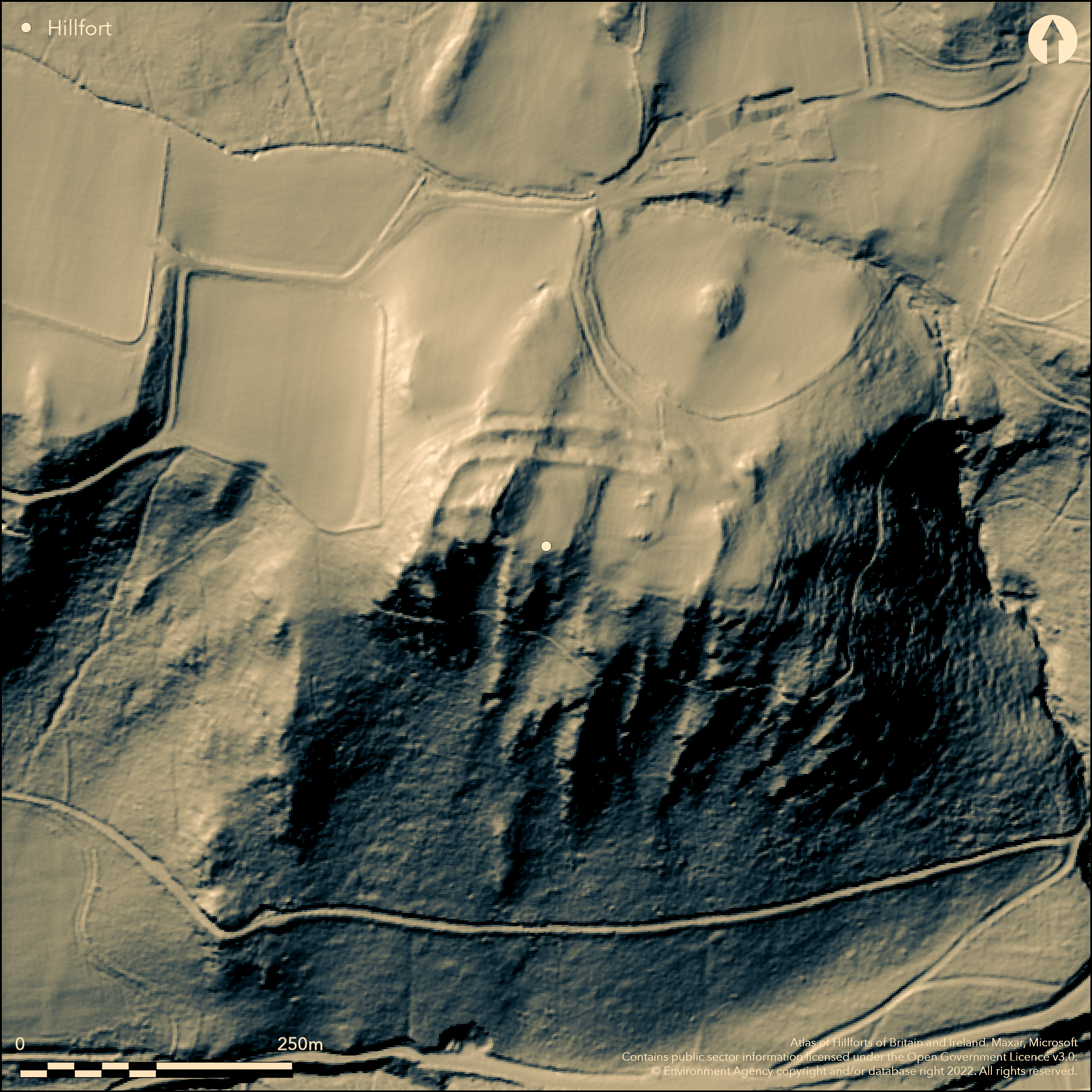
LiDAR 1m DTM Hillshade
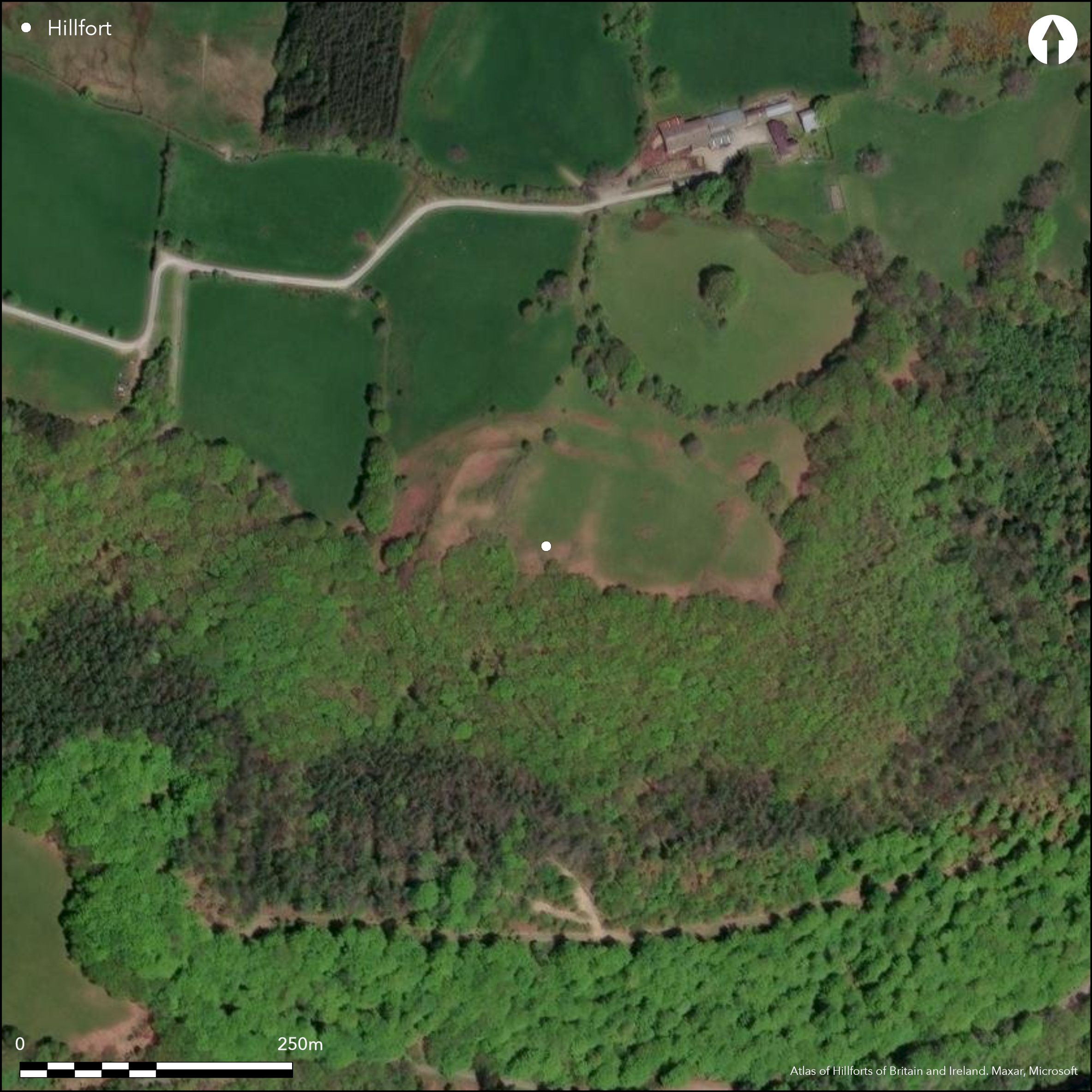
Satellite Imagery
LiDAR 1m DTM Hillshade
Satellite Imagery
Scroll left/right to view further images.
HER: Dyfed 2066 (None)
NMR: SN 77 SW (303671)
SM: CD012
NGR: SN72107249
X: 272100 Y: 272490 (OSGB36)
Partial contour hillfort sited in a commanding position on steep slopes above the Afon Ystwyth and possible route from the Ystwyth to the Afon Teifi. Moderate to strong surrounding slopes to N, precipitous to S and E, very steep to W. Roughly rectangular in plan, measuring c. 170m E-W by 100m, with internal area 0.72ha. As a result of topography, no ramparts are needed on S and only one bank on the W. Elsewhere, two widely-spaced banks with a ditch only on the outer. Interior 'divided' into series of stepped compartments, beginning with lowest NE point, then rising to W to highest outcrop point. Last internal area below the outcrop, is steep natural terrace, partly modified on N and E sides. On this last terrace are remains of three denuded house platforms, confirmed by topographical and geophysical survey in 2012. W outcrop encircled by well-built low ramparts set on good foundations and possibly earliest phase of enclosure on site. Main entrance on NE, with free-standing walled bastian and complex annexe arrangement. At least two other N entrances. Possible long and complex history to fort; possibly with smaller hillfort enclosing highest point on W first with subsequent enlargement on hillslopes below and to E. Various RCAHMW surveys, 2002, 2011 and 2012, the latter pointing to new evidence of possible phasing of fort and important post-medieval activity on site, the latter a low earthwork platform on N terrace surrounded by plough cultivation to S and W. Also traces exploratory mining cuts To N end small box-trench within NW ramparts, small excavation (Timberlake et al 2014), flanked by low spoil tip; a possible antiquarian excavation. In good condition under rough grazing. On 1st Ed. OS map (1888). Undated.
Citizen Science: ✗
Reliability of Data: Confirmed
Reliability of Interpretation: Confirmed
X: -431767 Y: 6861019 (EPSG: 3857)
Longitude: -3.878628418286728 Latitude: 52.335510255026854 (EPSG:4326)
Country: Wales
Current County or Unitary Authority: Ceredigion
Historic County: Cardiganshire
Current Parish/Community/Council/Townland: Trawsgoed
Good condition.
| Extant | ✓ |
| Cropmark | ✗ |
| Likely Destroyed | ✗ |
Rough grazing.
| Woodland | ✗ |
| Commercial Forestry Plantation | ✗ |
| Parkland | ✗ |
| Pasture (Grazing) | ✓ |
| Arable | ✗ |
| Scrub/Bracken | ✗ |
| Bare Outcrop | ✗ |
| Heather/Moorland | ✓ |
| Heath | ✗ |
| Built-up | ✗ |
| Coastal Grassland | ✗ |
| Other | ✗ |
Fine partial contour hillfort sited in a strong and commanding position on steep slopes above the Afon Ystwyth and possible route from the Ystwyth to the Afon Teifi. Moderate to strong surrounding slopes to N, precipitous to S and E, very steep to W. Ground falls steeply to S on site.
| Contour Fort | ✗ |
| Partial Contour Fort | ✓ |
| Promontory Fort | ✗ |
| Hillslope Fort | ✗ |
| Level Terrain Fort | ✗ |
| Marsh Fort | ✗ |
| Multiple Enclosure Fort | ✗ |
| Hilltop | ✓ |
| Coastal Promontory | ✗ |
| Inland Promontory | ✗ |
| Valley Bottom | ✗ |
| Knoll/Hillock/Outcrop | ✗ |
| Ridge | ✗ |
| Cliff/Plateau-edge/Scarp | ✓ |
| Hillslope | ✗ |
| Lowland | ✗ |
| Spur | ✗ |
Dominant Topographic Feature: Hill top
| North | ✗ |
| Northeast | ✗ |
| East | ✗ |
| Southeast | ✗ |
| South | ✓ |
| Southwest | ✗ |
| West | ✗ |
| Northwest | ✗ |
| Level | ✗ |
Altitude: 289.0m
N/A
None
Reliability: D - None
| Pre 1200BC | ✗ |
| 1200BC - 800BC | ✗ |
| 800BC - 400BC | ✗ |
| 400BC - AD50 | ✗ |
| AD50 - AD400 | ✗ |
| AD400 - AD 800 | ✗ |
| Post AD800 | ✗ |
| Unknown | ✓ |
| Pre Hillfort: | None |
| Post Hillfort: | Post medieval activity. |
On 1834 Ordnance Survey map of the region. Surveyed by I. Hughes for regional hillforts survey 1926. OS survey at 1:2500 scale 1974. Survey by T. Driver RCAHMW and R. Knisely-Marpole 2002. Cambria Archaeology defended enclosures survey 2006. Sampled in 2011 by pXRF scanner by Keith Haylock and Toby Driver to assess the presence of metal working evidence 2011. Re-survey by by Louise Barker RCAHMW 2012 at which point new evidence emerged about the possible phasing of the fort and important post-medieval activity on site. Geophysical survey of house platforms and high lead anomaly on the N terrace by ArchaeoPhysica Ltd. Excavation 2013 (Timberlake et al 2014).
| 1st Identified Map Depiction (1834): | OS map. |
| Other (1888): | OS 2500 map. |
| Other (1926): | Surveyed by I. Hughes. |
| Other (1974): | OS survey. |
| Other (2002): | Survey by Driver RCAHMW and R. Knisely-Marpole. |
| Other (2006): | Cambria Archaeology defended enclosures survey. |
| Other (2011): | Survey by pXRF scanner by K. Haylock and T. Driver |
| Other (2012): | Re-survey by Louise Barke RCAHMW. |
| Geophysical Survey (2012): | ArchaeoPhysica Ltd. |
| Excavation (2013): | None |
On last terrace below W outcrop summit are remains of three denuded house platforms, confirmed by topographical and geophysical survey in 2012.
Stream 0.1km outside fort.
| None | ✓ |
| Spring | ✗ |
| Stream | ✗ |
| Pool | ✗ |
| Flush | ✗ |
| Well | ✗ |
| Other | ✗ |
On last terrace below W outcrop summit are remains of three denuded house platforms, confirmed by topographical and geophysical survey in 2012.
| No Known Features | ✗ |
| Round Stone Structures | ✗ |
| Rectangular Stone Structures | ✗ |
| Curvilinear Platforms | ✓ |
| Other Roundhouse Evidence | ✗ |
| Pits | ✗ |
| Quarry Hollows | ✗ |
| Other | ✗ |
Possible antiquarian investigation but no details.
| No Known Excavation | ✗ |
| Pits | ✗ |
| Postholes | ✗ |
| Roundhouses | ✗ |
| Rectangular Structures | ✗ |
| Roads/Tracks | ✗ |
| Quarry Hollows | ✗ |
| Other | ✗ |
| Nothing Found | ✓ |
On last terrace below W outcrop summit are remains of three denuded house platforms, confirmed by topographical and geophysical survey in 2012.
| No Known Geophysics | ✗ |
| Pits | ✗ |
| Roundhouses | ✗ |
| Rectangular Structures | ✗ |
| Roads/Tracks | ✗ |
| Quarry Hollows | ✗ |
| Other | ✓ |
| Nothing Found | ✗ |
None
| No Known Finds | ✓ |
| Pottery | ✗ |
| Metal | ✗ |
| Metalworking | ✗ |
| Human Bones | ✗ |
| Animal Bones | ✗ |
| Lithics | ✗ |
| Environmental | ✗ |
| Other | ✗ |
None
| APs Not Checked | ✓ |
| None | ✗ |
| Roundhouses | ✗ |
| Rectangular Structures | ✗ |
| Pits | ✗ |
| Postholes | ✗ |
| Roads/Tracks | ✗ |
| Other | ✗ |
One main overlapping entrance at NE, and lowest, point, with impressive free-standing walled bastion associated with a complex annexe arrangement to entry. At least two further gateways on N defensive circuit, but type not exactly defined.
| 3: | Possibly more. |
| 2: | At least two further gateways on N defensive circuit as well as main gate to NE. |
Guard Chambers: ✗
Chevaux de Frise: ✗
| 1. Over-lapping (North east): | Free-standing walled bastion associated with a complex annexe arrangement to the entry. |
| 1. Outworks (North east): | Free-standing walled bastian. |
| 2. Simple Gap (North): | Type not exactly defined. |
| 3. Simple Gap (North): | Type not exactly defined. |
As a result of topography, no defence is needed on S and only one bank on the W. Elsewhere, two widely-spaced banks with a ditch only on the outer. Interior 'divided' into series of stepped compartments, beginning with lowest NE point, then rising to W to highest outcrop point. Last internal area below the outcrop, is steep natural terrace, partly modified on N and E sides. W outcrop encircled by well-built low ramparts set on good foundations and possibly earliest phase of enclosure on site.
| Area 1: | 0.3ha. |
| Area 2: | 0.72ha. |
| Total: | 0.72ha. |
Total Footprint Area: Noneha.
None
| ✓ | Possible long and complex history to fort; possibly with smaller hillfort enclosing highest point on W first with subsequent enlargement on hillslopes below and to E. |
| ✗ | Quadrants estimated. |
| NE Quadrant: | 2 |
| SE Quadrant: | 0 |
| SW Quadrant: | 0 |
| NW Quadrant: | 1 |
| Total: | 2 |
| Partial Univallate | ✓ |
| Univallate | ✗ |
| Partial Bivallate | ✓ |
| Bivallate | ✗ |
| Partial Multivallate | ✗ |
| Multivallate | ✗ |
| Unknown | ✗ |
| Partial Univallate | ✗ |
| Univallate | ✓ |
| Partial Bivallate | ✗ |
| Bivallate | ✗ |
| Partial Multivallate | ✗ |
| Multivallate | ✗ |
None
| None | ✗ |
| Earthen Bank | ✓ |
| Stone Wall | ✗ |
| Rubble | ✗ |
| Wall-walk | ✗ |
| Evidence of Timber | ✗ |
| Vitrification | ✗ |
| Other Burning | ✗ |
| Palisade | ✗ |
| Counter Scarp Bank | ✗ |
| Berm | ✗ |
| Unfinished | ✗ |
| Other | ✗ |
To N end small box-trench within NW ramparts, flanked by low spoil tip; a possible antiquarian excavation. No details.
| None | ✗ |
| Earthen Bank | ✗ |
| Stone Wall | ✗ |
| Murus Duplex | ✗ |
| Timber-framed | ✗ |
| Timber-laced | ✗ |
| Vitrification | ✗ |
| Other Burning | ✗ |
| Palisade | ✗ |
| Counter Scarp Bank | ✗ |
| Berm | ✗ |
| Unfinished | ✗ |
| No Known Excavation | ✗ |
| Other | ✓ |
| ✗ | None |
| ✓ | Ditch only on outer bank. |
Number of Ditches: 1
| ✓ | Annexe associated with main NE gate. |
Davies, J. L. and Hogg, A. H. A. 1994. The Iron Age, in eds Davies, J.L. and Kirby, D.A.. Cardiganshire County History, Vol 1, From the earliest times to the coming of the Normans, Cardiff: University of Wales Press.
Driver, T. 2013. Architecture, Regional Identity and Power in the Iron Age landscapes of Mid Wales: The hillforts of north Ceredigion, BAR 583, Archaeopress.
Hogg, A.H.A. 1962. List of hill-forts in Cardiganshire, Bull Board Celtic Stud, 19, 363.
Hughes, I.T. 1926. A regional survey of the prehistoric earthworks of North Cardiganshire, Trans Cardiganshire Ant Soc, 4 (1926), 22-56.
Murphy, K, Ramsey, R. and Page, M. 2006. A survey of defended enclosures in Ceredigion 2006: Gazetteer of Ordnance Survey Grid Squares SN75, SN76, SN77 and SN78, Project Report No. 2006/20, Project Record No. 54269, Llandeilo: Cambria Archaeology.
Timberlake, S., Haylock, K., Driver, T., Barker, L., Andrews, P., Craddock, B., Gilmour A. and Mepham, L. 2014. The strange case of a mytserious lead anomaly: Castell Grogwynion hillfort, Ceredigion - Iron Age smelting, 18th century pottery, or post-medieval prospection? Archaeol Wales, 53, 27-36.
Atlas of Hillforts:
Wikidata:
This work is licensed under CC BY-SA 4.0

 and should be cited as:
Lock, Gary and Ralston, Ian. 2024. Atlas of Hillforts of Britain and Ireland. Available at: https://hillforts.arch.ox.ac.uk
Document Version 1.1